Category:March 2012 in Kent
Jump to navigation
Jump to search
Deutsch: Bilder, die im März 2012 in Kent aufgenommen worden sind. Bitte beachten Sie, dass dies weder das Datum des Uploads noch das Datum des Scannens eines Fotos ist.
English: Images/pictures taken in Kent during March 2012. Note this is not the date of the upload, nor the date a photo was scanned.
Español: Fotografías o imágenes tomadas en Kent durante marzo 2012. No es la fecha de subida ni escaneo, sino la fecha en que las fotografías o imágenes se crearon.
Esperanto: Bildoj faritaj en Kent en marto 2012. Tio ne estas la dato, kiam la bildoj estis alŝutitaj aŭ skanitaj.
Français : Photographies ou images prises en Kent durant mars 2012. Ce n'est pas la date du téléchargement ou du scan.
Galego: Fotografías ou imaxes tomadas en Kent durante marzo 2012. Non é a data de subida nin escaneamento, senón a data na que se crearon as fotografías ou imaxes.
Italiano: Fotografie o immagini scattate a Kent nel marzo 2012. Nota bene: la data non si riferisce né a quella di upload né a quella in cui la foto è stata digitalizzata.
Norsk bokmål: Bilder tatt i Kent i løpet av mars 2012. Merk at dette ikke er datoen for opplasting, eller når et bilde har blitt skannet.
Norsk nynorsk: Bilete teke i Kent i løpet av mars 2012. Merk at dette ikkje er datoen for opplasting, eller når eit bilete har vorte skanna.
Русский: Изображения, сделанные в Kent в течение март 2012 (не дата загрузки изображения).
Українська: Зображення, зроблені в Kent протягом березень 2012. Зауважте, що це не дата завантаження чи дата сканування фотографії.
| March 2011 | ← | March 2012 | → | March 2013 | |||||||
| Jan | Feb | Mar | Apr | May | Jun | Jul | Aug | Sep | Oct | Nov | Dec |
| 36 | 129 | 159 | 43 | 53 | 33 | 118 | 98 | 55 | 113 | 137 | 63 |
|---|---|---|---|---|---|---|---|---|---|---|---|
Subcategories
This category has only the following subcategory.
Media in category "March 2012 in Kent"
The following 158 files are in this category, out of 158 total.
-
 171729 Cheesemans Green.jpg 4,074 × 2,478; 3.49 MB
-
 171729 Cheesemans Green (1).jpg 4,200 × 2,710; 3.93 MB
-
 171728 Cheesemans Green.jpg 4,240 × 2,776; 4.54 MB
-
 466032 at Ashford International.jpg 4,270 × 2,820; 4.22 MB
-
 465195 at Tonbridge.jpg 4,194 × 2,700; 3.85 MB
-
 24 - 30 Mount Ephraim - geograph.org.uk - 3030549.jpg 640 × 430; 85 KB
-
 A mishapen tree, Happey Valley - geograph.org.uk - 3023224.jpg 430 × 640; 114 KB
-
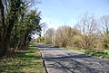
 A21, Pembury bypass - geograph.org.uk - 2939885.jpg 640 × 430; 66 KB
-
 A21, Pembury bypass - geograph.org.uk - 2939890.jpg 640 × 430; 49 KB
-
 Approaching Little Bayhall - geograph.org.uk - 2939791.jpg 640 × 430; 65 KB
-
 Approaching Little Bayhall Farm - geograph.org.uk - 2939794.jpg 640 × 430; 66 KB
-
 Arriva Bus Depot - geograph.org.uk - 3030572.jpg 640 × 430; 60 KB
-
 AXA offices - geograph.org.uk - 2934406.jpg 640 × 430; 63 KB
-
 Barn, Smockham Farm - geograph.org.uk - 3022467.jpg 640 × 430; 94 KB
-
 Bayhall Rd, Hall's Hole Rd junction - geograph.org.uk - 2934411.jpg 640 × 430; 70 KB
-
 Beacon at The Beacon - geograph.org.uk - 3023208.jpg 640 × 430; 110 KB
-
 Beacon, Tea Garden Lane - geograph.org.uk - 3023207.jpg 640 × 430; 88 KB
-
 Beau Nash - geograph.org.uk - 3029417.jpg 640 × 458; 66 KB
-
 BP Filling Station - geograph.org.uk - 3030576.jpg 640 × 430; 60 KB
-
 Bridleway to Smockham Farm - geograph.org.uk - 3022449.jpg 640 × 430; 134 KB
-
 Bridleway west of Smockham Farm - geograph.org.uk - 3022468.jpg 640 × 430; 140 KB
-
 BT Building, St John's Rd - geograph.org.uk - 3231218.jpg 640 × 430; 64 KB
-
 Building in High Wood - geograph.org.uk - 2937488.jpg 640 × 430; 96 KB
-
 Building overlooking the cemetery - geograph.org.uk - 3231237.jpg 640 × 430; 79 KB
-
 Building west of Smockham Farm - geograph.org.uk - 3022454.jpg 640 × 430; 99 KB
-
 Bus Stop, Medway Maritime Hospital - geograph.org.uk - 2860476.jpg 4,288 × 3,216; 6.2 MB
-
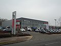
 Caffyns Vauxhall Chevrolet Skoda, Tunbridge Wells - geograph.org.uk - 2829853.jpg 4,320 × 3,240; 3.8 MB
-
 Calverley Park Crescent - geograph.org.uk - 3227583.jpg 640 × 430; 68 KB
-
 Camden Park - geograph.org.uk - 2934398.jpg 640 × 430; 78 KB
-
 Canon Hoare's Grave - geograph.org.uk - 3231238.jpg 640 × 430; 91 KB
-
 Church of Christ - geograph.org.uk - 3013501.jpg 640 × 430; 54 KB
-
 Clearing, Hurst Wood - geograph.org.uk - 3022480.jpg 640 × 430; 150 KB
-
 Cold bath, Happy Valley - geograph.org.uk - 3023221.jpg 640 × 430; 138 KB
-
 Cooper's Rough - geograph.org.uk - 2939799.jpg 640 × 430; 60 KB
-
 Cooper's Rough - geograph.org.uk - 2939800.jpg 640 × 430; 77 KB
-
 Coppiced trees, Happy Valley - geograph.org.uk - 3023216.jpg 640 × 430; 161 KB
-
 Coppicing, High Wood - geograph.org.uk - 2937501.jpg 640 × 430; 108 KB
-
 Coppicing, High Wood - geograph.org.uk - 2937525.jpg 640 × 430; 140 KB
-
 Daffodils by Langton Rd - geograph.org.uk - 3023177.jpg 640 × 430; 132 KB
-
 Dodhurst Farm - geograph.org.uk - 2937541.jpg 640 × 430; 55 KB
-
 Dodhurst Farm Oast - geograph.org.uk - 2937544.jpg 640 × 430; 51 KB
-
 Dodhurst Farm Oast - geograph.org.uk - 2937551.jpg 640 × 430; 60 KB
-
 Dodhurst Farm Oast - geograph.org.uk - 2937554.jpg 640 × 430; 40 KB
-

-
 Driving Test Centre - geograph.org.uk - 3227630.jpg 640 × 430; 55 KB
-
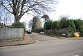
 Entrance to Camden Park - geograph.org.uk - 2934392.jpg 640 × 430; 97 KB
-
 Farmers Market - geograph.org.uk - 3227603.jpg 640 × 430; 62 KB
-
 Filling Station, St John's Rd - geograph.org.uk - 3030574.jpg 640 × 430; 60 KB
-

-
 Former Kent and Sussex hospital, Tunbridge Wells - geograph.org.uk - 2843634.jpg 4,320 × 3,240; 3.72 MB
-
 Former Rehoboth Chapel, Chapel Place, Tunbridge Wells - Date Plaque on Gable.JPG 2,400 × 1,200; 617 KB
-
 Fountain, Woodbury Park Cemetery - geograph.org.uk - 3231246.jpg 430 × 640; 86 KB
-
 Furniture World - geograph.org.uk - 3227622.jpg 640 × 430; 70 KB
-
 Gate across High Woods Lane - geograph.org.uk - 2937465.jpg 640 × 430; 90 KB
-
 Gates, Nevill Park - geograph.org.uk - 3025911.jpg 640 × 430; 106 KB
-
 Grosvenor Lodge - geograph.org.uk - 3227638.jpg 640 × 430; 68 KB
-
 Happy Valley - geograph.org.uk - 3023203.jpg 640 × 430; 107 KB
-
 Happy Valley Rocks - geograph.org.uk - 3025884.jpg 640 × 430; 126 KB
-
 Happy Valley Rocks - geograph.org.uk - 3025887.jpg 640 × 430; 118 KB
-
 High Brooms Gasholder - geograph.org.uk - 3013500.jpg 640 × 430; 39 KB
-

-

-
 High Wood - geograph.org.uk - 2937528.jpg 640 × 430; 126 KB
-
 High Woods Lane - geograph.org.uk - 2937445.jpg 640 × 430; 54 KB
-
 High Woods Lane - geograph.org.uk - 2937472.jpg 640 × 430; 70 KB
-
 High Woods Lane - geograph.org.uk - 2937476.jpg 640 × 430; 66 KB
-
 High Woods Lane - geograph.org.uk - 2937535.jpg 640 × 430; 72 KB
-
 High Woods Lane - geograph.org.uk - 2937537.jpg 640 × 430; 59 KB
-
 High Woods Lane - geograph.org.uk - 2939792.jpg 640 × 430; 54 KB
-
 High Woods Lane, High Wood - geograph.org.uk - 2937483.jpg 640 × 430; 127 KB
-
 Hoopers - geograph.org.uk - 3029356.jpg 640 × 430; 78 KB
-

-
 Hungershall Park - geograph.org.uk - 3025907.jpg 640 × 430; 61 KB
-
 Hungershall Park Rd - geograph.org.uk - 3025922.jpg 640 × 430; 96 KB
-
 Il Vesuvio - geograph.org.uk - 2934365.jpg 640 × 430; 62 KB
-
 In Happy Valley - geograph.org.uk - 3025878.jpg 640 × 430; 130 KB
-
 Invicta Motors Honda, Tunbridge Wells - geograph.org.uk - 2829849.jpg 4,320 × 3,240; 4.03 MB
-
 Invicta Motors Mazda, Tunbridge Wells - geograph.org.uk - 2829828.jpg 4,320 × 3,240; 4.26 MB
-
 Job Centre, Tunbridge Wells - geograph.org.uk - 3030559.jpg 640 × 430; 77 KB
-
 Kelsey Arms - geograph.org.uk - 3030585.jpg 640 × 430; 62 KB
-
 Kent and Sussex Hospital - geograph.org.uk - 3030552.jpg 640 × 430; 57 KB
-
 Langton Rd - geograph.org.uk - 3023179.jpg 640 × 430; 98 KB
-
 Large house, Camden Park - geograph.org.uk - 2934403.jpg 640 × 430; 90 KB
-
 Lexus Tunbridge Wells - geograph.org.uk - 2829862.jpg 4,320 × 3,240; 4.25 MB
-
 Lifestyle Ford, Tunbridge Wells - geograph.org.uk - 2843619.jpg 4,320 × 3,240; 3.77 MB
-
 Lifestyle Subaru Isuzu, Tunbridge Wells - geograph.org.uk - 2843605.jpg 4,320 × 3,240; 3.44 MB
-
 Little Bayhall Farm - geograph.org.uk - 2939795.jpg 640 × 430; 66 KB
-
 Little Bayhall Farm - geograph.org.uk - 2939796.jpg 640 × 430; 60 KB
-
 Little Bayhall Farm - geograph.org.uk - 2939797.jpg 640 × 430; 56 KB
-
 Lloyds TSB - geograph.org.uk - 3227600.jpg 640 × 430; 106 KB
-
 Lodge, Woodbury Park Cemetery - geograph.org.uk - 3231247.jpg 640 × 430; 77 KB
-
 Major York's Rd - geograph.org.uk - 3025914.jpg 640 × 430; 115 KB
-
 Mereworth Motors - geograph.org.uk - 3231261.jpg 640 × 430; 61 KB
-
 Millennium Clock - geograph.org.uk - 3029364.jpg 430 × 640; 57 KB
-

-
 Motorline Nissan, Tunbridge Wells - geograph.org.uk - 2829857.jpg 4,320 × 3,240; 3.63 MB
-
 Motorline Toyota, Tunbridge Wells - geograph.org.uk - 2829860.jpg 4,320 × 3,240; 3.89 MB
-
 Motorline Volkswagen, Tunbridge Wells - geograph.org.uk - 2829851.jpg 4,320 × 3,240; 3.76 MB
-
 Muddy path - geograph.org.uk - 2939802.jpg 640 × 430; 106 KB
-
 Napier House - geograph.org.uk - 3029411.jpg 640 × 430; 69 KB
-
 Nevill Park - geograph.org.uk - 3025901.jpg 640 × 430; 94 KB
-
 NexusH, Goods Station Rd - geograph.org.uk - 3227611.jpg 640 × 430; 69 KB
-
 Oakfield Crescent - geograph.org.uk - 2934390.jpg 640 × 430; 84 KB
-
 Odeon cinema, Knights Park, Tunbridge Wells - geograph.org.uk - 2829825.jpg 4,320 × 3,240; 4.05 MB
-
 Offices, Mount Ephraim Rd - geograph.org.uk - 3029409.jpg 640 × 430; 127 KB
-
 One Stop, Hawkenbury - geograph.org.uk - 2934409.jpg 640 × 430; 51 KB
-
 Out of Africa - geograph.org.uk - 2934367.jpg 640 × 430; 68 KB
-
 Path junction, High Wood - geograph.org.uk - 2937522.jpg 640 × 430; 106 KB
-

-
 Post box on New Pond Road - geograph.org.uk - 2861288.jpg 640 × 428; 125 KB
-
 Ramsgate Montefiore Mausoleum-geograph.org.uk-2847126.jpg 640 × 480; 67 KB
-
 Richborough power station.jpg 3,506 × 2,521; 2.18 MB
-
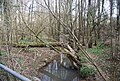
 River Teise - geograph.org.uk - 2939804.jpg 640 × 430; 148 KB
-
 River Teise, Cooper's Rough - geograph.org.uk - 2939806.jpg 640 × 430; 142 KB
-
 Rose and Crown - geograph.org.uk - 3227634.jpg 640 × 430; 70 KB
-
 Royal Bank of Scotland - geograph.org.uk - 3029358.jpg 430 × 640; 47 KB
-
 Sainsbury's Local - geograph.org.uk - 3231256.jpg 640 × 430; 67 KB
-
 Sandringham Mews - geograph.org.uk - 3231250.jpg 640 × 430; 93 KB
-
 Sankeys - geograph.org.uk - 3030542.jpg 640 × 419; 74 KB
-
 Shatters Wood - geograph.org.uk - 3231265.jpg 640 × 430; 80 KB
-
 SLM Vauxhall, Tunbridge Wells - geograph.org.uk - 2829845.jpg 4,320 × 3,240; 3.62 MB
-
 Smockham Farmhouse - geograph.org.uk - 3022495.jpg 640 × 412; 80 KB
-
 St John's Recreation Ground - geograph.org.uk - 3022439.jpg 640 × 430; 79 KB
-
 Station approach, High Brooms - geograph.org.uk - 3013499.jpg 640 × 430; 54 KB
-
 Teddies - geograph.org.uk - 3030582.jpg 640 × 426; 77 KB
-
 Temple House - geograph.org.uk - 3029423.jpg 640 × 430; 68 KB
-
 Tesco Metro - geograph.org.uk - 3227633.jpg 640 × 430; 54 KB
-
 Thames Fiat Citroen, Tunbridge Wells - geograph.org.uk - 2829868.jpg 4,320 × 3,240; 3.53 MB
-
 Thames Fiat Peugeot, Tunbridge Wells - geograph.org.uk - 2829875.jpg 4,320 × 3,240; 3.64 MB
-
 The Beacon - geograph.org.uk - 3023213.jpg 640 × 398; 114 KB
-
 The Beau Nash - geograph.org.uk - 3029414.jpg 640 × 430; 89 KB
-
 The Cheesewright, Happy Valley Rocks - geograph.org.uk - 3025891.jpg 430 × 640; 119 KB
-
 The Crossway - geograph.org.uk - 3025897.jpg 640 × 430; 124 KB
-
 The former St Paul's School - geograph.org.uk - 3023193.jpg 640 × 430; 66 KB
-
 The Great Hall Arcade - geograph.org.uk - 3029357.jpg 640 × 430; 83 KB
-
 The Midway - geograph.org.uk - 3025895.jpg 640 × 430; 89 KB
-
 The Montefiore Mausoleum, Ramsgate - geograph.org.uk - 2847096.jpg 640 × 480; 78 KB
-
 The Old Main Post Office - geograph.org.uk - 3029354.jpg 640 × 430; 92 KB
-
 Tile hung house, Mount Ephraim - geograph.org.uk - 3029427.jpg 640 × 430; 81 KB
-
 TN4 - geograph.org.uk - 3030545.jpg 640 × 408; 59 KB
-
 Tunbridge Wells Circular Path - geograph.org.uk - 2939798.jpg 640 × 430; 140 KB
-
 Tunbridge Wells Circular Walk - geograph.org.uk - 2934400.jpg 640 × 430; 118 KB
-
 Tunbridge Wells Hyundai - geograph.org.uk - 2829846.jpg 4,320 × 3,240; 3.97 MB
-
 Tunbridge Wells Indoor Bowls Centre - geograph.org.uk - 2937467.jpg 640 × 430; 59 KB
-
 Tunbridge Wells Sandstone cliff - geograph.org.uk - 3030587.jpg 640 × 430; 121 KB
-
 Tunbridge Wells War Memorial - geograph.org.uk - 3029363.jpg 640 × 430; 99 KB
-
 United Reformed Church, Hawkenbury - geograph.org.uk - 2934408.jpg 640 × 430; 54 KB
-
 Victoria Grove - geograph.org.uk - 3025929.jpg 640 × 430; 133 KB
-
 Victoria Lodge - geograph.org.uk - 2934378.jpg 640 × 430; 98 KB
-
 Victoria Lodge - geograph.org.uk - 3227589.jpg 640 × 430; 72 KB
-
 Victoria Lodge - geograph.org.uk - 3227591.jpg 640 × 430; 74 KB
-
 Weathered gravestones - geograph.org.uk - 3231243.jpg 640 × 430; 119 KB
-
 Wellington Rocks - geograph.org.uk - 3025927.jpg 640 × 430; 89 KB
-
 Woodbury Park Cemetery - geograph.org.uk - 3231227.jpg 640 × 430; 85 KB
-
 Woodbury Park Cemetery - geograph.org.uk - 3231239.jpg 640 × 430; 134 KB
-
 Woodland south of High Woods Lane - geograph.org.uk - 2937546.jpg 640 × 430; 61 KB
-
 Woodland, Happy Valley - geograph.org.uk - 3023214.jpg 640 × 430; 141 KB
-
 YMCA, Tunbridge Wells - geograph.org.uk - 3227627.jpg 640 × 430; 61 KB

.jpg)


