Category:Marden, Kent
Jump to navigation
Jump to search
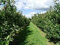
English: Marden is a village and civil parish in the Maidstone District of Kent, England. The parish is located on the flood plain of the River Beult (a tributary of the River Medway south of Maidstone. It is on the B2079 road linking the A229 from Maidstone with the A21 at Flimwell. It has its own railway station. It is in an apple-growing area, and has a population of approximately 4000 persons.
village in Kent, England, UK  | |||||
| Upload media | |||||
| Instance of | |||||
|---|---|---|---|---|---|
| Location | Maidstone, Kent, South East England, England | ||||
| Said to be the same as | Marden (Wikimedia duplicated page, civil parish) | ||||
 | |||||
Subcategories
This category has the following 5 subcategories, out of 5 total.
Media in category "Marden, Kent"
The following 200 files are in this category, out of 666 total.
(previous page) (next page)-
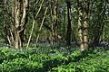
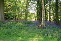 A carpet of bluebells - geograph.org.uk - 2499915.jpg 640 × 430; 134 KB
-
 A crop of hay - geograph.org.uk - 3194040.jpg 640 × 430; 96 KB
-
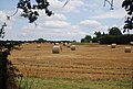 A field of bales - geograph.org.uk - 3194034.jpg 640 × 430; 76 KB
-
 A hedge and ditch - geograph.org.uk - 3194048.jpg 640 × 430; 75 KB
-
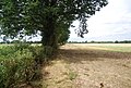 A hedgeline north of Church Farm - geograph.org.uk - 3194043.jpg 640 × 430; 110 KB
-
 A very broken stile - geograph.org.uk - 3196097.jpg 640 × 430; 136 KB
-
 A wooded pond - geograph.org.uk - 3200906.jpg 640 × 430; 70 KB
-
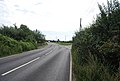 A229 - geograph.org.uk - 3202745.jpg 640 × 430; 73 KB
-
 A229 at Stile Bridge - geograph.org.uk - 3202753.jpg 640 × 430; 69 KB
-
 Albion Cottage, Albion Road - geograph.org.uk - 5743703.jpg 4,000 × 3,000; 2.2 MB
-
 Albion Road, Marden - geograph.org.uk - 5494697.jpg 3,264 × 2,448; 1.32 MB
-
 Albion Road, Marden - geograph.org.uk - 5494719.jpg 3,264 × 2,448; 1.65 MB
-
 All fenced in - geograph.org.uk - 3218772.jpg 640 × 430; 113 KB
-
 Alpacas grazing - geograph.org.uk - 3087996.jpg 3,072 × 2,304; 1.37 MB
-
 Alterations to Sunny Side Farm, Maidstone Road, Marden - geograph.org.uk - 4993582.jpg 2,448 × 3,264; 2.49 MB
-
 An old orchard, Beale Farm - geograph.org.uk - 4916084.jpg 640 × 426; 51 KB
-
 Apple Orchard - geograph.org.uk - 5530827.jpg 640 × 480; 123 KB
-
 Ashford train at Marden - geograph.org.uk - 3191313.jpg 640 × 430; 80 KB
-
 Ashford train at Marden Station - geograph.org.uk - 2490995.jpg 640 × 430; 73 KB
-

-
 B2079 - geograph.org.uk - 5030734.jpg 640 × 426; 59 KB
-
 B2079 - geograph.org.uk - 5033128.jpg 640 × 426; 93 KB
-
 B2079 - geograph.org.uk - 5033150.jpg 640 × 426; 58 KB
-
 B2079 - geograph.org.uk - 5033158.jpg 640 × 426; 74 KB
-
 B2079 towards Marden - geograph.org.uk - 2995039.jpg 2,256 × 1,496; 911 KB
-
 B2079 towards Marden - geograph.org.uk - 5005914.jpg 640 × 480; 168 KB
-
 B2079, Marden - geograph.org.uk - 4916671.jpg 640 × 426; 63 KB
-
 B2079, Marden - geograph.org.uk - 5030706.jpg 640 × 426; 57 KB
-
 B2079, Marden - geograph.org.uk - 5030711.jpg 640 × 426; 63 KB
-
 B2079, Marden - geograph.org.uk - 5030713.jpg 640 × 426; 70 KB
-
 B2079, south - geograph.org.uk - 5033134.jpg 640 × 426; 93 KB
-
 Barn at Mill Farm - geograph.org.uk - 4633843.jpg 4,000 × 3,000; 2.59 MB
-
 Barn at Reed Court Farm - geograph.org.uk - 4633168.jpg 1,024 × 768; 278 KB
-
 Barn conversion, Marden Beech - geograph.org.uk - 5033203.jpg 640 × 426; 94 KB
-
 Barn on Hunton Road, Marden, Kent - geograph.org.uk - 629213.jpg 640 × 436; 54 KB
-
 Barn, Poplar Hill Farm - geograph.org.uk - 3196137.jpg 640 × 430; 65 KB
-
 Battle Lane - geograph.org.uk - 3196189.jpg 640 × 430; 75 KB
-
 Battle Lane - geograph.org.uk - 3850487.jpg 640 × 480; 169 KB
-
 Battle Lane - geograph.org.uk - 4923943.jpg 640 × 426; 94 KB
-
 Battle Lane, near Wanshurst Green - geograph.org.uk - 5500641.jpg 3,264 × 2,448; 1.72 MB
-
 Battle Lane, St. Ann's Green - geograph.org.uk - 5510988.jpg 3,264 × 2,448; 1.92 MB
-
 Battle Lane, St. Ann's Green - geograph.org.uk - 5510998.jpg 3,264 × 2,448; 2.17 MB
-
 Battle Lane, St. Ann's Green - geograph.org.uk - 5511000.jpg 3,264 × 2,448; 1.76 MB
-
 Battle Lane, Wanshurst Green - geograph.org.uk - 5511009.jpg 3,264 × 2,448; 2.04 MB
-
 Battle Lane, Wanshurst Green - geograph.org.uk - 5511010.jpg 3,264 × 2,448; 1.97 MB
-
 Battle Lane, Wanshurst Green - geograph.org.uk - 5511011.jpg 3,264 × 2,448; 1.85 MB
-
 Beech Cottages - geograph.org.uk - 5033226.jpg 640 × 426; 88 KB
-
 Beech Farm - geograph.org.uk - 5033216.jpg 640 × 426; 76 KB
-
 Beech Farm Oast - geograph.org.uk - 5033230.jpg 640 × 426; 88 KB
-
 Beech Farm Oast - geograph.org.uk - 5033235.jpg 640 × 426; 70 KB
-
 Beech Farm Oast - geograph.org.uk - 5033239.jpg 640 × 426; 137 KB
-
 Beech Farm Oast - geograph.org.uk - 5035463.jpg 640 × 426; 65 KB
-
 Beech Farmhouse - geograph.org.uk - 5033236.jpg 640 × 426; 102 KB
-
 Beech Meadow Cottage - geograph.org.uk - 5033165.jpg 640 × 426; 105 KB
-
 Beech Oast - geograph.org.uk - 5033210.jpg 640 × 426; 85 KB
-
 Beech Oast - geograph.org.uk - 5033214.jpg 640 × 426; 48 KB
-
 Beech Oast - geograph.org.uk - 5033218.jpg 640 × 426; 53 KB
-
 Beechbridge Cottages - geograph.org.uk - 5033156.jpg 640 × 426; 76 KB
-
 Beechbridge Cottages - geograph.org.uk - 5033162.jpg 640 × 426; 101 KB
-
 Bend, Tilden Lane - geograph.org.uk - 3207374.jpg 640 × 430; 78 KB
-
 Bend, Tilden Lane - geograph.org.uk - 3211673.jpg 640 × 430; 58 KB
-
 Beult valley - geograph.org.uk - 3202769.jpg 640 × 430; 52 KB
-
 Blackmoor Barn - geograph.org.uk - 1238216.jpg 640 × 447; 83 KB
-
 Blackmoor Farm Barn - geograph.org.uk - 5033228.jpg 640 × 426; 83 KB
-
 Blackmoor House - geograph.org.uk - 1238220.jpg 640 × 447; 81 KB
-
 Bluebells in Woodland by Tilden Lane - geograph.org.uk - 5743708.jpg 5,184 × 3,456; 5.27 MB
-
 Branns Farmhouse - geograph.org.uk - 5033146.jpg 640 × 426; 86 KB
-
 Bridge Across Drainage Ditch, and Footpath, Marden - geograph.org.uk - 3910149.jpg 4,608 × 3,456; 3.48 MB
-
 Bridge Across Drainage Ditch, Marden - geograph.org.uk - 3909668.jpg 4,608 × 3,456; 3.44 MB
-
 Bridge Across Lesser Teise, Marden - geograph.org.uk - 3907787.jpg 4,608 × 3,456; 3.45 MB
-
 Bridge and Railside Track, Marden - geograph.org.uk - 3908312.jpg 4,608 × 3,456; 3.43 MB
-
-
 Bridge over stream, Plain Road - geograph.org.uk - 4275364.jpg 640 × 480; 121 KB
-
 Bridgehurst Wood - geograph.org.uk - 4011522.jpg 640 × 430; 64 KB
-
 Bridgehurst Wood - geograph.org.uk - 4011523.jpg 640 × 430; 56 KB
-
 Bridgehurst Wood Reservoir - geograph.org.uk - 1238327.jpg 640 × 446; 62 KB
-
 Broad Forstal Farm - geograph.org.uk - 3211679.jpg 640 × 430; 37 KB
-
 Broad Forstal Farm - geograph.org.uk - 3211681.jpg 640 × 430; 46 KB
-
 Broad Forstal Farm - geograph.org.uk - 3214607.jpg 640 × 430; 93 KB
-
 Broad Forstal Farmhouse - geograph.org.uk - 3211688.jpg 640 × 430; 69 KB
-
 Building at Little Mill Farm - geograph.org.uk - 4364515.jpg 640 × 480; 146 KB
-
 Building by Battle Road - geograph.org.uk - 5743727.jpg 5,184 × 3,456; 4.63 MB
-
 Building new houses - geograph.org.uk - 5030746.jpg 640 × 426; 58 KB
-
 Building site, Marden - geograph.org.uk - 4275590.jpg 640 × 480; 101 KB
-
 Buildings in Church Green - geograph.org.uk - 3620623.jpg 913 × 684; 202 KB
-
 Bumpers Hall, Marden - geograph.org.uk - 5968834.jpg 4,808 × 3,205; 1.31 MB
-
 Bus stop and road junction, Marden Beech - geograph.org.uk - 4275354.jpg 640 × 480; 129 KB
-
 Bygone bus JHA232L.jpg 640 × 466; 56 KB
-

-
 Caravan site - geograph.org.uk - 3202772.jpg 640 × 430; 78 KB
-
 Cereals, The Teise Valley - geograph.org.uk - 5033153.jpg 640 × 426; 46 KB
-
 Chainhurst Farmhouse - geograph.org.uk - 4633796.jpg 1,024 × 768; 223 KB
-
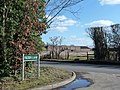
 Chainhurst Village Sign - geograph.org.uk - 5494604.jpg 3,264 × 2,448; 2.33 MB
-
 Chainhurst Village Sign - geograph.org.uk - 5494628.jpg 3,264 × 2,448; 2.25 MB
-
 Chambers College - geograph.org.uk - 1237853.jpg 640 × 442; 51 KB
-
 Chambers Cottages - geograph.org.uk - 3200823.jpg 640 × 430; 81 KB
-
-
 Church Farm - geograph.org.uk - 3194024.jpg 640 × 430; 56 KB
-
 Church Green, Marden - geograph.org.uk - 1711024.jpg 2,048 × 1,536; 1.03 MB
-
 Church Green, Marden - geograph.org.uk - 2701553.jpg 1,095 × 801; 170 KB
-
 Church of St Michael and All Angels - geograph.org.uk - 4916639.jpg 417 × 640; 89 KB
-
 Church of St Michael and All Angels - geograph.org.uk - 4916649.jpg 640 × 426; 67 KB
-
 Church of St Michael and All Angels - geograph.org.uk - 4916654.jpg 640 × 460; 76 KB
-
 Church of St Michael and All Angels - geograph.org.uk - 5030693.jpg 640 × 426; 122 KB
-
 Claygate - geograph.org.uk - 5030680.jpg 640 × 426; 48 KB
-
 Clump of trees in stubble - geograph.org.uk - 3200839.jpg 640 × 430; 58 KB
-
 Construction of houses, Maidstone Road - geograph.org.uk - 4993575.jpg 3,264 × 2,448; 2.22 MB
-
 Converted barn, Marden Beech - geograph.org.uk - 5033201.jpg 640 × 426; 89 KB
-
 Converted Chapel - geograph.org.uk - 3218806.jpg 640 × 430; 71 KB
-
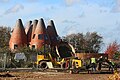
 Converted oast house, Chainhurst - geograph.org.uk - 5005597.jpg 640 × 428; 118 KB
-
 Copper Lane, Marden - geograph.org.uk - 1111812.jpg 640 × 480; 91 KB
-
 Copper Lane, Marden - geograph.org.uk - 5494737.jpg 3,264 × 2,448; 2.63 MB
-
 Copper or Coppen Lane Marden - geograph.org.uk - 5182805.jpg 640 × 480; 125 KB
-
 Cornwells Farm - geograph.org.uk - 2494679.jpg 640 × 430; 42 KB
-
 Cornwells Farm - geograph.org.uk - 5530819.jpg 640 × 480; 83 KB
-
 Cottage, Pattenden Lane - geograph.org.uk - 3218803.jpg 640 × 430; 62 KB
-
 Cottages on Goudhurst Road - geograph.org.uk - 2369890.jpg 640 × 480; 85 KB
-

-
 Cricket and Hockey Club under construction - geograph.org.uk - 5969822.jpg 5,184 × 3,456; 1.7 MB
-
 Crop Field - geograph.org.uk - 4342132.jpg 640 × 480; 36 KB
-
 Crop Spraying - geograph.org.uk - 1843977.jpg 1,024 × 768; 228 KB
-
 Dairy Lane, Chainhurst - geograph.org.uk - 5494631.jpg 3,264 × 2,448; 3.02 MB
-
 Dairy Lane, Chainhurst - geograph.org.uk - 5494634.jpg 3,264 × 2,448; 1.8 MB
-
 Dairy Lane, Chainhurst - geograph.org.uk - 5494637.jpg 3,264 × 2,448; 1.82 MB
-
 Derelict building - geograph.org.uk - 3218755.jpg 640 × 430; 66 KB
-
 Derelict Track Maintenance Shed, Marden - geograph.org.uk - 3908320.jpg 4,608 × 3,456; 3.47 MB
-
 Digging up Pattenden Lane - geograph.org.uk - 3218791.jpg 640 × 430; 78 KB
-
 Direction Sign - Signpost on the B2079 Goudhurst Road - geograph.org.uk - 6049147.jpg 1,784 × 1,273; 193 KB
-
 Discarded Hop Kernels - geograph.org.uk - 5530779.jpg 640 × 480; 68 KB
-
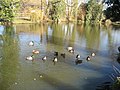 Ducks at Wanshurst Green Farm - geograph.org.uk - 2084273.jpg 640 × 480; 100 KB
-
 Electricity pole in field - geograph.org.uk - 5005932.jpg 640 × 480; 112 KB
-
 Entering Marden - geograph.org.uk - 5033137.jpg 640 × 426; 86 KB
-
 Entrance on Tilden Lane - geograph.org.uk - 3214678.jpg 640 × 430; 74 KB
-

-
 Entrance to Chain Dene Farm - geograph.org.uk - 3211660.jpg 640 × 430; 63 KB
-
 Entrance to Marden Meadows Nature Reserve - geograph.org.uk - 3918531.jpg 3,104 × 2,328; 1.28 MB
-
 Farm building, Maidstone Rd - geograph.org.uk - 3193988.jpg 640 × 430; 85 KB
-
 Farm Track and Field, Marden - geograph.org.uk - 3909651.jpg 4,608 × 3,456; 3.4 MB
-
 Farm Track, Marden - geograph.org.uk - 3909642.jpg 4,608 × 3,456; 3.46 MB
-
 Farmland - geograph.org.uk - 3196116.jpg 640 × 374; 44 KB
-
 Farmland and woodland - geograph.org.uk - 3223590.jpg 640 × 339; 42 KB
-
 Farmland and woodland - geograph.org.uk - 3284338.jpg 640 × 430; 56 KB
-
 Farmland and woodland by the railway - geograph.org.uk - 2947923.jpg 640 × 430; 59 KB
-

-
 Farmland by Tilden Lane - geograph.org.uk - 3214676.jpg 640 × 430; 60 KB
-
 Farmland in the Teise Valley - geograph.org.uk - 2499918.jpg 640 × 345; 51 KB
-
 Farmland near Marden - geograph.org.uk - 3216860.jpg 640 × 430; 60 KB
-
 Farmland near Milebush - geograph.org.uk - 3196121.jpg 640 × 430; 51 KB
-
 Farmland near Poplar Tree Farm - geograph.org.uk - 3196118.jpg 640 × 430; 51 KB
-
 Farmland near Poplar Tree Farm - geograph.org.uk - 3196143.jpg 640 × 430; 66 KB
-
 Farmland north of the railway line - geograph.org.uk - 4011528.jpg 640 × 430; 54 KB
-
 Farmland off Tilden Lane - geograph.org.uk - 3207427.jpg 640 × 430; 103 KB
-
 Farmland off Underlyn Lane - geograph.org.uk - 3333205.jpg 2,464 × 1,632; 4.2 MB
-
 Farmland south of Underlyn Lane - geograph.org.uk - 3216845.jpg 640 × 430; 59 KB
-
 Farmland, Poplar Tree Farm - geograph.org.uk - 3196125.jpg 640 × 430; 57 KB
-
 Farmland, Teise Valley - geograph.org.uk - 5033170.jpg 640 × 426; 86 KB
-
 Farmland, Teise Valley - geograph.org.uk - 5033180.jpg 640 × 426; 65 KB
-
 Field barn - geograph.org.uk - 2499909.jpg 640 × 430; 73 KB
-
 Field beside Hunton Road Chainhurst - geograph.org.uk - 4671863.jpg 640 × 480; 54 KB
-
 Field boundary - geograph.org.uk - 3434853.jpg 640 × 370; 59 KB
-
 Field boundary, Broad Forstal Farm - geograph.org.uk - 3211677.jpg 640 × 430; 51 KB
-
 Field by Sherenden Lane - geograph.org.uk - 5743685.jpg 5,184 × 3,456; 4.38 MB
-
 Field by the side of Goudhurst Rd - geograph.org.uk - 2494623.jpg 640 × 430; 80 KB
-
 Field in Marden - geograph.org.uk - 3908295.jpg 4,608 × 3,456; 3.47 MB
-
 Field North of Marden - geograph.org.uk - 5969811.jpg 3,456 × 5,184; 2.29 MB
-
 Field North of Marden - geograph.org.uk - 5969812.jpg 5,184 × 3,456; 1.16 MB
-
 Field north of Marden Station - geograph.org.uk - 5030681.jpg 640 × 426; 35 KB
-
 Field of stubble - geograph.org.uk - 3216848.jpg 640 × 430; 66 KB
-
 Fields and Footbridge, Marden Meadows Nature Reserve - geograph.org.uk - 3917367.jpg 3,104 × 2,328; 1.67 MB
-
 Fields off Tilden Lane - geograph.org.uk - 3333216.jpg 2,216 × 1,419; 2.19 MB
-

-
 Filling station and garage - geograph.org.uk - 5030694.jpg 640 × 426; 60 KB
-
 Fingerpost near Wanshurst Green - geograph.org.uk - 5511017.jpg 2,448 × 3,264; 2.91 MB
-
 Flat Wealden farmland - geograph.org.uk - 4916089.jpg 640 × 343; 32 KB
-
 Flowering orchards, Marden Beech - geograph.org.uk - 2499913.jpg 640 × 430; 97 KB
-
 Footbridge Across the Railway, Marden - geograph.org.uk - 3913021.jpg 4,608 × 3,456; 3.41 MB
-
 Footbridge over drainage ditch, near Chainhurst - geograph.org.uk - 5494581.jpg 3,264 × 2,448; 3.07 MB
-
 Footbridge over drainage ditch, near Chainhurst - geograph.org.uk - 5494584.jpg 3,264 × 2,448; 3.16 MB
-
 Footbridge over the River Teise - geograph.org.uk - 2499919.jpg 640 × 430; 136 KB
-
 Footpath along the hedge - geograph.org.uk - 3196128.jpg 640 × 430; 71 KB
-
 Footpath along the hedge - geograph.org.uk - 3216847.jpg 640 × 430; 78 KB
-
 Footpath by the industrial estate - geograph.org.uk - 3218765.jpg 640 × 430; 61 KB
-
 Footpath by the railway line - geograph.org.uk - 3218767.jpg 640 × 430; 134 KB
-
 Footpath by the railway line - geograph.org.uk - 3218780.jpg 640 × 430; 112 KB
-
 Footpath by the railway line 2 - geograph.org.uk - 3218770.jpg 640 × 430; 117 KB
-
 Footpath heading north - geograph.org.uk - 3196099.jpg 640 × 430; 74 KB
-
 Footpath off B2079 - geograph.org.uk - 5033139.jpg 640 × 426; 110 KB
-
 Footpath off Goudhurst Rd - geograph.org.uk - 2494616.jpg 640 × 430; 75 KB
-
 Footpath off Maidstone Rd - geograph.org.uk - 3200830.jpg 640 × 411; 103 KB
-
 Footpath off Sheephurst Lane - geograph.org.uk - 5033227.jpg 640 × 426; 91 KB
-
 Footpath off Stilebridge Lane - geograph.org.uk - 3207315.jpg 640 × 430; 105 KB
-
 Footpath off Tilden Lane - geograph.org.uk - 3211647.jpg 640 × 430; 114 KB
-
 Footpath off Tilden Lane - geograph.org.uk - 3214658.jpg 640 × 430; 89 KB
-
 Footpath south from Marden - geograph.org.uk - 2491016.jpg 640 × 430; 104 KB
-
 Footpath through orchards - geograph.org.uk - 2494634.jpg 640 × 430; 89 KB
-
 Footpath to Marden Beech - geograph.org.uk - 2491028.jpg 640 × 430; 120 KB
-
 Footpath, Great Pattenden - geograph.org.uk - 4011512.jpg 640 × 421; 49 KB
-
 Former Providence Chapel - geograph.org.uk - 5030699.jpg 640 × 409; 59 KB
-
 Former Providence Chapel, Marden - geograph.org.uk - 4275580.jpg 640 × 428; 86 KB
-
 Forstal Orchards - geograph.org.uk - 3211683.jpg 640 × 430; 83 KB


