Category:Margaretenbrunnen
Jump to navigation
Jump to search
| Object location | | View all coordinates using: OpenStreetMap |
|---|
 | |||||
| Upload media | |||||
| Instance of | |||||
|---|---|---|---|---|---|
| Location | |||||
| Street address |
| ||||
| Creator |
| ||||
| Heritage designation | |||||
 | |||||
Deutsch: Margaretenbrunnen
 |
Media in category "Margaretenbrunnen"
The following 11 files are in this category, out of 11 total.
-
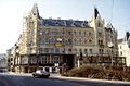 113R25120284 Stadt, Margaretenplatz, Häuser.jpg 1,064 × 703; 210 KB
-
 Margaretenbrunnen Figur Nacht.jpg 2,592 × 3,888; 3.82 MB
-
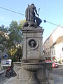
 Margaretenbrunnen Wien Detail.JPG 1,000 × 669; 244 KB
-
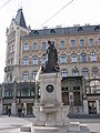
 Margaretenbrunnen Wien Margareta.JPG 1,000 × 668; 378 KB
-
 Margaretenbrunnen,Wien 1050, Gedenktafeln.jpg 2,378 × 1,772; 731 KB
-
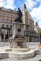
 Margaretenbrunnen.jpg 1,200 × 1,600; 305 KB
-
 Margaretenbrunnenrueckseite.JPG 3,000 × 4,000; 2.63 MB
-
 Margaretenhof, Wien.jpg 4,032 × 3,024; 4.59 MB
-
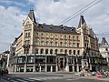
 Margaretenplatz 5, Margareten.jpg 4,032 × 3,024; 4.25 MB
-
 Margherita di Antiochia.jpg 3,456 × 4,608; 5.47 MB
-
 Wien fontanna Margareten.jpg 4,000 × 6,000; 8.95 MB


