Category:Mariä Himmelfahrt (Rohr)
Jump to navigation
Jump to search
This is the category of the Bavarian Baudenkmal (cultural heritage monument) with the ID D-2-73-165-2 (Wikidata)
|
| Object location | | View all coordinates using: OpenStreetMap |
|---|
 | |||||
| Upload media | |||||
| Instance of | |||||
|---|---|---|---|---|---|
| Location | Rohr in Niederbayern, Kelheim, Lower Bavaria, Bavaria, Germany | ||||
| Street address |
| ||||
| Architectural style | |||||
| Has part(s) |
| ||||
| Heritage designation | |||||
 | |||||
Subcategories
This category has the following 3 subcategories, out of 3 total.
Media in category "Mariä Himmelfahrt (Rohr)"
The following 31 files are in this category, out of 31 total.
-
 Abteikirche Mariä Himmelfahrt (Rohr).jpg 2,301 × 1,722; 1.44 MB
-
 Abteikirche Mariä Himmelfahrt Rohr Chorgewölbe.jpg 2,102 × 1,576; 1.29 MB
-
 Abteikirche Mariä Himmelfahrt Rohr Gewölbescheitel.jpg 2,304 × 1,728; 1.42 MB
-
 Abteikirche Mariä Himmelfahrt Rohr Langhausgewölbe.jpg 1,614 × 2,154; 1.37 MB
-
 Abteikirche Mariä Himmelfahrt Rohr Lkr Kelheim Niederbayern.JPG 2,129 × 2,821; 2.87 MB
-
 Abteikirche Mariä Himmelfahrt Rohr Marienskulptur.jpg 1,201 × 1,588; 763 KB
-
 Abteikirche Mariä Himmelfahrt Rohr Simse.jpg 2,042 × 1,532; 1,001 KB
-
 Abteikirche Mariä Himmelfahrt Rohr Stuhlwangen.jpg 2,304 × 1,728; 1,011 KB
-
 Abteikirche Mariä Himmelfahrt Rohr Turmhaube.jpg 2,304 × 1,728; 518 KB
-
 Benediktinerabteilkirche Rohr in Niederbayern 03.jpg 3,860 × 5,800; 7.55 MB
-
 Benediktinerabteilkirche Rohr in Niederbayern 07.jpg 3,595 × 5,800; 6.25 MB
-
 Benediktinerabteilkirche Rohr in Niederbayern 13.jpg 5,100 × 4,184; 11.97 MB
-
 Benediktinerabteilkirche Rohr in Niederbayern 17.jpg 4,350 × 5,800; 13.89 MB
-
 Benediktinerabteilkirche Rohr in Niederbayern 18.jpg 4,349 × 5,800; 14.69 MB
-
 Benediktinerabteilkirche Rohr in Niederbayern 19.jpg 3,024 × 4,032; 4.23 MB
-
 Benediktinerabteilkirche Rohr in Niederbayern 20.jpg 3,024 × 4,032; 3.52 MB
-
 Ein Blick zur Orgelempore.jpg 2,298 × 1,719; 1.17 MB
-
 Heiliger Augustinus.jpg 3,648 × 5,100; 7.94 MB
-
 Hochaltar mit Aufnahme Mariens in den Himmel 2.jpg 4,097 × 5,800; 8.93 MB
-
 Hochaltar mit Aufnahme Mariens in den Himmel.jpg 4,451 × 5,800; 9.28 MB
-
 Kloster Rohr Hochaltar 01.jpg 1,155 × 1,725; 650 KB
-
 Kloster Rohr in Nby Detail Hochaltar.JPG 2,048 × 1,536; 574 KB
-
 Kloster Rohr Niederbayern 02.jpg 3,968 × 2,976; 3.73 MB
-
 Kloster Rohr Niederbayern 03.jpg 5,567 × 2,240; 3.71 MB
-
 Kloster Rohr Niederbayern 04.jpg 3,968 × 2,976; 3.69 MB
-
 Kloster Rohr Niederbayern.JPG 2,480 × 1,652; 2.49 MB
-
 Kloster-Rohr-Asam-Kirche-innen-Decke.jpg 2,448 × 3,264; 2.86 MB
-
 Rohr in NB Klosterkirche Innenraum 2011.jpg 2,554 × 1,702; 3.06 MB
-
 Rohr in Niederbayern Mariä Himmelfahrt 999.jpg 3,264 × 4,896; 8.63 MB
-
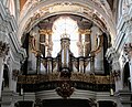 Rohr Klosterkirche Orgel (retouched).jpg 1,700 × 1,375; 617 KB
-
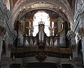 Rohr Klosterkirche Orgel.jpg 1,713 × 1,389; 455 KB
.jpg)


.jpg)
