Category:Mariä Himmelfahrt (Schlanders)
Jump to navigation
Jump to search
| Object location | | View all coordinates using: OpenStreetMap |
|---|
| This category shows the cultural heritage monument with the number 17265 in South Tyrol. (Wikidata)
|
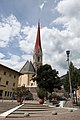
church building in Schlanders, Italy  | |||||
| Upload media | |||||
| Instance of | |||||
|---|---|---|---|---|---|
| Named after | |||||
| Dedicated to | |||||
| Location | Schlanders, South Tyrol, Trentino-South Tyrol, Italy | ||||
| Diocese | |||||
| Heritage designation | |||||
| Religion or worldview | |||||
 | |||||
Subcategories
This category has the following 3 subcategories, out of 3 total.
C
- Cemetery (Schlanders) (7 F)
Media in category "Mariä Himmelfahrt (Schlanders)"
The following 10 files are in this category, out of 10 total.
-
 Blick auf die Pfarrkirche.JPG 1,920 × 2,560; 934 KB
-
 Maria Himmelfahrt (Schlanders) 16.jpg 3,456 × 4,608; 6.47 MB
-
 Maria Himmelfahrt (Schlanders) 17.jpg 3,456 × 4,608; 6.57 MB
-
 Maria Himmelfahrt (Schlanders) 18.jpg 4,608 × 3,456; 6.58 MB
-
 Maria Himmelfahrt (Schlanders) 19.jpg 3,456 × 4,608; 7.63 MB
-
 Mariä Himmelfahrt - Schlanders.jpg 6,000 × 4,000; 20.25 MB
-
 Silandro 07-2011 - panoramio (1).jpg 1,280 × 853; 586 KB
-
 Silandro 07-2011 - panoramio (2).jpg 853 × 1,280; 537 KB
-
 Silandro-Chiesa Parrocchiale.jpg 1,536 × 2,048; 1.3 MB
-
 Silandro-Schlanders, Chiesa Parrocchiale 001.JPG 1,200 × 1,600; 402 KB
_16.jpg)
_17.jpg)
_18.jpg)
_19.jpg)

.jpg)
.jpg)

