Category:Mariahoek 6, Utrecht
Jump to navigation
Jump to search
| Object location | | View all coordinates using: OpenStreetMap |
|---|
 | |||||
| Upload media | |||||
| Instance of |
| ||||
|---|---|---|---|---|---|
| Location | Utrecht, Netherlands | ||||
| Street address |
| ||||
| Located on street | |||||
| Heritage designation |
| ||||
 | |||||
|
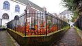
This is a category about rijksmonument number 36345
|
| Address |
|
Media in category "Mariahoek 6, Utrecht"
The following 6 files are in this category, out of 6 total.
-
 Lange Elisabethstraat Mariaplaats, 3511 Utrecht, Netherlands - panoramio (7).jpg 2,048 × 1,155; 534 KB
-
 Lange Elisabethstraat Mariaplaats, 3511 Utrecht, Netherlands - panoramio (8).jpg 2,048 × 1,155; 689 KB
-
 Mariahoek, voorgevels - Utrecht - 20235983 - RCE.jpg 803 × 1,200; 151 KB
-
 Mariahoek6.jpg 1,328 × 1,997; 635 KB
-
 Utrecht - Mariahoek 5-6-7 RM36345.JPG 2,742 × 4,479; 935 KB
-
 Utrecht Rijksmonument 36345 Pand Mariahoek 6.JPG 4,320 × 3,240; 5.54 MB
.jpg)
.jpg)


