Category:Mariakerk, 't Zandt
Jump to navigation
Jump to search
| Object location | | View all coordinates using: OpenStreetMap |
|---|
church building in Loppersum, Netherlands  | |||||
| Upload media | |||||
| Instance of | |||||
|---|---|---|---|---|---|
| Patron saint | |||||
| Location | 't Zandt, 't Zandt | ||||
| Street address |
| ||||
| Located on street |
| ||||
| Heritage designation |
| ||||
| Inception |
| ||||
 | |||||
|
This is a category about rijksmonument number 40295
|
| Address |
|
Subcategories
This category has the following 2 subcategories, out of 2 total.
I
Media in category "Mariakerk, 't Zandt"
The following 26 files are in this category, out of 26 total.
-
 't Zandt - kerk - zijaanzicht.jpg 3,701 × 2,776; 3.79 MB
-
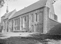
 't Zandt - kerk.jpg 3,612 × 2,709; 3.73 MB
-
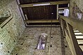 't Zandt - Mariakerk - binnenzijde toren.jpg 4,896 × 3,264; 18.21 MB
-
 't Zandt - Mariakerk - buitenmuur.jpg 4,896 × 3,264; 14.88 MB
-
 Exterieur koor zuid-zijde - 't Zandt - 20220917 - RCE.jpg 951 × 1,200; 392 KB
-
 Exterieur noord-gevel - 't Zandt - 20220914 - RCE.jpg 1,200 × 949; 313 KB
-
 Exterieur zuid-gevel - 't Zandt - 20220916 - RCE.jpg 1,200 × 960; 464 KB
-
 Exterieur zuid-gevel - 't Zandt - 20220918 - RCE.jpg 961 × 1,200; 349 KB
-
 Exterieur zuid-gevel, ingang - 't Zandt - 20220919 - RCE.jpg 960 × 1,200; 362 KB
-
 Exterieur zuid-oost zijde - 't Zandt - 20220915 - RCE.jpg 949 × 1,200; 198 KB
-
 Gedeelte van interieur met orgel - 't Zandt - 20220797 - RCE.jpg 1,200 × 957; 187 KB
-
 Gedenksteen in de toren - 't Zandt - 20220842 - RCE.jpg 1,200 × 839; 239 KB
-
 Kerk koorzijde naar het noord-westen - 't Zandt - 20220788 - RCE.jpg 965 × 1,200; 314 KB
-
 Kerk naar het noord-westen - 't Zandt - 20220792 - RCE.jpg 952 × 1,200; 234 KB
-
 Kerk naar het zuid-westen - 't Zandt - 20220787 - RCE.jpg 1,200 × 881; 302 KB
-
-

-

-
 Kerk, top van de west-gevel - 't Zandt - 20220789 - RCE.jpg 1,200 × 1,188; 342 KB
-
 Mariakerk - panoramio.jpg 2,592 × 1,952; 1.6 MB
-
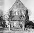
 Mariakerk tZandt.jpg 1,368 × 1,824; 487 KB
-
 Mariakerk2 tZandt.jpg 1,368 × 1,824; 721 KB
-
 West-gevel - 't Zandt - 20220790 - RCE.jpg 1,200 × 1,168; 421 KB
-
 Zilveren beker - 't Zandt - 20220840 - RCE.jpg 672 × 960; 90 KB
-
 Zuid-gevel naar het noord-oosten - 't Zandt - 20220793 - RCE.jpg 944 × 1,200; 354 KB
-
 Zuid-gevel naar het noord-westen - 't Zandt - 20220791 - RCE.jpg 954 × 1,200; 372 KB


