Category:Marine protected areas of Scotland
Jump to navigation
Jump to search
Media in category "Marine protected areas of Scotland"
The following 17 files are in this category, out of 17 total.
-
 Barra Fan and Hebrides Terrace Seamount MPA.png 799 × 442; 112 KB
-
 Central Fladden MPA.png 1,359 × 871; 224 KB
-
 East Caithness Cliffs SPA.png 864 × 581; 415 KB
-
 East of Gannet and Montrose Fields MPA.png 1,359 × 871; 224 KB
-
 Faroe-Shetland Sponge Belt MPA.png 1,359 × 871; 224 KB
-
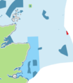
 Firth of Forth Banks MPA.png 604 × 606; 112 KB
-
 Geikie Slide and Hebridean Slope MPA.png 546 × 574; 110 KB
-
 Loch Sunart to the Sound of Jura MPA.png 663 × 604; 655 KB
-
 Map of MPA proposals (8272127250).jpg 1,600 × 1,098; 826 KB
-
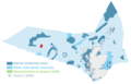
 Marine Protected Areas Scotland 2021.png 1,889 × 1,240; 268 KB
-
 Marine Protected Areas Scotland.png 1,359 × 871; 200 KB
-
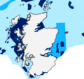
 North-east Faroe-Shetland Channel MPA.png 1,359 × 871; 224 KB
-
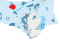
 Norwegian Boundary Sediment Plain MPA.png 323 × 368; 36 KB
-
 Rockall-Hatton Basin MPA.png 1,359 × 871; 224 KB
-
 Rosemary Bank MPA.png 788 × 548; 122 KB
-
 Turbot Bank MPA.png 455 × 430; 92 KB
-
 West of Scotland MPA.png 374 × 285; 48 KB


.jpg)


