Category:Marmaduke Street, Liverpool
Jump to navigation
Jump to search
| Object location | | View all coordinates using: OpenStreetMap |
|---|
Marmaduke Street runs north/south between Wavertree Road and Edge Lane, Liverpool. Most of the buildings on it are Grade II listed houses.
Subcategories
This category has the following 2 subcategories, out of 2 total.
C
Media in category "Marmaduke Street, Liverpool"
The following 8 files are in this category, out of 8 total.
-
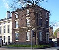 12A Edge Lane.jpg 4,423 × 3,729; 9.41 MB
-
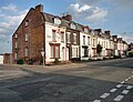 15-37 Marmaduke Street, Liverpool - geograph.org.uk - 5054805.jpg 640 × 489; 164 KB
-
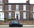
 16A Marmaduke Street.jpg 5,152 × 3,864; 7.55 MB
-
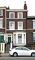
 24 Marmaduke Street.jpg 4,501 × 3,652; 7.93 MB
-
 26 Marmaduke Street.jpg 2,944 × 4,936; 6.87 MB
-
 28 Marmaduke Street.jpg 3,064 × 4,744; 6.69 MB
-
 30 Marmaduke Street.jpg 3,832 × 3,560; 6.85 MB
-
 Benchmark at Rose Vaults, Wavertree Road.jpg 4,096 × 3,168; 9.42 MB


