Category:Marsh Baldon
Jump to navigation
Jump to search
village and civil parish in South Oxfordshire, England  | |||||
| Upload media | |||||
| Instance of | |||||
|---|---|---|---|---|---|
| Location | South Oxfordshire, Oxfordshire, South East England, England | ||||
| Population |
| ||||
| Area |
| ||||
| official website | |||||
 | |||||
Subcategories
This category has the following 4 subcategories, out of 4 total.
Media in category "Marsh Baldon"
The following 166 files are in this category, out of 166 total.
-
 'Holly Tree Cottage', ^21 Toot Baldon - geograph.org.uk - 3950955.jpg 684 × 1,024; 156 KB
-
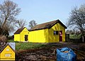
 A yellow telephone exchange - geograph.org.uk - 3950483.jpg 683 × 1,024; 254 KB
-
 A4074 towards Oxford - geograph.org.uk - 6236562.jpg 1,024 × 684; 317 KB
-
 A4074 towards Oxford - geograph.org.uk - 6236575.jpg 1,024 × 684; 260 KB
-
 Across to the north aisle - geograph.org.uk - 5792683.jpg 1,024 × 683; 90 KB
-
 Along by the hedge - geograph.org.uk - 5790443.jpg 1,024 × 683; 195 KB
-
 B4015 southwest of Golden Balls roundabout - geograph.org.uk - 2800736.jpg 2,982 × 2,241; 1.13 MB
-
 B4015 towards Chiselhampton - geograph.org.uk - 6819019.jpg 1,024 × 684; 296 KB
-
 B4015 towards Chiselhampton - geograph.org.uk - 6819030.jpg 1,024 × 684; 273 KB
-
 B4105, Little Baldon - geograph.org.uk - 2997006.jpg 1,600 × 1,200; 434 KB
-
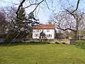
 Baldon House - geograph.org.uk - 5387917.jpg 640 × 360; 57 KB
-

-
 Baldon Lane in Marsh Baldon - geograph.org.uk - 1566132.jpg 640 × 427; 64 KB
-
 Barn by Little Baldon Farm - geograph.org.uk - 1409687.jpg 640 × 427; 70 KB
-
 Barns near Marsh Baldon - geograph.org.uk - 158963.jpg 640 × 480; 135 KB
-
 Bart memorial - geograph.org.uk - 5792475.jpg 533 × 800; 69 KB
-

-
 Benchmark on buttress of St Peter's Church - geograph.org.uk - 3950542.jpg 1,024 × 686; 255 KB
-
 Benchmark on gatepost beside footpath from B4015 - geograph.org.uk - 3911598.jpg 683 × 1,024; 213 KB
-
 Benchmark on telephone exchange - geograph.org.uk - 3950454.jpg 704 × 1,024; 308 KB
-
 Benchmark on ^4 Little Baldon - geograph.org.uk - 3912790.jpg 652 × 1,024; 199 KB
-
 Bequest by the wall - geograph.org.uk - 5791526.jpg 533 × 800; 91 KB
-
 Berries in the Arboretum - geograph.org.uk - 3450264.jpg 1,880 × 2,816; 982 KB
-
 Block on the bridleway - geograph.org.uk - 2380326.jpg 1,500 × 1,000; 373 KB
-
 Bridge for B4015 over Baldon Brook - geograph.org.uk - 3912854.jpg 683 × 1,024; 256 KB
-
 By the east end - geograph.org.uk - 5791322.jpg 1,024 × 683; 160 KB
-
 Carving on the headstone - geograph.org.uk - 5790442.jpg 533 × 800; 100 KB
-
 Chancel at St Peter - geograph.org.uk - 5792693.jpg 1,024 × 683; 123 KB
-
 Cherry Tree, Marsh Baldon - geograph.org.uk - 2437965.jpg 3,160 × 2,300; 2.29 MB
-
 Churchyard by the east end - geograph.org.uk - 5791405.jpg 1,024 × 683; 165 KB
-
 Churchyard by the south side - geograph.org.uk - 5791409.jpg 1,024 × 683; 159 KB
-
 Churchyard from the Gate - geograph.org.uk - 5790431.jpg 1,024 × 683; 200 KB
-
 Corner of field near Barclays Farm - geograph.org.uk - 6397851.jpg 1,024 × 683; 211 KB
-
 Cottages at Little Baldon - geograph.org.uk - 3912806.jpg 1,024 × 683; 192 KB
-
 Couple of chest tombs - geograph.org.uk - 5790569.jpg 1,024 × 683; 248 KB
-
 Covering of snowdrops - geograph.org.uk - 5791415.jpg 1,024 × 683; 201 KB
-
 Crossing of bridleways - geograph.org.uk - 2380331.jpg 1,500 × 1,000; 271 KB
-

-
 Door in the porch - geograph.org.uk - 5791317.jpg 533 × 800; 92 KB
-
 East end of St Peter - geograph.org.uk - 5791413.jpg 1,024 × 683; 123 KB
-
 Electricity Pylons at Toot Baldon - geograph.org.uk - 1566201.jpg 640 × 422; 40 KB
-
 Entering Nuneham Courtenay - geograph.org.uk - 3267516.jpg 2,287 × 1,665; 1.59 MB
-

-
 Farmland north of Little Baldon - geograph.org.uk - 6397825.jpg 1,024 × 683; 225 KB
-
 Farmland, Marsh Baldon - geograph.org.uk - 1566200.jpg 640 × 480; 138 KB
-
 Farmland, Marsh Baldon - geograph.org.uk - 2817491.jpg 640 × 480; 185 KB
-
 Farmland, Marsh Baldon - geograph.org.uk - 6081538.jpg 1,024 × 768; 262 KB
-
 Farmland, Marsh Baldon - geograph.org.uk - 6200487.jpg 1,024 × 683; 278 KB
-
 Farmland, Marsh Baldon - geograph.org.uk - 6200488.jpg 1,024 × 683; 267 KB
-
 Father John Bridges - geograph.org.uk - 5792477.jpg 533 × 800; 94 KB
-
 Field edge path north of Little Baldon - geograph.org.uk - 6397828.jpg 1,024 × 683; 224 KB
-
 Field of rape and Hanginglands Copse - geograph.org.uk - 1409672.jpg 640 × 427; 85 KB
-
 Field of rape at Marsh Baldon - geograph.org.uk - 2380347.jpg 1,500 × 1,000; 288 KB
-

-
 Floor in the chancel - geograph.org.uk - 5792467.jpg 533 × 800; 95 KB
-
 Flowers in the Arboretum - geograph.org.uk - 3450256.jpg 1,880 × 2,816; 1.25 MB
-
 Font by the painting - geograph.org.uk - 5791502.jpg 533 × 800; 75 KB
-

-
 Forgotten vault - geograph.org.uk - 5791410.jpg 533 × 800; 135 KB
-
 From the south east - geograph.org.uk - 5791324.jpg 1,024 × 683; 128 KB
-

-
 Golden Balls - geograph.org.uk - 2896883.jpg 3,429 × 2,096; 1.4 MB
-
 Graves at the West end - geograph.org.uk - 5790454.jpg 1,024 × 683; 218 KB
-
 Harcourt Arboretum - geograph.org.uk - 2676060.jpg 1,024 × 683; 210 KB
-
 Headstones near the porch - geograph.org.uk - 5790579.jpg 1,024 × 683; 176 KB
-
 House and gateway on Baldon Lane - geograph.org.uk - 6397834.jpg 1,024 × 683; 243 KB
-
 House on Oxford Road, Golden Balls - geograph.org.uk - 6304519.jpg 1,572 × 1,017; 1,005 KB
-
 Houses on Baldon Lane - geograph.org.uk - 6397837.jpg 1,024 × 683; 240 KB
-
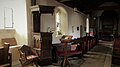 Inside St Peter, Marsh Baldon - geograph.org.uk - 5387950.jpg 640 × 360; 39 KB
-
 Into Nuneham Courtenay - geograph.org.uk - 2676090.jpg 1,024 × 683; 195 KB
-

-

-
 Junction of lanes east of village - geograph.org.uk - 3950655.jpg 1,024 × 683; 265 KB
-
 Just Sittin' In The Leaves - geograph.org.uk - 2880268.jpg 3,181 × 2,115; 1.51 MB
-
 Little Baldon - geograph.org.uk - 6397823.jpg 1,024 × 683; 236 KB
-
 Little Baldon Farm - geograph.org.uk - 2997009.jpg 3,504 × 2,496; 1.5 MB
-
 Lodge at the Gates - geograph.org.uk - 2676061.jpg 1,024 × 683; 202 KB
-
 Looking from the east - geograph.org.uk - 5790435.jpg 1,024 × 683; 156 KB
-
 Louisa Hawken - geograph.org.uk - 5791505.jpg 1,024 × 683; 56 KB
-
 March ^ Little Baldon Roll of Honour - geograph.org.uk - 5792688.jpg 1,024 × 683; 72 KB
-
 Marsh Baldon - geograph.org.uk - 4379091.jpg 4,320 × 3,240; 4.66 MB
-
 Marsh Baldon cricket ground - geograph.org.uk - 1135174.jpg 640 × 480; 69 KB
-
 Marsh Baldon, St Peter - geograph.org.uk - 4460956.jpg 4,608 × 3,456; 5.34 MB
-
 MarshBaldon cottage.JPG 2,750 × 1,650; 1.43 MB
-
 MarshBaldon cottages.JPG 3,000 × 1,800; 1.81 MB
-
 MarshBaldon Gateways.JPG 3,000 × 2,000; 2.52 MB
-
 MarshBaldon SevenStars.JPG 3,000 × 1,800; 1.68 MB
-
 Memorial in St Peter - geograph.org.uk - 5792472.jpg 533 × 800; 74 KB
-
 Nave in St Peter - geograph.org.uk - 5791508.jpg 1,024 × 683; 102 KB
-
 Nave window - geograph.org.uk - 5791519.jpg 533 × 800; 91 KB
-
 Nave window 2 - geograph.org.uk - 5791523.jpg 533 × 800; 67 KB
-
 North aisle of St Peter's Church - geograph.org.uk - 3950572.jpg 1,024 × 683; 234 KB
-
 Old Telephone Exchange - geograph.org.uk - 2328734.jpg 3,528 × 2,536; 1.22 MB
-
 Oxford Road, Golden Balls - geograph.org.uk - 6304518.jpg 1,788 × 1,167; 1.26 MB
-
 Parsonage Farm - geograph.org.uk - 3402058.jpg 640 × 427; 172 KB
-
 Parsonage Farm House, Marsh Baldon - geograph.org.uk - 2670969.jpg 3,264 × 2,448; 1.69 MB
-
 Parsonage Farm, Marsh Baldon - geograph.org.uk - 2428304.jpg 3,264 × 2,448; 1.52 MB
-
 Path in strip of woodland east of Marsh Baldon - geograph.org.uk - 6397849.jpg 1,024 × 683; 309 KB
-
 Path toward gate near Baldon House - geograph.org.uk - 6397829.jpg 1,024 × 683; 287 KB
-
 Peacocks at Harcourt Arboretum - geograph.org.uk - 5965537.jpg 4,525 × 3,082; 3.66 MB
-
 Pebble Hill, Marsh Baldon - geograph.org.uk - 2428254.jpg 3,264 × 2,448; 1.86 MB
-
 Plank footbridge near Marsh Baldon - geograph.org.uk - 6397843.jpg 1,024 × 683; 310 KB
-
 Planter in the corner - geograph.org.uk - 5790456.jpg 533 × 800; 109 KB
-
 Pond in Marsh Baldon - geograph.org.uk - 2325558.jpg 3,096 × 2,412; 1.21 MB
-
 Porch on St Peter - geograph.org.uk - 5790581.jpg 533 × 800; 130 KB
-
 Porch on the south side - geograph.org.uk - 5790576.jpg 1,024 × 683; 146 KB
-
 Private A.W.Gooding - geograph.org.uk - 5790451.jpg 533 × 800; 99 KB
-
 Private G. J. Gooding - geograph.org.uk - 5790453.jpg 533 × 800; 100 KB
-
 Pulpit and sound board - geograph.org.uk - 5792676.jpg 533 × 800; 93 KB
-
 Pulpit in St Peter - geograph.org.uk - 5792464.jpg 533 × 800; 84 KB
-
 Pulpit view - geograph.org.uk - 5792680.jpg 1,024 × 683; 122 KB
-
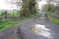
 Road to Chiselhampton - geograph.org.uk - 1409677.jpg 640 × 427; 69 KB
-
 Roll of Honour - geograph.org.uk - 5791320.jpg 533 × 800; 92 KB
-
 Roman Road, Baldon Row - geograph.org.uk - 2341887.jpg 3,264 × 2,448; 1.89 MB
-
 Rooster on the Fence - geograph.org.uk - 2328700.jpg 3,564 × 2,500; 1.38 MB
-
 Section of old road near Golden Balls - geograph.org.uk - 6236555.jpg 1,024 × 684; 441 KB
-
 Seven Stars public house - geograph.org.uk - 3950630.jpg 1,024 × 683; 147 KB
-
 Small wood on east side of A4074 - geograph.org.uk - 3950395.jpg 1,024 × 683; 214 KB
-
 Snowdrops in the grass - geograph.org.uk - 5790444.jpg 533 × 800; 154 KB
-
 Snowdrops mark the grave - geograph.org.uk - 5790572.jpg 1,024 × 683; 213 KB
-
 South of the church - geograph.org.uk - 5790574.jpg 1,024 × 683; 165 KB
-
 St Peter Baldon - geograph.org.uk - 5790428.jpg 1,024 × 683; 226 KB
-
 St Peter's Benchmark - geograph.org.uk - 5790458.jpg 533 × 800; 147 KB
-
 St Peter's church, Marsh Baldon - geograph.org.uk - 4380576.jpg 4,320 × 3,240; 5.87 MB
-
 St Peter's Church, Marsh Baldon - geograph.org.uk - 6397832.jpg 1,024 × 683; 246 KB
-
 St Peter, Marsh Baldon - geograph.org.uk - 5388003.jpg 640 × 360; 46 KB
-
 St. Peters, Marsh Baldon - geograph.org.uk - 2341743.jpg 3,888 × 2,592; 1.45 MB
-
 Stone house on the green, Marsh Baldon - geograph.org.uk - 4380568.jpg 4,320 × 3,240; 5.74 MB
-
 Sundial over the door - geograph.org.uk - 5791318.jpg 533 × 800; 83 KB
-
 Telephone Exchange, Golden Balls (1) - geograph.org.uk - 3704307.jpg 3,072 × 2,304; 1.8 MB
-
 Telephone Exchange, Golden Balls (2) - geograph.org.uk - 3704317.jpg 3,072 × 2,304; 1.78 MB
-

-
 The Belltower - geograph.org.uk - 5790577.jpg 533 × 800; 92 KB
-
 The chancel - geograph.org.uk - 5791513.jpg 1,024 × 683; 113 KB
-
 The east window - geograph.org.uk - 5792469.jpg 533 × 800; 136 KB
-
 The footpath to Marsh Baldon - geograph.org.uk - 2380350.jpg 1,500 × 1,000; 137 KB
-
 The Seven Stars at Marsh Baldon - geograph.org.uk - 1566099.jpg 640 × 427; 71 KB
-
 The village green at Marsh Baldon - geograph.org.uk - 1566115.jpg 640 × 427; 55 KB
-
 The village green at Marsh Baldon - geograph.org.uk - 1566135.jpg 640 × 427; 45 KB
-
 The village green at Marsh Baldon - geograph.org.uk - 1566139.jpg 640 × 421; 52 KB
-
 The village green at Marsh Baldon - geograph.org.uk - 1566162.jpg 640 × 427; 60 KB
-
 This aisle - geograph.org.uk - 5791512.jpg 1,024 × 683; 80 KB
-
 To the organ - geograph.org.uk - 5792699.jpg 533 × 800; 88 KB
-
 Towards Marsh Baldon Dutch Barns - geograph.org.uk - 3402068.jpg 640 × 427; 207 KB
-
 Towards the end - geograph.org.uk - 5790438.jpg 1,024 × 683; 200 KB
-
 Towards the nave - geograph.org.uk - 5791499.jpg 1,024 × 683; 114 KB
-
 Towards the tower - geograph.org.uk - 5790445.jpg 1,024 × 683; 135 KB
-
 Tower of St Peter's Church - geograph.org.uk - 3950613.jpg 683 × 1,024; 256 KB
-
 Tower on St Peter - geograph.org.uk - 5790448.jpg 533 × 800; 72 KB
-
 Track and farmland, Marsh Baldon - geograph.org.uk - 6200484.jpg 1,024 × 683; 259 KB
-
 Two War Graves - geograph.org.uk - 5790449.jpg 1,024 × 683; 218 KB
-
 Under the seat - geograph.org.uk - 5792478.jpg 533 × 800; 95 KB
-
 Village Green - geograph.org.uk - 1384919.jpg 640 × 480; 79 KB
-

-
 Window in the chancel - geograph.org.uk - 5792696.jpg 533 × 800; 50 KB
-
 Barn at Little Baldon - geograph.org.uk - 158956.jpg 640 × 480; 131 KB
-
 Bridleway to Marsh Baldon - geograph.org.uk - 1409689.jpg 640 × 427; 83 KB
-
 Field of wheat by Little Baldon - geograph.org.uk - 1409684.jpg 640 × 427; 76 KB
-
 Golden Balls - geograph.org.uk - 83512.jpg 640 × 481; 53 KB
-
 Little Baldon Farm - geograph.org.uk - 83516.jpg 640 × 481; 38 KB
-
 Looking Southeast - geograph.org.uk - 83515.jpg 640 × 481; 32 KB
-
 Marsh Baldon - geograph.org.uk - 82904.jpg 640 × 481; 37 KB
-
-
 Rose proving grounds - geograph.org.uk - 83514.jpg 640 × 481; 33 KB
-
 View of Cowley from Toot Baldon - geograph.org.uk - 192201.jpg 640 × 480; 81 KB
-
 Willow trees near Toot Baldon - geograph.org.uk - 192185.jpg 640 × 480; 116 KB


_-_geograph.org.uk_-_3704307.jpg)
_-_geograph.org.uk_-_3704317.jpg)


