Category:Maruyama River
Jump to navigation
Jump to search
日本語: 円山川、および円山川水系の河川。
English: Maruyama-gawa River and branches, in Tajima area, Hyogo Japan.
river in Japan  | |||||
| Upload media | |||||
| Instance of | |||||
|---|---|---|---|---|---|
| Location | Hyōgo Prefecture, Japan | ||||
| Length |
| ||||
| Mouth of the watercourse | |||||
| Drainage basin |
| ||||
| Tributary |
| ||||
 | |||||
Subcategories
This category has the following 7 subcategories, out of 7 total.
H
- Hinosojima (4 F)
T
- Tataragi Dam (25 F)
- Toshima Wetland (4 F)
- Tsuiyama Fishing Port (3 F)
Media in category "Maruyama River"
The following 26 files are in this category, out of 26 total.
-
 Billboard showing Hiyoriyama Seaside on bank of Maruyamagawa River.jpg 2,448 × 3,264; 2.21 MB
-
 Confluence of Maruyamagawa River and Momoshimagawa River.JPG 3,215 × 2,411; 1.92 MB
-
 Gembudō Station Ferry Landing.jpg 3,648 × 2,736; 4.22 MB
-
 Genbudo passing boat.JPG 3,872 × 2,592; 2.1 MB
-
 Genbudoutosen.jpg 4,032 × 2,272; 3.21 MB
-
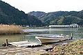
 Maruyama river - panoramio.jpg 2,048 × 1,536; 752 KB
-
 Maruyamagawa 06f3823sv.jpg 900 × 600; 84 KB
-
 Maruyamagawa 06f3827w.jpg 1,800 × 900; 293 KB
-
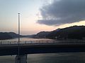
 Maruyamagawa River at dusk.JPG 3,264 × 2,448; 2.1 MB
-
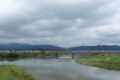
 Maruyamagawa River near river mouth 1.JPG 3,145 × 2,359; 1.75 MB
-
 Maruyamagawa River near river mouth 2.JPG 3,264 × 2,448; 1.6 MB
-
 Maruyamagawa River near river mouth 3.jpg 3,196 × 2,397; 2.05 MB
-
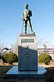 Masao Akagi bronze0001.jpg 2,848 × 4,288; 4.51 MB
-
 Michinoeki Asago M10 04.JPG 2,496 × 1,664; 2.93 MB
-
 Michinoeki Asago M10 25.JPG 2,496 × 1,664; 2.02 MB
-
 Minato-Ohashi Bridge from East at dusk.JPG 3,264 × 2,448; 2.35 MB
-
 R312-2019-099.jpg 1,500 × 844; 185 KB
-
 丸山川下流域1.JPG 640 × 480; 137 KB
-
 丸山川下流域2.JPG 640 × 480; 134 KB
-
 丸山川下流域3.JPG 640 × 480; 134 KB
-
 丸山川下流域4.JPG 640 × 480; 138 KB
-
 丸山川下流域5.JPG 640 × 480; 136 KB
-
 丸山川下流域6.JPG 640 × 480; 135 KB
-
 円山川上を河口(右)に向かって流れる霧.jpg 4,608 × 3,456; 3.79 MB
-
 来日岳から見た円山川河口.jpg 4,608 × 3,456; 3.57 MB
-
 来日岳から見た豊岡.jpg 4,608 × 3,456; 3.53 MB


