Category:Maryland Route 33
Jump to navigation
Jump to search
 | number: | (thirty-three) |
|---|---|---|
| State highways in Maryland: | 14 · 16 · 17 · 18 · 19 · 20 · 21 · 22 · 23 · 24 · 25 · 26 · 27 · 28 · 30 · 31 · 32 · 33 · 34 · 35 · 36 · 38 · 39 · 41 · 42 · 43 · 45 · 47 · 49 · 51 · 53 |
State highway in Talbot County, Maryland, US  | |||||
| Upload media | |||||
| Instance of | |||||
|---|---|---|---|---|---|
| Location | Maryland | ||||
| Transport network | |||||
| Owned by | |||||
| Maintained by | |||||
| Inception |
| ||||
| Length |
| ||||
| |||||
Subcategories
This category has only the following subcategory.
Media in category "Maryland Route 33"
The following 16 files are in this category, out of 16 total.
-
 Maryland Route 33 Drawbridge, Tilghman Island, Maryland.jpg 3,072 × 2,304; 1.86 MB
-
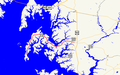 Maryland Route 33 map.png 922 × 579; 40 KB
-
 MD 33 EB approaching MD 322.JPG 843 × 576; 66 KB
-
 MD 33 EB at Railroad Street-Cherry Street.JPG 3,072 × 2,304; 715 KB
-
 MD 33 EB between MD 329 and MD 370.JPG 3,072 × 2,304; 589 KB
-
 MD 33 EB over Oak Creek 2.JPG 3,072 × 2,304; 439 KB
-
 MD 33 EB past MD 370.JPG 843 × 576; 55 KB
-
 MD 33 EB past Oak Creek 2.JPG 3,072 × 2,304; 488 KB
-
 MD 33 WB approaching MD 370.JPG 841 × 574; 44 KB
-
 MD 33 WB approaching Oak Creek.JPG 843 × 576; 43 KB
-
 MD 33 WB between MD 329 and St. Michaels.JPG 3,072 × 2,304; 486 KB
-
 MD 33 WB between MD 370 and MD 329 2.JPG 847 × 578; 46 KB
-
 MD 33 WB past MD 322 2.JPG 848 × 579; 52 KB
-
 MD 33 WB past MD 329 western terminus.JPG 843 × 576; 38 KB
-
 MD 33 WB past Oak Creek.JPG 3,072 × 2,304; 551 KB
-
 MD Route 33.svg 2,400 × 2,400; 10 KB


