Category:Mattersey
Jump to navigation
Jump to search
English: Mattersey is a village in Nottinghamshire, England. It is located 8 miles north of Retford. According to the 2001 census it had a population of 779 .
village in United Kingdom | |||||
| Upload media | |||||
| Instance of | |||||
|---|---|---|---|---|---|
| Location | Bassetlaw, Nottinghamshire, East Midlands, England | ||||
| Population |
| ||||
 | |||||
Subcategories
This category has the following 3 subcategories, out of 3 total.
Media in category "Mattersey"
The following 181 files are in this category, out of 181 total.
-
 A bridleway from Scrooby to Mattersey - geograph.org.uk - 2454385.jpg 768 × 1,024; 288 KB
-
 A field of carrots - geograph.org.uk - 4616090.jpg 800 × 533; 120 KB
-
 Abbey Road, Mattersey - geograph.org.uk - 2031502.jpg 1,024 × 709; 424 KB
-
 Abbey Road, Mattersey - geograph.org.uk - 2688008.jpg 800 × 600; 120 KB
-
 Abbey Road, Mattersey - geograph.org.uk - 2750756.jpg 1,024 × 768; 159 KB
-
 All Saints church in Mattersey. - geograph.org.uk - 5209635.jpg 640 × 480; 63 KB
-
 All Saints church, Mattersey - geograph.org.uk - 6587560.jpg 1,600 × 1,065; 419 KB
-
 All Saints church, Mattersey - geograph.org.uk - 6587563.jpg 1,600 × 1,065; 549 KB
-
 All Saints, Mattersey - geograph.org.uk - 4616763.jpg 3,044 × 1,676; 2.74 MB
-
 Animal Hotel at Mattersey Wood House - geograph.org.uk - 4610386.jpg 800 × 533; 130 KB
-
 Approaching Mattersey on old road-path from north - geograph.org.uk - 4616792.jpg 3,020 × 1,628; 3.33 MB
-
 At Mattersey Priory - geograph.org.uk - 4784150.jpg 3,753 × 5,062; 4.97 MB
-
 Barley Mow - geograph.org.uk - 2751264.jpg 1,024 × 768; 101 KB
-
 Barley Mow House, Mattersey - geograph.org.uk - 4260533.jpg 1,280 × 844; 149 KB
-
 Barns at Priory Farm - geograph.org.uk - 2351692.jpg 1,280 × 959; 245 KB
-
 Bench Mark, Lyndhurst, Mattersey - geograph.org.uk - 4260622.jpg 1,280 × 1,280; 283 KB
-
 Bench mark, Mattersey Road Bridge - geograph.org.uk - 4260541.jpg 986 × 1,280; 420 KB
-
 Bend in the track - geograph.org.uk - 4627803.jpg 1,024 × 768; 177 KB
-
 Blaco Hill - geograph.org.uk - 2451977.jpg 640 × 427; 119 KB
-
 Blaco Hill Farm - geograph.org.uk - 2452404.jpg 640 × 427; 81 KB
-
 Boarded up cottage, Abbey Road, Mattersey - geograph.org.uk - 2751230.jpg 1,024 × 768; 158 KB
-
 Breck Lane towards Mattersey - geograph.org.uk - 2687987.jpg 800 × 600; 126 KB
-
 Bridge House - geograph.org.uk - 2451722.jpg 427 × 640; 91 KB
-
 Bridge House, Church Lane - geograph.org.uk - 4260527.jpg 1,280 × 960; 248 KB
-
 Bridge on the bridleway southeast of Scrooby - geograph.org.uk - 4425611.jpg 1,600 × 1,200; 766 KB
-
 Bridleway at Mattersey Wood - geograph.org.uk - 4425534.jpg 1,600 × 1,200; 1.07 MB
-
 Bridleway south of Mattersey Grange - geograph.org.uk - 4425538.jpg 1,600 × 1,200; 667 KB
-
 Bridleway south of Mattersey Wood - geograph.org.uk - 4425523.jpg 1,600 × 1,200; 638 KB
-
 Bridleway to Broomfield Lane - geograph.org.uk - 4627828.jpg 1,024 × 768; 151 KB
-
 Bridleway to Mattersey Grange - geograph.org.uk - 1241928.jpg 640 × 480; 103 KB
-
 Bridleway to Mattersey Grange - geograph.org.uk - 2446664.jpg 640 × 427; 107 KB
-
 Bridleway towards Broomfield Lane - geograph.org.uk - 2687982.jpg 1,024 × 768; 380 KB
-
 Broomfield Lane - geograph.org.uk - 4803549.jpg 4,608 × 3,456; 4.04 MB
-
 Broomfield Lane a bridleway from Scrooby - geograph.org.uk - 2454393.jpg 1,024 × 768; 242 KB
-
 Broomfield Lane towards Mattersey Wood House - geograph.org.uk - 4425571.jpg 1,600 × 1,200; 499 KB
-
 Broomfield Lane west of Mattersey Thorpe - geograph.org.uk - 4784337.jpg 5,184 × 3,888; 5.84 MB
-
 Broomfield Lane, Mattersey Thorpe - geograph.org.uk - 4616696.jpg 3,072 × 1,728; 3.36 MB
-
 Broomfield Lane, near Mattersey Thorpe - geograph.org.uk - 4616690.jpg 3,056 × 1,700; 2.84 MB
-
 Brow of the hill - geograph.org.uk - 1574200.jpg 640 × 427; 69 KB
-
 Carr Road (track) - geograph.org.uk - 2688011.jpg 800 × 600; 99 KB
-
 Cemetery at Mattersey and Mattersey Thorpe - geograph.org.uk - 4616731.jpg 3,072 × 1,728; 3.86 MB
-
 Chapel House, Main Street - geograph.org.uk - 4260638.jpg 1,280 × 960; 269 KB
-

-
 Church Lane, Mattersey - geograph.org.uk - 4260535.jpg 1,280 × 876; 241 KB
-
 Converted chapel, Mattersey - geograph.org.uk - 2687999.jpg 640 × 480; 48 KB
-
 Coppice beside bridleway - geograph.org.uk - 2687985.jpg 800 × 600; 195 KB
-

-
 Entering Mattersey Thorpe on Breck Lane - geograph.org.uk - 4786122.jpg 5,184 × 3,888; 4.15 MB
-
 Entrance to rifle range. - geograph.org.uk - 514716.jpg 640 × 470; 183 KB
-
 Farm range at Laurels Farm , Mattersey - geograph.org.uk - 4260636.jpg 1,280 × 884; 290 KB
-
 Farmland at Mattersey - geograph.org.uk - 4616065.jpg 800 × 533; 120 KB
-
 Farmland near Mattersey Hill - geograph.org.uk - 2687995.jpg 640 × 480; 27 KB
-
 Farmland near Scrooby - geograph.org.uk - 2454379.jpg 1,024 × 768; 219 KB
-
 Farmland off Breck Lane - geograph.org.uk - 2687990.jpg 800 × 600; 85 KB
-
 Fence. - geograph.org.uk - 514718.jpg 640 × 459; 156 KB
-
 Field Adjoining Mattersey Wood - geograph.org.uk - 4803546.jpg 4,537 × 3,345; 3.49 MB
-
 Field road from Retford Road - geograph.org.uk - 1241939.jpg 640 × 480; 69 KB
-
-
 Fields towards Blaco Hill - geograph.org.uk - 2031527.jpg 1,024 × 768; 384 KB
-
 Football field at Mattersey Thorpe - geograph.org.uk - 4260483.jpg 1,280 × 829; 164 KB
-
 Footbridge over Main Drain, near Scrooby - geograph.org.uk - 4616667.jpg 3,072 × 1,728; 4.81 MB
-
 Footbridge over the River Idle at Mattersey - geograph.org.uk - 4424359.jpg 1,600 × 1,200; 859 KB
-
 Footpath off Ranskill Road - geograph.org.uk - 2687978.jpg 800 × 600; 125 KB
-
 Footpath off Retford Road - geograph.org.uk - 2688015.jpg 1,600 × 1,200; 406 KB
-
 Footpath to Ranskill - geograph.org.uk - 5084344.jpg 1,024 × 768; 337 KB
-
 Footpath to Wild Goose Farm - geograph.org.uk - 5085042.jpg 1,024 × 768; 196 KB
-
 Former Methodist Chapel, Mattersey - geograph.org.uk - 4260640.jpg 1,280 × 960; 198 KB
-
 Former sand and gravel pit - geograph.org.uk - 4028414.jpg 1,024 × 768; 143 KB
-
 Former school at Mattersey - geograph.org.uk - 4425493.jpg 1,600 × 1,200; 558 KB
-
 Former school, Mattersey - geograph.org.uk - 2031488.jpg 1,024 × 732; 436 KB
-
 Gate and driveway to Mattersey Hill Farm - geograph.org.uk - 1241937.jpg 640 × 468; 146 KB
-
 Gateway at Mattersey Thorpe - geograph.org.uk - 4784341.jpg 5,070 × 3,693; 4.76 MB
-
 George VI Postbox on Main Street, Mattersey - geograph.org.uk - 6587587.jpg 886 × 1,600; 338 KB
-
 Guinea fowl try to out run walkers - geograph.org.uk - 4616684.jpg 3,072 × 1,728; 3.76 MB
-
 Hall Farm, Mattersey - geograph.org.uk - 4260655.jpg 1,280 × 941; 235 KB
-
 Harvest over, sowing yet to begin - geograph.org.uk - 5085168.jpg 1,024 × 768; 209 KB
-
 House on Main Street, Mattersey - geograph.org.uk - 6587565.jpg 1,600 × 1,065; 448 KB
-
 Houses in Mattersey - geograph.org.uk - 2506401.jpg 640 × 426; 66 KB
-
 Irrigation pump - geograph.org.uk - 2447062.jpg 640 × 427; 112 KB
-
 January in Mattersey - geograph.org.uk - 4786174.jpg 3,888 × 5,184; 4.53 MB
-
 Lakeland House between Ranskill and Mattersey - geograph.org.uk - 4425512.jpg 1,600 × 1,200; 623 KB
-
 Lakeland House off Ranskill Road - geograph.org.uk - 4784353.jpg 3,888 × 5,062; 5.25 MB
-
 Lane and path off Retford Road. - geograph.org.uk - 514696.jpg 640 × 389; 94 KB
-
 Left hand bend with road junction to the right - geograph.org.uk - 4260642.jpg 1,280 × 952; 341 KB
-
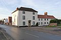
 Main Street, Mattersey - geograph.org.uk - 2688002.jpg 800 × 600; 91 KB
-
 Malt Kiln House - geograph.org.uk - 2447179.jpg 640 × 427; 83 KB
-
 Malt Kiln House - geograph.org.uk - 4260628.jpg 1,280 × 888; 190 KB
-
 Mattersey Church from Mattersey Road - geograph.org.uk - 4260631.jpg 1,280 × 891; 482 KB
-
 Mattersey F.C.sign - geograph.org.uk - 4786539.jpg 5,184 × 3,888; 5.42 MB
-
 Mattersey Football Club play here - geograph.org.uk - 4616707.jpg 3,072 × 1,728; 3.16 MB
-
 Mattersey Grange - geograph.org.uk - 4425546.jpg 1,600 × 1,200; 454 KB
-
 Mattersey Grange Farm - geograph.org.uk - 4616088.jpg 800 × 533; 116 KB
-
 Mattersey Hall-geograph-4260644.jpg 1,280 × 878; 345 KB
-
 Mattersey Hill - geograph.org.uk - 5083618.jpg 1,024 × 768; 178 KB
-
 Mattersey House - geograph.org.uk - 4260619.jpg 1,280 × 878; 241 KB
-
 Mattersey House - geograph.org.uk - 4260624.jpg 1,280 × 960; 323 KB
-
 Mattersey in the distance - geograph.org.uk - 1574192.jpg 640 × 427; 73 KB
-

-
 Mattersey Post Office and village store - geograph.org.uk - 4260536.jpg 1,280 × 886; 165 KB
-
 Mattersey Priory - The Refectory - geograph.org.uk - 4784134.jpg 5,184 × 3,888; 5.81 MB
-
 Mattersey Priory by The River Idle - geograph.org.uk - 4784334.jpg 5,038 × 3,644; 4.56 MB
-
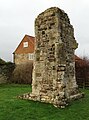
 Mattersey Priory ruins, Notts - geograph.org.uk - 3760792.jpg 768 × 1,024; 190 KB
-
 Mattersey Road Bridge - geograph.org.uk - 4260540.jpg 1,280 × 861; 254 KB
-
 Mattersey Thorpe football pitch - geograph.org.uk - 4610381.jpg 800 × 533; 104 KB
-
 Mattersey Thorpe postbox ref DN10 148 - geograph.org.uk - 4260502.jpg 1,280 × 960; 423 KB
-
 Mattersey to Ranskill Road the B6045 - geograph.org.uk - 2208077.jpg 640 × 427; 90 KB
-
 Mattersey village - geograph.org.uk - 1574173.jpg 640 × 427; 62 KB
-
 Mattersey village boundary sign - geograph.org.uk - 4616061.jpg 800 × 533; 105 KB
-
 Mattersey village entrance sign - geograph.org.uk - 4260633.jpg 1,280 × 895; 420 KB
-
 Mattersey Wood - geograph.org.uk - 2447065.jpg 640 × 427; 108 KB
-
 Mattersey Wood House - geograph.org.uk - 4425600.jpg 1,600 × 1,200; 640 KB
-
 Mattersey Wood House - geograph.org.uk - 4616679.jpg 3,072 × 1,728; 3.52 MB
-
 Medieval cross stump, Mattersey Churchyard - geograph.org.uk - 4260505.jpg 1,280 × 960; 417 KB
-
 Near Ellis Plantation - geograph.org.uk - 5085172.jpg 1,024 × 768; 169 KB
-
 Newall Drive, Mattersey Thorpe - geograph.org.uk - 4616724.jpg 3,072 × 1,728; 3.14 MB
-
 Old village cross in Mattersey churchyard - geograph.org.uk - 4786131.jpg 3,764 × 5,013; 5.5 MB
-
 One mile to the Animal hospital - geograph.org.uk - 1241932.jpg 640 × 444; 88 KB
-
 Ordnance Survey Cut Mark - geograph.org.uk - 4980201.jpg 640 × 457; 117 KB
-
 Path to the left, corn to the right - geograph.org.uk - 4616674.jpg 3,072 × 1,728; 3.64 MB
-
 Post Office, Main Street, Mattersey - geograph.org.uk - 6587569.jpg 1,600 × 1,065; 387 KB
-
 Priory Garage, Ranskill Road, Mattersey - geograph.org.uk - 6587620.jpg 1,600 × 1,065; 460 KB
-
 Priory House, Mattersey - geograph.org.uk - 4425502.jpg 1,600 × 1,200; 348 KB
-
 Public Bridleway near Scrooby - geograph.org.uk - 4803542.jpg 4,608 × 3,456; 3.83 MB
-
 Ranskill Road - geograph.org.uk - 2447094.jpg 640 × 427; 89 KB
-
 Ranskill Road towards Mattersey - geograph.org.uk - 2687979.jpg 800 × 600; 131 KB
-
 Retford Road - geograph.org.uk - 2451989.jpg 640 × 427; 88 KB
-
 Retford Road heading south - geograph.org.uk - 2688014.jpg 800 × 600; 73 KB
-
 Retford Road heading south - geograph.org.uk - 2688017.jpg 1,024 × 768; 114 KB
-
 Retford Road, Mattersey - geograph.org.uk - 4260652.jpg 1,280 × 884; 172 KB
-
 River Ide - geograph.org.uk - 2451730.jpg 640 × 427; 89 KB
-
 River Idle at Mattersey looking West - geograph.org.uk - 1889315.jpg 1,024 × 768; 253 KB
-
 River Idle near Mattersey - geograph.org.uk - 4260503.jpg 1,280 × 960; 407 KB
-
 Site of former sand pit west of Mattersey Wood House - geograph.org.uk - 4425590.jpg 1,600 × 1,200; 452 KB
-
 Sluice and the River Idle - geograph.org.uk - 4028420.jpg 1,024 × 768; 170 KB
-
 Strawstack and woodland edge - geograph.org.uk - 4627841.jpg 1,024 × 768; 131 KB
-
 Swans on the Idle - geograph.org.uk - 4260629.jpg 1,280 × 868; 436 KB
-
 The B6045 looking towards Mattersey - geograph.org.uk - 2208075.jpg 640 × 427; 74 KB
-
 The entrance to Clearwater fishing lakes - geograph.org.uk - 1241924.jpg 640 × 480; 110 KB
-
 The font in All Saints Church, Mattersey - geograph.org.uk - 4786140.jpg 3,888 × 5,184; 4.16 MB
-
 The lane leading from Blaco Hill - geograph.org.uk - 4028381.jpg 1,024 × 768; 126 KB
-
 The Old Chapel - geograph.org.uk - 2447158.jpg 640 × 427; 69 KB
-
 The Old Chapel - geograph.org.uk - 4616070.jpg 800 × 533; 101 KB
-
 The Old Vicarage, Mattersey - geograph.org.uk - 4260647.jpg 1,280 × 950; 275 KB
-
 The River Idle at Mattersey - geograph.org.uk - 4616056.jpg 800 × 533; 81 KB
-
 The River Idle from Mattersey Bridge - geograph.org.uk - 4784089.jpg 5,184 × 3,888; 6.14 MB
-
 The River Idle looking East towards Mattersey - geograph.org.uk - 1889329.jpg 1,024 × 768; 185 KB
-
 The River Idle near Mattersey - geograph.org.uk - 4803563.jpg 4,608 × 3,456; 3.7 MB
-
 The sports pavilion - Mattersey Thorpe - geograph.org.uk - 4784344.jpg 5,184 × 3,888; 6.51 MB
-
 The track to Mattersey Hill - geograph.org.uk - 4784347.jpg 5,184 × 3,888; 6.41 MB
-
 The Village Shop. Mattersey - geograph.org.uk - 2751272.jpg 1,024 × 768; 121 KB
-
 There's a works in there behind the trees - geograph.org.uk - 4616743.jpg 3,072 × 1,728; 2.81 MB
-
 Through the hedge - geograph.org.uk - 2454400.jpg 1,024 × 768; 254 KB
-
 Top Cottages, Blaco Hill - geograph.org.uk - 4028385.jpg 1,024 × 768; 156 KB
-

-
 Track to Mattersey Hill - geograph.org.uk - 5085055.jpg 1,024 × 768; 172 KB
-
 Track to Mattersey Hill Farm - geograph.org.uk - 2687992.jpg 800 × 600; 225 KB
-
 Track to Mattersey Priory - geograph.org.uk - 2031510.jpg 1,024 × 726; 467 KB
-
 Tree by the roadside - geograph.org.uk - 1574211.jpg 537 × 640; 88 KB
-
 Trespassers will be disposed of humanely^ - geograph.org.uk - 2454410.jpg 1,024 × 768; 203 KB
-
 View from Abbey Road - geograph.org.uk - 4260651.jpg 1,280 × 874; 173 KB
-

-
 View towards Lound - geograph.org.uk - 5085179.jpg 1,024 × 768; 221 KB
-
 View towards Mattersey Hill - geograph.org.uk - 5084364.jpg 1,024 × 768; 217 KB
-
 View towards Pusto Hill Wood - geograph.org.uk - 2751240.jpg 1,024 × 768; 137 KB
-
 Village Scene in Mattersey - geograph.org.uk - 4803558.jpg 4,506 × 3,277; 3.19 MB
-
 Village scene, Mattersey - geograph.org.uk - 2031497.jpg 1,024 × 703; 416 KB
-
 Welcome to Mattersey - geograph.org.uk - 4616754.jpg 3,072 × 1,728; 2.8 MB
-
 Bridleway to Scaftworth - geograph.org.uk - 221110.jpg 640 × 480; 113 KB
-
 Field and Hill - geograph.org.uk - 221250.jpg 640 × 480; 96 KB
-
 Field side flora. - geograph.org.uk - 514743.jpg 493 × 640; 149 KB
-

-
 Gate marks entrance to danger area^ - geograph.org.uk - 514729.jpg 640 × 426; 136 KB
-
 Idle View Farm - geograph.org.uk - 220849.jpg 640 × 480; 108 KB
-

-
 Lane to Mattersey - geograph.org.uk - 711402.jpg 640 × 480; 85 KB
-
 Looking east towards Retford road. - geograph.org.uk - 514732.jpg 640 × 428; 106 KB
-
 Mattersey Hill - geograph.org.uk - 221253.jpg 640 × 480; 93 KB
-
 Modern Mansion - geograph.org.uk - 221256.jpg 640 × 480; 76 KB
-
 Retford road heading north. - geograph.org.uk - 514708.jpg 640 × 480; 126 KB
-
 Stile and footpath sign. - geograph.org.uk - 514702.jpg 640 × 480; 196 KB
-
 Sunny wild flowers. - geograph.org.uk - 514727.jpg 640 × 428; 112 KB


_-_geograph.org.uk_-_2688011.jpg)


_towards_disused_quarry_-_geograph.org.uk_-_2688019.jpg)


