Category:May 2006 in London
Jump to navigation
Jump to search
Deutsch: Bilder, die im Mai 2006 in London aufgenommen worden sind. Bitte beachten Sie, dass dies weder das Datum des Uploads noch das Datum des Scannens eines Fotos ist.
English: Images/pictures taken in London during May 2006. Note this is not the date of the upload, nor the date a photo was scanned.
Español: Fotografías o imágenes tomadas en London durante mayo 2006. No es la fecha de subida ni escaneo, sino la fecha en que las fotografías o imágenes se crearon.
Esperanto: Bildoj faritaj en London en majo 2006. Tio ne estas la dato, kiam la bildoj estis alŝutitaj aŭ skanitaj.
Français : Photographies ou images prises en London durant mai 2006. Ce n'est pas la date du téléchargement ou du scan.
Galego: Fotografías ou imaxes tomadas en London durante maio 2006. Non é a data de subida nin escaneamento, senón a data na que se crearon as fotografías ou imaxes.
Italiano: Fotografie o immagini scattate a London nel maggio 2006. Nota bene: la data non si riferisce né a quella di upload né a quella in cui la foto è stata digitalizzata.
Norsk bokmål: Bilder tatt i London i løpet av mai 2006. Merk at dette ikke er datoen for opplasting, eller når et bilde har blitt skannet.
Norsk nynorsk: Bilete teke i London i løpet av mai 2006. Merk at dette ikkje er datoen for opplasting, eller når eit bilete har vorte skanna.
Русский: Изображения, сделанные в London в течение май 2006 (не дата загрузки изображения).
Українська: Зображення, зроблені в London протягом травень 2006. Зауважте, що це не дата завантаження чи дата сканування фотографії.
| May 2005 | ← | May 2006 | → | May 2007 | |||||||
| Jan | Feb | Mar | Apr | May | Jun | Jul | Aug | Sep | Oct | Nov | Dec |
| 350 | 143 | 239 | 222 | 244 | 322 | 319 | 229 | 240 | 379 | 163 | 134 |
|---|---|---|---|---|---|---|---|---|---|---|---|
Subcategories
This category has the following 10 subcategories, out of 10 total.
L
R
Media in category "May 2006 in London"
The following 200 files are in this category, out of 234 total.
(previous page) (next page)-
 149 Old Farm Avenue, Sidcup - geograph.org.uk - 874335.jpg 640 × 480; 93 KB
-
 179 Old Farm Avenue, Sidcup - geograph.org.uk - 874345.jpg 640 × 484; 116 KB
-
 1912 houses, Horn Lane, North Acton - geograph.org.uk - 177939.jpg 640 × 480; 94 KB
-
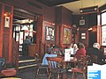
 Elephant and Castle Pub - geograph.org.uk - 165898.jpg 640 × 480; 115 KB
-
 Kayaks at Paddington Station - Firetrap9254.jpg 1,760 × 1,135; 203 KB
-
 Bromley North Railway Station.jpg 1,024 × 768; 428 KB
-
 2006-05-13 - London - Walthamstow Dogs (4888898512).jpg 2,592 × 1,726; 3.45 MB
-
 Paddington station 2006-05-19.jpg 1,932 × 2,576; 1.36 MB
-
 London-underground-travelcard-2006.jpg 1,224 × 800; 223 KB
-
 Water lily pond, Kew Gardens - geograph.org.uk - 176645.jpg 640 × 480; 168 KB
-
 Charlton Station - geograph.org.uk - 234017.jpg 640 × 480; 75 KB
-
 KXSP 2006-05-30 01.jpg 2,112 × 2,816; 3.26 MB
-
 KXSP 2006-05-30 02.jpg 2,816 × 2,112; 2.47 MB
-
 KXSP 2006-05-30 03.jpg 2,816 × 2,112; 2.19 MB
-
 KXSP 2006-05-30 04.jpg 2,816 × 2,112; 2.34 MB
-
 KXSP 2006-05-30 05.jpg 2,112 × 2,816; 3.47 MB
-
 KXSP 2006-05-30 06.jpg 2,816 × 2,112; 3.64 MB
-
 KXSP 2006-05-30 07.jpg 2,816 × 2,112; 3.71 MB
-
 KXSP 2006-05-30 08.jpg 2,816 × 2,112; 3.3 MB
-
 KXSP 2006-05-30 09.jpg 2,816 × 2,112; 3.04 MB
-
 KXSP 2006-05-30 10.jpg 2,816 × 2,112; 3.05 MB
-
 KXSP 2006-05-30 11.jpg 2,112 × 2,816; 2.85 MB
-
 KXSP 2006-05-30 12.jpg 2,112 × 2,816; 3.67 MB
-
 KXSP 2006-05-30 13.jpg 2,112 × 2,816; 2.75 MB
-
 KXSP 2006-05-30 14.jpg 2,816 × 2,112; 1.93 MB
-
 KXSP 2006-05-30 15.jpg 2,816 × 2,112; 3.01 MB
-
 KXSP 2006-05-30 16.jpg 2,816 × 2,112; 3.57 MB
-
 2006-05-30 15-52 100 0693.JPG 1,932 × 2,576; 964 KB
-
 Southeastern-465164-01.jpg 1,600 × 1,200; 913 KB
-
 Enfield, Lincoln Road level crossing - geograph.org.uk - 167837.jpg 640 × 480; 120 KB
-
 A view of the map repository at The National Archives.jpg 1,605 × 1,134; 629 KB
-
 Abbey Mills pumping station - panoramio.jpg 1,470 × 1,092; 546 KB
-
 Abraham Lincoln memorial in London, May 06.jpg 1,280 × 960; 314 KB
-

-
 Acton cemetery - geograph.org.uk - 177865.jpg 640 × 480; 124 KB
-
 Acton Cemetery - geograph.org.uk - 177875.jpg 640 × 480; 117 KB
-
 Albert Bridge 14 May 2006.JPG 1,200 × 800; 208 KB
-
 Albion Road N16 - geograph.org.uk - 170546.jpg 640 × 480; 103 KB
-
 ApolloTheatreStageDoor.JPG 2,584 × 1,736; 412 KB
-
 Arnold Circus - geograph.org.uk - 167305.jpg 640 × 270; 78 KB
-

-
 Atlantic Road SW9 - geograph.org.uk - 166854.jpg 640 × 480; 121 KB
-

-
 Battersea Park Road SW11 (2) - geograph.org.uk - 183399.jpg 640 × 480; 124 KB
-
 Battersea Park Road SW11 - geograph.org.uk - 168226.jpg 640 × 480; 138 KB
-
 Bedford Square gardens - geograph.org.uk - 169265.jpg 640 × 456; 163 KB
-
 Bedford Square Mews, Bloomsbury - geograph.org.uk - 169259.jpg 640 × 576; 183 KB
-
 Bedford Square, Bloomsbury - geograph.org.uk - 169262.jpg 640 × 480; 102 KB
-
 BMA Headquarters - geograph.org.uk - 169838 (cropped).jpg 640 × 473; 124 KB
-
 BMA Headquarters - geograph.org.uk - 169838.jpg 640 × 518; 130 KB
-
 The 'Bo-Peep', near Chelsfield - geograph.org.uk - 163480.jpg 640 × 480; 93 KB
-
 Bowes Park station - geograph.org.uk - 166875.jpg 640 × 426; 50 KB
-
 Brunswick Square, Bloomsbury - geograph.org.uk - 172058.jpg 640 × 480; 138 KB
-
 Brushfield Street, Spitalfields.jpg 2,048 × 1,536; 961 KB
-
 Buckingham Palace & guards, May 06.jpg 1,280 × 960; 304 KB
-
 Buckston Browne Farm, Downe, Kent - geograph.org.uk - 874390.jpg 640 × 480; 87 KB
-

-
 Canary wharf ticket barrier.jpg 1,932 × 2,576; 794 KB
-
 Canon IXUS 400 demo shot Peta.jpg 1,704 × 2,272; 1.4 MB
-
 Car wash, Horn Lane, North Acton - geograph.org.uk - 174602.jpg 640 × 480; 110 KB
-
 Carlton Road, Higham Hill - geograph.org.uk - 174710.jpg 640 × 503; 73 KB
-
 Carnaby Street, (May 2006) - panoramio.jpg 3,500 × 1,938; 1.65 MB
-

-
 Changing the Guard at Buckingham Palace 1, May 06.jpg 1,280 × 960; 296 KB
-
 Changing the Guard at Buckingham Palace 2, May 06.jpg 1,280 × 960; 303 KB
-
 Charing Cross Hospital - geograph.org.uk - 177084.jpg 640 × 480; 124 KB
-
 Chatham House entrance.jpg 443 × 591; 227 KB
-
 Christ Church - North Finchley - geograph.org.uk - 162889.jpg 640 × 480; 135 KB
-
 Citroën 2CV in Soho.jpg 1,852 × 1,236; 1.68 MB
-
 Clapham Road SW9 - geograph.org.uk - 166831.jpg 640 × 480; 110 KB
-
 Clapton Common - geograph.org.uk - 169787.jpg 640 × 480; 114 KB
-
-
 Concorde G-CONC, Heathrow, 31 May 2006.jpg 2,592 × 1,944; 400 KB
-
 Congress House, Bloomsbury - geograph.org.uk - 169254.jpg 475 × 640; 77 KB
-
 Critical mass-the may day.JPG 1,024 × 768; 468 KB
-
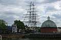 Cutty Sark (before the Fire) , Greenwich , London , May 2006 - panoramio.jpg 2,279 × 1,502; 602 KB
-
 Dalston Theatre - geograph.org.uk - 171138.jpg 640 × 480; 112 KB
-
 De Beauvoir Estate (2) - geograph.org.uk - 171434.jpg 640 × 480; 104 KB
-
 Departures level in T5. - geograph.org.uk - 966278.jpg 640 × 480; 95 KB
-

-
 Dock Entrance, London Dock, Wapping - geograph.org.uk - 172486.jpg 640 × 480; 110 KB
-
 Downing St., Whitehall, London (167195872).jpg 2,592 × 1,944; 752 KB
-
 Downing Street (156670938).jpg 1,704 × 2,272; 1.39 MB
-
 Dragon's Fury - geograph.org.uk - 167096.jpg 480 × 640; 40 KB
-
 Durning Library, Kennington - geograph.org.uk - 175711.jpg 480 × 640; 102 KB
-

-
 Edgware Road W2 (1) - geograph.org.uk - 176622.jpg 640 × 480; 138 KB
-
 Edgware Road W2 (2) - geograph.org.uk - 176655.jpg 640 × 480; 138 KB
-
 Electric Avenue SW9 - geograph.org.uk - 166845.jpg 640 × 480; 127 KB
-
 Electricity sub-station, North Acton - geograph.org.uk - 177938.jpg 640 × 480; 103 KB
-
 Elwin Street E2 - geograph.org.uk - 172822.jpg 640 × 480; 106 KB
-
 Enfield Magistrates Court.jpg 1,782 × 712; 191 KB
-
 Enfield, Lincoln Road level crossing - geograph.org.uk - 167817.jpg 640 × 480; 93 KB
-
 FACT taxi.jpg 2,816 × 2,112; 3.15 MB
-
 Farm buildings, Cudham Grange, Kent - geograph.org.uk - 167743.jpg 640 × 480; 113 KB
-
 Fentiman Road SW8 - geograph.org.uk - 165877.jpg 640 × 480; 141 KB
-
 Finnair.a320-200.oh-lxf.arp.jpg 1,855 × 1,264; 125 KB
-

-
-
 Friars Gardens, Acton - geograph.org.uk - 174632.jpg 640 × 480; 98 KB
-
 Friars Way, Acton - geograph.org.uk - 174631.jpg 640 × 480; 92 KB
-
 FT reflection - geograph.org.uk - 175691.jpg 480 × 640; 71 KB
-
 Garden City, Edgware - geograph.org.uk - 252447.jpg 360 × 480; 56 KB
-
 Go Ahead London Rew Arrow bus.jpg 2,026 × 801; 1.11 MB
-
 Government offices on Webber Street - geograph.org.uk - 175698.jpg 459 × 612; 243 KB
-
 Green Repository at The National Archives.jpg 1,280 × 960; 459 KB
-
 Greenford Broadway - geograph.org.uk - 175143.jpg 640 × 480; 114 KB
-
 Gwynne Road SW11 - geograph.org.uk - 168249.jpg 640 × 480; 128 KB
-
 Harleyford Road Community Garden - geograph.org.uk - 180302.jpg 640 × 480; 139 KB
-
 Harrington Square - geograph.org.uk - 1284955.jpg 640 × 480; 119 KB
-
 Harrow on the Hill (1) - geograph.org.uk - 175017.jpg 640 × 480; 111 KB
-
 Harrow on the Hill (2) - geograph.org.uk - 175019.jpg 640 × 480; 96 KB
-
 High Street Carshalton.jpg 610 × 813; 147 KB
-
 High Street, Carshalton. - geograph.org.uk - 316808.jpg 480 × 640; 110 KB
-
 Himalaya Palace Cinema, Southall - geograph.org.uk - 173961.jpg 640 × 480; 131 KB
-
 HMS Belfast rear turrets May 2006.JPG 2,048 × 1,536; 521 KB
-
 Holland Park.jpg 621 × 463; 136 KB
-
 Honeywood, Carshalton - geograph.org.uk - 316783.jpg 500 × 346; 83 KB
-
 Horn Lane, near Gipsy Corner - geograph.org.uk - 177857.jpg 640 × 480; 91 KB
-

-
 Houses on Watford Road, Kenton - geograph.org.uk - 175005.jpg 640 × 480; 105 KB
-
 Hungerford Bridge - geograph.org.uk - 260426.jpg 640 × 480; 106 KB
-
-
 Inside Upton Park. - geograph.org.uk - 186097.jpg 640 × 436; 105 KB
-

-

-
 Kennington Park Road SE11 - geograph.org.uk - 167810.jpg 640 × 480; 146 KB
-
 Kennington Park, SE11 - geograph.org.uk - 167813.jpg 640 × 480; 170 KB
-
 KnockholtRailwayStation.jpg 640 × 480; 107 KB
-
 Lamppost, Cockspur Street SW1 - geograph.org.uk - 1282676.jpg 417 × 640; 54 KB
-
 Leadenhall Market - geograph.org.uk - 192497.jpg 640 × 440; 133 KB
-

-
 LGOC B-Type bus B340 London Transport Museum (1).jpg 480 × 640; 145 KB
-
 Lloyd Park, Walthamstow - geograph.org.uk - 174691.jpg 554 × 640; 65 KB
-
 London (Wimbledon)-buddhist temple.jpg 1,632 × 1,232; 559 KB
-
 London Eye Pod - geograph.org.uk - 263229.jpg 640 × 480; 84 KB
-
 London General bus PDL17 (PJ02 PZP) route 77A Aldwych May 2006.jpg 306 × 446; 97 KB
-
 London Science Museum (151506915).jpg 800 × 600; 152 KB
-
 LondonHomeless2006.jpg 1,600 × 1,200; 550 KB
-
 LondonNauticalSchool.jpg 640 × 480; 97 KB
-

-

-
 Lunchtime in the Tally Ho - geograph.org.uk - 162903.jpg 640 × 480; 111 KB
-
 Malet Street and Senate House.jpg 480 × 640; 108 KB
-
 Maxwell Road, Fulham, SW6 - Porsche - geograph.org.uk - 680218.jpg 640 × 480; 100 KB
-
 Maya Road - geograph.org.uk - 182531.jpg 640 × 480; 154 KB
-
 Mile End Park, London Borough of Tower Hamlets, E3 (400633008).jpg 1,024 × 768; 250 KB
-

-
 Mohammedi Park Masjid Complex - geograph.org.uk - 174311.jpg 640 × 480; 116 KB
-
 Montpelier Rise, Kenton - geograph.org.uk - 174999.jpg 640 × 480; 120 KB
-
 Mornington Crescent Station - geograph.org.uk - 178542.jpg 640 × 480; 102 KB
-
 My Allotment - geograph.org.uk - 896952.jpg 640 × 427; 91 KB
-
 Myddleton Road, Bowes Park - geograph.org.uk - 166866.jpg 640 × 483; 69 KB
-
 New Zealand House, Haymarket SW1 - geograph.org.uk - 1283330.jpg 417 × 640; 77 KB
-
 No. 1 Westminster Bridge - geograph.org.uk - 171789.jpg 640 × 480; 112 KB
-
 North End Road-Star Road, W14 - geograph.org.uk - 679845.jpg 640 × 480; 78 KB
-
 Numbers 467 to 483 Lordship Lane N22.jpg 2,500 × 1,401; 455 KB
-
 Office block, Park Royal - geograph.org.uk - 177878.jpg 640 × 480; 90 KB
-

-

-
 Orde Hall Street, Bloomsbury - geograph.org.uk - 173420.jpg 640 × 480; 117 KB
-
 Oval Underground Station - geograph.org.uk - 167804.jpg 640 × 480; 134 KB
-
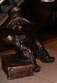 Paddington Bear Statue.jpg 588 × 860; 226 KB
-
 Paradise Gardens, London Borough of Tower Hamlets, E2 (400632503).jpg 1,024 × 768; 246 KB
-
 Peter Johansson WWRY 2006.jpg 850 × 638; 314 KB
-
 Peter WWRY BoRhap 2006.jpg 1,500 × 955; 680 KB
-

-
 Platform, Greenford tube station.jpg 1,280 × 960; 414 KB
-
 Playing Fields off Lower Road, Harrow - geograph.org.uk - 175024.jpg 640 × 480; 96 KB
-
 Pratts Bottom, near Orpington, Kent - geograph.org.uk - 873532.jpg 640 × 480; 92 KB
-
 Prince Charles' Spinney, Richmond Park - geograph.org.uk - 349496.jpg 480 × 640; 121 KB
-

-
 R.A.D.A. - geograph.org.uk - 169279.jpg 436 × 640; 87 KB
-
 Ravens-ait-looking-upstream-cropped.jpg 578 × 207; 44 KB
-
 Rensburg Road E17 - geograph.org.uk - 169769.jpg 640 × 480; 115 KB
-
 Replica Penfold.jpg 1,061 × 1,921; 468 KB
-
 Sackler Crossing, Kew Gardens lake - geograph.org.uk - 166678.jpg 640 × 480; 126 KB
-
 Seacole Close, North Acton - geograph.org.uk - 177897.jpg 640 × 480; 99 KB
-
 Self storage - geograph.org.uk - 162812.jpg 640 × 480; 78 KB
-

-
 Shree Jalaram Mandir, Greenford - geograph.org.uk - 173898.jpg 640 × 480; 103 KB
-
 Sibella Road SW4 - geograph.org.uk - 166806.jpg 640 × 480; 122 KB
-
 Site-of-Surbiton-Lagoon-from-across-Raebarn-Avenue.jpg 1,080 × 720; 243 KB
-
 Site-of-Surbiton-Lagoon-from-same-side-of-Raebarn-Avenue.jpg 1,080 × 720; 276 KB
-
 St Ann's Road N15 (1) - geograph.org.uk - 170765.jpg 640 × 480; 96 KB
-

-
 St. Patrick's Church, Waterloo - geograph.org.uk - 175695.jpg 480 × 640; 104 KB
-
 Stamford Hill N16 (2) - geograph.org.uk - 169796.jpg 640 × 480; 121 KB
-
 Stamford Hill railway station - geograph.org.uk - 167490.jpg 640 × 480; 109 KB
-
 Starbucks - geograph.org.uk - 168525.jpg 480 × 640; 118 KB
-

-
 Strassenschild soho.JPG 2,304 × 1,728; 940 KB
-

-
 SwarthmoreLecture2006-May-27.jpg 800 × 600; 87 KB
-
 Tate Britain and Millbank Tower - geograph.org.uk - 176062.jpg 480 × 640; 86 KB
-
 Tate modern Hall.jpg 1,920 × 2,560; 1.89 MB
-
-
 Taviton Street, Bloomsbury - geograph.org.uk - 169835.jpg 640 × 484; 107 KB
-
 Telephone boxes, Byng Place, Bloomsbury - geograph.org.uk - 174728.jpg 480 × 640; 169 KB
-


.jpg)


_-_geograph.org.uk_-_183399.jpg)


.jpg)


_-_panoramio.jpg)


_,_Greenwich_,_London_,_May_2006_-_panoramio.jpg)

_-_geograph.org.uk_-_171434.jpg)


.jpg)
.jpg)


_-_geograph.org.uk_-_176622.jpg)
_-_geograph.org.uk_-_176655.jpg)


_heritage_route_9_Aldwych_May_2006.jpg)


_-_geograph.org.uk_-_175017.jpg)
_-_geograph.org.uk_-_175019.jpg)


-buddhist_temple.jpg)

_route_77A_Aldwych_May_2006.jpg)
.jpg)


.jpg)


.jpg)


_collection,_Kew_Gardens_-_geograph.org.uk_-_176634.jpg)


.jpg)


_-_geograph.org.uk_-_170765.jpg)


_-_geograph.org.uk_-_169796.jpg)


.jpg)