Category:May 2008 in Leeds
Jump to navigation
Jump to search
Media in category "May 2008 in Leeds"
The following 48 files are in this category, out of 48 total.
-
 A huge drag line on Astley lane - geograph.org.uk - 823368.jpg 640 × 480; 75 KB
-
 Armley Gaol - geograph.org.uk - 1262970.jpg 640 × 480; 98 KB
-
 Billy Bremner at Elland Road - geograph.org.uk - 1319845.jpg 640 × 480; 88 KB
-
 Bramhope Post Office - Breary Lane - geograph.org.uk - 798339.jpg 640 × 539; 75 KB
-
 BrearyMarsh.jpg 2,048 × 1,536; 1.43 MB
-
 Bridge from Daffy Wood, Cookridge - geograph.org.uk - 819053.jpg 450 × 600; 138 KB
-
 Bridge over the railway, Horsforth - geograph.org.uk - 819037.jpg 640 × 480; 126 KB
-
 Bridge TJC 3-249 - Wakefield Road - geograph.org.uk - 807649.jpg 640 × 440; 38 KB
-
 Bridge to Daffy Wood - geograph.org.uk - 819059.jpg 450 × 600; 157 KB
-
 Bridge to Silk Mill Gardens - geograph.org.uk - 819082.jpg 640 × 480; 141 KB
-
 Bridge Wood Close, Horsforth - geograph.org.uk - 821715.jpg 640 × 480; 85 KB
-
 Chapeltown Road - geograph.org.uk - 807500.jpg 640 × 480; 88 KB
-
 Construction, Broadcasting Place - geograph.org.uk - 800821.jpg 640 × 480; 87 KB
-
 Farewell Florence Nightingale - geograph.org.uk - 784918.jpg 640 × 480; 99 KB
-
 Farewell The Bull - geograph.org.uk - 800137.jpg 640 × 480; 67 KB
-
 First Direct - Wakefield Road - geograph.org.uk - 807671.jpg 640 × 414; 46 KB
-
 GoldenAcreSign.jpg 1,161 × 1,239; 754 KB
-
 Holtparkasdaleedsreload.jpg 1,600 × 1,200; 492 KB
-
 Hunslet Gate Centre - Sussex Gardens - geograph.org.uk - 807694.jpg 640 × 421; 45 KB
-
 Hunslet Park Bus Depot (2) - geograph.org.uk - 807153.jpg 640 × 480; 217 KB
-

-
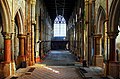 Mount St Mary's derelict interior - geograph.org.uk - 798587.jpg 640 × 424; 98 KB
-
 Plane Tree Avenue - Shadwell Lane - geograph.org.uk - 791305.jpg 640 × 413; 46 KB
-
 Post Office - Sussex Gardens - geograph.org.uk - 807695.jpg 640 × 466; 42 KB
-
 Queen Street - Wakefield Road - geograph.org.uk - 807644.jpg 640 × 448; 37 KB
-
 Reflections in The Bourse - geograph.org.uk - 785729.jpg 640 × 488; 97 KB
-
 River Aire - geograph.org.uk - 784980.jpg 640 × 480; 89 KB
-
 Roger Stevens Building - geograph.org.uk - 817281.jpg 640 × 480; 63 KB
-
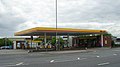 Shell Filling Station - Low Road - geograph.org.uk - 807718.jpg 640 × 356; 31 KB
-
 Shopping Parade, Chapeltown Road - geograph.org.uk - 807555.jpg 640 × 480; 90 KB
-
 Silk Mill Bridge - geograph.org.uk - 819074.jpg 450 × 600; 145 KB
-
 Skyline Apartments, Leeds - geograph.org.uk - 807132.jpg 480 × 640; 229 KB
-
 St James Drive, Horsforth - geograph.org.uk - 829932.jpg 640 × 480; 68 KB
-

-
 Subway entrance, Woodhouse Lane - geograph.org.uk - 800820.jpg 640 × 480; 131 KB
-
 The Crooked Billet - Thwaite Gate - geograph.org.uk - 807689.jpg 640 × 421; 39 KB
-
 The Makkah Masjid Mosque, Leeds - geograph.org.uk - 1289187.jpg 640 × 480; 57 KB
-
 The Punch Clock - Low Road - geograph.org.uk - 807690.jpg 640 × 428; 34 KB
-

-

-

-

-

-

-

-

-

-


_-_geograph.org.uk_-_807153.jpg)


