Category:May 2010 in the East Riding of Yorkshire
Jump to navigation
Jump to search
Ceremonial counties of England: Bedfordshire · Berkshire · Buckinghamshire · Cambridgeshire · Cheshire · Cornwall · Cumbria · Derbyshire · Devon · Dorset · Durham · East Riding of Yorkshire · East Sussex · Essex · Gloucestershire · Greater London · Greater Manchester · Hampshire · Herefordshire · Hertfordshire · Isle of Wight · Kent · Lancashire · Leicestershire · Lincolnshire · Merseyside · Norfolk · North Yorkshire · Northamptonshire · Northumberland · Nottinghamshire · Oxfordshire · Rutland · Shropshire · Somerset · South Yorkshire · Staffordshire · Suffolk · Surrey · Tyne and Wear · Warwickshire · West Midlands · West Sussex · West Yorkshire · Wiltshire · Worcestershire
City-counties: Bristol ·
Former historic counties:
Other former counties:
City-counties: Bristol ·
Former historic counties:
Other former counties:
Deutsch: Bilder, die im Mai 2010 in the East Riding of Yorkshire aufgenommen worden sind. Bitte beachten Sie, dass dies weder das Datum des Uploads noch das Datum des Scannens eines Fotos ist.
English: Images/pictures taken in the East Riding of Yorkshire during May 2010. Note this is not the date of the upload, nor the date a photo was scanned.
Español: Fotografías o imágenes tomadas en the East Riding of Yorkshire durante mayo 2010. No es la fecha de subida ni escaneo, sino la fecha en que las fotografías o imágenes se crearon.
Esperanto: Bildoj faritaj en the East Riding of Yorkshire en majo 2010. Tio ne estas la dato, kiam la bildoj estis alŝutitaj aŭ skanitaj.
Français : Photographies ou images prises en the East Riding of Yorkshire durant mai 2010. Ce n'est pas la date du téléchargement ou du scan.
Galego: Fotografías ou imaxes tomadas en the East Riding of Yorkshire durante maio 2010. Non é a data de subida nin escaneamento, senón a data na que se crearon as fotografías ou imaxes.
Italiano: Fotografie o immagini scattate a the East Riding of Yorkshire nel maggio 2010. Nota bene: la data non si riferisce né a quella di upload né a quella in cui la foto è stata digitalizzata.
Norsk bokmål: Bilder tatt i the East Riding of Yorkshire i løpet av mai 2010. Merk at dette ikke er datoen for opplasting, eller når et bilde har blitt skannet.
Norsk nynorsk: Bilete teke i the East Riding of Yorkshire i løpet av mai 2010. Merk at dette ikkje er datoen for opplasting, eller når eit bilete har vorte skanna.
Русский: Изображения, сделанные в the East Riding of Yorkshire в течение май 2010 (не дата загрузки изображения).
Українська: Зображення, зроблені в the East Riding of Yorkshire протягом травень 2010. Зауважте, що це не дата завантаження чи дата сканування фотографії.
| May 2009 | ← | May 2010 | → | May 2011 | |||||||
| Jan | Feb | Mar | Apr | May | Jun | Jul | Aug | Sep | Oct | Nov | Dec |
| 45 | 234 | 398 | 54 | 97 | 28 | 37 | 65 | 3 | 71 | 30 | 73 |
|---|---|---|---|---|---|---|---|---|---|---|---|
Media in category "May 2010 in the East Riding of Yorkshire"
The following 97 files are in this category, out of 97 total.
-
 A166 towards York - geograph.org.uk - 1838218.jpg 640 × 480; 47 KB
-
 A166, Garrowby Hill with emergency run off lane.jpg 640 × 480; 62 KB
-
 Across the River Derwent to Low Catton - geograph.org.uk - 2494259.jpg 3,264 × 2,448; 2.68 MB
-
 Aldbrough Road leaving Withernwick (geograph 1840467).jpg 640 × 480; 60 KB
-
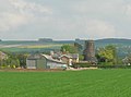
 Bolton Grange Farm (geograph 1846184).jpg 640 × 480; 72 KB
-
 Bridleway off Withernwick Lane, Cowden (geograph 1840353).jpg 640 × 480; 98 KB
-
 Bridleway towards York Grounds Farm - geograph.org.uk - 1869059.jpg 640 × 480; 69 KB
-
 Bridlington Wikivoyage Banner.jpg 4,000 × 575; 2.16 MB
-
 Broad Dale with York Bank to the Right - geograph.org.uk - 2422003.jpg 3,264 × 2,448; 1.44 MB
-
 Caravan park, Withernsea (geograph 1842464).jpg 503 × 640; 184 KB
-
 Chicks in Pearson Park, Hull - panoramio.jpg 1,400 × 958; 577 KB
-
 Cooks Wood (geograph 1845116).jpg 640 × 480; 55 KB
-
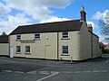
 Cottages Skirpenbeck.jpg 640 × 480; 86 KB
-
 Cowden Drain (geograph 1840489).jpg 640 × 480; 110 KB
-
 Creyke Beck substation from St. Marys church tower (geograph 1877250).jpg 1,600 × 1,067; 281 KB
-
 Entrance to smallholding (geograph 1840471).jpg 640 × 480; 69 KB
-
 Entrering Skirpenbeck.jpg 640 × 480; 122 KB
-
 Farm building, Cowden Magna (geograph 1840407).jpg 640 × 480; 127 KB
-
 Farm building, Yapham Grange (geograph 1845982).jpg 640 × 480; 53 KB
-
 Farm buildings, Fir Tree Farm (geograph 1845150).jpg 640 × 480; 75 KB
-
 Farm buildings, Smylett Hall Farm (geograph 1845974).jpg 640 × 429; 50 KB
-
 Farm track beside The Beck, Withernwick (geograph 1840450).jpg 640 × 480; 97 KB
-
 Farmland looking Millans Wood (geograph 1845975).jpg 640 × 480; 59 KB
-

-
 Farmland looking Yapham Wood (geograph 1845977).jpg 640 × 480; 29 KB
-
 Farmland near Fir Tree Farm, Meltonby (geograph 1845152).jpg 640 × 480; 62 KB
-
 Farmland near Meltonby (geograph 1845153).jpg 640 × 480; 88 KB
-
 Farmland near Rowland Hill Farm (geograph 1845973).jpg 640 × 480; 74 KB
-
 Farmland off Withernwick Lane, Cowden (geograph 1840342).jpg 640 × 480; 107 KB
-
 Farmland, Grimthorpe (geograph 1846838).jpg 640 × 480; 46 KB
-
 Farmland, Yapham Common (geograph 1846167).jpg 640 × 480; 57 KB
-
 Feoffee Lane, Yapham Common (geograph 1846178).jpg 640 × 480; 103 KB
-
 Flamborough head landing beach.jpg 4,000 × 2,651; 11.66 MB
-
 Footpath near Meltonby Hall (geograph 1845144).jpg 640 × 480; 65 KB
-
 Footpath to Great Givendale (geograph 1845160).jpg 640 × 480; 83 KB
-
 Gated field entrance near Yapham Grange (geograph 1845981).jpg 640 × 480; 79 KB
-
 Givendale Lane (geograph 2497877).jpg 3,264 × 2,448; 2.41 MB
-
 Goole station (geograph 1881215).jpg 3,456 × 2,304; 5.04 MB
-
 Goole, Boothferry Road - geograph.org.uk - 1881333.jpg 3,456 × 2,304; 5.59 MB
-
 Goole, Times Buildings, Boothferry Road - geograph.org.uk - 1881323.jpg 3,456 × 2,304; 5.62 MB
-
 Grimthorpe Hill towards Givendale (geograph 1846841).jpg 640 × 480; 72 KB
-
 Hodgson Wood (geograph 1845163).jpg 640 × 480; 46 KB
-
 Holderness Drain, Kingston upon Hull (geograph 5597560).jpg 1,370 × 1,847; 635 KB
-
 House Skirpenbeck.jpg 640 × 480; 114 KB
-
 Low Belthorpe Farm (geograph 1845965).jpg 640 × 480; 55 KB
-
 Meltonby Grange (geograph 1845139).jpg 640 × 480; 61 KB
-
 Meltonby Lane, Yapham (geograph 1845978).jpg 640 × 480; 47 KB
-
 Minor road to Meltonby (geograph 1845135).jpg 640 × 480; 53 KB
-
 Minor road to Meltonby (geograph 1845156).jpg 640 × 480; 70 KB
-
 Minor road to Uncleby.jpg 640 × 480; 76 KB
-
 Minor road to Withernwick (geograph 1840412).jpg 640 × 480; 85 KB
-
 Minor road towards Bolton (geograph 1845967).jpg 640 × 480; 79 KB
-
 Minor road towards Bolton (geograph 1846187).jpg 640 × 480; 130 KB
-
 Ousethorpe Farm (geograph 1845102).jpg 640 × 480; 71 KB
-
 Pavilion Leisure Centre, Withernsea (geograph 1839344).jpg 640 × 435; 192 KB
-
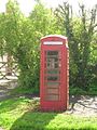 Phone Box Skirpenbeck.jpg 480 × 640; 119 KB
-
 Prospect Farm, Broad Ings (geograph 1845130).jpg 640 × 480; 82 KB
-
 Pumping Station near Millington (geograph 1845101).jpg 640 × 480; 147 KB
-
 Rape field beside Aldbrough Road (geograph 1840460).jpg 640 × 480; 84 KB
-
 Rape field near Yapham Grange (geograph 1845980).jpg 640 × 480; 87 KB
-
 Richard Cooper Street (geograph 1845229).jpg 640 × 426; 88 KB
-
 Richard Cooper Street (geograph 1845232).jpg 640 × 426; 78 KB
-
 River Derwent upstream from Kexby Bridge - geograph.org.uk - 2494168.jpg 3,264 × 2,448; 1.78 MB
-
 River Derwent with Low Catton beyond - geograph.org.uk - 2494246.jpg 3,264 × 2,448; 2.76 MB
-
 Rowland Hill Farm near Bolton (geograph 1845971).jpg 640 × 479; 45 KB
-
 Silvester St, Hull - panoramio (1).jpg 1,200 × 800; 357 KB
-
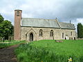 St Marys Church Skirpenbeck 1.jpg 640 × 480; 90 KB
-
 St Nicholas Church, Withernsea (geograph 1838426).jpg 640 × 438; 219 KB
-
 Steps to the sea, Withernsea (geograph 1841137).jpg 477 × 640; 221 KB
-
 The Beck, Withernwick (geograph 1840443).jpg 640 × 480; 136 KB
-
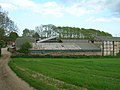
 The Black Mill on Beverley Westwood (geograph 1872019).jpg 2,550 × 1,911; 2.75 MB
-
 The edge of the Yorkshire Wolds (geograph 2497885).jpg 3,264 × 2,448; 1.93 MB
-
 The Falcon, Withernwick (geograph 1840428).jpg 640 × 480; 63 KB
-
 Track to Belsom Farm (geograph 1846164).jpg 640 × 480; 87 KB
-
 Track to Homer House Farm (geograph 1840452).jpg 640 × 480; 113 KB
-
 Track to Pocklington Wood (footpath) (geograph 1845112).jpg 640 × 480; 63 KB
-
 Track to Whitehill (geograph 1840482).jpg 640 × 480; 82 KB
-
 Tranquility near Brigham Bridge (geograph 1844776).jpg 2,970 × 1,950; 1.48 MB
-
 Tree sculpture, Hull - geograph.org.uk - 1880003.jpg 450 × 640; 187 KB
-
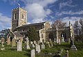
 St James Church Warter (Nigel Coates).jpg 1,944 × 2,592; 968 KB
-
 Waxholme cliffs, near Withernsea (geograph 1842229).jpg 433 × 640; 213 KB
-
 Well Dale.jpg 3,264 × 2,448; 2.03 MB
-
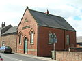 Wesleyan Church Withernwick.jpg 640 × 480; 75 KB
-
 Westwood grazing - panoramio.jpg 1,000 × 594; 107 KB
-
 Withernsea beach (geograph 1839163).jpg 640 × 426; 217 KB
-
 Withernsea High School (geograph 1840244).jpg 640 × 466; 202 KB
-
 Withernsea lighthouse (geograph 1840197).jpg 460 × 640; 219 KB
-
 Withernsea playground (geograph 1839260).jpg 464 × 640; 209 KB
-
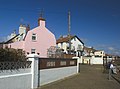 Withernsea promenade (geograph 1840660).jpg 640 × 476; 186 KB
-
 Withernsea seafront (geograph 1842443).jpg 640 × 438; 187 KB
-
 Withernwick Lane, Cowden (geograph 1840348).jpg 640 × 480; 83 KB
-
 Yapham Cricket Club (geograph 1845976).jpg 640 × 480; 41 KB
-
 Yapham Grange (geograph 1845983).jpg 640 × 457; 67 KB
-
 Yapham Hall Farm (geograph 1846174).jpg 640 × 480; 127 KB
-
 Yapham Mill (geograph 1845985).jpg 640 × 475; 48 KB
-
 York Grounds Farm - geograph.org.uk - 1869069.jpg 640 × 480; 72 KB
-
 York Road, Sledmere - geograph.org.uk - 1876197.jpg 640 × 452; 157 KB


.jpg)
.jpg)
.jpg)


.jpg)

.jpg)

.jpg)
.jpg)
.jpg)

.jpg)
.jpg)
.jpg)
.jpg)
.jpg)
.jpg)

.jpg)
.jpg)
.jpg)
.jpg)
.jpg)
.jpg)
.jpg)
.jpg)

.jpg)
.jpg)
.jpg)
.jpg)
.jpg)


.jpg)
.jpg)
.jpg)

.jpg)
.jpg)
.jpg)
.jpg)
.jpg)

.jpg)
.jpg)
.jpg)
.jpg)
.jpg)

.jpg)
.jpg)
.jpg)
.jpg)
.jpg)
.jpg)


.jpg)
.jpg)

.jpg)
.jpg)
.jpg)
.jpg)
.jpg)
.jpg)
.jpg)
.jpg)
_(geograph_1845112).jpg)
.jpg)
.jpg)

.jpg)
.jpg)


.jpg)
.jpg)
.jpg)
.jpg)
.jpg)
.jpg)
.jpg)
.jpg)
.jpg)
.jpg)
.jpg)

