Category:McGrath, Alaska
Jump to navigation
Jump to search
city in Alaska, United States  | |||||
| Upload media | |||||
| Instance of | |||||
|---|---|---|---|---|---|
| Location | Yukon-Koyukuk Census Area, Unorganized Borough, Alaska | ||||
| Population |
| ||||
| Area |
| ||||
| Elevation above sea level |
| ||||
| official website | |||||
 | |||||
Media in category "McGrath, Alaska"
The following 14 files are in this category, out of 14 total.
-
 AC Store in McGrath.jpg 4,032 × 3,024; 4.34 MB
-

-
 Conservation Practice - surveying in McGrath GPS base station - Brant Dallas.jpg 8,192 × 5,464; 34.83 MB
-

-

-
 KSKO studios in McGrath, Alaska (cropped).jpg 1,038 × 763; 514 KB
-
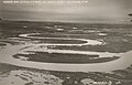 Landing Fields - Alaska - McGrath Landing Field - NARA - 68158890 (cropped).jpg 5,393 × 3,455; 8.86 MB
-
 Landing Fields - Alaska - McGrath Landing Field - NARA - 68158890.jpg 6,924 × 5,340; 16.45 MB
-

-

-

-
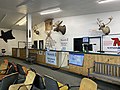 McGrath Airport Terminal.jpg 4,032 × 3,024; 5.93 MB
-
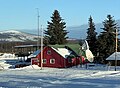
 McGrath Alaska.jpg 4,032 × 3,024; 5.44 MB
-


.jpg)

.jpg)
.jpg)
.jpg)
.jpg)

.jpg)
.jpg)
.jpg)

.jpg)