Category:Media needing category review as of 1 August 2017
Jump to navigation
Jump to search

Media in category "Media needing category review as of 1 August 2017"
The following 200 files are in this category, out of 248 total.
(previous page) (next page)-
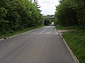
 Accommodation bridge over the M4 - geograph.org.uk - 911842.jpg 419 × 640; 73 KB
-
 Beech Hill Road bridge - geograph.org.uk - 1315307.jpg 640 × 427; 190 KB
-
 Binfield, Pitt's Bridge (2) - geograph.org.uk - 1059203.jpg 640 × 480; 112 KB
-
 Box Wood - geograph.org.uk - 974802.jpg 640 × 427; 237 KB
-
 Bull Brook in Bullbrook - geograph.org.uk - 1234330.jpg 640 × 480; 130 KB
-
 Bull Brook in Warfield - geograph.org.uk - 1215325.jpg 640 × 480; 133 KB
-

-
 Bus shelter at Scratchface Lane - geograph.org.uk - 987503.jpg 640 × 427; 187 KB
-
 Byway at Fayleys Border - geograph.org.uk - 1149980.jpg 640 × 427; 184 KB
-
 Byway at Handpost Corner or The Throat - geograph.org.uk - 1587742.jpg 480 × 640; 124 KB
-
 Byway bins - geograph.org.uk - 975925.jpg 640 × 427; 193 KB
-
 Byway Bucklebury Alley - geograph.org.uk - 1016907.jpg 640 × 480; 123 KB
-
 Byway crossroads - geograph.org.uk - 1591921.jpg 640 × 426; 208 KB
-
 Byway down Drove lane - geograph.org.uk - 1016789.jpg 640 × 480; 85 KB
-
 Byway from North Heath - geograph.org.uk - 1271526.jpg 640 × 480; 76 KB
-
 Byway off Hungerford lane - geograph.org.uk - 1017408.jpg 640 × 480; 116 KB
-
 Byway south of Wellhouse Lane - geograph.org.uk - 974856.jpg 427 × 640; 243 KB
-
 Byway to Compton - geograph.org.uk - 1154627.jpg 640 × 427; 178 KB
-
 Byway towards East Ilsley - geograph.org.uk - 1591942.jpg 640 × 427; 249 KB
-
 Byway towards Hill Corner - geograph.org.uk - 1344823.jpg 640 × 426; 266 KB
-
 Byway, Stanmore - geograph.org.uk - 1585682.jpg 640 × 480; 152 KB
-
 Calves at Streatley Warren - geograph.org.uk - 1591983.jpg 640 × 427; 189 KB
-
 Cannon Lane, Woodlands Park - geograph.org.uk - 875455.jpg 640 × 480; 121 KB
-
 Canoe by the Pang - geograph.org.uk - 981399.jpg 640 × 427; 202 KB
-
 Carbinswood lane - geograph.org.uk - 1017278.jpg 640 × 480; 94 KB
-
 Careful where you walk - geograph.org.uk - 1154358.jpg 640 × 426; 172 KB
-
 Cars keep to road - geograph.org.uk - 1154639.jpg 640 × 427; 147 KB
-
 Cattle in pasture, Warfield - geograph.org.uk - 1556161.jpg 640 × 480; 113 KB
-
 Cattle in pasture, Warfield - geograph.org.uk - 1556163.jpg 640 × 480; 107 KB
-
 Cattle, Woolley Green - geograph.org.uk - 872690.jpg 640 × 480; 103 KB
-
 Cherry Garden Lane - geograph.org.uk - 1351492.jpg 640 × 480; 70 KB
-

-
 Christmas trees at Gravelpit Copse - geograph.org.uk - 987495.jpg 640 × 427; 182 KB
-
 Copse in farmland, Littlewick Green - geograph.org.uk - 872789.jpg 640 × 480; 93 KB
-
 Corn off Burntbush Lane - geograph.org.uk - 974862.jpg 640 × 427; 175 KB
-
 Corner of a field - geograph.org.uk - 986872.jpg 427 × 640; 191 KB
-
 Corner of Money's Allotment - geograph.org.uk - 975955.jpg 640 × 427; 242 KB
-
 Cottages, Marlow Road, Bisham - geograph.org.uk - 987759.jpg 640 × 480; 171 KB
-
 Countryside north of Crows Foot - geograph.org.uk - 1149861.jpg 640 × 427; 189 KB
-
 Crossing of the ways - geograph.org.uk - 861416.jpg 640 × 427; 114 KB
-
 Descent towards Ashampstead - geograph.org.uk - 1344815.jpg 640 × 427; 213 KB
-
 Disused retail units on Pincents Lane - geograph.org.uk - 883198.jpg 640 × 427; 76 KB
-
 Ditches across the field - geograph.org.uk - 1712354.jpg 1,024 × 683; 88 KB
-
 Dutch barge at Windsor - geograph.org.uk - 948459.jpg 640 × 427; 202 KB
-
 Eastbury Bottom - geograph.org.uk - 1550299.jpg 640 × 425; 189 KB
-
 Edge of the byway - geograph.org.uk - 1154661.jpg 640 × 426; 180 KB
-
 End of the Long Copse footpath - geograph.org.uk - 1149993.jpg 640 × 428; 201 KB
-
 Entrance to Great Bear - geograph.org.uk - 1384255.jpg 427 × 640; 171 KB
-
 Entrance to The Common - geograph.org.uk - 975960.jpg 427 × 640; 201 KB
-
 Entrance to the Windsor Farm Shop - geograph.org.uk - 1520596.jpg 640 × 427; 70 KB
-
 Escape gate - geograph.org.uk - 1471528.jpg 640 × 480; 129 KB
-
 Everington Lane - geograph.org.uk - 879813.jpg 640 × 480; 70 KB
-
 Extension for the gunnera^ - geograph.org.uk - 975934.jpg 640 × 427; 219 KB
-
 Farm road, Kenney's Farm, Arborfield - geograph.org.uk - 1253541.jpg 640 × 480; 138 KB
-
 Farmland near Old Warren - geograph.org.uk - 1555819.jpg 640 × 426; 162 KB
-
 Farmland, Jealott's Hill - geograph.org.uk - 800534.jpg 640 × 480; 138 KB
-
 Farmland, Maidenhead - geograph.org.uk - 875384.jpg 640 × 480; 121 KB
-
 Farmland, Maidenhead - geograph.org.uk - 875388.jpg 640 × 480; 128 KB
-
 Farmland, Nuptown - geograph.org.uk - 799211.jpg 640 × 480; 135 KB
-
 Farmland, Temple - geograph.org.uk - 987736.jpg 480 × 640; 158 KB
-
 Farmland, Wargrave - geograph.org.uk - 1048339.jpg 640 × 480; 115 KB
-
 Farmland, West End, Warfield - geograph.org.uk - 1556160.jpg 640 × 480; 130 KB
-
 Fawley and its monument - geograph.org.uk - 1591856.jpg 640 × 426; 157 KB
-
 Fawley monument - geograph.org.uk - 1555908.jpg 425 × 640; 162 KB
-
 Field near Cabbage Hill - geograph.org.uk - 833792.jpg 640 × 424; 75 KB
-
 Fields, Bisham - geograph.org.uk - 856478.jpg 640 × 480; 103 KB
-
 Fields, Cookham - geograph.org.uk - 857236.jpg 640 × 480; 125 KB
-
 First battle of Newbury - geograph.org.uk - 1181161.jpg 640 × 426; 225 KB
-
 Fisher's lane crossing - geograph.org.uk - 1016759.jpg 640 × 480; 87 KB
-
 Footpath to Longmoor Lake - geograph.org.uk - 1350076.jpg 640 × 480; 137 KB
-
 Footpath, Spencers Wood - geograph.org.uk - 839597.jpg 640 × 480; 128 KB
-
 Footprints in the snow - geograph.org.uk - 1153715.jpg 426 × 640; 156 KB
-
 Frozen field - geograph.org.uk - 1154606.jpg 640 × 427; 160 KB
-
 Frozen field - geograph.org.uk - 1154610.jpg 640 × 427; 188 KB
-
 Gas pipeline in Gravelpit Copse - geograph.org.uk - 987487.jpg 427 × 640; 178 KB
-
 Gates to Cayton Park - geograph.org.uk - 1352793.jpg 640 × 480; 76 KB
-
 George VI letter box - geograph.org.uk - 888829.jpg 427 × 640; 87 KB
-
 Gidley Lane - geograph.org.uk - 854308.jpg 640 × 427; 114 KB
-
 Gidley Lane - geograph.org.uk - 854312.jpg 427 × 640; 91 KB
-
 Green Hams Lane - geograph.org.uk - 861440.jpg 427 × 640; 131 KB
-
 Green Hams Lane - geograph.org.uk - 861447.jpg 640 × 427; 122 KB
-
 Green Hams Lane - geograph.org.uk - 861452.jpg 427 × 640; 102 KB
-
 Green Park - geograph.org.uk - 1314664.jpg 640 × 426; 210 KB
-
 Greenham and Crookham Commons - geograph.org.uk - 1187536.jpg 640 × 427; 140 KB
-
 Halfpenny Catch Lane - geograph.org.uk - 861539.jpg 427 × 640; 107 KB
-
 Hatch Ride, Crowthorne - geograph.org.uk - 1186701.jpg 640 × 480; 131 KB
-
 Hawthorn Lane, Nuptown - geograph.org.uk - 799210.jpg 640 × 480; 190 KB
-
 Heading towards Pibworth House - geograph.org.uk - 881847.jpg 640 × 480; 83 KB
-
 Hedge bindweed - geograph.org.uk - 883217.jpg 427 × 640; 85 KB
-
 Helpful sign - geograph.org.uk - 981317.jpg 640 × 427; 200 KB
-
 Helpful sign^ - geograph.org.uk - 981375.jpg 640 × 427; 207 KB
-
 High wall at the Windsor Farm Shop - geograph.org.uk - 1520595.jpg 640 × 427; 72 KB
-
 Hindhay Lane, Maidenhead - geograph.org.uk - 857229.jpg 640 × 480; 134 KB
-
 Hindhay Lane, Maidenhead - geograph.org.uk - 857232.jpg 640 × 480; 141 KB
-
 Holly lane - geograph.org.uk - 1017029.jpg 640 × 480; 128 KB
-
 Homebase garden centre - geograph.org.uk - 883209.jpg 427 × 640; 85 KB
-
 Horses at Woods Folly - geograph.org.uk - 854305.jpg 640 × 427; 72 KB
-
 Horseshoe Crescent - geograph.org.uk - 1383693.jpg 640 × 426; 181 KB
-
 House at Scratchface Lane - geograph.org.uk - 987508.jpg 640 × 427; 186 KB
-
 House at Wash Common - geograph.org.uk - 1181158.jpg 640 × 426; 179 KB
-
 House builder's plaque - geograph.org.uk - 1189223.jpg 640 × 427; 203 KB
-
 House on School Road - geograph.org.uk - 1103307.jpg 640 × 427; 77 KB
-

-
 Houses at Bucklebury Alley - geograph.org.uk - 975928.jpg 640 × 427; 191 KB
-
 Houses at Scratchface Lane - geograph.org.uk - 987510.jpg 640 × 427; 186 KB
-

-
 Hungerford - Crown Passage - geograph.org.uk - 828413.jpg 480 × 640; 94 KB
-
 Hungerford - The Croft Hall - geograph.org.uk - 827255.jpg 640 × 458; 102 KB
-
 Hungerford - Wisteria House - geograph.org.uk - 828441.jpg 640 × 480; 105 KB
-
 Hurley Lane - geograph.org.uk - 1352956.jpg 640 × 480; 69 KB
-
 Ilsley Down Riding Route - geograph.org.uk - 854282.jpg 427 × 640; 106 KB
-
 Ilsley Down Riding Route - geograph.org.uk - 854291.jpg 640 × 427; 99 KB
-
 Ilsley Down Riding Route - geograph.org.uk - 861383.jpg 640 × 427; 109 KB
-
 Ilsley Down Riding Route - geograph.org.uk - 861398.jpg 427 × 640; 83 KB
-
 Inquisitive cows - geograph.org.uk - 861428.jpg 640 × 427; 74 KB
-
 Jigs Lane, Bracknell - geograph.org.uk - 833819.jpg 640 × 452; 89 KB
-
 Junction of Everington Lane - geograph.org.uk - 879737.jpg 640 × 480; 89 KB
-
 Junction of the ... what^ - geograph.org.uk - 854321.jpg 640 × 427; 84 KB
-
 Junction south of Burghfield Common - geograph.org.uk - 1315567.jpg 640 × 426; 199 KB
-
 Knowl Hill Bridleway Circuit - geograph.org.uk - 1245889.jpg 640 × 480; 140 KB
-
 Land Off Bottle Lane,near Moss End - geograph.org.uk - 805093.jpg 640 × 467; 79 KB
-
 Lane in The Alders Woods - geograph.org.uk - 879801.jpg 640 × 480; 125 KB
-
 Lane junction in spring - geograph.org.uk - 1752453.jpg 800 × 600; 179 KB
-
 Lane under M4 - geograph.org.uk - 1570825.jpg 640 × 480; 69 KB
-
 Leaving Royal Ascot - geograph.org.uk - 852130.jpg 640 × 480; 104 KB
-
 Lee Lane, Pinkneys Green - geograph.org.uk - 856426.jpg 640 × 480; 125 KB
-

-
 Little Park Farm - geograph.org.uk - 1223275.jpg 640 × 426; 177 KB
-
 Logs from Langley Wood - geograph.org.uk - 889038.jpg 640 × 427; 88 KB
-
 Long pillbox - geograph.org.uk - 1712371.jpg 1,024 × 683; 123 KB
-
 Lots more crops - geograph.org.uk - 862729.jpg 640 × 427; 76 KB
-
 Maize near Slade Gate - geograph.org.uk - 914296.jpg 427 × 640; 85 KB
-
 Maize stubble, Padworth - geograph.org.uk - 1015345.jpg 640 × 480; 168 KB
-
 Manor Farm - geograph.org.uk - 1223281.jpg 640 × 425; 205 KB
-
 Meadow of ragwort - geograph.org.uk - 917120.jpg 640 × 427; 107 KB
-
 Meadow, Binfield - geograph.org.uk - 814114.jpg 640 × 480; 131 KB
-
 Meadow, Hurst - geograph.org.uk - 873192.jpg 640 × 480; 129 KB
-
 Meadow, Spencers Wood - geograph.org.uk - 839920.jpg 640 × 480; 121 KB
-
 Meadow, White Waltham - geograph.org.uk - 814123.jpg 640 × 480; 143 KB
-
 Meeting of the paths - geograph.org.uk - 986861.jpg 427 × 640; 194 KB
-
 Mill stream at Padworth - geograph.org.uk - 1189276.jpg 640 × 427; 180 KB
-
 Motorway at Tanner's Copse - geograph.org.uk - 987527.jpg 640 × 428; 186 KB
-
 Mown hay, Fawley - geograph.org.uk - 872820.jpg 640 × 480; 125 KB
-
 Near Trapshill - geograph.org.uk - 1534230.jpg 640 × 427; 205 KB
-
 Newell Green, Watersplash Lane ford - geograph.org.uk - 1204250.jpg 640 × 480; 111 KB
-
 Nine Mile Ride, Bracknell - geograph.org.uk - 1181918.jpg 640 × 480; 146 KB
-
 No access - geograph.org.uk - 1421805.jpg 640 × 480; 242 KB
-
 North from Leckhampstead Thicket - geograph.org.uk - 862724.jpg 640 × 427; 116 KB
-
 Not the byway - geograph.org.uk - 854265.jpg 640 × 427; 88 KB
-
 Oak, Wargrave - geograph.org.uk - 1050880.jpg 640 × 480; 127 KB
-
 Off Green Hams Lane - geograph.org.uk - 861461.jpg 640 × 427; 53 KB
-
 Old chalk pit next to the A338 - geograph.org.uk - 1555897.jpg 640 × 427; 204 KB
-
 Old Street - geograph.org.uk - 1591931.jpg 640 × 427; 196 KB
-
 One of the fairways - geograph.org.uk - 917104.jpg 640 × 427; 64 KB
-
 One of the two wheels - geograph.org.uk - 987501.jpg 640 × 427; 243 KB
-
 Outline in the ground - geograph.org.uk - 1713223.jpg 1,024 × 683; 187 KB
-
 Padworth Mill - geograph.org.uk - 1189236.jpg 640 × 426; 186 KB
-
 Padworth Mill - geograph.org.uk - 1189269.jpg 426 × 640; 191 KB
-
 Paley Street, The Cut - geograph.org.uk - 1032629.jpg 640 × 480; 107 KB
-
 Pasture near Stone House - geograph.org.uk - 1223289.jpg 640 × 427; 160 KB
-
 Pasture near Stone House - geograph.org.uk - 1223300.jpg 640 × 427; 185 KB
-
 Pasture, Braywoodside - geograph.org.uk - 799047.jpg 640 × 480; 109 KB
-
 Pasture, Stichens Green, Streatley - geograph.org.uk - 1558820.jpg 640 × 480; 161 KB
-
 Pasture, Swallowfield - geograph.org.uk - 839624.jpg 640 × 480; 103 KB
-
 Path but no foxgloves - geograph.org.uk - 1344775.jpg 425 × 640; 231 KB
-
 Path junction near Gowrings Garage - geograph.org.uk - 1587739.jpg 480 × 640; 159 KB
-
 Permissive path towards Haw Farm - geograph.org.uk - 1148993.jpg 640 × 427; 169 KB
-
 Permissive path towards Southfield - geograph.org.uk - 1148989.jpg 640 × 427; 178 KB
-
 Pig farm - geograph.org.uk - 918408.jpg 640 × 427; 94 KB
-
 Pine trees at Cold Ash Common - geograph.org.uk - 975949.jpg 427 × 640; 243 KB
-
 Pingewood gravel pits - geograph.org.uk - 1303582.jpg 640 × 428; 172 KB
-
 Post boxes by the fields - geograph.org.uk - 1715393.jpg 2,272 × 1,704; 1.96 MB
-
 Protecting the green - geograph.org.uk - 918405.jpg 640 × 427; 90 KB
-
 Pylon next to the M4 - geograph.org.uk - 911855.jpg 427 × 640; 101 KB
-
 Pylons and glass houses, Bowden - geograph.org.uk - 915467.jpg 640 × 427; 48 KB
-
 Restoration work on the hedge - geograph.org.uk - 981379.jpg 640 × 427; 214 KB
-
 Ridgeway by Keeper's Cottage - geograph.org.uk - 915129.jpg 640 × 480; 96 KB
-
 Ridgeway on Compton Downs - geograph.org.uk - 1000117.jpg 640 × 480; 58 KB
-
 Ridgeway sign - geograph.org.uk - 1153728.jpg 427 × 640; 197 KB
-
 River Thames near Windsor - geograph.org.uk - 1076203.jpg 640 × 480; 65 KB
-
 River Thames Old Windsor - geograph.org.uk - 948980.jpg 640 × 480; 78 KB
-
 River Thames past The Home Park - geograph.org.uk - 948579.jpg 640 × 427; 182 KB
-
 River Thames, Old Windsor Weir - geograph.org.uk - 1076222.jpg 640 × 480; 63 KB
-
 Road junction at Lilley - geograph.org.uk - 1722594.jpg 640 × 480; 108 KB
-
 Road junction by Hailey Copse - geograph.org.uk - 1722292.jpg 640 × 480; 124 KB
-
 Rose Cottage, Bottle Lane - geograph.org.uk - 805099.jpg 640 × 424; 108 KB
-
 Shed at Victoria Lodge - geograph.org.uk - 988050.jpg 640 × 427; 167 KB
-
 Sheep in pasture, Basildon - geograph.org.uk - 1558799.jpg 640 × 427; 145 KB
-
 Slade Gate - geograph.org.uk - 914300.jpg 640 × 427; 106 KB
-
 Slanting Hill lane - geograph.org.uk - 879699.jpg 640 × 480; 118 KB
-
 Sluice in the field - geograph.org.uk - 1712061.jpg 1,024 × 683; 195 KB
-
 Smallmead Cottages - geograph.org.uk - 848471.jpg 427 × 640; 105 KB
-
 Snowy Warfield - geograph.org.uk - 912724.jpg 640 × 480; 91 KB
-
 Sold, just in time^ - geograph.org.uk - 975943.jpg 640 × 427; 219 KB
-
 St Patrick's Stream - geograph.org.uk - 919678.jpg 480 × 640; 153 KB
-
 St. Andrew's School gatehouse - geograph.org.uk - 915344.jpg 640 × 427; 97 KB
-
 Stanlake Park - geograph.org.uk - 799216.jpg 640 × 480; 150 KB
-
 Stubble, Mortimer - geograph.org.uk - 956973.jpg 640 × 480; 131 KB
-
 Surrells Wood - geograph.org.uk - 799257.jpg 640 × 480; 216 KB
-
 The A338, Fawley - geograph.org.uk - 891793.jpg 640 × 480; 110 KB


_-_geograph.org.uk_-_1059203.jpg)


