Category:Medomsley
Jump to navigation
Jump to search
Main Wikipedia article: Medomsley.
village in United Kingdom  | |||||
| Upload media | |||||
| Instance of |
| ||||
|---|---|---|---|---|---|
| Location | County Durham, North East England, England | ||||
 | |||||
Subcategories
This category has only the following subcategory.
M
Media in category "Medomsley"
The following 39 files are in this category, out of 39 total.
-
 Adam's Terrace, The Dene - geograph.org.uk - 5629838.jpg 4,608 × 3,456; 3.3 MB
-
 Assorted horses - geograph.org.uk - 5635313.jpg 4,608 × 3,456; 2.52 MB
-
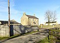
 Cottages on Manor Road, Medomsley - geograph.org.uk - 4806305.jpg 4,608 × 3,456; 4.87 MB
-
 East Farm, Medomsley - geograph.org.uk - 4067357.jpg 4,608 × 3,456; 4.97 MB
-
 Farm track - geograph.org.uk - 5635323.jpg 4,439 × 3,329; 3.87 MB
-
 Farm track from Low Bradley - geograph.org.uk - 5434636.jpg 4,608 × 3,456; 5.89 MB
-
 Fields beside Pont Lane - geograph.org.uk - 5982564.jpg 4,415 × 3,311; 3.34 MB
-
 Fines Road cottages - geograph.org.uk - 4117132.jpg 1,024 × 696; 192 KB
-
 Footpath to Fines Road - geograph.org.uk - 5434304.jpg 4,608 × 3,456; 5.13 MB
-
 Houses from Fines Road - geograph.org.uk - 4742941.jpg 1,500 × 1,000; 2.13 MB
-
 Houses on Manor Road, Medomsley - geograph.org.uk - 4067345.jpg 4,608 × 3,456; 5.74 MB
-
 Large house on Manor Road, Medomsley - geograph.org.uk - 4806335.jpg 4,608 × 3,456; 6.35 MB
-
 Lonesome Pine - geograph.org.uk - 3901534.jpg 4,608 × 3,456; 5.68 MB
-
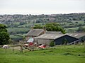
 Longhorn Cattle at Medomsley - geograph.org.uk - 2421403.jpg 3,264 × 2,448; 1.82 MB
-
 Looking across hay meadows to Medomsley village - geograph.org.uk - 2423017.jpg 3,264 × 2,448; 1.59 MB
-
 Looking back down the hill towards Hamsterley - geograph.org.uk - 2421387.jpg 3,264 × 2,448; 2.23 MB
-
 Looking South along the path to Medomsley - geograph.org.uk - 2423068.jpg 3,264 × 2,448; 1.31 MB
-
 Looking west down The Dene - geograph.org.uk - 5629826.jpg 4,608 × 3,456; 3.45 MB
-
 Manor Road, Medomsley - geograph.org.uk - 3662645.jpg 2,000 × 1,500; 527 KB
-
 Medomsley Grange farmhouse - geograph.org.uk - 3897746.jpg 3,372 × 2,446; 3.03 MB
-
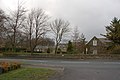
 Medomsley village street - geograph.org.uk - 2421415.jpg 3,264 × 2,448; 1.65 MB
-
 Old farmhouse at East Farm, Medomsley - geograph.org.uk - 4806341.jpg 4,608 × 3,456; 4.68 MB
-
 Old gateway - geograph.org.uk - 5635317.jpg 4,608 × 3,456; 5.71 MB
-
 Peelflats Plantation near Medomsley - geograph.org.uk - 2423097.jpg 3,264 × 2,448; 1.54 MB
-
 Rear view of Bradley Hall - geograph.org.uk - 5434761.jpg 4,608 × 3,456; 5.91 MB
-
 Rough path along the field edge - geograph.org.uk - 5635334.jpg 4,608 × 3,456; 3.36 MB
-
 Snow covered fields near High Bradley farm - geograph.org.uk - 4785042.jpg 4,608 × 3,456; 5.83 MB
-
 Stone cottages, Medomsley - geograph.org.uk - 4119937.jpg 800 × 600; 153 KB
-
 The Dene, Medomsley - geograph.org.uk - 3897763.jpg 4,608 × 3,456; 6.46 MB
-
 The Miners Arms - geograph.org.uk - 3637703.jpg 2,000 × 1,500; 581 KB
-
 The Miners Arms Medomsley - geograph.org.uk - 2422974.jpg 3,264 × 2,448; 1.56 MB
-
 The Oak, Medomsley - geograph.org.uk - 2422985.jpg 3,264 × 2,448; 1.48 MB
-
 Trees along field boundary line - geograph.org.uk - 4715466.jpg 1,500 × 1,125; 1.85 MB
-
 Trees in the snow - geograph.org.uk - 4785069.jpg 4,608 × 3,456; 7.16 MB
-
 View of Medomsley Grange Farm - geograph.org.uk - 3897723.jpg 4,608 × 3,456; 6.13 MB
-
 View south near Low Bradley - geograph.org.uk - 5434645.jpg 4,608 × 3,456; 4.74 MB
-
 Warning notice - geograph.org.uk - 5434316.jpg 4,608 × 3,456; 4.67 MB
-
 Wild flowers beside the path, Medomsley - geograph.org.uk - 2423005.jpg 3,264 × 2,448; 1.83 MB
-
 Cottages Medomsley - geograph.org.uk - 346568.jpg 640 × 426; 136 KB


