Category:Melbury Sampford
Jump to navigation
Jump to search
English: Melbury Sampford is a settlement in north west Dorset, England situated to the west of the A37 road around eight miles south of Yeovil. There was once a village here, but all that remains now is the parish church, directly next to Melbury House
village and civil parish in Dorset, England, UK  | |||||
| Upload media | |||||
| Instance of | |||||
|---|---|---|---|---|---|
| Location |
| ||||
 | |||||
Subcategories
This category has the following 2 subcategories, out of 2 total.
M
- Melbury House (22 F)
S
Media in category "Melbury Sampford"
The following 40 files are in this category, out of 40 total.
-
 A glimpse of Lucerne Lake - geograph.org.uk - 5845543.jpg 640 × 480; 327 KB
-
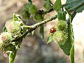 A many-spotted ladybird - geograph.org.uk - 5845531.jpg 640 × 480; 248 KB
-
 An oasis of shade - geograph.org.uk - 5845347.jpg 640 × 480; 311 KB
-
 Bridleway alongside Chetnole Lodge - geograph.org.uk - 5580053.jpg 1,024 × 768; 375 KB
-
 Bridleway through Melbury Park - geograph.org.uk - 5544698.jpg 1,024 × 742; 124 KB
-
 Browning (OfMelburySampford) Arms.png 918 × 1,059; 63 KB
-
 Cattle grid and Chetnole Lodge - geograph.org.uk - 5544700.jpg 1,024 × 768; 227 KB
-
 Closed track to Lodge Farm - geograph.org.uk - 5580037.jpg 1,024 × 768; 238 KB
-
 Cottage in Melbury Park - geograph.org.uk - 5580049.jpg 1,024 × 768; 157 KB
-
 Estate vehicles in Melbury Park - geograph.org.uk - 5845354.jpg 640 × 480; 258 KB
-

-
 Great High Woods - geograph.org.uk - 2465418.jpg 640 × 480; 131 KB
-
 Hazel Wood, Melbury House Estate - geograph.org.uk - 4317890.jpg 640 × 427; 58 KB
-
 Horses in Melbury Park - geograph.org.uk - 5845351.jpg 640 × 480; 305 KB
-
 In Melbury Park - geograph.org.uk - 5580029.jpg 1,024 × 768; 309 KB
-
 Lookout post - geograph.org.uk - 2465531.jpg 640 × 441; 131 KB
-
 Main driveway in Melbury Park - geograph.org.uk - 5845344.jpg 640 × 480; 259 KB
-
 Melbury House, Lane with Gate - geograph.org.uk - 2242830.jpg 1,600 × 1,071; 1.72 MB
-
 Melbury House, Melbury Sampford - geograph.org.uk - 3368394.jpg 640 × 369; 158 KB
-
 Melbury House, Sweeping Drive - geograph.org.uk - 2243018.jpg 1,600 × 1,080; 1.92 MB
-
 Melbury Park - geograph.org.uk - 2222451.jpg 640 × 480; 68 KB
-
 Melbury park - geograph.org.uk - 2222456.jpg 640 × 480; 102 KB
-
 Melbury Park - geograph.org.uk - 2222465.jpg 640 × 480; 80 KB
-
 Melbury Park, Gate into Deer Park - geograph.org.uk - 2243031.jpg 1,071 × 1,600; 1.28 MB
-
 Melbury Park, Lane through the Park - geograph.org.uk - 2243025.jpg 1,600 × 1,071; 1.52 MB
-

-
 Melbury Sampford, postbox № DT2 138 - geograph.org.uk - 3759766.jpg 480 × 640; 98 KB
-
 Murderer's Lane, Stock Wood - geograph.org.uk - 4317910.jpg 640 × 427; 105 KB
-
 New Plantation Great High Woods - geograph.org.uk - 2465422.jpg 640 × 480; 137 KB
-
 Parkland in Melbury Park - geograph.org.uk - 5845547.jpg 640 × 480; 291 KB
-
 Parkland, Melbury Sampford (1) - geograph.org.uk - 4257711.jpg 640 × 377; 156 KB
-
 Parkland, Melbury Sampford (2) - geograph.org.uk - 4257716.jpg 640 × 355; 214 KB
-
 Passing through Melbury Park - geograph.org.uk - 5580030.jpg 1,024 × 768; 263 KB
-
 Pond in Melbury Park - geograph.org.uk - 5844652.jpg 640 × 480; 316 KB
-
 Red Deer, Melbury Park - geograph.org.uk - 4848834.jpg 640 × 548; 85 KB
-
 Rhododendron, Great High Woods - geograph.org.uk - 2465414.jpg 480 × 640; 169 KB
-
 Selfheal in the woods - geograph.org.uk - 2465476.jpg 640 × 497; 76 KB
-
 Track and barn in Melbury Park - geograph.org.uk - 5580051.jpg 1,024 × 768; 280 KB
-
 View towards a pond in Melbury Park - geograph.org.uk - 5580035.jpg 1,024 × 768; 129 KB
-
 Woodland Track - geograph.org.uk - 2465525.jpg 640 × 480; 144 KB


_Arms.png)


_-_geograph.org.uk_-_4257711.jpg)
_-_geograph.org.uk_-_4257716.jpg)


