Category:Mergie
Jump to navigation
Jump to search
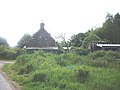
English: Mergie is a settlement in Aberdeenshire approximately six miles west of Stonehaven, Scotland. Situated in the former Kincardineshire slightly south of the Slug Road.
village in Aberdeenshire, Scotland, UK  | |||||
| Upload media | |||||
| Instance of | |||||
|---|---|---|---|---|---|
| Location |
| ||||
 | |||||
Media in category "Mergie"
The following 52 files are in this category, out of 52 total.
-
 A bit of the old Slug Road - geograph.org.uk - 1377179.jpg 640 × 480; 94 KB
-
 A WWII pillbox near Whitehill - geograph.org.uk - 1370479.jpg 640 × 480; 69 KB
-
 Access lane to Whitehill - geograph.org.uk - 1370408.jpg 640 × 480; 200 KB
-
 Access to disused quarry - geograph.org.uk - 1370443.jpg 640 × 480; 176 KB
-
 Access to Fetteresso Forest carpark - geograph.org.uk - 1382971.jpg 640 × 480; 75 KB
-
 Access to Tentyhillock - geograph.org.uk - 1370395.jpg 640 × 480; 163 KB
-

-
 Bales and Trailer - geograph.org.uk - 1743021.jpg 640 × 427; 267 KB
-
 Beech bole in wood by Cowie Water - geograph.org.uk - 1377231.jpg 480 × 640; 101 KB
-
 Beech leaves - geograph.org.uk - 1377408.jpg 640 × 480; 101 KB
-
 Bend in Road - geograph.org.uk - 810286.jpg 640 × 480; 115 KB
-
 Bend in road to Mergie - geograph.org.uk - 1370289.jpg 640 × 480; 203 KB
-
 Birch Woods near Mergie - geograph.org.uk - 1743017.jpg 640 × 427; 306 KB
-
 Bridge over the Black Burn - geograph.org.uk - 1382991.jpg 640 × 480; 103 KB
-

-
 Crossing point of Black Burn at Mergie - geograph.org.uk - 1370313.jpg 640 × 480; 155 KB
-
 Downhill from Clachanshiels - geograph.org.uk - 1377397.jpg 640 × 480; 101 KB
-
 Downstream Black Burn - geograph.org.uk - 1370321.jpg 640 × 480; 208 KB
-
 Downstream Black Burn - geograph.org.uk - 1383000.jpg 640 × 480; 116 KB
-
 Entrance to Clachanshiels - geograph.org.uk - 1377308.jpg 640 × 480; 91 KB
-

-
 Fields by the Cowie Water - geograph.org.uk - 1743026.jpg 640 × 427; 235 KB
-
 Former Slug Road - geograph.org.uk - 1382934.jpg 640 × 480; 82 KB
-
 Haugh Head - geograph.org.uk - 1370388.jpg 640 × 480; 141 KB
-
 Haugh Head - geograph.org.uk - 810273.jpg 640 × 480; 116 KB
-
 Haugh Head bridge - geograph.org.uk - 1377481.jpg 640 × 480; 117 KB
-
 Haugh Head garden - geograph.org.uk - 1370459.jpg 488 × 343; 88 KB
-
 Insects on umbels - geograph.org.uk - 1382938.jpg 640 × 480; 73 KB
-
 Lane from Whitehill farm - geograph.org.uk - 1370451.jpg 640 × 480; 154 KB
-

-

-
 Mergie - geograph.org.uk - 1370303.jpg 640 × 480; 168 KB
-
 Old bridge footings near Haugh Head - geograph.org.uk - 1377201.jpg 640 × 480; 126 KB
-
 Power lines by Cowie Water - geograph.org.uk - 1377402.jpg 640 × 480; 126 KB
-
 Road bridge on the old Slug Road - geograph.org.uk - 1382942.jpg 480 × 640; 114 KB
-
 Road down to Haugh Head - geograph.org.uk - 810264.jpg 640 × 480; 119 KB
-
 Road through Mergie Wood - geograph.org.uk - 810285.jpg 640 × 480; 115 KB
-
 Road to Snob Cott - geograph.org.uk - 1377558.jpg 640 × 480; 66 KB
-
 Road to Snob Cott - geograph.org.uk - 810262.jpg 531 × 384; 87 KB
-
 Sawing horse - geograph.org.uk - 1377415.jpg 640 × 480; 123 KB
-
 Snob Cottage - geograph.org.uk - 1370362.jpg 640 × 480; 84 KB
-
 Snob Croft - geograph.org.uk - 178321.jpg 640 × 480; 82 KB
-
 Stone piles on bluff above Cowie Water - geograph.org.uk - 810280.jpg 640 × 480; 118 KB
-
 The Black Burn - geograph.org.uk - 178320.jpg 480 × 640; 130 KB
-
 The old Slug Road bridge - geograph.org.uk - 1382948.jpg 640 × 480; 128 KB
-
 Upstream Black Burn - geograph.org.uk - 1370325.jpg 640 × 480; 192 KB
-
 Upstream Black Burn - geograph.org.uk - 1383011.jpg 640 × 480; 117 KB
-
 View to Snob Cottage - geograph.org.uk - 810282.jpg 640 × 480; 121 KB
-
 View towards Whitehill - geograph.org.uk - 1370490.jpg 640 × 480; 146 KB
-
 Well camouflaged - geograph.org.uk - 978313.jpg 640 × 427; 35 KB
-
 Whitehill farm - geograph.org.uk - 1370426.jpg 551 × 399; 101 KB
-
 Whitehill quarry - geograph.org.uk - 1377434.jpg 640 × 480; 81 KB


