Category:Methley
Jump to navigation
Jump to search
village in West Yorkshire, UK | |||||
| Upload media | |||||
| Instance of |
| ||||
|---|---|---|---|---|---|
| Location | Leeds, West Yorkshire, Yorkshire and the Humber, England | ||||
 | |||||
English: Methley is a dispersed village in the City of Leeds metropolitan borough, south east of Leeds, West Yorkshire, England. It is located near Rothwell, Oulton, Woodlesford, Mickletown and Allerton Bywater. The Leeds City Ward is called Kippax and Methley. It is within the triangle formed by Leeds, Castleford and Wakefield, and between the confluence of the River Aire and River Calder. The latter is crossed by Methley Bridge, the A639 road, about a mile south-east of the village. (→Methley)

Subcategories
This category has the following 11 subcategories, out of 11 total.
B
H
M
- Methley Bridge (9 F)
- Methley Cricket Club (3 F)
- Methley Hall (9 F)
- Methley Mining Memorial (4 F)
- Mickletown Ings (4 F)
S
- Shan House Bridge (4 F)
Media in category "Methley"
The following 110 files are in this category, out of 110 total.
-
 A footpath towards Wood Row - geograph.org.uk - 2117854.jpg 800 × 600; 385 KB
-
 A huge drag line on Astley lane - geograph.org.uk - 823368.jpg 640 × 480; 75 KB
-
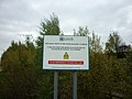 A notice on the bank of the River Aire - geograph.org.uk - 2117848.jpg 800 × 600; 272 KB
-
 A strange contraption - geograph.org.uk - 3837710.jpg 3,240 × 4,320; 2.24 MB
-
 A639 Leeds Road, Church side Methley - geograph.org.uk - 1481244.jpg 640 × 480; 120 KB
-
 A639 Leeds Road, Methley - geograph.org.uk - 1481237.jpg 640 × 480; 52 KB
-
 All moored up - geograph.org.uk - 5652353.jpg 4,608 × 3,456; 2.31 MB
-
 Anglers' path below the floodbank - geograph.org.uk - 6481911.jpg 1,600 × 1,200; 596 KB
-
 Barnsdale Road (A639) - geograph.org.uk - 2627916.jpg 1,600 × 1,200; 366 KB
-
 Bend in the Calder - geograph.org.uk - 2014299.jpg 1,024 × 768; 176 KB
-

-
 Boats moored alongside the Calder. - geograph.org.uk - 5988272.jpg 1,024 × 683; 157 KB
-
 Bucyrus Erie - geograph.org.uk - 756712.jpg 640 × 424; 71 KB
-
 Cereal field, Thorpe Ings - geograph.org.uk - 6481694.jpg 1,600 × 1,200; 477 KB
-
 Cereals growing on the north bank of the River Calder - geograph.org.uk - 6481700.jpg 1,600 × 1,200; 592 KB
-
 Church Side Farm - Methley - geograph.org.uk - 404437.jpg 640 × 460; 66 KB
-

-
 Crop field, Parkin Farm - geograph.org.uk - 2734863.jpg 640 × 480; 89 KB
-
 Dunford House, near Methley - geograph.org.uk - 6316855.jpg 1,024 × 768; 83 KB
-
 Eastbound M62 Crossing River Calder - geograph.org.uk - 4768169.jpg 640 × 427; 293 KB
-

-
 Entering the river Aire - geograph.org.uk - 5691271.jpg 4,608 × 3,072; 3.36 MB
-
 Entrance to Methley Lane Hospital - geograph.org.uk - 3857861.jpg 1,200 × 798; 499 KB
-
 Entrance to Methley quarry. - geograph.org.uk - 149755.jpg 640 × 480; 93 KB
-
 Eroded stonework, chapel entrance - geograph.org.uk - 1592326.jpg 480 × 640; 86 KB
-
 Farm building, off Hungate Lane - geograph.org.uk - 1592288.jpg 640 × 480; 89 KB
-
 Farm building, Park Farm - geograph.org.uk - 2734858.jpg 640 × 480; 84 KB
-
 Farm field of rape, Methley, Leeds - geograph.org.uk - 5479732.jpg 4,128 × 2,322; 3.34 MB
-
 Farmland off Watergate - geograph.org.uk - 2734854.jpg 640 × 480; 49 KB
-
 Farmland, Methley - geograph.org.uk - 2734839.jpg 640 × 480; 79 KB
-
 Fatty Cake Methley April 2017.jpg 2,836 × 2,327; 3.05 MB
-
 Fennel Court - Longbow Avenue - geograph.org.uk - 4888707.jpg 640 × 480; 63 KB
-
 Field off Methley Lane - geograph.org.uk - 5205055.jpg 1,024 × 683; 200 KB
-
 Fields near Scholey Hill - geograph.org.uk - 4000256.jpg 1,024 × 768; 116 KB
-
 Flood gauge on the River Calder - geograph.org.uk - 2163204.jpg 1,024 × 768; 152 KB
-
 Harvest time at Methley - geograph.org.uk - 6557212.jpg 3,508 × 2,412; 1.12 MB
-
 Haystacks at Park Farm - geograph.org.uk - 1592297.jpg 640 × 480; 74 KB
-
 Heading downstream - geograph.org.uk - 5652363.jpg 4,608 × 3,456; 3.3 MB
-
 House situated near Methley Church - geograph.org.uk - 404432.jpg 640 × 409; 94 KB
-
 Hungate Lane - geograph.org.uk - 1592290.jpg 640 × 480; 94 KB
-
 J Davey Elsecar manhole cover April 2017.jpg 3,264 × 2,448; 3.48 MB
-

-
 Leeds Country Way (1) - geograph.org.uk - 3288653.jpg 1,024 × 768; 131 KB
-
 Leeds Country Way (2) - geograph.org.uk - 3288666.jpg 1,024 × 768; 181 KB
-
 Leeds Country Way (3) - geograph.org.uk - 3288680.jpg 1,024 × 768; 205 KB
-
 Leeds Country Way (4) - geograph.org.uk - 3288702.jpg 1,024 × 768; 233 KB
-
 Leeds Country Way (5) - geograph.org.uk - 3288723.jpg 1,024 × 768; 149 KB
-
 Leeds Country Way (6) - geograph.org.uk - 3288770.jpg 1,024 × 768; 235 KB
-

-
 Look, no hedge^ - geograph.org.uk - 1592436.jpg 640 × 480; 53 KB
-
 Looking across to Methley Mires - geograph.org.uk - 1155917.jpg 640 × 427; 241 KB
-
 M62 Motorway - geograph.org.uk - 39766.jpg 640 × 480; 81 KB
-

-
 Methley Ex-Services Club - geograph.org.uk - 1592322.jpg 640 × 480; 54 KB
-
 Methley Park Hospital. - geograph.org.uk - 149741.jpg 640 × 480; 95 KB
-
 Mickletown Ings - geograph.org.uk - 1155675.jpg 640 × 427; 240 KB
-
 Mickletown Road - Church Lane - geograph.org.uk - 4888394.jpg 640 × 480; 66 KB
-
 Mickletown Road, Mickletown - geograph.org.uk - 2117877.jpg 800 × 600; 331 KB
-

-
 Nothing moving at the sand quarry - geograph.org.uk - 1592453.jpg 640 × 480; 71 KB
-
 Old river Calder - geograph.org.uk - 1155885.jpg 640 × 429; 275 KB
-
 Old River Calder - geograph.org.uk - 1155956.jpg 640 × 445; 340 KB
-
 Over the Calder to Methley mires. - geograph.org.uk - 5988278.jpg 1,024 × 683; 112 KB
-

-
 Parsley Mews - Longbow Avenue - geograph.org.uk - 4888721.jpg 640 × 480; 78 KB
-
 Piles of sand at the sand quarry - geograph.org.uk - 1592459.jpg 640 × 480; 64 KB
-
 Post Office and The Commercial, Main Street Mickletown.jpg 3,264 × 2,448; 1.66 MB
-

-
 Power lines against a stormy sky - geograph.org.uk - 1592497.jpg 640 × 480; 46 KB
-
 Pylon behind Willow Grove Farm - geograph.org.uk - 1592431.jpg 640 × 480; 53 KB
-
 Pylon, off Watergate - geograph.org.uk - 1592471.jpg 640 × 480; 92 KB
-
 Rail bridge from Watergate, Methley - geograph.org.uk - 1776975.jpg 640 × 467; 68 KB
-
 Railway bridge - geograph.org.uk - 1592316.jpg 640 × 480; 78 KB
-
 Railway Bridge over Fleet Lane - geograph.org.uk - 461418.jpg 640 × 480; 77 KB
-
 Red dead-nettle - Lamium purpureum - geograph.org.uk - 1117763.jpg 512 × 640; 67 KB
-
 Redundant canal - geograph.org.uk - 1155701.jpg 640 × 408; 281 KB
-
-
 Rubbish at the road side, Green Lane - geograph.org.uk - 1592442.jpg 640 × 480; 109 KB
-

-

-
 Sluice outfall to the river Calder - geograph.org.uk - 6317172.jpg 1,024 × 768; 138 KB
-
 Station Road, Methley - geograph.org.uk - 1592144.jpg 640 × 480; 77 KB
-

-
 The Mexboro Public House Crossroads. - geograph.org.uk - 258519.jpg 640 × 480; 116 KB
-
 The Mexboro' Arms Public House (closed) - geograph.org.uk - 5649629.jpg 1,024 × 683; 281 KB
-

-
 The river Calder at Whitwood - geograph.org.uk - 6690337.jpg 1,024 × 768; 241 KB
-
 The River Calder from Methley Bridge - geograph.org.uk - 2117950.jpg 800 × 600; 208 KB
-
 Track to Willow Grove Farm - geograph.org.uk - 1481264.jpg 640 × 480; 56 KB
-
 Trees at field edge - geograph.org.uk - 1592425.jpg 640 × 480; 75 KB
-
 View along Towing Path towards Methley Bridge - geograph.org.uk - 3134371.jpg 4,320 × 3,240; 4.79 MB
-
 Wakefield Railway - panoramio.jpg 2,048 × 1,536; 575 KB
-
 Watergate - Methley - geograph.org.uk - 404430.jpg 640 × 432; 88 KB
-
 Where the sand comes from - geograph.org.uk - 1592460.jpg 640 × 480; 94 KB
-
 Where's the water^ - geograph.org.uk - 1155715.jpg 640 × 441; 287 KB
-
 Willow Grove Farm across Methley Mires - geograph.org.uk - 11140.jpg 640 × 480; 96 KB
-
 Woodland at Methley Park - geograph.org.uk - 1592303.jpg 640 × 480; 73 KB
-
 Astley Loading Staithe - geograph.org.uk - 490632.jpg 640 × 452; 63 KB
-
 Church Side House - Methley - geograph.org.uk - 404440.jpg 640 × 454; 123 KB
-
 Cricket Ground - Methley - geograph.org.uk - 404445.jpg 640 × 340; 55 KB
-
 Lemonroyd Marina - geograph.org.uk - 296830.jpg 640 × 480; 52 KB
-
 Methley Bowling Club - geograph.org.uk - 234673.jpg 640 × 423; 63 KB
-

-
 Railway Bridge, Methley Junction - geograph.org.uk - 259292.jpg 640 × 480; 105 KB
-
 Red Poppies - geograph.org.uk - 344543.jpg 640 × 480; 163 KB
-
 Terraces in Methley - geograph.org.uk - 313213.jpg 640 × 440; 85 KB
-
 The Royal Oak Public House - geograph.org.uk - 461403.jpg 640 × 480; 51 KB
-

-
 War Memorial - Methley Churchyard - geograph.org.uk - 404449.jpg 446 × 640; 83 KB
-
 White Cross Field. - geograph.org.uk - 149746.jpg 640 × 480; 112 KB


_-_geograph.org.uk_-_2627916.jpg)


_-_geograph.org.uk_-_3288653.jpg)
_-_geograph.org.uk_-_3288666.jpg)
_-_geograph.org.uk_-_3288680.jpg)
_-_geograph.org.uk_-_3288702.jpg)
_-_geograph.org.uk_-_3288723.jpg)
_-_geograph.org.uk_-_3288770.jpg)


.jpg)


_-_geograph.org.uk_-_5649629.jpg)


