Category:Meyers Geographischer Hand-Atlas (1905)
Jump to navigation
Jump to search
| Meyers Geographischer Hand-Atlas
( |
|
|---|---|
| Author |
Hermann Julius Meyer |
| Title |
Meyers Geographischer Hand-Atlas |
| Edition | Dritte, neubearbeitete und vermehrte Auflage |
| Publisher |
Bibliographisches Institut |
| Language | German |
| Publication date | 1905 |
| Place of publication | Leipzig / Wien |
| Source | Self taken (14nu5) |
Media in category "Meyers Geographischer Hand-Atlas (1905)"
The following 29 files are in this category, out of 29 total.
-
 054 schottland (1905).png 1,187 × 1,789; 1.45 MB
-
 055 irland (1905).png 1,151 × 1,754; 1.42 MB
-
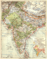 079 ostindien (1905).png 1,730 × 2,172; 2.28 MB
-
 080 hinterindien-und-malaien-archipel (1905).png 2,247 × 1,776; 2.68 MB
-
 081 franzosisch-indochina (1905).png 1,176 × 1,718; 1.41 MB
-
 082 china-und-japan (1905).png 2,175 × 1,797; 2.64 MB
-
 083 kiautschou-bucht-mit-tsingtau.png 1,106 × 1,776; 5.43 MB
-
 084 japan-und-korea (1905).png 1,824 × 2,215; 2.55 MB
-
 085 lander-des-gelben-meeres-und-der-sudliche-mandschurei.png 3,609 × 1,819; 4.04 MB
-
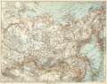 086 sibirien (1905).png 2,220 × 1,763; 2.6 MB
-
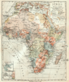 087 afrika-ubersichtskarte (1905).png 1,766 × 2,106; 2.42 MB
-
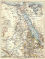 088 agypten-dar-fur-und-abessinien (1905).png 1,695 × 2,205; 2.24 MB
-
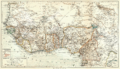
 089 algerien-marokko-und-tunis (1905).png 2,090 × 1,762; 2.22 MB
-
 090 ober-guinea-und-westsudan (1905).png 2,980 × 1,717; 3.01 MB
-
 091 kamerun (1905).png 1,165 × 1,775; 1.29 MB
-
 092 togo.png 1,146 × 1,750; 1.25 MB
-
 093 aquatorial-afrika (1905).png 2,196 × 1,719; 2.37 MB
-
 094 deutsch-ostafrika (1905).png 1,776 × 2,236; 2.52 MB
-
 095 deutsch-sudwestafrika (1905) detail bogen-fels.png 450 × 400; 133 KB
-
 095 deutsch-sudwestafrika (1905) detail.png 450 × 400; 162 KB
-
 095 deutsch-sudwestafrika (1905).png 1,744 × 2,189; 2.34 MB
-
 096 sudafrika (1905).png 2,154 × 1,728; 2.23 MB
-
 105 cuba (1905).png 1,818 × 1,121; 1.32 MB
-
 113 kaiser-wilhelms-land-bismarck-archipel-und-samoa-inseln (1905).png 1,761 × 1,094; 1.23 MB
-
 114 karolinen-marshall-marianen-und-palau-inseln (1905).png 1,763 × 1,154; 1.33 MB
-
 115 australien-festland (1905).png 2,218 × 1,799; 2.49 MB
-
 Dar-Es-Salam 1905.jpg 700 × 634; 412 KB
-
 Map of Tibet in 1905, from- 079 ostindien (1905) (cropped).png 1,166 × 702; 541 KB
-
 Map of Tibet in 1905, from- 082 china-und-japan (1905) (cropped).png 568 × 710; 293 KB
.png)
.png)
.png)
.png)
.png)
.png)

.png)

.png)
.png)
.png)
.png)
.png)
.png)

.png)
.png)
_detail_bogen-fels.png)
_detail.png)
.png)
.png)
.png)
.png)
.png)
.png)

_(cropped).png)
_(cropped).png)