Category:Michelstadt
Jump to navigation
Jump to search
town in Odenwaldkreis in Hesse, Germany | |||
Upload media | |||
![]() ![]() | |||
Instance of | town, Gemarkung, urban municipality of Germany | ||
---|---|---|---|
Location | Odenwaldkreis, Darmstadt Government Region, Hesse, Germany | ||
Population |
| ||
Area |
| ||
Elevation above sea level |
| ||
official website | |||
![]() | |||
| |||
![]() |
Subcategories
This category has the following 22 subcategories, out of 22 total.
- Quality images of Michelstadt (47 F)
B
E
- Ensinger (5 F)
F
- Fountains in Michelstadt (24 F)
M
- Matz-Bibliothek (12 F)
- Mühlhäuser (27 F)
P
- Postcards of Michelstadt (2 F)
S
- Herbert Schnauber (1 F)
- Senay Güler (2 F)
- Stolpersteine in Michelstadt (95 F)
T
V
W
- Seckel Löb Wormser (17 F)
Media in category "Michelstadt"
The following 121 files are in this category, out of 121 total.
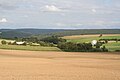
- AbraumhaldenSteinbach.jpg 1,024 × 768; 95 KB
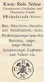
- Alte Fabrikhalle Relystraße - panoramio (1).jpg 2,032 × 1,524; 744 KB
- Alte Fabrikhalle Relystraße - panoramio (2).jpg 2,032 × 1,524; 791 KB
- Alte Fabrikhalle Relystraße - panoramio (3).jpg 2,032 × 1,524; 988 KB
- Alte Fabrikhalle Relystraße - panoramio (4).jpg 2,032 × 1,524; 711 KB
- Alte Fabrikhalle Relystraße - panoramio (5).jpg 1,524 × 2,032; 570 KB
- Alte Fabrikhalle Relystraße - panoramio.jpg 2,032 × 1,524; 776 KB
- Alte Lagerhalle am Bahnhof - panoramio.jpg 2,032 × 1,354; 777 KB
- Altes Michelstaedter Krankenhaus.jpg 1,480 × 876; 569 KB
- Am Bahnhof - panoramio - Zyzak2846 (3).jpg 2,032 × 1,354; 530 KB
- Am Bahnhof - panoramio - Zyzak2846 (7).jpg 2,032 × 1,354; 1.41 MB
- Am Bahnhof - panoramio.jpg 2,032 × 1,354; 422 KB
- Am Kisselberg - panoramio.jpg 2,032 × 1,354; 1.33 MB
- Am Kutschenweg - Darmstädter Straße - panoramio.jpg 2,032 × 1,354; 831 KB
- Am Kutschenweg - panoramio - Zyzak2846 (1).jpg 2,032 × 1,354; 805 KB
- Am Kutschenweg - panoramio - Zyzak2846 (2).jpg 2,032 × 1,354; 661 KB
- Am Kutschenweg - panoramio - Zyzak2846 (3).jpg 2,032 × 1,354; 686 KB
- Am Kutschenweg - panoramio - Zyzak2846 (4).jpg 2,032 × 1,354; 1.21 MB
- Am Kutschenweg - panoramio - Zyzak2846.jpg 2,032 × 1,354; 713 KB
- Am Kutschenweg - panoramio.jpg 2,032 × 1,354; 480 KB
- Am Kutschenweg, zum Bahnhof - panoramio.jpg 2,032 × 1,354; 437 KB
- An der Basilika, Feuerwehrhaus - panoramio.jpg 2,032 × 1,354; 662 KB
- An der Mümling - panoramio - Zyzak2846.jpg 2,032 × 1,354; 1.15 MB
- An der Mümling - panoramio.jpg 2,032 × 1,354; 1.26 MB
- Brücke an der Mümling - panoramio.jpg 2,032 × 1,354; 1.05 MB
- Darmstädter Straße - panoramio (1).jpg 2,032 × 1,354; 586 KB
- Darmstädter Straße - panoramio.jpg 2,032 × 1,354; 1.18 MB
- De-Michelstadt.ogg 2.1 s; 20 KB
- Dr.-Kurt-Schuhmacher-Ring - panoramio.jpg 1,354 × 2,032; 416 KB
- Dr.-Kurt-Schuhmacher-Ring, Friedhof - panoramio.jpg 2,032 × 1,354; 848 KB
- Einhardstraße - Darmstädter Straße - panoramio.jpg 2,032 × 1,354; 823 KB
- Einhardstraße - panoramio (1).jpg 2,032 × 1,524; 1.11 MB
- Einhardstraße - panoramio (10).jpg 2,032 × 1,354; 864 KB
- Einhardstraße - panoramio (11).jpg 2,032 × 1,354; 654 KB
- Einhardstraße - panoramio (2).jpg 2,032 × 1,524; 1.01 MB
- Einhardstraße - panoramio (3).jpg 2,032 × 1,524; 414 KB
- Einhardstraße - panoramio (4).jpg 2,032 × 1,524; 547 KB
- Einhardstraße - panoramio (5).jpg 2,032 × 1,524; 787 KB
- Einhardstraße - panoramio (6).jpg 2,032 × 1,524; 913 KB
- Einhardstraße - panoramio (7).jpg 2,032 × 1,524; 676 KB
- Einhardstraße - panoramio (8).jpg 1,524 × 2,032; 884 KB
- Einhardstraße - panoramio (9).jpg 2,032 × 1,354; 645 KB
- Einhardstraße - panoramio.jpg 2,032 × 1,524; 1.12 MB
- Einhardstraße, Brunnen - panoramio.jpg 2,032 × 1,354; 963 KB
- ESOC-Bodenstation Michelstadt 2.jpg 3,456 × 2,304; 3.09 MB
- ESOC-Bodenstation Michelstadt.jpg 3,456 × 2,304; 2.81 MB
- Gasse am Friedhof - panoramio.jpg 1,354 × 2,032; 945 KB
- GebauderestevonSuedost.JPG 2,560 × 1,920; 2.14 MB
- Gedenktafel Alfred Maul (Michelstadt).jpg 2,217 × 801; 676 KB
- Geo-Naturpark Bergstraße-Odenwald Einhardsbasilika Steinbach 01.jpg 4,921 × 3,103; 7.24 MB
- Geo-Naturpark Bergstraße-Odenwald Einhardsbasilika Steinbach 02.jpg 5,216 × 2,888; 7.57 MB
- Geo-Naturpark Bergstraße-Odenwald Einhardsbasilika Steinbach 03.jpg 5,378 × 2,848; 7.18 MB
- Geo-Naturpark Bergstraße-Odenwald Einhardsbasilika Steinbach 04.jpg 5,734 × 3,115; 10.86 MB
- Geo-Naturpark Bergstraße-Odenwald Fohlen 01.jpg 6,000 × 3,376; 8.64 MB
- Geo-Naturpark Bergstraße-Odenwald Fohlen 02.jpg 6,000 × 3,376; 8.41 MB
- Geo-Naturpark Bergstraße-Odenwald Grosser See bei Steinbach 01.jpg 5,496 × 3,048; 8.68 MB
- Geo-Naturpark Bergstraße-Odenwald Grosser See bei Steinbach 02.jpg 5,658 × 3,070; 9.48 MB
- GrabsteinFahlmer.jpg 1,920 × 2,560; 2.22 MB
- Höhenstraße - panoramio (1).jpg 2,032 × 1,354; 775 KB
- Höhenstraße - panoramio (2).jpg 2,032 × 1,354; 880 KB
- Höhenstraße - panoramio (3).jpg 2,032 × 1,354; 1.03 MB
- Höhenstraße - panoramio (4).jpg 2,032 × 1,354; 762 KB
- Höhenstraße - panoramio (5).jpg 2,032 × 1,354; 591 KB
- Höhenstraße - panoramio.jpg 2,032 × 1,354; 840 KB
- Höhenstraße Sportplatz - panoramio.jpg 2,032 × 1,354; 689 KB
- Kappenrainweg - Mossauer Straße - panoramio.jpg 2,032 × 1,524; 586 KB
- Kreuzung Einhardstraße - Darmstädter Straße - panoramio.jpg 2,032 × 1,354; 652 KB
- Kreuzung Einhardstraße - Mossauer Straße - panoramio.jpg 2,032 × 1,524; 667 KB
- Kreuzung Höhenstraße - An der Basilika - panoramio.jpg 2,032 × 1,354; 781 KB
- Kreuzung In den Schmelzäckern - Am Berg - panoramio.jpg 1,354 × 2,032; 735 KB
- Kreuzung Mossauer Straße - Kappenrainweg - panoramio.jpg 2,032 × 1,524; 647 KB
- Kurpfälzer Straße, Kirche - panoramio.jpg 1,354 × 2,032; 472 KB
- Kurpfälzer Straße, Treppe zur Unteren Schillerstraße - panoramio.jpg 1,354 × 2,032; 1.04 MB
- Kutschenweg - panoramio - Zyzak2846 (1).jpg 2,032 × 1,354; 493 KB
- Kutschenweg - panoramio - Zyzak2846 (2).jpg 2,032 × 1,354; 809 KB
- Kutschenweg - panoramio - Zyzak2846.jpg 2,032 × 1,354; 1.02 MB
- Kutschenweg - panoramio.jpg 2,032 × 1,354; 822 KB
- Lagerhalle am Bahnhof - panoramio - Zyzak2846.jpg 2,032 × 1,354; 807 KB
- Lagerhalle am Bahnhof - panoramio.jpg 2,032 × 1,354; 694 KB
- Lagerhalle am Roßbacher Weg - panoramio.jpg 2,032 × 1,524; 972 KB
- Wappen Michelstadt.png 2,000 × 2,169; 153 KB
- Wappen Michelstadt.svg 661 × 711; 141 KB
- Michelstadt - Bahnhofstraße - schmiedeeisernes Hoftor - linker Flügel - Detail.jpg 6,000 × 4,000; 6.84 MB
- Michelstadt - Bahnhofstraße - schmiedeeisernes Hoftor - linker Flügel.jpg 4,000 × 6,000; 9.53 MB
- Michelstadt - Bahnhofstraße - schmiedeeisernes Hoftor - rechter Flügel.jpg 4,000 × 6,000; 8.72 MB
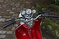
- Michelstadt Germany Motorcycle-RETRO-STAR-01.jpg 3,840 × 5,760; 11.04 MB
- Michelstadt Germany Motorcycle-RETRO-STAR-02.jpg 5,760 × 3,840; 7.85 MB
- Michelstadt Germany Motorcycle-RETRO-STAR-03.jpg 3,561 × 2,374; 6.63 MB
- Michelstadt Germany Zollingerdächer-Waldstrasse-01.jpg 5,759 × 3,050; 10.35 MB
- Michelstadt Germany Zollingerdächer-Waldstrasse-02.jpg 5,412 × 3,608; 13.16 MB
- Michelstadt in ERB.png 352 × 588; 17 KB
- Michelstadt in ERB.svg 688 × 688; 203 KB
- MICHELSTADT nieder.svg 512 × 427; 21 KB
- Mossauer Straße, TÜV - panoramio.jpg 2,032 × 1,524; 722 KB
- MuehlgrabennNordwest.JPG 2,560 × 1,920; 2.16 MB
- Mühläuser in Michelstadt.JPG 2,160 × 1,123; 664 KB
- Mühläuser, Michelstadt.JPG 2,160 × 1,128; 451 KB
- Odenwald (Grimm) b 018.jpg 1,500 × 2,400; 1.54 MB
- Panorama Michelstadt.jpg 2,304 × 696; 405 KB
- Parfuemerie Akzente Filiale Michelstadt 2015.jpg 2,709 × 1,259; 2.51 MB
- Pfad an den Schienen - panoramio.jpg 2,032 × 1,524; 1.47 MB
- Pfad an den Schienen, Einhardstraße - panoramio.jpg 2,032 × 1,524; 1 MB
- Pfad an der Mümling - panoramio - Zyzak2846.jpg 1,354 × 2,032; 1.21 MB
- Pfad an der Mümling - panoramio.jpg 2,032 × 1,354; 1.13 MB
- Pfad zur Mümling - panoramio.jpg 2,032 × 1,354; 1.21 MB
- Pfad zur Walther-Rathenau-Allee - panoramio.jpg 2,032 × 1,354; 1.09 MB
- Rathaus in Michelstadt.jpg 4,592 × 3,064; 7.4 MB
- Relystraße - panoramio.jpg 2,032 × 1,524; 972 KB
- Michelstadt, statuo de leganta knabino.jpg 3,216 × 4,288; 2.83 MB
- Steinbuch - Am Dalles K50 - geo.hlipp.de - 27060.jpg 640 × 416; 80 KB
- Steinbuch - Cemetery Building - geo.hlipp.de - 27061.jpg 640 × 425; 77 KB
- Treppe am Bahnhof - panoramio - Zyzak2846.jpg 2,032 × 1,354; 806 KB
- Treppe am Bahnhof - panoramio.jpg 2,032 × 1,354; 655 KB
- Untere Schillerstraße, Treppe zur Kurpfälzer Straße - panoramio.jpg 2,032 × 1,354; 1.17 MB
- Von Schloßstraße, Richtung Mümling - panoramio.jpg 2,032 × 1,354; 1.1 MB
- Walther-Rathenau-Allee - panoramio.jpg 2,032 × 1,354; 678 KB
- Weg am Friedhof - panoramio.jpg 2,032 × 1,354; 1.06 MB
- Weg am Stadttor - panoramio.jpg 2,032 × 1,524; 918 KB
- Wiese Am Schafberg - panoramio (1).jpg 2,032 × 1,354; 1.39 MB
- Wiese Am Schafberg - panoramio.jpg 2,032 × 1,354; 1.19 MB
- Wiese am Schafberg - panoramio.jpg 2,032 × 1,354; 1.01 MB