Category:Milford, Massachusetts
Jump to navigation
Jump to search
town in Worcester County, Massachusetts, United States   | |||||
| Upload media | |||||
| Instance of | |||||
|---|---|---|---|---|---|
| Part of | |||||
| Location | Worcester County, Massachusetts | ||||
| Inception |
| ||||
| Population |
| ||||
| Area |
| ||||
| Elevation above sea level |
| ||||
| official website | |||||
 | |||||
Subcategories
This category has the following 9 subcategories, out of 9 total.
M
S
T
Media in category "Milford, Massachusetts"
The following 66 files are in this category, out of 66 total.
-
 1878 Shattuck Milford Massachusetts ad WorcesterCountyDirectory.png 807 × 355; 110 KB
-
 A map of the town of Milford, Worcester County, Massachusetts (3120017239).jpg 1,485 × 2,000; 2.79 MB
-
 Annual report of the town officers of the town of Milford, Massachusetts (IA annualreportofto1895milf).pdf 1,406 × 2,216, 550 pages; 31.56 MB
-
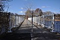
 CharlesRiver MilfordTrailsFootbridge1.jpg 1,024 × 680; 337 KB
-
 CharlesRiver MilfordTrailsFootbridge2.jpg 1,024 × 680; 333 KB
-
 CharlesRiver MilfordTrailsFootbridge3.jpg 1,024 × 680; 290 KB
-
 CharlesRiver MilfordTrailsFootbridge4.jpg 1,024 × 680; 343 KB
-
 CharlesRiver MilfordUpperCharlesRiverTrail NorthernBridge.jpg 1,024 × 680; 347 KB
-
 CharlesRiver MilfordUpperCharlesRiverTrail SouthernBridge.jpg 1,024 × 680; 336 KB
-
 CharlesRiver NorthernRoute85Bridge.jpg 1,024 × 680; 309 KB
-
 CharlesRiver SouthernRoute85Bridge.jpg 1,024 × 680; 365 KB
-
 CharlesRiver WildcatPond BridgeAndDam.jpg 1,024 × 680; 260 KB
-

-
-

-
-
 First Unitarian Universalist Church, Milford MA.jpg 1,692 × 2,540; 645 KB
-
 G&U at Route 140, October 2020.JPG 5,184 × 3,888; 4.26 MB
-
 G&U northeast of Vernon Street, October 2020.JPG 5,184 × 3,888; 4.56 MB
-
 G&U south of Route 140, October 2020.JPG 5,184 × 3,888; 6.01 MB
-
 G&U southwest of Vernon Street, October 2020.JPG 5,184 × 3,888; 4.18 MB
-

-

-
 HopedaleAndMilfordMA CharlesRiver HowardStreetBridge.jpg 1,024 × 680; 285 KB
-
 HopedaleAndMilfordMA CharlesRiver RRBridgeNorthOfHowardStreet.jpg 1,024 × 680; 317 KB
-
 Lincoln Square and Main Street, Milford, MA.jpg 796 × 427; 63 KB
-
 Main Street, Milford MA.jpg 5,472 × 3,648; 6.09 MB
-
 Main Street, Milford, with streetcar - postcard.jpg 818 × 524; 83 KB
-
 Map of Milford (3370521594).jpg 1,584 × 2,000; 3.16 MB
-
 Milford ma highlight.png 788 × 466; 54 KB
-
 Milford Pink Granite.jpg 2,320 × 1,320; 758 KB
-
 Milford Secondary and G&U at South Cedar Street, October 2020.JPG 4,516 × 3,393; 3.17 MB
-
 Milford Secondary and G&U crossing South Cedar Street, October 2020.JPG 5,184 × 3,888; 4.92 MB
-
 Milford Upper Charles Trail beginning, Milford MA.jpg 4,032 × 3,024; 8.03 MB
-
 Milford Upper Charles Trail rest area sign, Milford MA.jpg 4,032 × 3,024; 7.02 MB
-
 Milford Upper Charles Trail sign, Milford MA.jpg 4,032 × 3,024; 6.91 MB
-
 Milford Upper Charles Trail, Milford MA.jpg 2,592 × 1,728; 969 KB
-
 Milford, Massachusetts (2673689785).jpg 2,000 × 1,480; 2.92 MB
-
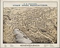
 Milford, Massachusetts, 1888. LOC 2015588504.jpg 10,754 × 7,713; 16.1 MB
-
 MilfordMA AldrichHouse.jpg 1,024 × 680; 244 KB
-
 MilfordMA AzariahNewtonHouse.jpg 1,024 × 680; 241 KB
-
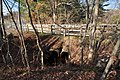
 MilfordMA CharlesRiver CentralStreetBridge.jpg 1,024 × 680; 252 KB
-
 MilfordMA CharlesRiver HowardStreetBridge.jpg 1,024 × 680; 292 KB
-
 MilfordMA CharlesRiver RRBridgeNorthOfHowardStreet.jpg 1,024 × 680; 305 KB
-
 MilfordMA CharlesRiverRoute16CulvertLowerEnd.jpg 1,024 × 680; 298 KB
-
 MilfordMA CharlesRiverRoute16CulvertUpperEnd.jpg 1,024 × 680; 264 KB
-
 MilfordMA DillaStreetBridgeAndDam.jpg 1,024 × 680; 253 KB
-
 MilfordMA I495 CharlesRiverCulvert.jpg 1,024 × 680; 375 KB
-
 MilfordMA MilfordPondDamAndFootbridge.jpg 1,024 × 680; 328 KB
-
 MilfordMA MilfordPondFootbridge.jpg 1,024 × 680; 251 KB
-
 MilfordMA UpperCharlesTrail CharlesRiverCrossingNorthOfCedarStreet.jpg 1,024 × 680; 334 KB
-
 MilfordMA UpperCharlesTrail OldRoadBridge.jpg 1,024 × 680; 355 KB
-
 North end of Milford Secondary, May 2017.JPG 4,320 × 3,240; 5.08 MB
-
 Old High School, Milford, MA.jpg 788 × 414; 76 KB
-
 Park School, Milford, MA.jpg 787 × 489; 61 KB
-
 PGillon block.jpg 1,500 × 1,004; 481 KB
-
 Seal of Milford, Massachusetts.png 315 × 315; 185 KB
-
 Split Boulder at Milford Quarry - DPLA - 0b2116a7ecd519a0193f594f0f652a05.jpg 1,071 × 800; 296 KB
-
 Steinway grand piano - brown.jpg 800 × 600; 147 KB
-
 Thom Block.jpg 1,500 × 1,352; 508 KB
-
 Upper Charles Rail Trail northeast from Hayward Street, May 2017.JPG 4,320 × 3,240; 3.67 MB
-
 Upper Charles Rail Trail southwest from Hayward Street, May 2017.JPG 4,320 × 3,240; 4.04 MB
-
 View of Milford, Mass. (2674502410).jpg 2,000 × 1,591; 3.22 MB
-

-

-


.jpg)


.jpg)


.jpg)


.jpg)
_highlighted.svg)
