Category:Moingt
Jump to navigation
Jump to search
| Object location | | View all coordinates using: OpenStreetMap |
|---|
 | |||||
| Upload media | |||||
| Instance of |
| ||||
|---|---|---|---|---|---|
| Location | Loire, Auvergne-Rhône-Alpes, Metropolitan France, France | ||||
| Dissolved, abolished or demolished date |
| ||||
| Replaced by | |||||
 | |||||
Subcategories
This category has the following 2 subcategories, out of 2 total.
C
É
Media in category "Moingt"
The following 21 files are in this category, out of 21 total.
-
 Brama moingt.jpg 3,024 × 4,032; 1.9 MB
-
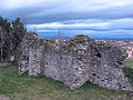
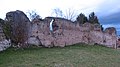
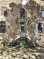
 Enceinte de Moingt.jpg 4,000 × 3,000; 4.92 MB
-
 Le Moingt avec lavoir à Moingt (Montbrison, Loire, Fr).JPG 3,072 × 2,304; 2.99 MB
-
 Le Moingt à Moingt (Montbrison), avec balisage PR.JPG 3,072 × 2,304; 3 MB
-
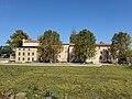
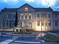 Moingt, mairie.jpg 3,041 × 2,263; 1.88 MB
-
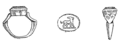 Moingt--clos vissaguet--bague or.png 593 × 214; 32 KB
-
 Moingt--clos vissaguet--vase tresor.png 258 × 348; 24 KB
-
 Montbrison, Moingt, théâtre romain, extérieur.jpg 3,072 × 2,304; 2.39 MB
-
 Montbrison, Moingt, théâtre romain, intérieur.jpg 3,072 × 1,728; 1.34 MB
-
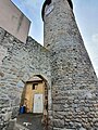
 Partie supérieure de la tour de Moingt.jpg 4,000 × 3,000; 4.92 MB
-
 Porte de ville et tour de Moingt.jpg 3,000 × 4,000; 3.96 MB
-
 Termy rzymskie w Aquae Segetae (Moingt) (1).jpg 512 × 384; 67 KB
-
 Termy rzymskie w Aquae Segetae (Moingt) (2).jpg 384 × 512; 77 KB
-
 Termy rzymskie w Aquae Segetae (Moingt) (3).jpg 384 × 512; 45 KB
-
 Termy rzymskie w Aquae Segetae (Moingt) (4).jpg 512 × 384; 46 KB
-
 Termy rzymskie w Aquae Segetae (Moingt) (5).jpg 384 × 512; 55 KB
-
 Wieża i brama moingt.jpg 3,456 × 4,608; 2.5 MB
-
 Wieża moingt 1.jpg 3,024 × 4,032; 1.69 MB
-
 Wieża monigt 2.jpg 3,456 × 4,608; 2.21 MB
-
 Wieża w moingt 3.jpg 3,456 × 4,608; 2.55 MB
-
 Zamurowane drzwi.jpg 3,456 × 4,608; 3.97 MB


.JPG)
,_avec_balisage_PR.JPG)


_(1).jpg)
_(2).jpg)
_(3).jpg)
_(4).jpg)
_(5).jpg)


