Category:Molkenkur
Jump to navigation
Jump to search
| Object location | | View all coordinates using: OpenStreetMap |
|---|
railway station in Heidelberg, Germany  | |||||
| Upload media | |||||
| Instance of | |||||
|---|---|---|---|---|---|
| Location | Heidelberg, Karlsruhe Government Region, Baden-Württemberg, Germany | ||||
 | |||||
wi
Subcategories
This category has the following 2 subcategories, out of 2 total.
M
- Molkenkur Bergbahnhof (22 F)
O
- Obere Burg Heidelberg (8 F)
Media in category "Molkenkur"
The following 18 files are in this category, out of 18 total.
-

-
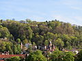 20160421Molkenkur.jpg 2,500 × 1,875; 1.13 MB
-
-
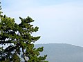
 Blick von der Molkenkur - panoramio (1).jpg 1,305 × 1,364; 320 KB
-
 Blick von der Molkenkur - panoramio (6).jpg 1,331 × 1,423; 363 KB
-

-
 ETH-BIB-Heidelberg, Buntsandsteintürme, bei Molkenkur-Dia 247-05133.tif 3,567 × 2,585; 8.88 MB
-
 Gedenkstein Alte Burg HD.jpg 2,942 × 3,672; 5.68 MB
-

-
 Hier an der Molkenkur stand das erste Heidelberger Schloss. - panoramio.jpg 1,645 × 1,703; 386 KB
-

-
 Linde an der Molkenkur, Heidelberg.jpg 2,199 × 2,932; 7.58 MB
-
 Linde Molkenkur im Frühling, Heidelberg.jpg 3,024 × 4,032; 6.56 MB
-
 Molkenkur - panoramio (1).jpg 1,565 × 1,552; 525 KB
-
 Molkenkur - panoramio (3).jpg 1,842 × 1,874; 314 KB
-
 Molkenkur im Herbst.jpg 3,300 × 2,202; 8.69 MB
-
 Molkenkurweg - geo.hlipp.de - 10822.jpg 640 × 480; 112 KB
-
 Wegweiser Molkenkur–Königsstuhl.jpg 920 × 770; 295 KB
,_RP-F-F00882-21.jpg)


.jpg)
.jpg)


.jpg)
.jpg)


