Category:Mont Rond
Jump to navigation
Jump to search
| Object location | | View all coordinates using: OpenStreetMap |
|---|
mountain in France in the Jura mountains  | |||||
| Upload media | |||||
| Instance of | |||||
|---|---|---|---|---|---|
| Location | Ain, Auvergne-Rhône-Alpes, Metropolitan France, France | ||||
| Mountain range | |||||
| Elevation above sea level |
| ||||
 | |||||
Subcategories
This category has the following 2 subcategories, out of 2 total.
T
- Télécombi du Mont-Rond (3 F)
É
- Émetteur du mont Rond (9 F)
Media in category "Mont Rond"
The following 28 files are in this category, out of 28 total.
-
 68-cgd mont rond 02.jpg 622 × 467; 18 KB
-
 Child in the Jura mountains.jpg 1,612 × 1,523; 1.67 MB
-
 Col de la Faucille 1.JPG 4,320 × 2,432; 4.41 MB
-
 Gex (01) - Montrond - Faucille.JPG 2,048 × 1,024; 1.33 MB
-
 Le Mont Rond et le Mont Chanais - img 38644.jpg 5,616 × 3,744; 9.16 MB
-
 Le Petit Mont Rond et la Dôle - img 38593.jpg 5,616 × 3,744; 7.37 MB
-
 Le Petit Mont Rond et la Dôle - img 38607.jpg 5,616 × 3,744; 9.11 MB
-
 Lis de saint-Bruno (Paradisea liliastrum) - img 38586.jpg 3,744 × 5,616; 5.2 MB
-

-
 Mont Rond Centre TdF 025.jpg 2,272 × 1,704; 3.27 MB
-
 Mountaintop Mont Rond in the Jura near Gex as a skiing center - panoramio.jpg 4,288 × 2,848; 2.86 MB
-
 Panneau de randonnée au Mont Rond - img 38587.jpg 5,616 × 3,744; 6.63 MB
-
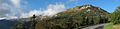
 Panoramic view to the French and Swiss Alps at Mont Ront Jura at 14 May 2015 - panoramio.jpg 4,288 × 2,848; 1.68 MB
-
 Pays de Gex (cropped) Grand Montrond.JPG 664 × 498; 412 KB
-
 Pays de Gex.JPG 4,320 × 2,432; 7.55 MB
-
 Petit Mont Rond, versan lémanique.jpg 1,584 × 2,816; 1.49 MB
-
 Petit Mont Rond.JPG 4,320 × 2,432; 5.37 MB
-
 Petit Montrond 2.JPG 4,320 × 2,432; 6.02 MB
-
 Petit Montrond Gex Ain 1.jpg 4,032 × 3,024; 4.94 MB
-
 Petit Montrond Gex Ain 2.jpg 4,032 × 3,024; 4.99 MB
-
 Petit Montrond Gex Ain 3.jpg 6,710 × 3,926; 21.19 MB
-
 Petit Montrond Gex Ain 4.jpg 4,032 × 3,024; 4.74 MB
-
 Petit Montrond Gex Ain 5.jpg 4,032 × 3,024; 4.22 MB
-
 Petit Montrond Gex Ain 6.jpg 4,032 × 3,024; 4.82 MB
-
 Petit Montrond Gex Ain 7.jpg 4,032 × 3,024; 4.7 MB
-
 Petit Montrond Gex Ain 8.jpg 4,032 × 3,024; 3.74 MB
-
 Petit Montrond01 2015-10-04.jpg 8,000 × 1,904; 6.75 MB
-
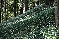 Sous-bois avec ail des ours - img 38582.jpg 5,616 × 3,744; 7.24 MB


_-_Montrond_-_Faucille.JPG)


_-_img_38586.jpg)


_Grand_Montrond.JPG)


