Category:Montafon
Jump to navigation
Jump to search
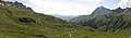
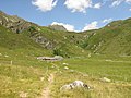
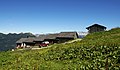
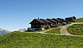
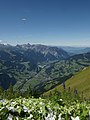
Deutsch: Das Montafon ist ein 39 km langes Tal in Vorarlberg (Österreich), das bei Bludenz abzweigt und von der Ill durchflossen wird. Das Tal wird im Norden von der Verwallgruppe und im Süden vom Rätikon und der Silvretta begrenzt. Die höchste Erhebung in der Umgebung ist der 3312 m hohe Piz Buin in der Silvretta-Gruppe.
Valley and region in the Austrian state of Vorarlberg  | |||||
| Upload media | |||||
| Instance of | |||||
|---|---|---|---|---|---|
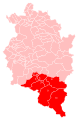
| Location | Bludenz District, Vorarlberg, Austria | ||||
| Headquarters location | |||||
| Length |
| ||||
| Mountain range | |||||
| Elevation above sea level |
| ||||
| official website | |||||
 | |||||
Subcategories
This category has the following 37 subcategories, out of 37 total.
B
C
G
- Golm (Österreich) (9 F)
- Gottvaterspitze (21 F)
- Großer Valkastiel (5 F)
H
- Herzsee (Schruns) (18 F)
K
- Kreuzjoch (Verwall) (8 F)
- Kristberg (Silbertal) (47 F)
L
M
- Montafoner Resonanzen (3 F)
- Montafoner Steinschaf (3 F)
P
S
- Sarotlahörner (5 F)
- Silvretta Nova (skiing area) (18 F)
T
- Tracht of Montafon (12 F)
V
- Vallülasee (5 F)
W
- Weißplatte (Rätikon) (6 F)
- Wormser Hütte (14 F)
Z
- Zimba (65 F)
Media in category "Montafon"
The following 100 files are in this category, out of 100 total.
-
De-Montafon.ogg 1.8 s; 18 KB
-
 05 Silbertal mit Zimba.jpg 3,264 × 1,832; 816 KB
-
 100 0993 Blick von den Katzenköpfen (oberhalb von Bludenz) ins Montafon. Rechts.jpg 2,592 × 1,944; 912 KB
-
 2008.08.06.DreiTuermeRaetikonBartholomaeberg.JPG 2,048 × 1,536; 536 KB
-
 360° Drei Türme und Sulzfluh.jpg 8,600 × 2,075; 14.13 MB
-
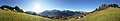
 360° Loischkopf Panorama.jpg 12,231 × 1,502; 4.8 MB
-
 Alpensteinböcke, Capra ibex auf der Sulzfluh.JPG 4,288 × 2,848; 2.52 MB
-
 Bartholomäberg - Montafoner Sonnenbalkon.jpg 5,372 × 1,080; 7.58 MB
-
 Bartholomäberg Montafon Panorama.JPG 8,430 × 1,488; 3.37 MB
-
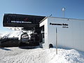 Bergstation Panorama Bahn.JPG 4,000 × 3,000; 4.31 MB
-
 Bitschweil Pano.jpg 6,245 × 2,023; 4.64 MB
-
 Bitschweil1.JPG 3,008 × 2,000; 3.19 MB
-
 Bitschweil2.JPG 3,008 × 2,000; 2.77 MB
-
 Blick-Partenen.jpg 2,048 × 1,536; 673 KB
-
 Blick-Schruns1.jpg 3,352 × 1,468; 1.16 MB
-
 BreiterSpitz2196m.jpg 2,592 × 3,888; 2.8 MB
-
 Cross near the top of the Breitspitze.JPG 3,644 × 2,750; 5.06 MB
-
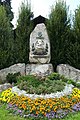
 Denkmal, Landamann Johann Josef Batlogg, Schruns.JPG 3,782 × 2,837; 8.76 MB
-
 Die Gartenlaube (1864) b 796.jpg 967 × 1,361; 219 KB
-
 Drusator.JPG 2,048 × 1,536; 589 KB
-
 Drusator02.jpg 2,048 × 1,536; 302 KB
-
 Drusenfluh2827m Geißspitze2334m.jpg 3,888 × 2,592; 2.21 MB
-
 DSCN8105 Wildried mit Mittagsjoch.jpg 3,264 × 2,448; 1.72 MB
-
 Duerf am Montafon.jpg 1,229 × 819; 474 KB
-
 Fairytale Hunter Robert Elwes Hat and Hound in Schruns IMG 0461.jpg 4,032 × 3,024; 2.07 MB
-
 Familienklettersteig.jpg 1,702 × 2,048; 594 KB
-
 Felsen Zirmen Seekopf Panorama.jpg 7,502 × 2,144; 10.95 MB
-
 Gafier Joch Aufstieg.jpg 13,021 × 4,280; 7.79 MB
-
 Garneratal1.jpg 3,716 × 1,493; 1.48 MB
-
 Garneratal2.jpg 2,046 × 1,364; 577 KB
-
 Garneratal3.jpg 3,940 × 1,460; 1.2 MB
-
 Garneratal4.jpg 2,048 × 1,536; 573 KB
-
 Gaschurn - panoramio.jpg 3,072 × 2,304; 3.25 MB
-
 Gaschurn Panorama.jpg 6,616 × 2,029; 10.9 MB
-
 Gaschurn Silvretta-Stausee Staumauer.jpg 5,000 × 3,122; 6.8 MB
-
 Gaschurn Vermuntsee Luftbild.jpg 5,000 × 2,876; 10.97 MB
-
 Gemeinden im Montafon.svg 407 × 624; 582 KB
-
 Haus Matschwitz Golm.JPG 3,072 × 2,048; 3.33 MB
-
 Höhenweg-Madrisella1.jpg 2,046 × 1,364; 652 KB
-
 Höhenweg-Madrisella2.jpg 2,048 × 1,365; 704 KB
-
 Höhenweg-Madrisella3.jpg 2,048 × 1,536; 734 KB
-
 Höhenweg-Madrisella4.jpg 2,048 × 1,536; 561 KB
-
 Höhenweg-Madrisella5.jpg 2,359 × 1,573; 1.09 MB
-
 Kirche-Schruns3.jpg 2,027 × 1,351; 738 KB
-
 Kopie von Gaschurn edit.jpg 6,616 × 2,029; 3.51 MB
-
 Kreuzjoch2396Schruns1.JPG 4,272 × 2,848; 2.3 MB
-
 Kreuzjoch2396Schruns2.JPG 2,848 × 4,272; 2.2 MB
-
 Kreuzjoch2396Schruns3.JPG 2,848 × 4,272; 9.1 MB
-
 LandamannBatlogg.JPG 2,000 × 3,008; 4.3 MB
-
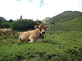 M braunvieh.JPG 3,072 × 2,304; 3.45 MB
-
 Madrisella1.jpg 1,728 × 1,481; 434 KB
-
 Madrisella2.jpg 1,955 × 1,380; 623 KB
-
 MatschunerJoch.jpg 2,048 × 1,365; 663 KB
-
 Montafon 128 Frattetobel fcm.jpg 2,448 × 3,264; 6.75 MB
-
 Montafon 2012 12.JPG 3,072 × 2,304; 1.18 MB
-
 Montafon 2012 21.JPG 3,072 × 2,304; 1.19 MB
-
 Montafon 2012 22.JPG 3,072 × 2,304; 1.27 MB
-
 Montafon 2012 23.JPG 3,072 × 2,304; 1.44 MB
-
 Montafon 2012 24.JPG 3,072 × 2,304; 1.56 MB
-
 Montafon 2012 25.JPG 3,072 × 2,304; 1.55 MB
-
 Montafon 2012 54.jpg 3,072 × 2,304; 1.56 MB
-
 Montafon 2012 55.jpg 3,072 × 2,304; 1.38 MB
-
 Montafon 2012 56.jpg 3,072 × 2,304; 1.53 MB
-
 Montafon 2012 62.jpg 3,072 × 2,304; 1.41 MB
-
 Montafon 2012 74.jpg 3,072 × 2,304; 1.17 MB
-
 Montafon 2012 75.jpg 3,072 × 2,304; 1.16 MB
-
 Montafonerhaus.png 772 × 446; 614 KB
-
 Panorama Panorama Bahn.JPG 4,600 × 920; 978 KB
-
 Rellstal01.JPG 3,008 × 2,000; 2.56 MB
-
 Rätschenfluh vom Gafierjoch aus.jpg 4,032 × 3,024; 4.81 MB
-
 Sankt Anton im Montafon Panorama.JPG 8,002 × 1,667; 3.82 MB
-
 Saulakopf2517m.jpg 3,888 × 2,592; 2.98 MB
-
 Schnee-Kapelle-Gaschurn4.jpg 1,830 × 1,220; 980 KB
-
 Schwarzhorn2460m 1.jpg 3,888 × 2,592; 1.7 MB
-
 Schwarzhorn2460m.jpg 2,592 × 3,888; 2.01 MB
-
 SennigratMontafon.JPG 4,272 × 2,848; 1.47 MB
-
 Silbertal (Österreich).jpg 768 × 839; 465 KB
-
 Silvesternacht am Kristberg - panoramio.jpg 366 × 217; 13 KB
-
 SilvrettaNova 01.jpg 3,888 × 2,592; 3.1 MB
-
 SpeicherseeHochjoch1.JPG 4,272 × 2,848; 1.78 MB
-
 SpeicherseeHochjoch2.JPG 4,272 × 2,848; 6.86 MB
-
 SpeicherseeHochjoch3.JPG 4,272 × 2,848; 1.02 MB
-
 SpeicherseeHochjoch4.JPG 4,272 × 2,848; 1.51 MB
-
 St. Antönier Joch.jpg 9,875 × 3,062; 5.8 MB
-
 Sulzfluh Plateau Panorama.jpg 9,325 × 1,844; 11.35 MB
-
 Sulzfluh2818m Kl Sulzfluh2708m.jpg 3,888 × 2,592; 1.7 MB
-
 TilisunaSeehorn2342m.jpg 3,888 × 2,592; 1.86 MB
-
 Valisera2716m.jpg 2,592 × 3,888; 3.53 MB
-
 Valschavieltal from near Valschavieler Jöchli.jpg 7,607 × 2,243; 3.41 MB
-
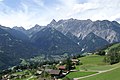
 Vandans St Anton im Montafon Panorama.jpg 7,654 × 1,904; 2.9 MB
-
 Verbella Alpe.jpg 3,648 × 2,736; 2.68 MB
-
 View of Grappeskopf, Montafon.jpg 10,180 × 2,455; 5.77 MB
-
 Vorderkapell42 a.JPG 4,272 × 2,500; 2.33 MB
-
 Vorderkapell42 b.JPG 4,272 × 2,500; 6.6 MB
-
 Vorderkapell42 c.JPG 4,272 × 2,500; 2.32 MB
-
 Walgau 2.JPG 3,008 × 2,000; 1.15 MB
-
 WormserHütteMontafon.JPG 2,848 × 3,797; 1.69 MB
-
 Zimba Gruppe.jpg 3,888 × 2,592; 1.24 MB
-
 Zimba Steintälikopf.jpg 3,888 × 2,592; 3.4 MB
-
 ZwHütte Drusator.JPG 2,048 × 1,536; 434 KB

_ins_Montafon._Rechts.jpg)


_b_796.jpg)


.jpg)


