Category:Monument op de Joodse begraafplaats, Katwijk
Jump to navigation
Jump to search
| Object location | | View all coordinates using: OpenStreetMap |
|---|
|
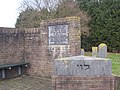
This is a category about a war memorial in the Netherlands, number: 2027
|
war memorial in Katwijk, the Netherlands  | |||||
| Upload media | |||||
| Instance of |
| ||||
|---|---|---|---|---|---|
| Location | Katwijk, South Holland, Netherlands | ||||
| Street address |
| ||||
| Inception |
| ||||
| Date of official opening |
| ||||
 | |||||
Media in category "Monument op de Joodse begraafplaats, Katwijk"
The following 4 files are in this category, out of 4 total.
-
 Gedenkteken Joodse begraafplaats Katwijk.JPG 2,560 × 1,920; 628 KB
-
 Joodse begraafplaats 5.JPG 2,560 × 1,920; 630 KB
-
 Joodse begraafplaats 6.JPG 2,560 × 1,920; 742 KB
-
 Joodse begraafplaats Katwijk, monument voor gevallene.jpeg 720 × 540; 67 KB


