Category:Moray Firth
Jump to navigation
Jump to search
inlet near Inverness, Aberdeenshire, Scotland, UK  | |||||
| Upload media | |||||
| Instance of | |||||
|---|---|---|---|---|---|
| Part of | |||||
| Location | Scotland | ||||
| Has part(s) | |||||
| Inflows |
| ||||
 | |||||
Subcategories
This category has the following 5 subcategories, out of 5 total.
Media in category "Moray Firth"
The following 200 files are in this category, out of 212 total.
(previous page) (next page)-
-
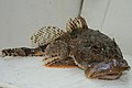 A Moray Firth Scorpion fish - geograph.org.uk - 1902232.jpg 800 × 532; 181 KB
-
 A tranquil Moray Firth - geograph.org.uk - 3777429.jpg 1,200 × 903; 533 KB
-
 A Very Heavy Pigeon - panoramio.jpg 4,320 × 3,240; 5.66 MB
-
 A Walk For The Ladies - panoramio.jpg 4,320 × 3,240; 6.83 MB
-
 Across the Moray Firth - geograph.org.uk - 135336.jpg 640 × 480; 165 KB
-
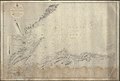
 Admiralty Chart No 115 Peterhead to Pentland Firth including Moray Firth, Published 1972.jpg 15,927 × 14,410; 36.3 MB
-
 Admiralty Chart No 115 Peterhead to Pentland Firth, Published 1916.jpg 14,025 × 13,084; 53.75 MB
-
 Admiralty Chart No 1451 Firth of Inverness and Beauly Basin, Published 1846.jpg 9,875 × 6,795; 19.58 MB
-
 Admiralty Chart No 1784 Inverness Firth, Published 1919.jpg 9,971 × 6,730; 30.41 MB
-
 Admiralty Chart No 1823 Banff to Dunbeath Harbour, Published 1847, Corrections to 1945.jpg 9,893 × 6,783; 25.16 MB
-
 Admiralty Chart No 1823 Banff to the Ord of Caithness, Published 1847.jpg 9,946 × 6,747; 24.25 MB
-
 Admiralty Chart No 2167 Cromarty Firth, Published 1903.jpg 16,129 × 11,019; 67.89 MB
-
 Admiralty Chart No 2397a Firth of Forth to Moray Firth, Published 1863.jpg 13,587 × 11,292; 58.46 MB
-
 Admiralty Chart No 3547 Logie Head to Tarbet Ness, Published 1906.jpg 10,560 × 6,354; 23.97 MB
-
 Air And Water - panoramio.jpg 4,320 × 3,240; 3.34 MB
-
 Alien - panoramio (4).jpg 3,004 × 2,252; 2.79 MB
-
 And Now A Jumping Dolphin - panoramio.jpg 2,432 × 4,320; 3.65 MB
-
 Annihilate annihilate^^ - geograph.org.uk - 3337166.jpg 800 × 535; 194 KB
-
 At the end of the world (3639229980).jpg 1,280 × 627; 86 KB
-
 Autumn Colours - panoramio (1).jpg 3,240 × 4,320; 4.54 MB
-
 Baby bottlenose dolphin shannonry point 2006.jpg 1,504 × 1,812; 287 KB
-
 Ballone Castle - panoramio.jpg 4,320 × 3,240; 4.95 MB
-
 Beach below Hillockhead - geograph.org.uk - 104263.jpg 640 × 480; 99 KB
-
 Beach In September - panoramio.jpg 4,320 × 3,240; 5.32 MB
-
 Beautiful Plumage - panoramio.jpg 4,320 × 3,240; 3.1 MB
-
 Beeches - panoramio (1).jpg 4,320 × 3,240; 5.84 MB
-
 Bench And Trees - panoramio.jpg 2,964 × 4,320; 5.5 MB
-
 Bench In The Park - panoramio.jpg 4,320 × 2,432; 4.54 MB
-
 Bottlenose dolphin with young.JPG 1,679 × 1,153; 987 KB
-
 Calm day by the Moray Firth - geograph.org.uk - 4674468.jpg 1,600 × 1,200; 682 KB
-

-
 Chanonry Point and Fort George - 51500339338.jpg 5,866 × 3,082; 12.97 MB
-
 Clachnaharry - panoramio.jpg 4,217 × 2,832; 4.89 MB
-
 Clear Up - panoramio.jpg 4,320 × 3,240; 4.78 MB
-
 Cliffs - panoramio (3).jpg 4,320 × 3,240; 5.85 MB
-
 Cliffs to the north of An Dun - geograph.org.uk - 2013407.jpg 2,736 × 3,648; 2.2 MB
-
 Cloudy And Windy - panoramio.jpg 4,320 × 2,432; 3.52 MB
-
 Coastal rocks by Scart Craig - geograph.org.uk - 4640948.jpg 1,600 × 1,200; 541 KB
-
 Coastline west of Cullen Bay - geograph.org.uk - 684684.jpg 640 × 401; 231 KB
-
 Construction Site - panoramio (1).jpg 4,320 × 2,432; 4.71 MB
-
 Cruise ship in the Moray Firth - geograph.org.uk - 5879750.jpg 1,024 × 575; 255 KB
-
 Dancing Teddy Bear - panoramio.jpg 3,240 × 4,320; 4.44 MB
-
 Danger - panoramio (3).jpg 4,320 × 2,432; 3.74 MB
-
 Decoys - panoramio.jpg 4,320 × 3,240; 4.59 MB
-
 Drift Wood - panoramio.jpg 4,320 × 3,240; 5.97 MB
-
 Fairway Buoy in Moray Firth - geograph.org.uk - 5096060.jpg 640 × 481; 419 KB
-
 Fine Foods - panoramio.jpg 4,320 × 3,240; 6.22 MB
-
 Flight School - panoramio.jpg 4,320 × 3,240; 6.16 MB
-
 Flyer - panoramio.jpg 4,320 × 3,240; 3.25 MB
-
 For Sale - panoramio (2).jpg 3,240 × 4,320; 5.54 MB
-
 Fortrose , Moray Firth - Dolphins - geograph.org.uk - 4966798.jpg 6,000 × 4,000; 7.21 MB
-
 Framed Colours - panoramio.jpg 4,242 × 3,135; 4.19 MB
-
 Framed Green - panoramio (1).jpg 4,320 × 3,240; 5.2 MB
-

-
 Genie From The Bottle - panoramio.jpg 4,320 × 3,240; 4.88 MB
-
 Grey Dog - panoramio.jpg 4,320 × 3,240; 5.67 MB
-
 Greylag - panoramio.jpg 4,320 × 3,240; 4.72 MB
-
 Hand Brake - panoramio.jpg 4,320 × 3,240; 6.57 MB
-
 Highland, UK - panoramio - nmdl04669.jpg 4,000 × 3,000; 3.87 MB
-
 Hillockhead, Looking eastwards up the Moray Firth - geograph.org.uk - 5037131.jpg 5,043 × 3,102; 7.26 MB
-
 Hit - panoramio.jpg 4,320 × 3,240; 4.97 MB
-
 Horses With Jacket - panoramio.jpg 4,320 × 3,240; 4.29 MB
-
 Hot And Cold - panoramio.jpg 4,320 × 3,240; 5.3 MB
-
 Hug - panoramio (2).jpg 3,240 × 4,320; 5.1 MB
-
 I got one, I got one^^^ - geograph.org.uk - 4963405.jpg 800 × 534; 322 KB
-
 I Like This Place - panoramio.jpg 4,320 × 2,432; 3.34 MB
-
 Independence Day - panoramio (1).jpg 4,320 × 2,432; 2.67 MB
-
 Inner Moray Firth Shore Line - geograph.org.uk - 55265.jpg 640 × 480; 103 KB
-
 Into the Moray Firth - geograph.org.uk - 4658117.jpg 640 × 427; 111 KB
-
 Inverness Moray Firth Panorama 01.jpg 15,797 × 3,309; 12.75 MB
-
 Judd 1873 Geological Map Moray Firth Quarterlyjourna291873geol 0248.jpg 2,005 × 2,319; 321 KB
-
 Katia - panoramio.jpg 4,320 × 2,432; 3.03 MB
-
 Kite Surfing - panoramio.jpg 4,227 × 3,113; 4.64 MB
-
 Lantern And Beech - panoramio.jpg 3,240 × 4,320; 6.28 MB
-
 Leaving the Inner Moray Firth under sail - geograph.org.uk - 4158898.jpg 1,400 × 1,057; 660 KB
-
 Lenticularis Clouds - panoramio.jpg 3,240 × 4,320; 4.38 MB
-
 Look At The Watch - panoramio.jpg 3,240 × 4,320; 3.9 MB
-
 Look Into Your Mirror - panoramio.jpg 4,320 × 2,432; 4.24 MB
-

-
 Looking out on the Moray Firth - geograph.org.uk - 3703136.jpg 640 × 428; 46 KB
-
 Looking towards the Moray Firth - geograph.org.uk - 1657352.jpg 640 × 480; 74 KB
-
 Low Tide - panoramio (2).jpg 4,320 × 2,432; 3.39 MB
-
 Low tide on the Moray Firth - geograph.org.uk - 955487.jpg 640 × 480; 182 KB
-
 Master of his element, that's the dolphin - geograph.org.uk - 5483835.jpg 1,200 × 802; 354 KB
-

-
 Missed - panoramio.jpg 4,320 × 3,240; 5.14 MB
-
 Moray Firth (1982).jpg 954 × 647; 140 KB
-
 Moray Firth - geograph.org.uk - 2237471.jpg 640 × 480; 33 KB
-
 Moray Firth - geograph.org.uk - 4569890.jpg 1,400 × 1,050; 244 KB
-
 Moray Firth - geograph.org.uk - 586300.jpg 640 × 480; 60 KB
-
 Moray Firth and a little bit of beach - geograph.org.uk - 104261.jpg 640 × 480; 98 KB
-

-
 Moray Firth evening - geograph.org.uk - 1436259.jpg 640 × 480; 82 KB
-
 Moray Firth from above Essich - geograph.org.uk - 1064733.jpg 640 × 480; 39 KB
-
 Moray Firth from Findhorn Beach - geograph.org.uk - 602485.jpg 640 × 481; 58 KB
-
 Moray Firth Map.png 624 × 432; 386 KB
-
 Moray Firth near McFarquhar's Bed - geograph.org.uk - 5305779.jpg 1,600 × 900; 386 KB
-
 Moray Firth Shipping - geograph.org.uk - 6144180.jpg 640 × 480; 45 KB
-
 Moray Firth topo.png 926 × 919; 939 KB
-

-
 Moray Firth, Scotland, 13 April 2011 - Flickr - PhillipC.jpg 3,983 × 2,535; 3 MB
-

-
 MorayFirth.jpg 2,128 × 2,832; 987 KB
-
 Morayfirthmap.png 995 × 1,000; 280 KB
-
 Nairn - panoramio.jpg 4,320 × 3,240; 6.27 MB
-
 Nairn and the Moray Firth, Inverness, Scotland, April 2011 - Flickr - PhillipC (1).jpg 4,288 × 2,848; 2.75 MB
-
 Nairn and the Moray Firth, Inverness, Scotland, April 2011 - Flickr - PhillipC.jpg 3,810 × 2,366; 3.15 MB
-
 Nairn Beach - geograph.org.uk - 1344617.jpg 640 × 440; 67 KB
-
 Navity Bank navigation buoy - geograph.org.uk - 2733747.jpg 640 × 427; 193 KB
-
 New Species - panoramio.jpg 4,320 × 3,043; 3.93 MB
-
 Nice Place - panoramio (2).jpg 4,320 × 3,240; 5.64 MB
-
 Nicholas Of Myra - panoramio.jpg 3,089 × 4,208; 4.22 MB
-
 No Smoking - panoramio (1).jpg 4,320 × 2,432; 3.32 MB
-
 No Step - panoramio.jpg 3,240 × 4,320; 4.34 MB
-
 Nosedive - panoramio.jpg 4,320 × 3,240; 3.41 MB
-
-
 Old And New - panoramio (4).jpg 1,941 × 1,302; 1.03 MB
-
 On dolphintour - panoramio.jpg 1,200 × 1,600; 985 KB
-
 Ordnance Survey One-Inch Sheet 28 Inverness, Published 1958.jpg 8,236 × 9,883; 9.83 MB
-
 Ordnance Survey One-Inch Sheet 28 Nairn and Cromarty, Published 1947.jpg 12,231 × 9,367; 11.42 MB
-
 Ordnance Survey Quarter-inch sheet 5 Eastern Highlands, published 1967.jpg 9,635 × 8,911; 10.25 MB
-
 Ordnance Survey Sheet NH 64 Inverness, Published 1962.jpg 7,612 × 8,798; 15.12 MB
-
 Ordnance Survey Sheet NH 65 (28 65) Munlochy, Published 1950.jpg 7,624 × 8,794; 13.29 MB
-
 Ordnance Survey Sheet NH 75 Fortrose, Published 1961.jpg 7,592 × 8,745; 15.22 MB
-
 Other Colour - panoramio.jpg 4,320 × 3,240; 6.7 MB
-
-
 Pickeldie - panoramio.jpg 4,320 × 3,240; 6.21 MB
-
 Pines - panoramio (7).jpg 4,320 × 3,240; 6.8 MB
-
 Pines In The Field - panoramio.jpg 3,240 × 4,320; 4.56 MB
-
 Pipeline into the Moray Firth - geograph.org.uk - 1330464.jpg 640 × 474; 149 KB
-
 Playing Sunlight - panoramio.jpg 4,320 × 3,240; 7.29 MB
-
 Preservation - panoramio.jpg 2,983 × 4,138; 4.98 MB
-
 PRIVATE - panoramio.jpg 4,320 × 3,240; 6.55 MB
-
 Rays - panoramio (2).jpg 4,320 × 2,756; 3.48 MB
-
 Real Bottlenose Dolphins. - panoramio.jpg 4,320 × 3,240; 5.32 MB
-
 Remove - panoramio.jpg 3,240 × 4,320; 5.32 MB
-
 Roofs Of Culloden - panoramio.jpg 4,222 × 3,106; 4.43 MB
-
 Rosemarkie - panoramio.jpg 4,320 × 2,432; 3.64 MB
-
 Ryan Amy in action on the Moray Firth - geograph.org.uk - 4963400.jpg 800 × 534; 335 KB
-
 Safe Water Mark in the Moray Firth - geograph.org.uk - 5096053.jpg 640 × 480; 509 KB
-
 Sailing Boat on the Moray Firth - geograph.org.uk - 1366776.jpg 640 × 490; 57 KB
-
 Sailing on the Moray Firth - geograph.org.uk - 1366768.jpg 640 × 447; 75 KB
-
 Sailing on the Moray Firth - geograph.org.uk - 1409666.jpg 640 × 350; 36 KB
-
 Scot Mariner en route to Inverness - geograph.org.uk - 5624295.jpg 1,024 × 640; 129 KB
-
 Seagull Female - panoramio.jpg 4,320 × 3,240; 4.3 MB
-
 Seagulls - panoramio (2).jpg 2,796 × 2,065; 1.5 MB
-
 Seals on a sandbank - geograph.org.uk - 3619378.jpg 2,376 × 1,584; 789 KB
-
 Seals, Moray Firth - geograph.org.uk - 1165746.jpg 640 × 359; 239 KB
-
 Shadow - panoramio (9).jpg 4,320 × 3,240; 6.3 MB
-
 Shandwick - geograph.org.uk - 8533.jpg 640 × 261; 112 KB
-
 Sharp-Edged Clouds - panoramio.jpg 4,320 × 3,240; 3.42 MB
-
 Sheep And Trees - panoramio.jpg 4,320 × 3,240; 5.07 MB
-
 Sheep Road - panoramio.jpg 3,240 × 4,320; 4.6 MB
-
 Sheltered bay on Moray Firth - geograph.org.uk - 609635.jpg 640 × 480; 89 KB
-
 Ships that pass........ - geograph.org.uk - 5483841.jpg 1,200 × 799; 429 KB
-
 Sick Bird - panoramio.jpg 1,280 × 960; 606 KB
-
 Single Malt - panoramio.jpg 4,320 × 3,240; 6.57 MB
-
-

-
 Skerry beacon - you have been warned^ - geograph.org.uk - 3337172.jpg 534 × 800; 184 KB
-

-
 Soul Catcher - panoramio.jpg 4,320 × 3,240; 4.12 MB
-
 Sperm Whale - Alturlie Point - geograph.org.uk - 1241380.jpg 640 × 268; 56 KB
-
 Spot - panoramio (2).jpg 4,320 × 3,240; 3.82 MB
-
 Spotlights - panoramio.jpg 3,240 × 4,320; 5.57 MB
-
 Stormy Weather, Moray Firth - David West - ABDAG000193.jpg 500 × 316; 20 KB
-
 Straight - panoramio (3).jpg 3,240 × 4,320; 3.42 MB
-
 Strange Sky - panoramio.jpg 4,320 × 3,240; 4.42 MB
-

-
 Sunset Over Moray Firth - panoramio.jpg 4,320 × 2,818; 3.78 MB
-
 Sunset Over The Beauly Firth - panoramio.jpg 4,320 × 3,240; 3.27 MB
-
 Tarbat Ness from across the Firth - geograph.org.uk - 248519.jpg 640 × 426; 69 KB
-
 The Bank At The River Ness - panoramio.jpg 3,240 × 4,320; 6.99 MB
-
 The Front Garden - panoramio.jpg 3,240 × 4,320; 7.23 MB
-
 The Fulmar (Fulmaris glacialis) - geograph.org.uk - 6127756.jpg 1,600 × 1,067; 635 KB
-
 The Future Of Europe - panoramio.jpg 3,240 × 4,320; 4.23 MB
-

-
 The Hairdresser Was There - panoramio.jpg 4,320 × 2,432; 4.03 MB
-
 The Loch Rannoch - panoramio.jpg 4,320 × 2,432; 3.84 MB
-
 The Moray Firth - geograph.org.uk - 1143588.jpg 640 × 480; 93 KB
-
 The Moray Firth - geograph.org.uk - 1144848.jpg 640 × 480; 94 KB
-
 The Moray Firth at Lossiemouth - geograph.org.uk - 4016698.jpg 640 × 427; 159 KB
-
 The Moray Firth from Fort George - geograph.org.uk - 820052.jpg 640 × 480; 54 KB
-
 The Place To Enjoy The Sunset - panoramio.jpg 4,320 × 3,240; 3.91 MB
-
 The price of oil - geograph.org.uk - 5785792.jpg 1,201 × 1,600; 260 KB
-
 The Quarterly journal of the Geological Society of London (13368873795).jpg 2,005 × 2,319; 568 KB
-
 The Ring - panoramio.jpg 3,240 × 4,320; 3.55 MB
-
 The shore of the Moray Firth - geograph.org.uk - 596957.jpg 640 × 480; 86 KB
-
 The Storm Is Over - panoramio.jpg 4,320 × 2,432; 3.08 MB
-
 The Swarm - panoramio.jpg 4,320 × 3,240; 4.57 MB
-
 The Weather Will Change - panoramio (1).jpg 4,320 × 3,240; 4.61 MB
-
 To Much People - panoramio.jpg 4,320 × 2,432; 2.89 MB
-
 Trees - panoramio (17).jpg 4,320 × 3,240; 5.5 MB
-
 Trees And Shadow - panoramio.jpg 3,240 × 4,320; 10.97 MB
-
 Typical For The UK - panoramio.jpg 3,240 × 4,320; 7.64 MB
-
 UHI - panoramio.jpg 4,212 × 3,092; 5.67 MB
-
 Washington report.png 3,070 × 2,047; 10.22 MB
-
 Watch Dolfins At Chanonry Point - panoramio.jpg 4,320 × 3,240; 4.55 MB
-
 Waterfront - panoramio (1).jpg 4,320 × 2,432; 3.16 MB
_-_geograph.org.uk_-_4705703.jpg)


.jpg)


.jpg)
.jpg)


.jpg)


.jpg)


.jpg)


.jpg)


.jpg)


.jpg)


.jpg)


.jpg)


.jpg)


.jpg)


.jpg)


.jpg)

.jpg)


.jpg)


_Munlochy,_Published_1950.jpg)


.jpg)


.jpg)


.jpg)


.jpg)


.jpg)


.jpg)


_-_geograph.org.uk_-_6127756.jpg)

_-_geograph.org.uk_-_4611135.jpg)


.jpg)


.jpg)

.jpg)


.jpg)