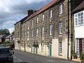
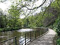
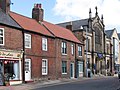
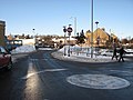
Category:Morpeth, Northumberland
Jump to navigation
Jump to search
town in Northumberland, England   | |||||
| Upload media | |||||
| Instance of | |||||
|---|---|---|---|---|---|
| Location | Northumberland, North East England, England | ||||
| Different from | |||||
| official website | |||||
 | |||||
Deutsch: Morpeth ist eine Kleinstadt mit ca. 13.833 Einwohnern (2001) in der Grafschaft Northumberland in England. Sie liegt am Fluss Wansbeck und ist der Verwaltungssitz der Grafschaft und des Boroughs Castle Morpeth.
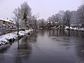
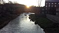
English: Morpeth is the county town of Northumberland, England. It is situated on the River Wansbeck which flows east through the town. The town is a mile from the A1, which bypasses it. Since 1981, it has been the administrative centre of the County of Northumberland. In the 2001 census the town had a population of 13,833. Nearby villages include Mitford and Pegswood.
Italiano: Morpeth è una cittadina di 14.096 abitanti, capoluogo della contea del Northumberland, in Inghilterra.
Latina: Morpitium est oppidum capitale comitatus Northumbrensis in Anglia septentrionali, super fluvium "Wansbeck" situm quod ad orientem per oppidum meat. Iuxta censum anni 2001 Morpitium incolas 14096 habebat.
Norsk bokmål: Morpeth er en liten markedsby ved elven Wansbeck i Northumberland, England. Den er administrasjonssenter for grevskapet Northumberland, og for distriktet Castle Morpeth.
Polski: Morpeth jest miastem w hrabstwie Northumberland, w Anglii, położonym o około 25 km na północ od Newcastle. Miasto liczyło 13,834 mieszkańców w 2001 roku.
Română: Morpeth este un oraş în comitatul Northumberland, regiunea North West, Anglia. Oraşul se află în districtul Castle Morpeth a cărui reşedinţă este.
Subcategories
This category has the following 13 subcategories, out of 13 total.
Media in category "Morpeth, Northumberland"
The following 200 files are in this category, out of 521 total.
(previous page) (next page)-
 A bend in the B6524 - geograph.org.uk - 4439194.jpg 640 × 480; 104 KB
-
 A Corner of The Wm Turner Garden - geograph.org.uk - 4421419.jpg 1,600 × 1,197; 643 KB
-

-

-
 A192 near Morpeth - geograph.org.uk - 2229155.jpg 640 × 480; 99 KB
-
 A192 north out of Morpeth - geograph.org.uk - 6354696.jpg 1,024 × 684; 146 KB
-
 A192 towards the A1 - geograph.org.uk - 3186075.jpg 640 × 480; 28 KB
-
 A197 heading south towards the A1 - geograph.org.uk - 3057097.jpg 640 × 480; 65 KB
-
 A197 near Morpeth - geograph.org.uk - 4559875.jpg 640 × 428; 113 KB
-
 A197 to Ashington - geograph.org.uk - 3385906.jpg 4,500 × 3,308; 4.78 MB
-
 A197 towards the A1 - geograph.org.uk - 3047588.jpg 640 × 480; 79 KB
-
 Abbey Well - geograph.org.uk - 6424128.jpg 3,264 × 2,448; 3.67 MB
-
 Abbey Well - geograph.org.uk - 6424134.jpg 3,264 × 2,448; 4.51 MB
-
 Admiral Collingwood Court, Morpeth - geograph.org.uk - 1942958.jpg 640 × 480; 76 KB
-
 Apartments under construction, Morpeth - geograph.org.uk - 5422242.jpg 2,000 × 1,500; 396 KB
-
 Arriva X15 coming out of Morpeth (geograph 7562544) (cropped).jpg 1,585 × 1,266; 661 KB
-
 Arriva X15 coming out of Morpeth (geograph 7562544).jpg 3,118 × 2,493; 2.26 MB
-
 Aruba- Thresher- Gianni's - geograph.org.uk - 1942858.jpg 640 × 480; 79 KB
-
 At work in the fields - geograph.org.uk - 1690567.jpg 4,000 × 2,664; 1.43 MB
-

-
 B6343 looking Northeast - geograph.org.uk - 3242809.jpg 640 × 480; 79 KB
-
 B6343 near Abbey Mills Farm - geograph.org.uk - 4726426.jpg 640 × 480; 527 KB
-
 Beautiful Woodpecker sculpture - geograph.org.uk - 6431933.jpg 1,527 × 2,184; 1.05 MB
-
 Beech Tree - geograph.org.uk - 693663.jpg 640 × 480; 81 KB
-
 Beggar's Lane, Morpeth (2022-12-26) 31.jpg 5,568 × 3,712; 21.99 MB
-
 Black Bull Hotel, Morpeth (2022-12-26) 80.jpg 3,712 × 5,568; 16.75 MB
-

-
 Bolland Hall, Morpeth (2022-12-26) 36.jpg 5,568 × 3,712; 19.67 MB
-
 Bolland Hall, Morpeth (2022-12-26) 37.jpg 5,568 × 3,712; 20.72 MB
-
 Bollard behind Joiners Arms, Morpeth (2022-12-26) 74.jpg 5,568 × 3,712; 21.59 MB
-
 Bollard behind Joiners Arms, Morpeth (2022-12-26) 75.jpg 5,568 × 3,712; 20.13 MB
-
 Boys Brigade building, Morpeth - geograph.org.uk - 948298.jpg 640 × 480; 87 KB
-
 Boys Brigade Headquarters.jpg 2,038 × 3,057; 1.03 MB
-
 Boys Brigade Headquaters in Morpeth.jpg 4,128 × 3,096; 2.84 MB
-
 Bricked-up windows, Morpeth - geograph.org.uk - 3242795.jpg 640 × 480; 108 KB
-
 Bridge Street - geograph.org.uk - 4559907.jpg 640 × 428; 95 KB
-
 Bridge Street, Morpeth - geograph.org.uk - 5521149.jpg 2,000 × 1,500; 488 KB
-
 Bridleway on former railway alignment - geograph.org.uk - 5045295.jpg 2,000 × 1,500; 789 KB
-
 Britain Before the First World War Q81834.jpg 5,363 × 3,896; 4.39 MB
-
 Broom Close - geograph.org.uk - 4470704.jpg 1,600 × 1,191; 425 KB
-
 Buildings at Morpeth Rugby Club - geograph.org.uk - 5506574.jpg 2,000 × 1,500; 515 KB
-
 Bull - another view - geograph.org.uk - 1928731.jpg 2,592 × 1,944; 1.32 MB
-
 Bullers Green - geograph.org.uk - 2504590.jpg 640 × 480; 85 KB
-
 Bullers Green, Morpeth (2022-12-26) 40.jpg 5,568 × 3,712; 16.91 MB
-
 Bullers Green, Morpeth (2022-12-26) 41.jpg 5,568 × 3,712; 20.42 MB
-
 Bus stop and shelter on the A197 - geograph.org.uk - 4437698.jpg 640 × 480; 92 KB
-
 Bus stop on Pottery Bank (A192) - geograph.org.uk - 4439273.jpg 640 × 480; 60 KB
-
 Bus stop on the A197 - geograph.org.uk - 4437699.jpg 640 × 480; 86 KB
-
 Bus stop with cherry blossom - geograph.org.uk - 4470708.jpg 1,600 × 1,224; 487 KB
-

-
 Car park, Morpeth - geograph.org.uk - 3905235.jpg 640 × 480; 54 KB
-
 Caravans and Camper Vans - geograph.org.uk - 2318814.jpg 640 × 430; 44 KB
-
 Caravans parked by the ECML, Morpeth - geograph.org.uk - 2446893.jpg 640 × 337; 27 KB
-
 Cast iron decoration - geograph.org.uk - 3204548.jpg 640 × 480; 82 KB
-
 Castle Walls - geograph.org.uk - 222833.jpg 640 × 475; 140 KB
-
 Chantry and Newminster Schools - geograph.org.uk - 3242817.jpg 640 × 480; 116 KB
-
 Chantry Place, Morpeth - geograph.org.uk - 3022297.jpg 640 × 480; 170 KB
-
 Church Walk, Morpeth - geograph.org.uk - 5045329.jpg 2,000 × 1,500; 479 KB
-
 Co-op supermarket, Loansdean, Morpeth - geograph.org.uk - 6354384.jpg 1,024 × 512; 164 KB
-
 Collingwood terrace - geograph.org.uk - 2111904.jpg 640 × 480; 70 KB
-
 Collingwood Terrace, Morpeth (2022-12-26) 50.jpg 5,568 × 3,712; 18.44 MB
-
 Collingwood Terrace.jpg 3,881 × 2,587; 2.38 MB
-
 Colourful footbridge, Morpeth - geograph.org.uk - 5557095.jpg 1,600 × 1,060; 680 KB
-
 Commemorative plaque (geograph 2111901).jpg 640 × 480; 80 KB
-
 Commemorative plaque, Morpeth - geograph.org.uk - 1941575.jpg 640 × 480; 87 KB
-
 Construction site of Pottery Bank, Morpeth - geograph.org.uk - 5041608.jpg 2,000 × 1,500; 720 KB
-
 Coopies Field, Morpeth - geograph.org.uk - 3186837.jpg 640 × 480; 46 KB
-
 Coopies Lane road junction - geograph.org.uk - 3186868.jpg 640 × 480; 72 KB
-
 Coopies Lane, Morpeth - geograph.org.uk - 3166121.jpg 640 × 480; 57 KB
-
 Cotting Burn, Morpeth - geograph.org.uk - 4802417.jpg 2,048 × 1,536; 1.8 MB
-
 Cottingwood Common - geograph.org.uk - 4009865.jpg 640 × 427; 432 KB
-
 Cottingwood Common - geograph.org.uk - 4009907.jpg 640 × 427; 345 KB
-
 Cottingwood Common - geograph.org.uk - 4010026.jpg 640 × 427; 359 KB
-

-
 Crawford Terrace, Morpeth - geograph.org.uk - 1859051.jpg 640 × 480; 67 KB
-
 Crocuses on Mill Race - geograph.org.uk - 3385915.jpg 4,556 × 3,386; 6.33 MB
-

-
 Cycle track along the A197 - geograph.org.uk - 2505147.jpg 640 × 480; 110 KB
-
 Dacre Street, Morpeth - geograph.org.uk - 2178580.jpg 640 × 480; 103 KB
-
 Dacre Street, Morpeth - geograph.org.uk - 3998442.jpg 2,048 × 1,152; 996 KB
-
 Dawson Place, Morpeth - geograph.org.uk - 3242776.jpg 640 × 480; 107 KB
-
 Debris poles designed to catch trees - geograph.org.uk - 5335889.jpg 1,600 × 1,067; 373 KB
-
 Direction sign on public footpath - geograph.org.uk - 3243335.jpg 640 × 480; 82 KB
-
 Distance Sign in Morpeth.jpg 3,264 × 1,836; 3.88 MB
-
 Dogger Bank - geograph.org.uk - 742415.jpg 640 × 357; 76 KB
-
 Dogger Bank, Morpeth - geograph.org.uk - 6286986.jpg 1,600 × 1,066; 558 KB
-
 Downstream from Elliott Bridge - geograph.org.uk - 1079108.jpg 640 × 480; 50 KB
-
 East Cottingwood - geograph.org.uk - 4010020.jpg 640 × 427; 371 KB
-
 East Lane End - geograph.org.uk - 4799394.jpg 2,048 × 1,536; 1.22 MB
-
 Elliott Bridge - geograph.org.uk - 4559900.jpg 640 × 428; 152 KB
-
 Elliott's Bridge, Morpeth - geograph.org.uk - 5556203.jpg 1,600 × 1,060; 544 KB
-
 Elm House, Morpeth - geograph.org.uk - 2178574.jpg 640 × 480; 80 KB
-
 Embankment beside the A197, Morpeth - geograph.org.uk - 3047587.jpg 480 × 640; 109 KB
-
 Emily Wilding Davison Statue Morpeth (cropped).jpg 1,836 × 2,010; 1.73 MB
-
 Emily Wilding Davison Statue Morpeth.jpg 1,836 × 3,264; 2.65 MB
-
 End of the path at Parkhouse Banks - geograph.org.uk - 5557076.jpg 1,600 × 1,060; 498 KB
-
 Entrance archway - geograph.org.uk - 1942957.jpg 640 × 480; 91 KB
-
 Entrance screen and west path of St James Morpeth.jpg 4,128 × 3,096; 4.72 MB
-
 Entrance screen for St James Morpeth.jpg 4,128 × 3,096; 3.69 MB
-
 Entrance to Church, Bridge Street - geograph.org.uk - 943679.jpg 640 × 480; 88 KB
-
 Entrance to Craik Park - geograph.org.uk - 2504574.jpg 640 × 480; 121 KB
-
 Entrance to Morpeth Rugby Club - geograph.org.uk - 3242820.jpg 640 × 480; 116 KB
-
 Entrance to Wighams Yard - geograph.org.uk - 1942906.jpg 640 × 480; 77 KB
-
 Farm track - geograph.org.uk - 1859091.jpg 640 × 480; 62 KB
-
 Farmland off the A192 - geograph.org.uk - 3186073.jpg 640 × 480; 43 KB
-
 Field above River Wansbeck - geograph.org.uk - 6304126.jpg 1,024 × 684; 234 KB
-
 Field of Dreams - geograph.org.uk - 4131638.jpg 1,600 × 1,250; 387 KB
-
 Fireplace in a strange place. - geograph.org.uk - 1552775.jpg 640 × 426; 43 KB
-
 Flood defences in the River Wansbeck - geograph.org.uk - 5506583.jpg 2,000 × 1,500; 778 KB
-
 Flood defences, Morpeth - geograph.org.uk - 5556089.jpg 1,600 × 1,060; 418 KB
-
 Flood waters rising (1178).jpg 1,181 × 900; 321 KB
-
 Footbridge across Wansbeck River - geograph.org.uk - 1859064.jpg 640 × 480; 85 KB
-
 Footbridge on Beggar's Lane, Morpeth (2022-12-26) 28.jpg 3,712 × 5,568; 23.48 MB
-
 Footbridge on Beggar's Lane, Morpeth (2022-12-26) 29.jpg 3,712 × 5,568; 26.29 MB
-
 Footbridge on Beggar's Lane, Morpeth (2022-12-26) 30.jpg 3,712 × 5,568; 22.15 MB
-
 Footbridge over the River Wansbeck - geograph.org.uk - 3735262.jpg 1,600 × 1,261; 337 KB
-
 Footpath - geograph.org.uk - 223101.jpg 640 × 475; 160 KB
-
 Footpath to Castle Bank - geograph.org.uk - 4559926.jpg 640 × 428; 127 KB
-
 Footpath to Park Houses - geograph.org.uk - 116403.jpg 640 × 434; 83 KB
-
 Former Hospital Buildings - geograph.org.uk - 4010030.jpg 640 × 427; 309 KB
-
 Former Hospital Buildings - geograph.org.uk - 4010034.jpg 640 × 427; 329 KB
-
 Fountain on the corner of Morrison's car park, Morpeth - geograph.org.uk - 3996739.jpg 2,048 × 1,152; 888 KB
-
 Fulbeck Lane Bridge, Morpeth Northern Bypass - geograph.org.uk - 5521087.jpg 2,000 × 1,500; 350 KB
-
 Garden Allotments - geograph.org.uk - 1859128.jpg 640 × 480; 97 KB
-
 Garden allotments, Morpeth - geograph.org.uk - 3166083.jpg 640 × 480; 108 KB
-
 Goose Hill nursery school, Morpeth - geograph.org.uk - 3166088.jpg 640 × 480; 81 KB
-
 Gott Technical services Ltd - geograph.org.uk - 3186881.jpg 640 × 480; 70 KB
-
 Gott Technical Services Ltd, Morpeth - geograph.org.uk - 2446869.jpg 640 × 430; 63 KB
-
 Grangehouse Well - geograph.org.uk - 6424146.jpg 2,448 × 3,264; 4.52 MB
-
 Greens Country Store, Morpeth - geograph.org.uk - 2318818.jpg 640 × 430; 43 KB
-
 Grounds of Morpeth Castle - geograph.org.uk - 3186051.jpg 640 × 480; 56 KB
-
 Hampton Court House, Morpeth - geograph.org.uk - 3242783.jpg 640 × 480; 90 KB
-
 Haw Hill - geograph.org.uk - 4584531.jpg 4,608 × 3,456; 2.53 MB
-
 Haw Hill.jpg 3,264 × 1,836; 2.38 MB
-
 Hedge and pasture near Morpeth - geograph.org.uk - 2577755.jpg 640 × 481; 81 KB
-
 Heighley Gate play area - geograph.org.uk - 261160.jpg 480 × 640; 107 KB
-
 High Stanners riverside park - geograph.org.uk - 2111915.jpg 640 × 480; 151 KB
-
 Hood Street Morpeth - geograph.org.uk - 3204538.jpg 640 × 480; 88 KB
-
 Housing development - geograph.org.uk - 1758202.jpg 4,000 × 3,000; 2.68 MB
-
 Howard Road Morpeth - geograph.org.uk - 3204533.jpg 640 × 480; 78 KB
-
 HSBC Morpeth (2022-12-26) 06.jpg 5,568 × 3,712; 17.16 MB
-
 Industrial estate, Morpeth - geograph.org.uk - 4525377.jpg 1,600 × 1,200; 370 KB
-
 Information ,The Old Red Bull - geograph.org.uk - 3204251.jpg 640 × 480; 61 KB
-
 Information about the Melange - geograph.org.uk - 3385930.jpg 2,434 × 1,824; 1.42 MB
-
 Information sign, St. George's Church - geograph.org.uk - 1941616.jpg 640 × 480; 119 KB
-
 Inside Sanderson Arcade, Morpeth - geograph.org.uk - 3996688.jpg 1,536 × 2,048; 529 KB
-
 Jennings-1950.jpg 249 × 249; 20 KB
-
 Jewson building suppliers, Morpeth - geograph.org.uk - 3186822.jpg 640 × 480; 63 KB
-
 Joiners Arms, Morpeth (2022-12-26) 73.jpg 5,568 × 3,712; 20.76 MB
-
 Joseph Webb Sewer Gas Destructor Lamp - geograph.org.uk - 6394893.jpg 2,448 × 3,264; 3.18 MB
-

-
 Keen walker near Morpeth - geograph.org.uk - 2225534.jpg 640 × 480; 91 KB
-
 Kings Avenue Morpeth - geograph.org.uk - 3204561.jpg 640 × 480; 104 KB
-
 Lane heading north from Fulbeck - geograph.org.uk - 4439276.jpg 640 × 480; 84 KB
-
 Lane into Fulbeck - geograph.org.uk - 3186070.jpg 640 × 480; 113 KB
-
 Lane, Fenwick Grove - geograph.org.uk - 3268059.jpg 480 × 640; 297 KB
-
 Level crossing, Morpeth - geograph.org.uk - 3166145.jpg 640 × 480; 51 KB
-
 Level crossing, Morpeth - geograph.org.uk - 3166149.jpg 640 × 480; 68 KB
-
 Level crossing, Morpeth - geograph.org.uk - 5557084.jpg 1,600 × 1,060; 407 KB
-
 Lidl in Morpeth.jpg 4,128 × 3,096; 2.73 MB
-
 Lidl, Morpeth - geograph.org.uk - 1942950.jpg 640 × 480; 63 KB
-

-
 Line off the East Coast Main Line - geograph.org.uk - 2318811.jpg 640 × 430; 53 KB
-
 Line off the mainline at Morpeth - geograph.org.uk - 2446824.jpg 640 × 370; 41 KB
-
 Lloyds Bank, Morpeth - geograph.org.uk - 1942881.jpg 640 × 480; 86 KB
-
 Lloyds Bank, Newgate - geograph.org.uk - 2112512.jpg 640 × 480; 91 KB
-
 Looking along the A1 - geograph.org.uk - 560459.jpg 640 × 425; 93 KB
-
 Looking west from Chantry Bridge, Morpeth.jpg 3,264 × 1,836; 2.42 MB
-
 Lumsdens Lane, Morpeth - geograph.org.uk - 2178559.jpg 480 × 640; 87 KB
-
 Mafeking Park (Roundabout).jpg 3,264 × 1,836; 3.13 MB
-
 Mafeking Park, Morpeth information board.jpg 3,264 × 1,836; 2.01 MB
-
 Masonic Hall, Winton House - geograph.org.uk - 116398.jpg 640 × 566; 96 KB
-
 Mathesons, nursery and seedsman (geograph 2111920).jpg 640 × 480; 100 KB
-
 Media reporting on Morpeth flood (844).jpg 1,200 × 845; 232 KB
-
 Methodist Church gardens Morpeth - geograph.org.uk - 3242761.jpg 640 × 480; 120 KB
-
 Mile post - geograph.org.uk - 1756870.jpg 4,000 × 3,000; 6.95 MB
-
 Millstone in Morrisons Car Park - geograph.org.uk - 2532603.jpg 3,472 × 2,604; 3.08 MB
-
 Minor rail line east of Morpeth - geograph.org.uk - 5422231.jpg 2,000 × 1,500; 694 KB
-
 Minor road heading for Morpeth - geograph.org.uk - 1437842.jpg 640 × 480; 73 KB
-
 Minor road near Lowford Bridge - geograph.org.uk - 3243330.jpg 640 × 480; 137 KB
-
 Morpeth - Bakehouse Stepping Stones - geograph.org.uk - 2924213.jpg 1,600 × 1,200; 960 KB
-
 Morpeth - Newgate Street above Registry Office - geograph.org.uk - 2924228.jpg 1,600 × 1,198; 679 KB
-
 Morpeth - Newgate Street near junction with Copper Chare - geograph.org.uk - 2924263.jpg 1,600 × 1,204; 558 KB
-
 Morpeth - Registry Office - geograph.org.uk - 2924235.jpg 1,600 × 1,330; 676 KB
-
 Morpeth - Station Buildings - geograph.org.uk - 2924306.jpg 1,600 × 1,231; 562 KB
-
 Morpeth - stone terrace on Dogger Bank - geograph.org.uk - 2921457.jpg 1,600 × 1,200; 672 KB
-
 Morpeth - The Willows - geograph.org.uk - 2924274.jpg 1,282 × 1,600; 795 KB
-
 Morpeth - weir on River Wansbeck - geograph.org.uk - 2924202.jpg 1,600 × 1,200; 754 KB
-
 Morpeth - west bank of River Wansbeck - geograph.org.uk - 2924207.jpg 1,600 × 1,200; 1.03 MB
-
 Morpeth - west end of Manchester Street - geograph.org.uk - 2924267.jpg 1,600 × 1,195; 638 KB
-
 Morpeth Ambulance Station (2) - geograph.org.uk - 1941591.jpg 640 × 480; 62 KB
-
 Morpeth Ambulance Station - geograph.org.uk - 1941587.jpg 640 × 480; 54 KB
-
 Morpeth and A197 - geograph.org.uk - 4559891.jpg 640 × 428; 129 KB
-
 Morpeth and the coast from the air - geograph.org.uk - 4377879.jpg 640 × 390; 89 KB
-
 Morpeth banner Oldgate Bridge.jpg 2,030 × 290; 308 KB
-
 Morpeth Boys Brigade head-quarters - geograph.org.uk - 1942912.jpg 480 × 640; 87 KB
-
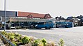
 Morpeth Bus Station - geograph.org.uk - 2229166.jpg 640 × 480; 73 KB
-
 Morpeth Bus Station - geograph.org.uk - 3998459.jpg 2,048 × 1,152; 884 KB
-
 Morpeth Cenotaph.jpg 4,128 × 3,096; 5.24 MB
-
 Morpeth Clock Tower in 2022.jpg 4,128 × 3,096; 3.02 MB


_(cropped).jpg)
.jpg)


_31.jpg)
_80.jpg)

_36.jpg)
_37.jpg)
_74.jpg)
_75.jpg)


_40.jpg)
_41.jpg)

_-_geograph.org.uk_-_4439273.jpg)


_50.jpg)


.jpg)


.jpg)


.jpg)

_28.jpg)
_29.jpg)
_30.jpg)


_06.jpg)


_73.jpg)

_-_geograph.org.uk_-_3067121.jpg)


.jpg)


.jpg)
.jpg)


_-_geograph.org.uk_-_1941591.jpg)


