Category:Moserkopf
Jump to navigation
Jump to search
Deutsch: Der Moserkopf ist ein (lt. SAGIS) 1895 m oder (lt. OpenStreetMap) 1896 m oder (lt. basemap) 1905 m hoher Berg der Schladminger Tauern im Salzburger Bezirk Tamsweg im Gemeindegebiet von Mauterndorf.
mountain in Salzburg, Austria  | |||||
| Upload media | |||||
| Instance of | |||||
|---|---|---|---|---|---|
| Location | Mauterndorf, Tamsweg District, Salzburg, Austria | ||||
| Mountain range | |||||
| Elevation above sea level |
| ||||
 | |||||
Media in category "Moserkopf"
The following 8 files are in this category, out of 8 total.
-
 Landschaft in Österreich 24082018 004.jpg 6,000 × 4,000; 5.06 MB
-
 Landschaft in Österreich 24082018 008.jpg 6,000 × 4,000; 6.47 MB
-
 Landschaft in Österreich 24082018 011.jpg 6,000 × 4,000; 5.59 MB
-
 Landschaft in Österreich 24082018 012.jpg 6,000 × 4,000; 6.44 MB
-
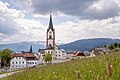
 Mauterndorf Lungau.jpg 3,992 × 2,242; 6.85 MB
-
 Road in Salzburger Land 2.jpg 3,357 × 2,238; 5.01 MB
-
 View of chalet neighborhood with the Moserkopf in the background, Mauterndorf, 2023.jpg 5,807 × 2,848; 6.87 MB
-
 Wallfahrtsbasilika Mariapfarr ©Salzburger Lungau.jpg 5,128 × 3,419; 9.36 MB


