Category:Moss Side, Manchester
Jump to navigation
Jump to search
English: Moss Side is an inner-city area in the Manchester City Council ward of Moss Side in the City of Manchester. It lies south of Manchester city centre and has a population of around 17,537. Moss Side is bounded by the neighbourhoods of Hulme (north), Chorlton-on-Medlock, Rusholme, Fallowfield, Whalley Range, and Old Trafford (west), going clockwise.
inner-city area of Manchester, England  Alexandra Road, à Moss Side | |||||
| Upload media | |||||
| Instance of | |||||
|---|---|---|---|---|---|
| Location | Manchester, Greater Manchester, North West England, England | ||||
| Different from | |||||
 | |||||
Subcategories
This category has the following 8 subcategories, out of 8 total.
H
- Church of St Mary, Hulme (7 F)
M
- Maine Place (6 F)
- Christ Church, Moss Side (8 F)
P
R
- Royal Brewery, Manchester (13 F)
S
U
W
Media in category "Moss Side, Manchester"
The following 200 files are in this category, out of 208 total.
(previous page) (next page)-
 Alexandra Avenue in Moss Side, Manchester, UK.jpg 1,000 × 666; 359 KB
-
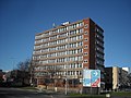 Alexandra House, Moss Side - panoramio.jpg 3,072 × 2,304; 1.84 MB
-

-
 Alley off Broadfield Road in Moss Side, Manchester, UK.jpg 747 × 1,000; 445 KB
-

-
-
 Back alley by old bus depot in Moss Side Manchester.jpg 506 × 900; 160 KB
-
 Back alley off Horton Road in Moss Side, Manchester - panoramio.jpg 700 × 656; 126 KB
-
 Back alley off Thorton Road in Moss Side, Manchester - panoramio.jpg 900 × 506; 131 KB
-

-
 Back of Roberts Avenue in Moss Side, Manchester.jpg 1,000 × 666; 377 KB
-
 Barnhill Street in Moss Side, Manchester - panoramio.jpg 800 × 600; 368 KB
-
 Bell tower of former Greenheys School in Moss Side, Manchester.jpg 429 × 644; 108 KB
-
 Beresford Street in Moss Side, Manchester - panoramio (1).jpg 950 × 534; 400 KB
-
 Beresford Street in Moss Side, Manchester - panoramio.jpg 950 × 534; 349 KB
-
 Beresford Street in Moss Side.jpg 950 × 619; 471 KB
-
 Big Shine Hand Car Wash - geograph.org.uk - 4735418.jpg 640 × 480; 76 KB
-
 Bilsborrow Road in Moss Side, Manchester - panoramio.jpg 599 × 800; 263 KB
-
 Brentwood Street in Moss Side - Manchester.jpg 1,500 × 1,154; 518 KB
-
 Brentwood Street, Moss Side.jpg 1,536 × 1,264; 691 KB
-
 Broadfield Road, Moss Side - geograph.org.uk - 3245692.jpg 3,872 × 2,592; 3.16 MB
-
 Btwmossside.JPG 1,710 × 1,579; 659 KB
-

-
 Carnival Place - Maine Place, Moss Side, Manchester.jpg 800 × 600; 166 KB
-

-
 Claremont house moss side.jpg 600 × 800; 205 KB
-
 Claremont Road West in Moss Side.jpg 950 × 534; 221 KB
-
 Claremount Road - geograph.org.uk - 3048399.jpg 640 × 480; 179 KB
-
 Cowesby Street and Community Allotment in Moss Side, Manchester, UK.jpg 1,000 × 562; 290 KB
-
 Daffodils in Rosebery Park, Moss Side.jpg 1,595 × 2,053; 867 KB
-
 Dalston Avenue in Moss Side.jpg 950 × 712; 492 KB
-

-
 Demolition of terrace houses in Rosebery Street.JPG 4,320 × 2,432; 3.96 MB
-
 Edith Avenue in Moss Side.jpg 950 × 534; 346 KB
-
 Elm Tree Avenue in Moss Side.jpg 850 × 588; 231 KB
-
 Elmswood Avenue in Moss Side, Manchester, UK.jpg 1,000 × 666; 406 KB
-
 End terrace on Playfair Street in Moss Side, Manchester - panoramio.jpg 800 × 599; 342 KB
-
 Fairbank Avenue in Moss Side.jpg 2,000 × 1,500; 1.29 MB
-
 Flats in Bowes Street, Moss Side, Manchester - panoramio.jpg 1,600 × 1,200; 280 KB
-
 Flats on Moss Lane East in Moss Side, Manchester - panoramio.jpg 800 × 533; 245 KB
-
 Flats under construction in Moss Side.jpg 950 × 534; 212 KB
-
 Footsteps on Parkside Road in Moss Side, Manchester - panoramio.jpg 534 × 950; 382 KB
-

-

-

-
 Government Offices, Moss Lane West - geograph.org.uk - 3365140.jpg 640 × 480; 59 KB
-
 Great Western Street - geograph.org.uk - 5408806.jpg 5,183 × 2,486; 1.78 MB
-
 Great Western Street - October 2009.jpg 1,920 × 1,440; 1.21 MB
-
 Great Western Street in a snow storm.jpg 1,787 × 2,538; 813 KB
-
 Great Western Street in Moss Side, Manchester - panoramio.jpg 522 × 696; 292 KB
-
 Great Western Street, Moss Side, Manchester in the snow - panoramio.jpg 1,698 × 2,551; 914 KB
-
 Greenheys Adult Learning Centre - geograph.org.uk - 6058888.jpg 1,024 × 768; 146 KB
-

-
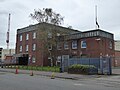 Greenheys Police Station Moss Side - geograph.org.uk - 4735433.jpg 640 × 480; 63 KB
-
 Hadyn Avenue in Moss Side, Manchester - panoramio (1).jpg 950 × 534; 367 KB
-
 Hadyn Avenue in Moss Side, Manchester - panoramio.jpg 800 × 600; 280 KB
-
 Hardy's Well - geograph.org.uk - 6313351.jpg 1,280 × 1,072; 986 KB
-
 Hardy's Well - geograph.org.uk - 6313358.jpg 1,280 × 984; 959 KB
-
 Hardy's Well, An apostrophe conundrum - geograph.org.uk - 6313471.jpg 1,280 × 1,070; 925 KB
-
 Hartingtonst.JPG 2,645 × 2,086; 1.08 MB
-
 Houses on Yeovil Street in Moss Side, Manchester - panoramio.jpg 950 × 700; 551 KB
-

-

-
 Housing Association Property with Nissan - Bowes Street.jpg 960 × 1,280; 417 KB
-
 Housing improvements on Great Western Street, Moss Side, Manchester - panoramio.jpg 1,600 × 1,285; 368 KB
-
 Housing in Moss Side - geograph.org.uk - 3245749.jpg 3,872 × 2,592; 5.9 MB
-
 Huntsman Inn - geograph.org.uk - 6198688.jpg 3,141 × 3,636; 1.68 MB
-
 Hydes Brewery, Moss Side - geograph.org.uk - 3245772.jpg 3,872 × 2,592; 2.75 MB
-
 Infusion Homes - Beresford Street in Moss Side, Manchester, UK.jpg 1,000 × 666; 442 KB
-
 Infusion Homes and Beresford Street in Moss Side, Manchester, UK.jpg 1,000 × 666; 396 KB
-

-

-

-
 Infusion Homes and Bowes Street in Moss Side, Manchester, UK.jpg 1,000 × 562; 192 KB
-
 Infusion Homes and Cowesby Street in Moss Side, Manchester - geograph.org.uk - 3643202.jpg 2,736 × 1,824; 1.47 MB
-
 Infusion Homes and Cowesby Street in Moss Side, Manchester, UK.jpg 1,000 × 666; 316 KB
-
 Infusion Homes and Rosebery Street in Moss Side, Manchester, UK.jpg 1,000 × 666; 283 KB
-
 Infusion Homes from Alexandra Park in Moss Side, Manchester, UK.jpg 1,000 × 562; 373 KB
-
 Infusion Homes on Bowes Street in Moss Side, Manchester - geograph.org.uk - 3643171.jpg 4,320 × 2,432; 3.58 MB
-

-
 Ivy on a house in Moss Side, Manchester - geograph.org.uk - 3643225.jpg 1,000 × 563; 267 KB
-

-
 Largeterracehouses.JPG 2,159 × 1,465; 735 KB
-
 Laurel Avenue in Moss Side, Manchester - panoramio.jpg 900 × 582; 324 KB
-
 Leslie Street in Moss Side.jpg 950 × 534; 285 KB
-
 Lloyd Street South in Moss Side Manchester.jpg 900 × 599; 338 KB
-
 Lloyd Street South in Moss Side.jpg 950 × 534; 337 KB
-
 Magic Bus bus (10).jpg 2,048 × 1,536; 1.57 MB
-
 Maine Place in Moss Side, Manchester - panoramio.jpg 1,200 × 1,600; 324 KB
-
 Maine road - maine place development.jpg 4,176 × 2,784; 3.19 MB
-
 Maine Road development - Moss Side - June 2009.JPG 2,490 × 1,564; 664 KB
-
 Maine Road, Manchester - geograph.org.uk - 2545302.jpg 3,872 × 2,592; 3.9 MB
-

-
 Manchester , Moss Lane East - geograph.org.uk - 4203288.jpg 4,608 × 3,456; 7.36 MB
-
 Manchester , Plainsfield Close - geograph.org.uk - 4203280.jpg 4,608 × 3,456; 7.42 MB
-
 Manchester Academy in Moss Side - June 2009.jpg 2,319 × 1,487; 1.09 MB
-
 Manchester Academy in Moss Side, January 2014.jpg 3,755 × 2,108; 4.48 MB
-
 Manchester Academy school in Moss Side, Manchester - panoramio.jpg 1,600 × 1,026; 429 KB
-
 Millennium Powerhouse.jpg 2,435 × 1,826; 776 KB
-

-
 Modern housing in Moss Lane West - geograph.org.uk - 5284874.jpg 640 × 360; 54 KB
-

-

-
 Moss Lane - geograph.org.uk - 4445366.jpg 4,036 × 2,767; 1.58 MB
-
 Moss Lane East looking towards Rusholme.jpg 1,250 × 937; 448 KB
-
 Bell tower of Greenheys School.jpg 833 × 1,250; 279 KB
-
 Moss Side - Burlington Street - geograph.org.uk - 1231212.jpg 640 × 480; 140 KB
-
 Moss Side - geograph.org.uk - 4348909.jpg 4,830 × 2,701; 1.95 MB
-
 Moss Side - geograph.org.uk - 4348913.jpg 2,925 × 5,183; 1.97 MB
-
 Moss Side - geograph.org.uk - 4348916.jpg 5,184 × 3,456; 2 MB
-
 Moss Side - geograph.org.uk - 4348919.jpg 5,031 × 2,758; 1.76 MB
-
 Moss Side - geograph.org.uk - 4746812.jpg 4,938 × 2,514; 1.86 MB
-
 Moss Side Academy school in Moss Side - June 2009.JPG 2,443 × 1,625; 1.22 MB
-
 Moss Side Community Allotment.jpg 744 × 416; 283 KB
-
 Moss Side Fire Station - geograph.org.uk - 1963821.jpg 800 × 600; 120 KB
-
 Moss Side fire station - geograph.org.uk - 607249.jpg 640 × 427; 243 KB
-
 Moss Side Fire Station Boxing Club (7735832604).jpg 4,608 × 3,072; 5.47 MB
-
 Moss Side Fire Station Boxing Club (7735835586).jpg 4,608 × 3,072; 6.29 MB
-
 Moss Side Fire Station Boxing Club (7735839350).jpg 3,624 × 3,072; 3.24 MB
-
 Moss Side Fire Station Boxing Club (7735848976).jpg 4,608 × 3,072; 6.03 MB
-
 Moss Side Fire Station Boxing Club (7735850872).jpg 4,608 × 3,072; 5.82 MB
-
 Moss Side Fire Station in Moss Side, Manchester, UK.jpg 1,000 × 666; 235 KB
-
 Moss Side, Ossory Street - geograph.org.uk - 6058891.jpg 1,024 × 768; 141 KB
-
 Msabwry409.JPG 3,586 × 1,824; 2.49 MB
-
 Offices on Raby Street in Moss Side, Manchester - panoramio.jpg 600 × 800; 293 KB
-

-
 Ornamental lake in Alexandra Park, Whalley Range, Manchester - geograph.org.uk - 3643237.jpg 4,320 × 2,432; 4.74 MB
-
 Ossory Street in Moss Side, Manchester - panoramio.jpg 950 × 534; 372 KB
-
 Our Lady's Church exterior.jpg 5,472 × 2,434; 7.33 MB
-
 Our Lady's Church interior.jpg 5,472 × 3,648; 7.34 MB
-
 Panoramic view of Whitworth Park.jpg 4,320 × 2,432; 3.74 MB
-
 Parade of Shops - Moss Side - geograph.org.uk - 2848165.jpg 3,438 × 2,126; 2.7 MB
-
 Park by Princess Road.jpg 3,648 × 2,736; 4.79 MB
-
 Parksiderdmsde.JPG 2,823 × 2,145; 1.19 MB
-
 Playfair Street in Moss Side.jpg 950 × 534; 359 KB
-
 Polish Church of Divine Mercy, Moss Side - panoramio.jpg 1,200 × 1,600; 561 KB
-
 Południowy Manchester - panoramio - dzidek (7).jpg 3,264 × 2,448; 4.32 MB
-
 Princess Park and benches in Moss Side, Manchester, UK.jpg 1,000 × 666; 353 KB
-
 Princess Road - geograph.org.uk - 3987353.jpg 640 × 480; 52 KB
-
 Princess Road in Autumn, Moss Side, Manchester, UK.jpg 1,000 × 563; 350 KB
-

-
 Princess Road in Moss Side, Manchester.jpg 3,500 × 691; 1.15 MB
-
 Princessroadbusst.JPG 2,932 × 2,499; 1.35 MB
-

-

-
 Rosebery Street in Moss Side, Manchester - panoramio.jpg 800 × 600; 100 KB
-
 Rosebery Street Park in Moss Side, Manchester - panoramio.jpg 1,000 × 673; 255 KB
-
 Royal Brewery with fermentation vessels - geograph.org.uk - 3643117.jpg 1,024 × 683; 131 KB
-
 Ruskin Avenue in Moss Side, Manchester, UK.jpg 1,000 × 561; 465 KB
-
 Russell Street in Autumn, Moss Side, Manchester, UK.jpg 1,000 × 563; 459 KB
-
 Russell Street with autumn leaves in Moss Side, Manchester, UK.jpg 1,000 × 563; 461 KB
-
 Russell Street with Princess Road in Moss Side, Manchester, UK.jpg 1,000 × 563; 394 KB
-
 Salisbury Street in Moss Side, Manchester - panoramio.jpg 793 × 532; 99 KB
-

-
 Snow in Millenium Park, Moss Side, Manchester - panoramio.jpg 1,707 × 2,560; 606 KB
-
 Social housing in Moss Side.jpg 2,503 × 3,435; 1.38 MB
-
 St Mary's Church spire from Moss Lane East - geograph.org.uk - 3245766.jpg 3,872 × 2,592; 5 MB
-
 Street in Moss SIde.JPG 3,146 × 2,028; 1.16 MB
-

-
 Sunshine Place at Maine Place in Moss Side Manchester.jpg 600 × 800; 162 KB
-
 Sunshine Place in Moss Side, Manchester - panoramio - Dai O'Nysius.jpg 600 × 800; 111 KB
-
 Sunshine Place in Moss Side, Manchester - panoramio.jpg 600 × 800; 223 KB
-
 Tarnbrook Walk - geograph.org.uk - 3048432.jpg 640 × 420; 148 KB
-
 Terrace House in Fairbank Avenue in Moss Side, Manchester - panoramio.jpg 800 × 1,200; 492 KB
-
 Terrace house in Playfair Street, Moss Side, Manchester - panoramio.jpg 619 × 780; 319 KB
-
 Terrace house on Playfair Street in Moss Side, Manchester - panoramio.jpg 800 × 1,067; 381 KB
-

-

-
 Terrace house with begonias in Moss Side, Manchester - panoramio.jpg 800 × 686; 354 KB
-
 Terrace houses in Haydn Avenue, Moss Side, Manchester - panoramio.jpg 600 × 800; 289 KB
-

-

-

-
 Terrace in Great Western Street in Moss Side, Manchester - panoramio.jpg 533 × 800; 282 KB
-
 Terrace in Moss Side from Alexandra Park.JPG 1,280 × 960; 1.03 MB
-
 Terrace in Upper Lloyd Street, Moss Side, Manchester - panoramio.jpg 800 × 599; 332 KB
-
 Terrace on Great Western Street in Moss Side, Manchester - panoramio.jpg 800 × 600; 120 KB
-
 Terrace on Lloyd Street South in Moss Side, Manchester.jpg 1,250 × 833; 706 KB
-

-
 The almshouses of the Westwood Charity built in 1877 in Moss Side - panoramio.jpg 1,600 × 1,067; 290 KB
-
 The Big Western, Moss Side - Sunday 2nd January 2011 - panoramio.jpg 960 × 720; 279 KB
-
 The Church of God of Prophecy - geograph.org.uk - 5144527.jpg 2,592 × 1,936; 1.45 MB
-
 The Clockworks - geograph.org.uk - 5963929.jpg 4,032 × 3,024; 1.78 MB
-
 Thornton Avenue in Moss Side.jpg 950 × 534; 442 KB
-
 Thornton Road in Moss Side Manchester.jpg 900 × 506; 158 KB
-
 Thornton Road in Moss Side, Manchester - panoramio.jpg 900 × 506; 101 KB
-
 Thorton Road in Moss Side.JPG 2,158 × 1,603; 737 KB
-
 Upper Lloyd Street, Moss Side - panoramio.jpg 1,200 × 1,600; 255 KB
-
 Wansford Street with Maine Place in background.jpg 672 × 472; 270 KB
-
 Welcome to the Curry Mile - geograph.org.uk - 5682057.jpg 1,280 × 966; 819 KB
-
 Westwood almhouses in Moss Side, Manchester - panoramio.jpg 599 × 800; 277 KB
-
 Westwood Cottages - geograph.org.uk - 5963927.jpg 4,032 × 2,311; 2.05 MB
-
 Westwood Cottages - Victorina almshouses in Moss Side,Manchester.jpg 300 × 208; 48 KB
-
 Westwood Cottages in Moss Side.jpg 887 × 634; 572 KB
-

-
 Whitnail Street in Moss Side, Manchester - geograph.org.uk - 2147440.jpg 529 × 800; 184 KB
-

-
 Window in Manchester Academy school in Moss Side, Manchester - panoramio.jpg 800 × 1,200; 437 KB
-

-


_in_background_-_in_Moss_Side,_Manchester_-_panoramio.jpg)


.jpg)


.jpg)


.jpg)


.jpg)
.jpg)
.jpg)
.jpg)
.jpg)


.jpg)


