Category:Mottbruchhalde
Jump to navigation
Jump to search
| Object location | | View all coordinates using: OpenStreetMap |
|---|
| Upload media | |||||
| Instance of | |||||
|---|---|---|---|---|---|
| Location | Gladbeck, Recklinghausen, Münster Government Region, North Rhine-Westphalia, Germany | ||||
 | |||||
Subcategories
This category has the following 2 subcategories, out of 2 total.
- Flora of Mottbruchhalde (26 F)
- Fungi of Mottbruchhalde (13 F)
Media in category "Mottbruchhalde"
The following 67 files are in this category, out of 67 total.
-
 Ausblick vom Gasometer Oberhausen am 23 08 2012 mit Sicht zum Tetraeder Bottrop.JPG 4,288 × 3,216; 3.07 MB
-

-
 Climbing the Mottbruchhalde (31838436472).jpg 3,456 × 5,184; 4.15 MB
-
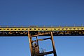 Conveyor belt (31696597170).jpg 5,184 × 3,456; 4.65 MB
-
 Conveyor belt (31720048930).jpg 5,184 × 3,456; 4.96 MB
-
 Conveyor belt (31977379751).jpg 3,456 × 5,184; 4.83 MB
-
 Conveyor belt (32071638235).jpg 5,184 × 3,456; 4.74 MB
-
 Gelsenkirchen Nordsternturm.jpg 4,032 × 3,024; 2.83 MB
-
 Gladbeck - Boystraße - Hahnenbach+Mottbruchhalde 01 ies.jpg 5,616 × 3,744; 9.31 MB
-
 Gladbeck - Boystraße - Hahnenbach+Mottbruchhalde 02 ies.jpg 3,744 × 5,616; 8.72 MB
-
 Gladbeck - Boystraße - Mottbruchhalde 01 ies.jpg 5,616 × 3,744; 12.31 MB
-
 Gladbeck - Boystraße - Mottbruchhalde 02 ies.jpg 5,616 × 3,744; 5.95 MB
-
 Gladbeck - Boystraße - Mottbruchhalde 03 ies.jpg 5,616 × 3,744; 10.11 MB
-
 Gladbeck - Boystraße - Mottbruchhalde 04 ies.jpg 5,616 × 3,744; 9.5 MB
-
 Gladbeck - Halde 22+Mottbruchhalde (Halde Prosperstraße) 01 ies.jpg 5,616 × 3,744; 9.47 MB
-
 Gladbeck - Halde 22+Mottbruchhalde (Halde Prosperstraße) 02 ies.jpg 5,616 × 3,744; 7.37 MB
-
 Gladbeck - Halde 22+Mottbruchhalde (Halde Prosperstraße) 03 ies.jpg 5,616 × 3,744; 7.28 MB
-
 Gladbeck - Mottbruchhalde (Halde 22) 01 ies.jpg 5,616 × 3,744; 10.41 MB
-
 Gladbeck - Mottbruchhalde (Halde 22) 02 ies.jpg 5,616 × 3,744; 10.74 MB
-
 Gladbeck - Mottbruchhalde (Halde 22) 03 ies.jpg 5,616 × 3,744; 10.42 MB
-
 Gladbeck - Mottbruchhalde (Halde 22) 04 ies.jpg 5,616 × 3,744; 9.21 MB
-
 Gladbeck - Mottbruchhalde (Halde Im Brauck) 01 ies.jpg 5,616 × 3,744; 16.81 MB
-
 Gladbeck - Mottbruchhalde (Halde Im Brauck) 02 ies.jpg 5,616 × 3,744; 19.5 MB
-
 Gladbeck - Mottbruchhalde (Pyramide) 01 ies.jpg 5,616 × 3,744; 9.93 MB
-
 Gladbeck - Mottbruchhalde (Pyramide) 02 ies.jpg 5,616 × 3,744; 7.44 MB
-
 Gladbeck - Mottbruchhalde (Welheimer Straße) 01 ies.jpg 5,616 × 3,744; 8.45 MB
-
 Gladbeck - Mottbruchhalde (Welheimer Straße) 02 ies.jpg 5,616 × 3,744; 8.97 MB
-
 Gladbeck - Mottbruchhalde (Welheimer Straße) 03 ies.jpg 5,616 × 3,744; 10.18 MB
-
 Gladbeck - Mottbruchhalde - Absetzturm (Halde Im Brauck) 01 ies.jpg 5,616 × 3,744; 13.28 MB
-
 Gladbeck - Mottbruchhalde - Absetzturm (Halde Im Brauck) 02 ies.jpg 5,616 × 3,744; 15.41 MB
-
 Gladbeck - Mottbruchhalde - Absetzturm 01 ies.jpg 5,616 × 3,744; 21.35 MB
-
 Gladbeck - Welheimer Straße - NSG Natroper Feld + Mottbruchhalde 01 ies.jpg 5,616 × 3,744; 19.22 MB
-
 Gladbeck Hahnenbach04.jpg 4,928 × 3,264; 7.78 MB
-
 Gladbeck Mottbruchhalde 01.jpg 4,032 × 3,024; 5.96 MB
-
 Gladbeck-An der Mottbruchhalde.jpg 4,608 × 2,592; 2.72 MB
-
 Gladbeck-Vulkanlandschaft auf der Mottbruchhalde 01.jpg 4,608 × 2,592; 1.99 MB
-
 Gladbeck-Vulkanlandschaft auf der Mottbruchhalde 02.jpg 4,608 × 2,592; 2.11 MB
-
 Gladbeck-Vulkanlandschaft auf der Mottbruchhalde 03.jpg 4,608 × 2,592; 2.02 MB
-
 Gladbeck-Vulkanlandschaft auf der Mottbruchhalde 04.jpg 4,608 × 2,592; 2.43 MB
-
 Gladbeck-Vulkanlandschaft auf der Mottbruchhalde 05.jpg 4,608 × 2,592; 2.4 MB
-
 Gladbeck-Vulkanlandschaft auf der Mottbruchhalde 06.jpg 4,608 × 2,592; 2.24 MB
-
 Gladbeck-Vulkanlandschaft auf der Mottbruchhalde 07.jpg 4,608 × 2,592; 2 MB
-
 Halde Graf Moltke (31646061600).jpg 5,184 × 3,456; 7.33 MB
-
 Kraftwerk Herne (31672496010).jpg 5,184 × 3,456; 4.25 MB
-
 Kraftwerk Scholven (31646044070).jpg 5,184 × 3,456; 4.27 MB
-
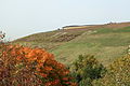
 Mottbruchhalde (31159569684).jpg 5,184 × 3,456; 6.32 MB
-
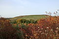
 Mottbruchhalde (31190487783).jpg 5,184 × 3,456; 5.75 MB
-
 Mottbruchhalde (31206492624).jpg 5,184 × 3,456; 6.91 MB
-
 Mottbruchhalde (31625771620).jpg 3,456 × 5,184; 4.59 MB
-
 Mottbruchhalde (31672494530).jpg 5,184 × 3,456; 6.35 MB
-
 Mottbruchhalde (31883019991).jpg 5,184 × 3,456; 5.59 MB
-
 Mottbruchhalde (31903593391).jpg 5,184 × 3,456; 4.66 MB
-
 Mottbruchhalde (31923379802).jpg 3,456 × 5,184; 5.38 MB
-
 Mottbruchhalde (32000067765).jpg 5,184 × 3,456; 4.93 MB
-
 Mottbruchhalde (32008297846).jpg 5,184 × 3,456; 5.78 MB
-
 Mottbruchhalde Geländemodell.jpg 1,920 × 1,080; 1.5 MB
-
 Mottbruchhhalde 12.03.2017 Panoramic view from the Mottbruchhalde (33564680392).jpg 21,582 × 2,740; 45.43 MB
-
 Mottbruchhhalde 12.03.2017 Pyrite? (33304015850).jpg 5,184 × 3,456; 5.32 MB
-
 Mottbruchhhalde 12.03.2017 Pyrite? (33558668961).jpg 5,184 × 3,456; 5.71 MB
-
 Mottbruchhhalde 12.03.2017 Pyrite? (33687966945).jpg 5,184 × 3,456; 5.57 MB
-
 Panoramic view from Mottbruchhalde (31327459473).jpg 60,000 × 3,291; 47.94 MB
-
 Panoramic view from Mottbruchhalde (31834815520).jpg 60,000 × 3,338; 46.51 MB
-
 Panoramic view from Mottbruchhalde (32003822620).jpg 21,468 × 2,664; 46.1 MB
-
 Railway bridge (31210826563).jpg 5,184 × 3,456; 5.63 MB
-
 Silver Birch - Betula pendula (31696598920).jpg 5,184 × 3,456; 10.04 MB
-
 Veltins-Arena Auf Schalke (31646007110).jpg 5,184 × 3,456; 4.52 MB
-
 Zeche Nordstern (32047334835).jpg 5,184 × 3,456; 4.59 MB

_01.jpg)
.jpg)
.jpg)
.jpg)
.jpg)
.jpg)


_01_ies.jpg)
_02_ies.jpg)
_03_ies.jpg)
_01_ies.jpg)
_02_ies.jpg)
_03_ies.jpg)
_04_ies.jpg)
_01_ies.jpg)
_02_ies.jpg)
_01_ies.jpg)
_02_ies.jpg)
_01_ies.jpg)
_02_ies.jpg)
_03_ies.jpg)
_01_ies.jpg)
_02_ies.jpg)


.jpg)
.jpg)
.jpg)
.jpg)
.jpg)
.jpg)
.jpg)
.jpg)
.jpg)
.jpg)
.jpg)
.jpg)
.jpg)

.jpg)
.jpg)
.jpg)
.jpg)
.jpg)
.jpg)
.jpg)
.jpg)
.jpg)
.jpg)
.jpg)