Category:Mount Bures
Jump to navigation
Jump to search
English: Mount Bures is a small village on the Essex and Suffolk borders. It takes its name from the mount or motte believed to have been built shortly after the invasion by William the Conqueror in 1066.
village in Essex, England | |||||
| Upload media | |||||
| Instance of | |||||
|---|---|---|---|---|---|
| Location | Colchester, Essex, East of England, England | ||||
| Population |
| ||||
 | |||||
Subcategories
This category has the following 2 subcategories, out of 2 total.
J
- Janke's Green (1 F)
Media in category "Mount Bures"
The following 59 files are in this category, out of 59 total.
-
 Abrams Farm, Mount Bures, Essex - geograph.org.uk - 227901.jpg 640 × 459; 82 KB
-
 Airfield Remains - geograph.org.uk - 3626892.jpg 1,024 × 768; 171 KB
-
 Airfield wheat - geograph.org.uk - 6184357.jpg 1,600 × 1,067; 339 KB
-
 Arable field, Peartree Hill, Mount Bures - geograph.org.uk - 3984269.jpg 3,648 × 2,736; 2.78 MB
-
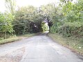
 B1508 Colchester Road, Mount Bures - geograph.org.uk - 6298299.jpg 4,608 × 3,456; 3.86 MB
-
 B1508 Colchester Road, Mount Bures - geograph.org.uk - 6298406.jpg 4,608 × 3,456; 4.18 MB
-
 Cattle at rest - geograph.org.uk - 6184369.jpg 1,600 × 1,067; 269 KB
-

-

-
 Crossing Cottage, Mount Bures (geograph 2457286).jpg 640 × 480; 148 KB
-
 Dry Reservoir - geograph.org.uk - 3626907.jpg 1,024 × 768; 226 KB
-
 Essex and Suffolk Gliding Club, Wormingford - geograph.org.uk - 3477650.jpg 3,968 × 2,232; 4 MB
-
 Essex from the air - geograph.org.uk - 3160497.jpg 640 × 480; 144 KB
-
 Farm buildings next to church in Mount Bures (geograph 1933767).jpg 4,000 × 3,000; 2.91 MB
-
 Farm Machinery - geograph.org.uk - 3626925.jpg 1,024 × 768; 180 KB
-
 Farming equipment by the lane - geograph.org.uk - 4367778.jpg 640 × 480; 111 KB
-
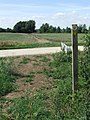 Footpath Guide Post - geograph.org.uk - 3627355.jpg 768 × 1,024; 312 KB
-
 Former RAF Wormingford from the air - geograph.org.uk - 2413520.jpg 640 × 377; 96 KB
-
 Former RAF Wormingford from the air - geograph.org.uk - 3141266.jpg 640 × 480; 161 KB
-
 Gate to Thornwood - geograph.org.uk - 3134613.jpg 429 × 640; 104 KB
-
 Kissing gate-Mount Bures (geograph 1933731).jpg 4,000 × 3,000; 2.86 MB
-
 Level Crossing Mount Bures (16752807336).jpg 3,072 × 2,304; 1.37 MB
-
 Looking down the steps from the Motte at Mount Bures (geograph 1933761).jpg 4,000 × 3,000; 2.93 MB
-
 Meadow - geograph.org.uk - 3627376.jpg 1,024 × 768; 189 KB
-
 Mount Bures churchyard - geograph.org.uk - 6183227.jpg 1,600 × 1,067; 488 KB
-
 New Building - geograph.org.uk - 3627368.jpg 1,024 × 768; 245 KB
-
 Old crossing keepers house Mount Bures (geograph 1933768).jpg 4,000 × 3,000; 2.89 MB
-
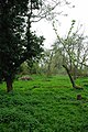 Old Orchard - geograph.org.uk - 1250125.jpg 428 × 640; 104 KB
-
 Peartree Hill Postbox - geograph.org.uk - 6298369.jpg 4,608 × 3,456; 4.2 MB
-
 Peartree Hill Postbox - geograph.org.uk - 6298374.jpg 4,608 × 3,456; 3.86 MB
-
 Peartree Hill Postbox - geograph.org.uk - 6298376.jpg 3,456 × 4,608; 4.17 MB
-
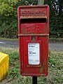 Peartree Hill Postbox - geograph.org.uk - 6298407.jpg 3,456 × 4,608; 3.93 MB
-
 Peartree Hill sign - geograph.org.uk - 6298438.jpg 3,917 × 2,938; 5.59 MB
-
 Peartree Hill sign ^ B1508 Colchester Road - geograph.org.uk - 6298321.jpg 4,608 × 3,456; 3.88 MB
-
 Peartree Hill, Mount Bures - geograph.org.uk - 6298319.jpg 4,608 × 3,456; 3.89 MB
-
 Pricketts Hall - geograph.org.uk - 244408.jpg 640 × 480; 104 KB
-
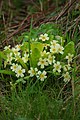 Primroses - geograph.org.uk - 1250208.jpg 428 × 640; 73 KB
-
 R.A.F. Wormingford - geograph.org.uk - 3626879.jpg 1,024 × 768; 199 KB
-
 Sergeant's Orchard - geograph.org.uk - 1250093.jpg 640 × 428; 69 KB
-
 Sergeant's Orchard - geograph.org.uk - 3626870.jpg 1,024 × 768; 291 KB
-

-
 Stairway at The Castle Mound or `Motte`, Mount Bures (geograph 1933750).jpg 4,000 × 3,000; 2.92 MB
-
 Stile - geograph.org.uk - 3627379.jpg 1,024 × 768; 296 KB
-
 Track Leading To Sergeant's Orchard - geograph.org.uk - 3626867.jpg 768 × 1,024; 286 KB
-
 View from the Thatcher's Arms - geograph.org.uk - 1154389.jpg 640 × 480; 187 KB
-
 View over the Stour Valley from footpath at Mount Bures - geograph.org.uk - 4517840.jpg 3,648 × 2,432; 2.46 MB
-
 View toward Hall Road, Mount Bures (geograph 1933757).jpg 4,000 × 3,000; 2.94 MB
-
 Warning Sign - geograph.org.uk - 3626900.jpg 768 × 1,024; 193 KB
-
 Water Tower, Wakes Colne - geograph.org.uk - 4514987.jpg 2,736 × 2,736; 1.43 MB
-
-
 Bart Hall - geograph.org.uk - 271549.jpg 640 × 480; 73 KB
-
 Farm buildings and footpath, near Bures - geograph.org.uk - 376984.jpg 640 × 427; 111 KB
-
-
 Farmhouse at White's Farm - geograph.org.uk - 300260.jpg 640 × 480; 87 KB
-
 Great Loveney Hall, near Bures - geograph.org.uk - 376998.jpg 640 × 427; 121 KB
-
 Horse Jumps - geograph.org.uk - 271553.jpg 640 × 480; 94 KB
-
 Ravensfield Farm - geograph.org.uk - 245041.jpg 640 × 480; 88 KB
-
 Rights of Way and Rusting Relics - geograph.org.uk - 252000.jpg 426 × 640; 130 KB
-


.jpg)


.jpg)


.jpg)
.jpg)
.jpg)


.jpg)


.jpg)


.jpg)


