Category:Mount Muhabura
Jump to navigation
Jump to search
mountain on Rwanda–Uganda border  | |||||
| Upload media | |||||
| Instance of | |||||
|---|---|---|---|---|---|
| Location | Musanze District, Northern Province, Rwanda | ||||
| Mountain range | |||||
| Topographic prominence |
| ||||
| Elevation above sea level |
| ||||
 | |||||
Media in category "Mount Muhabura"
The following 26 files are in this category, out of 26 total.
-
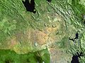
 1-Virunga Lodge Aerila ViewSinamatella - Rwanda - Virunga - 20180915 - 1054.jpg 4,048 × 3,032; 5.81 MB
-
 12--1920x1278.jpg 1,142 × 760; 95 KB
-
 Augite Rwanda.jpg 6,048 × 4,032; 12.91 MB
-
 Beautiful view of the lake burera.jpg 816 × 448; 31 KB
-
 Bufumbira volcanic field.jpg 637 × 480; 83 KB
-
 GahingaMuhabura.png 1,028 × 425; 297 KB
-
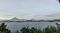
 Lake Mutanda - Virunga Mountains in the background.jpg 5,472 × 3,648; 4.6 MB
-
 Lake mutanda 1 LTO - 48264358446 (cropped right side).jpg 1,306 × 871; 386 KB
-
 Lake mutanda 1 LTO - 48264358446 (cropped).jpg 1,250 × 834; 320 KB
-
 Lake mutanda 1 LTO - 48264358446.jpg 3,072 × 2,048; 2.05 MB
-
 Lake Ruhondo exotic view 01.jpg 1,080 × 719; 68 KB
-
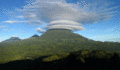
 Mist over Gorilla Mountain Rwanda by Bill Hallier.jpg 3,800 × 2,333; 8.36 MB
-
 Mountain Muhavura(left) and Mountain Gahinga(right).jpg 3,264 × 2,448; 1.55 MB
-

-

-
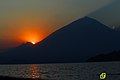 Sun set in burera lakes.jpg 5,184 × 3,456; 7.91 MB
-
 Team hiking on mt.Muhavula.jpg 4,864 × 2,736; 5.3 MB
-
 View from afar the Volcanoes Park in Kinigi sector, Musanze district, Rwanda.jpg 1,280 × 843; 249 KB
-

-
 View of the Volcano Muhavura - panoramio.jpg 3,888 × 2,592; 1.96 MB
-
 Virunga volcanoes.jpg 1,024 × 1,024; 81 KB
-
 VirungaPeaks2013.png 2,030 × 934; 3.08 MB
-
 Visit-Rwanda-Volcano-1920x1280.jpg 1,500 × 1,000; 136 KB
-
 Volcanoes in Western Uganda.jpg 4,096 × 2,304; 564 KB
-
 Volcanoes National Park Banner Image.gif 1,500 × 874; 548 KB
-
 Volcans.jpg 3,840 × 2,160; 1.93 MB


.jpg)
.jpg)


_and_Mountain_Gahinga(right).jpg)


