Category:Mountain saddles
Jump to navigation
Jump to search
lowest point on a mountain ridge between two peaks _02.jpg) _19.jpg) | |||||
| Upload media | |||||
| Subclass of |
| ||||
|---|---|---|---|---|---|
| Different from | |||||
| |||||
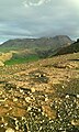
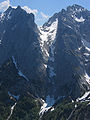
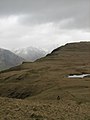
English: A col is a geologic term for the drainage divide that happens to lie between two peaks, mathematically, the point along one axis is an relative maximum -- water divides into one basin or the other, concurrently it is a relative low, the actual lowest point when traveling between two nearby peaks. This makes it a saddle (geography), which in media most untrained call a Saddle Mountain Pass.
Subcategories
This category has the following 5 subcategories, out of 5 total.
Media in category "Mountain saddles"
The following 25 files are in this category, out of 25 total.
-
 A CAMINHO DO PICO RUIVO 11.JPG 5,184 × 3,456; 9.07 MB
-
 Arbres courageux.JPG 4,608 × 3,219; 1.64 MB
-
 Bealach Traligill - geograph.org.uk - 158717.jpg 640 × 447; 99 KB
-
 Col Cornu.jpg 6,464 × 2,941; 5.84 MB
-
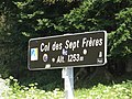 Col des Sept Frères 1.jpg 5,184 × 3,888; 4.8 MB
-
 Col des Sept Frères 2.jpg 5,184 × 3,888; 6.93 MB
-
 Col du Fanget.jpg 1,772 × 1,071; 959 KB
-
 ColDuLautaretJA.jpg 2,131 × 3,300; 2.6 MB
-
 Collet de Can Tripeta.JPG 4,000 × 3,000; 4.62 MB
-
 Cols Gluiras - panoramio.jpg 3,648 × 2,736; 4.24 MB
-
 Djebel Serj vue panoramique crop.jpg 860 × 614; 509 KB
-
 Gluiras Cols - panoramio.jpg 3,648 × 2,736; 4.07 MB
-
 Hengill-Nesjavallavegur 24.jpg 1,320 × 2,200; 1.09 MB
-
 Oshhamaho.jpg 600 × 400; 64 KB
-
 Predel IMG 0910 l.jpg 2,048 × 1,365; 1.18 MB
-
 Rabbit Lake and the Suicide Peaks. Chugach State Park, Alaska.jpg 5,646 × 3,764; 14.78 MB
-
 Røldal morning mist.jpg 2,560 × 1,920; 2.12 MB
-
 Saddleroute3.JPG 718 × 525; 29 KB
-
 Steinerne Rinne HQ.jpg 900 × 1,200; 210 KB
-
 The col (6073968059).jpg 2,048 × 1,152; 1.38 MB
-
 Togiak Refuge Mountains.jpg 1,050 × 699; 124 KB
-
 Vereda do Arieiro, Madeira - Jul 1990 - 03.jpg 688 × 1,048; 279 KB
-
 Voss southern Herdabreida Kistenuten IMG 3694.JPG 3,519 × 2,768; 1.87 MB
-
 West Homer Saddle Above Homer Tunnel.jpg 1,200 × 1,600; 906 KB
-
 Whin Rigg to Illgill Head - geograph.org.uk - 762131.jpg 480 × 640; 46 KB


.jpg)


