Category:Mountains of Djibouti
Jump to navigation
Jump to search
Countries of Africa: Algeria · Angola · Benin · Botswana · Burkina Faso · Burundi · Cameroon · Cape Verde · Central African Republic · Chad · Comoros · Democratic Republic of the Congo · Republic of the Congo · Djibouti · Egypt‡ · Equatorial Guinea · Eritrea · Eswatini · Ethiopia · Gabon · The Gambia · Ghana · Guinea · Guinea-Bissau · Ivory Coast · Kenya · Lesotho · Liberia · Libya · Madagascar · Malawi · Mali · Mauritania · Mauritius · Morocco · Mozambique · Namibia · Niger · Nigeria · Rwanda · São Tomé and Príncipe · Senegal · Seychelles · Sierra Leone · Somalia · South Africa · South Sudan · Sudan · Tanzania · Togo · Tunisia · Uganda · Zambia · Zimbabwe
Limited recognition: Somaliland – Other areas: Canary Islands · Ceuta · Madeira · Mayotte · Melilla · Réunion · Saint Helena, Ascension and Tristan da Cunha
‡: partly located in Africa
Limited recognition: Somaliland – Other areas: Canary Islands · Ceuta · Madeira · Mayotte · Melilla · Réunion · Saint Helena, Ascension and Tristan da Cunha
‡: partly located in Africa
Wikimedia category | |||||
| Upload media | |||||
| Instance of | |||||
|---|---|---|---|---|---|
| Category combines topics | |||||
| |||||
Media in category "Mountains of Djibouti"
The following 38 files are in this category, out of 38 total.
-
 11th MEU Djibouti Sustainment Training, A Walk in the Park 141106-M-QH793-017.jpg 1,600 × 1,066; 1.33 MB
-
 13th MEU sustains training in Djibouti 160414-M-AA830-008.jpg 5,760 × 3,840; 3.28 MB
-
 26th MEU MRF Joint Terminal Attack Control Training (Image 14 of 14) (9032075627).jpg 5,616 × 3,744; 2.86 MB
-
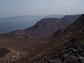
 Alaili Dadda, Djibouti - panoramio (2).jpg 2,592 × 1,944; 950 KB
-
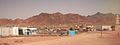 Ali Adde.jpg 796 × 299; 56 KB
-
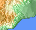
 Arrei Mountains Map.png 394 × 296; 96 KB
-
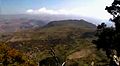
 Arrei Mountains see from Ali Sabieh.JPG 3,648 × 2,736; 2.37 MB
-
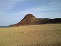
 Arrei Mountains.jpg 534 × 400; 67 KB
-
 ArreiMountains.jpg 406 × 154; 11 KB
-
 Boura Mountains Photo.jpg 437 × 239; 28 KB
-
 Boura Mountains.jpg 1,470 × 706; 283 KB
-
 Boura Mountains.png 286 × 244; 79 KB
-
 Dagouein Mountain Map.png 287 × 240; 48 KB
-
 Day Forest National Park banner.jpg 3,456 × 493; 416 KB
-
 De koron à Arta plage, Djibouti.jpg 4,608 × 2,592; 4.06 MB
-
 DjiboutiBayofGoudouk.jpg 500 × 375; 74 KB
-
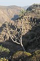 Dracaena ombet Djibouti (cropped).jpg 876 × 1,314; 461 KB
-
 Dracaena ombet Djibouti.jpg 1,704 × 2,272; 1.16 MB
-
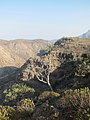
 Goda Mountains - National Park of Forêt du Day.jpg 3,456 × 5,184; 5.16 MB
-
 Goda Mountains.png 396 × 303; 93 KB
-
 GodaMountains.jpg 832 × 461; 32 KB
-
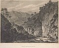 Henry Salt - Pass of Taranta.jpg 946 × 777; 734 KB
-
 Henry Salt - Sketch of a Daro Tree at the bottom of Taranta.jpg 800 × 681; 184 KB
-
 Itki.jpg 637 × 437; 51 KB
-
 Mabla Mountains.png 368 × 313; 77 KB
-
 Memerzan, Djibouti.jpg 4,608 × 2,592; 4.04 MB
-
 Monts Mabla Djibouti.jpg 734 × 522; 177 KB
-
 Monts Mabla forêt.jpg 617 × 864; 328 KB
-
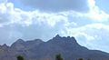
 Mountain of Ali Sabieh 1970.JPG 526 × 200; 27 KB
-
 MountainsofArtaRange.jpg 601 × 294; 38 KB
-
 Near mountains Arta.png 718 × 566; 424 KB
-
 Obock, Djibouti - panoramio.jpg 2,592 × 1,944; 779 KB
-
 Observatoire, Djibouti.jpg 4,608 × 2,592; 4.05 MB
-
 Randa Mountain Side.png 719 × 473; 737 KB
-
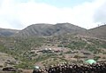
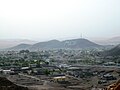
 Randa, Djibouti 2016.jpg 640 × 480; 50 KB
-
 Southern part of the Boura Mountains.jpg 1,414 × 994; 477 KB
-
 Vers koron, Djibouti.jpg 4,608 × 2,592; 4.17 MB
-
 View of Ali Sabieh.JPG 3,648 × 2,736; 2.16 MB


_(9032075627).jpg)
.jpg)


.jpg)


