Category:Muckle Flugga Lighthouse Shore Station
Jump to navigation
Jump to search
Media in category "Muckle Flugga Lighthouse Shore Station"
The following 41 files are in this category, out of 41 total.
-
 Burn of Burrafirth and the Shore Station - geograph.org.uk - 1654574.jpg 800 × 533; 138 KB
-
 Burra Firth - geograph.org.uk - 3928507.jpg 1,280 × 851; 283 KB
-

-

-
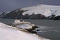 Burrafirth Shore Station in the snow - geograph.org.uk - 1055089.jpg 640 × 426; 73 KB
-
 Fiska Wick Jetty - geograph.org.uk - 5791104.jpg 3,648 × 2,736; 4.14 MB
-
 Hermaness sheep pens at Burrafirth - geograph.org.uk - 4255496.jpg 1,024 × 681; 217 KB
-
 Jetty at Fiska Wick - geograph.org.uk - 3459889.jpg 3,888 × 2,592; 1.38 MB
-
 Lifeboat Slipway, Balta Sound - geograph.org.uk - 5459610.jpg 3,888 × 2,592; 2.12 MB
-
 Lighthouse Shore Station, Burra Firth - geograph.org.uk - 206906.jpg 640 × 357; 196 KB
-
 Loch of Cliff from Houllna Grouna - geograph.org.uk - 862517.jpg 640 × 426; 45 KB
-
 Muckle Flugga lighthouse shore station - geograph.org.uk - 4999364.jpg 2,592 × 1,944; 1.33 MB
-
 Muckle Flugga shore station (geograph 1791062).jpg 1,024 × 768; 215 KB
-
 Muckle Flugga Shore Station - geograph.org.uk - 5922694.jpg 800 × 600; 748 KB
-
 Sculpture at Hermaness Shore Station - geograph.org.uk - 3508511.jpg 480 × 640; 145 KB
-
 Shore Station - geograph.org.uk - 3116053.jpg 1,024 × 683; 204 KB
-

-
 Shore Station for Muckle flugga lighthouse - geograph.org.uk - 2597154.jpg 1,024 × 722; 173 KB
-
 Shore Station from Sotland, Burrafirth - geograph.org.uk - 4218245.jpg 1,024 × 681; 105 KB
-
 Shore Station, Burrafirth - geograph.org.uk - 2602031.jpg 1,024 × 683; 117 KB
-
 Shore station, Burrafirth - geograph.org.uk - 3816721.jpg 640 × 462; 253 KB
-
 Shore Station, Burrafirth - geograph.org.uk - 6242558.jpg 1,600 × 1,065; 719 KB
-

-
 Shore Station, Burrafirth, from Saxa Vord - geograph.org.uk - 3755506.jpg 1,024 × 682; 226 KB
-
 Slipway and Shed at Fiska Wick - geograph.org.uk - 5475273.jpg 1,600 × 911; 353 KB
-

-
 The Lighthouse Shore Station at The Ness - geograph.org.uk - 4505470.jpg 640 × 480; 167 KB
-
 The Ness from Buddabrake - geograph.org.uk - 3178449.jpg 1,024 × 681; 178 KB
-
 The Ness, Burrafirth - geograph.org.uk - 2223908.jpg 800 × 534; 187 KB
-
 The Ness, Burrafirth, from the road up Saxa Vord - geograph.org.uk - 4329923.jpg 1,024 × 680; 253 KB
-
 The Shore Station at the Ness, Burrafirth - geograph.org.uk - 4512599.jpg 1,024 × 576; 162 KB
-
 The Shore Station from Burrafirth beach - geograph.org.uk - 1950131.jpg 800 × 600; 180 KB
-

-
 The Shore Station, Burrafirth - geograph.org.uk - 311395.jpg 600 × 399; 56 KB
-
 The Shore Station, Burrafirth - geograph.org.uk - 3842123.jpg 1,024 × 639; 147 KB
-
 The Shore Station, Burrafirth, from Buddabrake - geograph.org.uk - 3178451.jpg 1,024 × 681; 238 KB
-

-
 Track to Lighthouse Shore Station, Hermaness - geograph.org.uk - 2695485.jpg 1,336 × 1,000; 1.19 MB
-
 Unst Hermaness 13.jpg 4,080 × 3,072; 5.13 MB
-
 Winter comes early to these parts - geograph.org.uk - 2695491.jpg 1,267 × 1,000; 1.02 MB
-
 Yacht at anchor in Burra Firth - geograph.org.uk - 4504371.jpg 1,024 × 681; 82 KB


.jpg)


