Category:Mugu District
Jump to navigation
Jump to search
district of Nepal   | |||||
| Upload media | |||||
| Pronunciation audio | |||||
|---|---|---|---|---|---|
| Instance of | |||||
| Location |
| ||||
| Population |
| ||||
| Area |
| ||||
| official website | |||||
 | |||||

Subcategories
This category has the following 7 subcategories, out of 7 total.
G
- Gamgadhi (4 F)
K
- Kanjiroba (5 F)
M
- Maps of Mugu District (7 F)
- Murma, Mugu (4 F)
R
S
- Saipal (4 F)
T
- Talcha Airport (4 F)
Media in category "Mugu District"
The following 106 files are in this category, out of 106 total.
-
 Mugu District in Nepal 2015.svg 1,100 × 721; 812 KB
-
 Mugu Karnali locator.png 2,000 × 1,920; 583 KB
-
Mugu.ogg 1.2 s; 66 KB
-
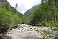
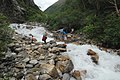
 A good path along the bank of the stream. - panoramio.jpg 1,936 × 1,296; 1.04 MB
-
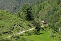
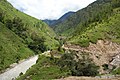
 A small village on the slope. - panoramio.jpg 1,936 × 1,296; 1.06 MB
-
 After that place begins the broad valley. - panoramio.jpg 1,936 × 1,296; 1.1 MB
-
 Another bridge on the left Bank. - panoramio.jpg 1,936 × 1,296; 1,002 KB
-
 Beginning descent from the pass in Gamgadhi. - panoramio.jpg 1,936 × 1,296; 1.02 MB
-
 Beginning of descent from the pass Chyargo La. - panoramio.jpg 1,936 × 1,296; 992 KB
-
 Beginning of the valley Chyandi Khola to the pass Yala La. - panoramio.jpg 1,936 × 1,296; 1,017 KB
-
 Beside slopes of Yala Kang. - panoramio.jpg 1,936 × 1,296; 1.24 MB
-
 Bridge over Chham Khola. - panoramio.jpg 1,936 × 1,296; 1,019 KB
-
 Bridge over Talak Khola. - panoramio.jpg 1,936 × 1,296; 1.26 MB
-
 Brookvalley to the pass Chyargo La. - panoramio.jpg 1,936 × 1,296; 1.04 MB
-
 Camp at an altitude of 5080 m. Upper DOLPA trekking in August. - panoramio.jpg 1,936 × 1,296; 1.08 MB
-
 Camp under a rock. - panoramio.jpg 1,936 × 1,296; 1.22 MB
-
 Check post - verification permissions. - panoramio.jpg 1,800 × 1,200; 1.02 MB
-
 Chhaila. Several houses on the left bank - panoramio.jpg 1,936 × 1,296; 1,014 KB
-
 Chhimimaru Khola. - panoramio (1).jpg 1,936 × 1,296; 1,012 KB
-
 Chhimimaru Khola. - panoramio.jpg 1,936 × 1,296; 1.07 MB
-
 Chilenchaura Kharka at the mouth of tributary Chham Khola. - panoramio.jpg 1,936 × 1,296; 1,022 KB
-
 Chilenchaura Kharka. Bridge from the right bank to the left Mugu Nadi. - panoramio.jpg 1,936 × 1,296; 1.22 MB
-
 Chyandi Khola on the border of the forest. - panoramio.jpg 1,936 × 1,296; 1.09 MB
-
 Chyandi Khola place. - panoramio.jpg 1,936 × 1,296; 1,022 KB
-
 Clearly visible Yala La (pass at the centre). - panoramio.jpg 1,936 × 1,296; 1.22 MB
-
 Crossing to the other side. - panoramio.jpg 1,936 × 1,296; 926 KB
-
 Darima, bridge. - panoramio.jpg 1,936 × 1,296; 1.13 MB
-
 Dolphu, Nepal - panoramio (1).jpg 1,936 × 1,296; 1.08 MB
-
 Dolphu, Nepal - panoramio (2).jpg 1,936 × 1,296; 1.01 MB
-
 Dolphu, Nepal - panoramio (3).jpg 1,936 × 1,296; 1.25 MB
-
 Dolphu, Nepal - panoramio (4).jpg 1,936 × 1,296; 1.16 MB
-
 Dolphu, Nepal - panoramio (5).jpg 1,936 × 1,296; 1.05 MB
-
 Dolphu, Nepal - panoramio.jpg 1,936 × 1,296; 988 KB
-
 Expansion of the valley on the border of the forest. - panoramio.jpg 1,936 × 1,296; 965 KB
-
 Further ascent to the pass. - panoramio.jpg 1,800 × 1,205; 1.07 MB
-
 General view of the pass Yala La. - panoramio.jpg 1,936 × 1,296; 952 KB
-
 General view to the pass Chyargo La. - panoramio.jpg 1,800 × 1,200; 1.02 MB
-
 Good forest in the floodplain. - panoramio.jpg 1,936 × 1,296; 1,006 KB
-
 Greener grasses, brighter lights , beautiful horses and amazing sky.jpg 4,928 × 3,264; 6.76 MB
-
 Himalayan Plains of Mugu.jpg 6,000 × 4,000; 4.05 MB
-
 In the distant mountains is located the pass Chyargo La. - panoramio.jpg 1,936 × 1,296; 925 KB
-
 Indian pilgrims on rest. - panoramio.jpg 1,936 × 1,296; 1.19 MB
-
 Kaitpuchonam Khola. - panoramio.jpg 1,936 × 1,296; 1.23 MB
-
 Long-awaited Yala La 5414 m. Upper DOLPA trekking - panoramio.jpg 1,936 × 1,296; 942 KB
-
 Look back to the valley Chyandi Khola. - panoramio.jpg 1,936 × 1,296; 1.09 MB
-
 Lusa. - panoramio.jpg 1,936 × 1,296; 1.14 MB
-
 Lusa. The school playground is the best place to camp. - panoramio.jpg 1,936 × 1,296; 1.16 MB
-
 Main road to Tibet. - panoramio.jpg 1,936 × 1,296; 1.08 MB
-
 Mangri 21100, Nepal - panoramio (1).jpg 1,936 × 1,296; 1.13 MB
-
 Mangri 21100, Nepal - panoramio.jpg 1,936 × 1,296; 1,013 KB
-
 Mugu District Hospital, Mugu.jpg 1,430 × 960; 268 KB
-
 Mugu District, Nepal.jpg 5,312 × 2,988; 3.12 MB
-
 Mugu Karnali river downstream. - panoramio.jpg 1,936 × 1,296; 1.03 MB
-
 Mugu Nadi river. Humla region. - panoramio.jpg 1,936 × 1,296; 1.21 MB
-
 Mugu Nadi. Shey Phoksundo National Park. - panoramio.jpg 1,936 × 1,296; 947 KB
-
 Mugu Nadi. This is not the place for rafting. - panoramio.jpg 1,936 × 1,296; 1.1 MB
-
 Mugu village women dressed in and gathered for cooking a weeding feast.jpg 4,898 × 3,265; 1.72 MB
-
 New hotels in the Mangri. - panoramio.jpg 1,936 × 1,296; 892 KB
-
 Not a lot of snow peaks in this district. - panoramio.jpg 1,800 × 1,200; 715 KB
-
 Of stone tours show the direction towards the pass. - panoramio.jpg 1,936 × 1,296; 1.25 MB
-
 Pass Chyargo La 5140 m. - panoramio.jpg 1,936 × 1,296; 856 KB
-
 Pass Ghurchi Lagna. 3458m. - panoramio.jpg 1,800 × 1,200; 1.13 MB
-
 Path at a height of 5000 meters. - panoramio.jpg 1,936 × 1,296; 1.09 MB
-
 Path to Mugu and farther to Tibet. - panoramio.jpg 1,936 × 1,296; 1.03 MB
-
 Pulu. Only four houses - for the night caravan. - panoramio.jpg 1,936 × 1,296; 1.1 MB
-
 Rara Lake 2.jpg 5,472 × 3,648; 5.31 MB
-
 Rara Lake 3.jpg 3,072 × 5,472; 6.34 MB
-
 River and valley Chyandi Khola in downstream. - panoramio.jpg 1,936 × 1,296; 1.04 MB
-
 River Valley Chhimimaru Khola. - panoramio.jpg 1,936 × 1,296; 1.04 MB
-
 River Valley to the top of the stream. - panoramio.jpg 1,936 × 1,296; 1.24 MB
-
 River valley towards GAMGADHI. - panoramio.jpg 1,936 × 1,296; 1.04 MB
-
 Road in the rocks after the bridge. - panoramio.jpg 1,936 × 1,296; 1.2 MB
-
 Road to Tibet above Mangri. - panoramio.jpg 1,936 × 1,296; 1.23 MB
-
 Rocky pass 5408 meters. Clearly visible the further way to the top. - panoramio.jpg 1,936 × 1,296; 1.04 MB
-
 Shelter for caravans with contraband. - panoramio.jpg 1,936 × 1,296; 1.01 MB
-
 Space the Takla Khola. - panoramio.jpg 1,936 × 1,296; 954 KB
-
 Start of the trail along the tributary Chham Khola. - panoramio.jpg 1,936 × 1,296; 1.17 MB
-
 Summer camp for caravans. Shey Phoksundo National Park. - panoramio.jpg 1,936 × 1,296; 1.17 MB
-
 The age-old road to Tibet. Mangri, Nepal. - panoramio.jpg 1,936 × 1,296; 1.1 MB
-
 The age-old way in the cliffs along the river. A look back. - panoramio.jpg 1,936 × 1,296; 1.24 MB
-
 The ascent to the pass. - panoramio.jpg 1,936 × 1,296; 891 KB
-
 The bridge just above the Pulu. - panoramio.jpg 1,936 × 1,296; 1.22 MB
-
 The bridge was built without the help of sponsors. - panoramio.jpg 1,936 × 1,296; 1.09 MB
-
 The descent from the pass into the valley Mundu Khola. - panoramio.jpg 1,936 × 1,296; 1.11 MB
-
 The descent into the valley. - panoramio.jpg 1,936 × 1,296; 1.17 MB
-
 The new road along the river - August 2014. - panoramio.jpg 1,936 × 1,296; 1.08 MB
-
 The path along the Chhimimaru Khola. - panoramio.jpg 1,936 × 1,296; 981 KB
-
 The river and the road above Lusa. - panoramio.jpg 1,936 × 1,296; 1.04 MB
-
 The road along the river Mugu Nadi. - panoramio.jpg 1,936 × 1,296; 965 KB
-
 The trail between Pulu and Tiyar. - panoramio.jpg 1,936 × 1,296; 1.16 MB
-
 These hotels are only for pilgrims. - panoramio.jpg 1,936 × 1,296; 1.05 MB
-
 This field is called the Thajuchaur. - panoramio.jpg 1,936 × 1,296; 696 KB
-
 Tiyar. Temple and old way into the Pho. - panoramio.jpg 1,936 × 1,296; 1.01 MB
-
 Transition to the left bank. - panoramio.jpg 1,936 × 1,296; 1.01 MB
-
 Upper reaches the valley. - panoramio.jpg 1,936 × 1,296; 965 KB
-
 Valley Chyandi Khola. A look back. - panoramio.jpg 1,936 × 1,296; 1,017 KB
-
 Valley in the upper course. - panoramio.jpg 1,936 × 1,296; 951 KB
-
 Valley Mugu Karnali river near Gangadhi. - panoramio.jpg 1,936 × 1,296; 995 KB
-
 Valley Mugu Karnali slightly lower Tiyar. - panoramio.jpg 1,936 × 1,296; 1.06 MB
-
 Valley Mundu Khola. A look back. - panoramio.jpg 1,936 × 1,296; 983 KB
-
 Valley Sephu Khola and the road to Saldang. - panoramio.jpg 1,936 × 1,296; 996 KB
-
 Valley to the pass Chyargo La 5140 m. - panoramio.jpg 1,936 × 1,296; 1.1 MB
-
 View of the valley to the pass Chyargo La. - panoramio.jpg 1,936 × 1,296; 1.19 MB
-
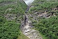
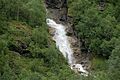 Waterfall on the Chham Khola. - panoramio.jpg 1,936 × 1,296; 943 KB
-
 Way into Mugu and Tibet. Humla district. - panoramio.jpg 1,936 × 1,296; 1.04 MB
-
 Yala Kang 5745 meters. - panoramio.jpg 1,936 × 1,296; 887 KB


.jpg)


.jpg)
.jpg)
.jpg)
.jpg)
.jpg)


.jpg)


._-_panoramio.jpg)