Category:Mulbarton, Norfolk
Jump to navigation
Jump to search

village and civil parish in Norfolk, England  | |||||
| Upload media | |||||
| Instance of | |||||
|---|---|---|---|---|---|
| Location | South Norfolk, Norfolk, East of England, England | ||||
| Area |
| ||||
| Said to be the same as | Mulbarton (Wikimedia duplicated page, civil parish) | ||||
 | |||||
Subcategories
This category has the following 4 subcategories, out of 4 total.
Media in category "Mulbarton, Norfolk"
The following 200 files are in this category, out of 309 total.
(previous page) (next page)-
 A farmer's work is never done - geograph.org.uk - 4983750.jpg 640 × 500; 345 KB
-
 A farmer's work is never done - geograph.org.uk - 4983765.jpg 640 × 360; 307 KB
-

-

-
 A patch of flowering oilseed rape - geograph.org.uk - 4217890.jpg 640 × 480; 136 KB
-
 A sunlit crop of winter wheat - geograph.org.uk - 1584736.jpg 640 × 450; 100 KB
-
 A sunny field margin in late November - geograph.org.uk - 4750447.jpg 640 × 360; 307 KB
-
 Access road to Richmond Lodge - geograph.org.uk - 4983811.jpg 640 × 360; 322 KB
-
 Another extension to Mulbarton - geograph.org.uk - 6112906.jpg 3,456 × 2,592; 3.87 MB
-
 Antique Clocks shop - geograph.org.uk - 5298981.jpg 640 × 480; 349 KB
-

-

-

-

-
 Ash tree (Fraxinus excelsior) fruits - geograph.org.uk - 4750466.jpg 640 × 640; 506 KB
-
 Ash trees on a field boundary - geograph.org.uk - 4750442.jpg 640 × 546; 501 KB
-
 Assorted houses on Cuckoofield Lane, Mulbarton - geograph.org.uk - 4357248.jpg 1,024 × 768; 272 KB
-
 Autumn colours on the path to Mulbarton - geograph.org.uk - 1584755.jpg 640 × 512; 228 KB
-
 Barley crop field by The Wood - geograph.org.uk - 5801395.jpg 640 × 480; 84 KB
-

-
 Barn in paddock south of footpath - geograph.org.uk - 1586355.jpg 640 × 480; 111 KB
-

-

-
 Blakeys Bus Café (detail) - geograph.org.uk - 4860668.jpg 640 × 410; 270 KB
-
 Blakeys Bus Café (detail) - geograph.org.uk - 4860675.jpg 480 × 640; 340 KB
-
 Blakeys Bus Café (detail) - geograph.org.uk - 4860681.jpg 640 × 480; 296 KB
-
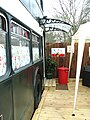 Blakeys Bus Café (entrance) - geograph.org.uk - 4860677.jpg 480 × 640; 348 KB
-
 Blakeys Bus Café - geograph.org.uk - 4860662.jpg 640 × 480; 393 KB
-
 Blakeys Bus Café in Mulbarton - geograph.org.uk - 4860661.jpg 640 × 480; 376 KB
-
 Blakeys Bus Café in Mulbarton - geograph.org.uk - 4860664.jpg 640 × 480; 329 KB
-
 Brambles beside the Tas Valley Way - geograph.org.uk - 4358993.jpg 640 × 480; 515 KB
-
 Brassica crop - geograph.org.uk - 4217904.jpg 640 × 480; 261 KB
-
 Brassica crop field - geograph.org.uk - 4217912.jpg 640 × 480; 202 KB
-
 Brick Kiln Lane - geograph.org.uk - 4357267.jpg 1,024 × 768; 246 KB
-
 Brick Kiln Lane and Low bridge warning sign - geograph.org.uk - 4357261.jpg 1,024 × 768; 239 KB
-
 Broad-leaved plantain (Plantago major) - geograph.org.uk - 4983715.jpg 640 × 562; 657 KB
-
 BT Repeater Station - geograph.org.uk - 1133471.jpg 640 × 480; 96 KB
-
 Bungalows in Long Lane - geograph.org.uk - 4248789.jpg 640 × 421; 113 KB
-
 Bungalows next to the green - geograph.org.uk - 4357243.jpg 1,024 × 768; 306 KB
-

-
 Bus shelter in Norwich Road, Mulbarton - geograph.org.uk - 5319568.jpg 640 × 555; 436 KB
-
 By the pond, Mulbarton - geograph.org.uk - 3793017.jpg 640 × 480; 131 KB
-
 Church Lane, Mulbarton - geograph.org.uk - 4416799.jpg 3,072 × 2,304; 1.82 MB
-
 Church Road junction - geograph.org.uk - 4248782.jpg 640 × 447; 150 KB
-
 Co-operative Food Store, Mulbarton - geograph.org.uk - 4599248.jpg 640 × 480; 58 KB
-
 Coach House, Mulbarton - geograph.org.uk - 959574.jpg 452 × 640; 55 KB
-
 Conifers, Mulbarton - geograph.org.uk - 5305385.jpg 522 × 640; 260 KB
-
 Cottage by the pond in Mulbarton - geograph.org.uk - 5299011.jpg 640 × 574; 436 KB
-
 Cottage in Mulbarton - geograph.org.uk - 5299012.jpg 640 × 480; 408 KB
-
 Cottages by the pond at Mulbarton Common - geograph.org.uk - 4315643.jpg 640 × 527; 181 KB
-
 Cottages by the pond in Mulbarton - geograph.org.uk - 5299017.jpg 640 × 499; 373 KB
-
 Cottages in Mulbarton - geograph.org.uk - 5299014.jpg 480 × 640; 368 KB
-

-
 Crop field east of Mulbarton - geograph.org.uk - 4590911.jpg 640 × 480; 100 KB
-
 Crop field north of Lodge Farm - geograph.org.uk - 4750456.jpg 640 × 360; 260 KB
-
 Crop fields by Paddock Farm - geograph.org.uk - 4983784.jpg 640 × 360; 244 KB
-
 Crop fields south of Catbridge Lane - geograph.org.uk - 4983725.jpg 640 × 360; 221 KB
-
 Crop fields west of Swainsthorpe - geograph.org.uk - 4750436.jpg 640 × 360; 185 KB
-
 Crop spraying - geograph.org.uk - 4983743.jpg 638 × 640; 457 KB
-
 Crop spraying beside the footpath - geograph.org.uk - 4983619.jpg 640 × 360; 292 KB
-
 Crop spraying beside the footpath - geograph.org.uk - 4983768.jpg 640 × 474; 390 KB
-
 Cuckoofield Lane, Mulbarton - geograph.org.uk - 4357245.jpg 1,024 × 768; 213 KB
-
 Cuckoofield Lane, Mulbarton - geograph.org.uk - 4599250.jpg 640 × 480; 61 KB
-

-
 Dead tree in a pond in The Carrs - geograph.org.uk - 4359076.jpg 640 × 480; 464 KB
-

-
 Disused building beside Norwich Road - geograph.org.uk - 5319532.jpg 640 × 480; 390 KB
-
 Dogs must be on lead ^ - geograph.org.uk - 5812029.jpg 3,456 × 2,592; 3.95 MB
-
 Dozing ducks at Mulbarton Common - geograph.org.uk - 4315645.jpg 640 × 543; 231 KB
-
 East Carleton Road looking east - geograph.org.uk - 1100622.jpg 640 × 480; 75 KB
-
 Elder flowers - geograph.org.uk - 4983612.jpg 640 × 360; 361 KB
-
 Elder flowers - geograph.org.uk - 4983613.jpg 640 × 445; 396 KB
-

-

-

-

-
 Electricity Sub Station off Gowthorpe Lane - geograph.org.uk - 4416773.jpg 3,072 × 2,304; 1.86 MB
-
 Entering Mulbarton - geograph.org.uk - 4590914.jpg 640 × 480; 87 KB
-
 Farm track off Brickkiln Lane - geograph.org.uk - 4599252.jpg 640 × 480; 87 KB
-
 Farm track to Swainsthorpe - geograph.org.uk - 4750431.jpg 640 × 360; 262 KB
-
 Farm track west of Paddock Farm - geograph.org.uk - 4983722.jpg 640 × 360; 219 KB
-
 Farmland east of Mulbarton - geograph.org.uk - 4406423.jpg 2,592 × 1,944; 1.43 MB
-
 Farmwork in June - geograph.org.uk - 4983759.jpg 640 × 474; 434 KB
-
 Field boundary south of "The Wood" - geograph.org.uk - 4750418.jpg 640 × 360; 351 KB
-

-
 Field near Swardeston village - geograph.org.uk - 4750422.jpg 640 × 360; 314 KB
-
 Fields east of Swardeston - geograph.org.uk - 4750413.jpg 640 × 360; 331 KB
-
 Fields north of Brickkiln Lane - geograph.org.uk - 4217898.jpg 640 × 480; 148 KB
-
 Fields north of Lodge Farm - geograph.org.uk - 4750454.jpg 640 × 360; 331 KB
-
 Flordon Common - geograph.org.uk - 163528.jpg 640 × 480; 199 KB
-

-
 Footbridge on the Tas Valley Way - geograph.org.uk - 4359012.jpg 640 × 480; 531 KB
-
 Footbridge on the Tas Valley Way - geograph.org.uk - 4359030.jpg 480 × 640; 458 KB
-
 Footbridge over ditch - geograph.org.uk - 1584677.jpg 640 × 480; 200 KB
-
 Footpath east of Mulbarton - geograph.org.uk - 4750408.jpg 640 × 360; 321 KB
-
 Footpath East of Mulbarton - geograph.org.uk - 995035.jpg 640 × 480; 90 KB
-
 Footpath marker at path junction - geograph.org.uk - 1584729.jpg 640 × 480; 136 KB
-

-
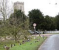
 Footpath past St Mary Magdalen's church - geograph.org.uk - 1586320.jpg 640 × 490; 170 KB
-
 Footpath skirting crop field - geograph.org.uk - 4750428.jpg 640 × 360; 281 KB
-
 Footpath to Mulbarton - geograph.org.uk - 5812033.jpg 3,456 × 2,592; 3.88 MB
-
 Footpath to Mulbarton Common - geograph.org.uk - 4983800.jpg 640 × 360; 376 KB
-
 Footpath to Swardeston village - geograph.org.uk - 4359090.jpg 640 × 480; 461 KB
-
 Footpath to Wood Lane - geograph.org.uk - 4750405.jpg 640 × 360; 396 KB
-
 Footpath to Wood Lane, Swardeston - geograph.org.uk - 4750416.jpg 640 × 360; 325 KB
-
 Frozen pond at Mulbarton Common - geograph.org.uk - 4315633.jpg 640 × 480; 153 KB
-
 Frozen pond at Mulbarton Common - geograph.org.uk - 4315634.jpg 640 × 575; 130 KB
-
 Frozen pond at Mulbarton Common - geograph.org.uk - 4315636.jpg 640 × 480; 151 KB
-
 Frozen pond at Mulbarton Common - geograph.org.uk - 4315639.jpg 640 × 480; 106 KB
-
 Frozen pond at Mulbarton Common - geograph.org.uk - 4315640.jpg 640 × 480; 167 KB
-
 Frozen pond at Mulbarton Common - geograph.org.uk - 4315642.jpg 640 × 480; 169 KB
-

-
 Game bird crops - geograph.org.uk - 4750451.jpg 640 × 360; 326 KB
-
 Game bird crops and feeders - geograph.org.uk - 4750453.jpg 640 × 360; 302 KB
-
 Gate on the Tas Valley Way - geograph.org.uk - 4358979.jpg 640 × 480; 530 KB
-
 Gowthorpe Lane, Mulbarton - geograph.org.uk - 4416784.jpg 3,072 × 2,052; 2.54 MB
-
 Gowthorpe Lane, Swardeston - geograph.org.uk - 5812039.jpg 3,321 × 2,491; 3.04 MB
-
 Grazing near Kenningham Hall - geograph.org.uk - 4590916.jpg 640 × 480; 64 KB
-
 Hay meadow west of Mulbarton - geograph.org.uk - 4983808.jpg 640 × 360; 368 KB
-
 Hedge in low November sunshine - geograph.org.uk - 1584744.jpg 640 × 480; 153 KB
-
 House by the pond in Mulbarton - geograph.org.uk - 5299018.jpg 640 × 554; 485 KB
-
 House for sale by the pond in Mulbarton - geograph.org.uk - 5299016.jpg 640 × 476; 378 KB
-
 Houses in The Rosery - geograph.org.uk - 1416184.jpg 515 × 640; 78 KB
-
 Houses Near Mulbarton Church - geograph.org.uk - 914151.jpg 640 × 480; 96 KB
-
 Houses on Cuckoofield Lane - geograph.org.uk - 4599249.jpg 640 × 480; 78 KB
-
 Houses on Cuckoofield Lane, Mulbarton - geograph.org.uk - 4590905.jpg 640 × 480; 102 KB
-
 Ivy-clad trees on a field boundary - geograph.org.uk - 4750459.jpg 640 × 360; 349 KB
-
 Kenningham Hall - geograph.org.uk - 4357272.jpg 1,024 × 768; 352 KB
-
 Know The Footpath Rules - geograph.org.uk - 5801402.jpg 640 × 480; 91 KB
-
 Leaving Mulbarton - geograph.org.uk - 4590913.jpg 640 × 480; 79 KB
-
 Lichen-covered ash tree trunk - geograph.org.uk - 4750444.jpg 522 × 640; 539 KB
-
 Long Lane past Mulbarton Common - geograph.org.uk - 1586118.jpg 640 × 419; 102 KB
-
 Long Lane, Mulbarton - geograph.org.uk - 4248786.jpg 640 × 476; 155 KB
-
 Long Lane, Mulbarton - geograph.org.uk - 4590908.jpg 640 × 480; 114 KB
-
 Maize crop for game birds - geograph.org.uk - 4750449.jpg 640 × 360; 337 KB
-
 Marker post at footpath junction - geograph.org.uk - 4750446.jpg 640 × 360; 285 KB
-

-
 Minor road to Swardeston - geograph.org.uk - 4248780.jpg 640 × 439; 166 KB
-
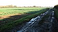
 Muddy farm track - geograph.org.uk - 4750427.jpg 640 × 360; 317 KB
-
 Mulbarton - geograph.org.uk - 4406427.jpg 2,592 × 1,944; 1.31 MB
-
 Mulbarton - St Mary Magdalen Church - geograph.org.uk - 6014382.jpg 5,184 × 2,920; 5.34 MB
-

-
 Mulbarton Common - geograph.org.uk - 44785.jpg 640 × 480; 72 KB
-
 Mulbarton Common on the Norwich Road - geograph.org.uk - 5063882.jpg 640 × 478; 183 KB
-
 Mulbarton Primary Electricity Substation - geograph.org.uk - 1583903.jpg 640 × 435; 120 KB
-
 Mulbarton St Mary Magdalene church - geograph.org.uk - 6003502.jpg 3,072 × 2,304; 2.53 MB
-
 Mulbarton village pond - geograph.org.uk - 5063864.jpg 2,592 × 1,936; 2.16 MB
-
 Mulbarton War Memorials - geograph.org.uk - 6018554.jpg 956 × 1,320; 326 KB
-
 Narrow path traversing wheat crop field - geograph.org.uk - 4983782.jpg 640 × 360; 283 KB
-
 New housing, Mulbarton - geograph.org.uk - 44786.jpg 640 × 480; 54 KB
-
 No Entry - geograph.org.uk - 4750460.jpg 640 × 360; 393 KB
-
 Norwich Road past the old forge - geograph.org.uk - 5319527.jpg 640 × 428; 195 KB
-
 Oak tree in crop field - geograph.org.uk - 4983790.jpg 640 × 360; 213 KB
-
 Oak trees on the edge of The Carrs - geograph.org.uk - 4359041.jpg 640 × 480; 445 KB
-
 Oilseed rape crop field - geograph.org.uk - 4750424.jpg 640 × 360; 293 KB
-
 Oilseed rape crop field - geograph.org.uk - 4750443.jpg 640 × 360; 325 KB
-
-
 Oilseed rape leaves - geograph.org.uk - 4750426.jpg 635 × 640; 672 KB
-
 Old Milestone - geograph.org.uk - 1254750.jpg 480 × 640; 103 KB
-
 Old plough at Kenningham Hall - geograph.org.uk - 4357274.jpg 1,024 × 768; 499 KB
-
 On the way to Mulbarton - geograph.org.uk - 1584718.jpg 640 × 480; 98 KB
-
 Ordnance Survey Cut Mark - geograph.org.uk - 4218600.jpg 640 × 480; 132 KB
-
 Outgrown hedge on the edge of The Carrs - geograph.org.uk - 4359017.jpg 640 × 480; 424 KB
-
 Path along stock fence - geograph.org.uk - 1416171.jpg 640 × 480; 124 KB
-
 Path through a field of ripening wheat - geograph.org.uk - 1416157.jpg 640 × 480; 113 KB
-
 Path through fields east of Mulbarton - geograph.org.uk - 4750448.jpg 640 × 540; 466 KB
-
 Path through fields east of Mulbarton - geograph.org.uk - 4750461.jpg 640 × 360; 371 KB
-
 Path to Swardeston Common - geograph.org.uk - 4359059.jpg 640 × 554; 564 KB
-
 Path to Swardeston House - geograph.org.uk - 4359044.jpg 640 × 480; 553 KB
-

-
 Plank bridge over a ditch - geograph.org.uk - 1416164.jpg 480 × 640; 103 KB
-
 Plank bridge over a ditch - geograph.org.uk - 1416175.jpg 480 × 640; 138 KB
-
 Plantation beside the Tas Valley Way - geograph.org.uk - 4359061.jpg 640 × 480; 559 KB
-
 Pond beside the Tas Valley Way - geograph.org.uk - 4983575.jpg 640 × 360; 406 KB
-
 Pond in The Carrs - geograph.org.uk - 4358999.jpg 640 × 480; 512 KB
-
 Pond in The Carrs - geograph.org.uk - 4359013.jpg 640 × 480; 419 KB
-
 Pond in The Carrs - geograph.org.uk - 4359023.jpg 640 × 480; 426 KB
-
 Pond in The Carrs - geograph.org.uk - 4359069.jpg 640 × 480; 440 KB
-
 Pond in The Carrs - geograph.org.uk - 4359072.jpg 640 × 480; 459 KB
-
 Pond in The Carrs - geograph.org.uk - 4359080.jpg 640 × 480; 480 KB
-
 Pond south of Catbridge Lane - geograph.org.uk - 4983578.jpg 640 × 360; 389 KB
-

-
 Protecting the crop - geograph.org.uk - 4983757.jpg 640 × 360; 411 KB
-
 Public footpath to Greenways - geograph.org.uk - 1416205.jpg 640 × 480; 131 KB
-
 Public footpath to Mulbarton - geograph.org.uk - 1583892.jpg 640 × 480; 127 KB
-
 Public footpath to Mulbarton - geograph.org.uk - 5801396.jpg 640 × 480; 99 KB
-
 Public footpath to Swardeston - geograph.org.uk - 1584750.jpg 640 × 450; 150 KB
-
 Pump house by The Rosery - geograph.org.uk - 4248791.jpg 640 × 480; 227 KB
-
 Railway goods van - shed in paddock - geograph.org.uk - 1583885.jpg 640 × 480; 96 KB
-
 Road junction at The Rosery and Brick Kiln Lane - geograph.org.uk - 4357255.jpg 1,024 × 768; 467 KB
-
 Road past Richmond House - geograph.org.uk - 4983820.jpg 640 × 360; 319 KB
-
 Roadsign on Gowthorpe Lane - geograph.org.uk - 4416792.jpg 2,304 × 3,072; 3.31 MB
-
 Rooftops at Vale Farm - geograph.org.uk - 1429321.jpg 640 × 480; 105 KB
-
 Shotesham Road - geograph.org.uk - 3307513.jpg 640 × 480; 73 KB
-
 Shotesham Road - geograph.org.uk - 3307515.jpg 640 × 480; 55 KB
-
 Small cottage by the old forge - geograph.org.uk - 5319505.jpg 640 × 480; 411 KB
-
 Snowy fields - geograph.org.uk - 3307518.jpg 640 × 480; 35 KB
-

-
 Solitary oak tree in crop field - geograph.org.uk - 4750457.jpg 640 × 603; 480 KB
-
 Stables in paddock east of Old Hall - geograph.org.uk - 1586366.jpg 640 × 480; 100 KB


_fruits_-_geograph.org.uk_-_4750466.jpg)


_-_geograph.org.uk_-_4860668.jpg)
_-_geograph.org.uk_-_4860675.jpg)
_-_geograph.org.uk_-_4860681.jpg)
_-_geograph.org.uk_-_4860677.jpg)


_-_geograph.org.uk_-_4983715.jpg)


_-_winged_fruits_-_geograph.org.uk_-_4983683.jpg)


_-_geograph.org.uk_-_4983679.jpg)


_in_Norwich_Road_-_geograph.org.uk_-_5298980.jpg)


