Category:Mundaring Weir grounds
Jump to navigation
Jump to search
- Grounds includes stairs, picnic grounds and items listed in Water maps located at the weir
- separate from Hotel, the Weir structure itself and Lake O'Connor

Subcategories
This category has the following 13 subcategories, out of 13 total.
M
- Mundaring Weir grounds kangaroos (11 F)
- Mundaring Weir grounds steps (4 F)
N
W
- Weir Village Road (1 F)
Media in category "Mundaring Weir grounds"
The following 17 files are in this category, out of 17 total.
-
 Bibbulmun track mundaring weir.JPG 2,304 × 1,728; 1.54 MB
-
 Camping ground sign at Hills Discovery centre on hill above Mundaring weir.jpg 1,280 × 848; 869 KB
-
 Decomissioned water authority buildings.jpg 848 × 1,280; 922 KB
-
 Mundaring Dam map of grounds and surrounds.jpg 1,280 × 848; 634 KB
-
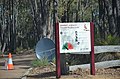
 Mundaring Weir discovery centre sign.jpg 1,280 × 848; 1.02 MB
-
 Mundaring weir grounds gate at Bibbulman entry area.jpg 1,280 × 603; 714 KB
-
 Mundaring weir historic and modern form of lookout on to Lake O'Connor.jpg 1,280 × 848; 997 KB
-
 Mundaring Weir Road at the weir from the south.jpg 2,304 × 3,072; 3 MB
-
 Pedestrian bridge sign next to Power station No 1 Mundaring Weir.jpg 1,280 × 848; 739 KB
-
 Pipe joint gfwss gnangarra.jpg 1,932 × 2,576; 2.22 MB
-
 Road alignment on river channel next to pumping station.jpg 1,280 × 848; 1.02 MB
-
 Steps and hand rail down through garden.jpg 848 × 1,280; 824 KB
-
 Time limit sign for Mundaring Weir grounds.jpg 1,280 × 848; 975 KB
-
 Unidentified lizard on rock at Mundaring Weir May 2020.jpg 1,535 × 760; 522 KB
-
 View south across the valley in front of Mundaring Weir.jpg 1,280 × 848; 541 KB
-
 Water authority building next to No 1 pumping station.jpg 1,280 × 848; 758 KB
-
 Zig zag railway formation on side of hill at Mundaring Weir.jpg 1,280 × 848; 1.03 MB


