Category:Mynydd Epynt
Jump to navigation
Jump to search
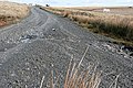
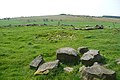
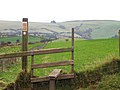
English: Mynydd Epynt is an upland area of Mid Wales in the county of Powys, Wales. It is bounded to the south by the upper section of the valley of the River Usk, and the Brecon Beacons National Park, to the north by the valley of the Afon Irfon and to the east by the valley of the River Wye. Its western boundary is less distinct but lies eastward of the A483 Llandovery to Llanwrtyd Wells road. Its character is that of an extensive though dissected moorland plateau lying between 400 and 450m above sea level and whose highest point of 478m (1,568 ft).
Site of Special Scientific Interest in Wales | |||||
| Upload media | |||||
| Instance of | |||||
|---|---|---|---|---|---|
| Location | Powys, Wales | ||||
| Area |
| ||||
 | |||||
Media in category "Mynydd Epynt"
The following 39 files are in this category, out of 39 total.
-
 Above Nant Bran - geograph.org.uk - 1179924.jpg 640 × 428; 164 KB
-
 Across Mynydd Epynt - geograph.org.uk - 1179778.jpg 640 × 427; 191 KB
-
 Approach to Mynydd Epynt - geograph.org.uk - 1173464.jpg 640 × 427; 178 KB
-
 Cwm above Troedyrhiw - geograph.org.uk - 838155.jpg 640 × 427; 83 KB
-
 Disgwylfa visitor centre - geograph.org.uk - 839775.jpg 640 × 427; 93 KB
-
 Drove road across the Epynt - geograph.org.uk - 1178377.jpg 640 × 427; 174 KB
-
 Drove road across the Epynt - geograph.org.uk - 1179775.jpg 640 × 427; 209 KB
-
 Drove road across the Epynt - geograph.org.uk - 1179777.jpg 640 × 426; 190 KB
-
 Drover's Arms Inn on Epynt mountain - geograph.org.uk - 157616.jpg 640 × 480; 139 KB
-
 Entrance to SENTA - geograph.org.uk - 816089.jpg 640 × 427; 49 KB
-
 Epynt rally stage - geograph.org.uk - 1126338.jpg 640 × 429; 61 KB
-
 Epynt training area - geograph.org.uk - 815606.jpg 640 × 427; 56 KB
-
 Epynt training area near Cae'n-y-waun - geograph.org.uk - 815613.jpg 640 × 427; 61 KB
-
 Former Epynt drove road - geograph.org.uk - 1178355.jpg 640 × 427; 149 KB
-
 Former Epynt drove road - geograph.org.uk - 1178407.jpg 640 × 426; 191 KB
-
 From the Brynhynae bridleway - geograph.org.uk - 814840.jpg 640 × 427; 82 KB
-
 House at Ffrwd-wen on Epynt mountain - geograph.org.uk - 157607.jpg 640 × 480; 219 KB
-
 Into the danger zone - geograph.org.uk - 468892.jpg 640 × 480; 49 KB
-
 Looking into the Epynt - geograph.org.uk - 815627.jpg 640 × 427; 72 KB
-
 Moorland on Epynt - geograph.org.uk - 1013499.jpg 640 × 480; 67 KB
-
 Moorland on Epynt - geograph.org.uk - 1013507.jpg 640 × 480; 117 KB
-
 Motor Rallying on Epynt Ranges - geograph.org.uk - 392723.jpg 640 × 480; 93 KB
-
 Mynydd Epynt observation post - geograph.org.uk - 1173460.jpg 640 × 426; 186 KB
-
 Mynydd Epynt training area - geograph.org.uk - 814898.jpg 640 × 427; 66 KB
-
 Mynydd Epynt training area - geograph.org.uk - 816475.jpg 640 × 427; 67 KB
-
 On Mynydd Epynt - geograph.org.uk - 826098.jpg 640 × 427; 74 KB
-
 On reflection, it's OK - geograph.org.uk - 839534.jpg 427 × 640; 84 KB
-
 Red kite viewing area - geograph.org.uk - 815545.jpg 640 × 414; 46 KB
-
 Road across the moors - geograph.org.uk - 839690.jpg 640 × 427; 58 KB
-
 Road crosses stream on Epynt mountain - geograph.org.uk - 157601.jpg 640 × 480; 161 KB
-
 South from Crug Du - geograph.org.uk - 1179818.jpg 640 × 426; 173 KB
-
 Stile to Epynt - geograph.org.uk - 1013516.jpg 640 × 480; 109 KB
-
 Stop sign on B4519 near Upper Chapel - geograph.org.uk - 157647.jpg 640 × 480; 124 KB
-
 Stop sign on road north of Epynt mountain - geograph.org.uk - 157581.jpg 640 × 480; 172 KB
-
 Strata above Nant Talar - geograph.org.uk - 1178413.jpg 640 × 427; 185 KB
-
 Tour of Epynt rally - geograph.org.uk - 1176688.jpg 640 × 427; 201 KB
-
 Track on Mynydd Epynt - geograph.org.uk - 1173401.jpg 640 × 427; 200 KB
-
 Training use only - geograph.org.uk - 839632.jpg 427 × 640; 96 KB
-
 Welsh TT races Trophy.jpg 480 × 640; 70 KB


