Category:Mysore district
Jump to navigation
Jump to search
Mysore (Kannada: ಮೈಸೂರು ಜಿಲ್ಲೆ) is one of the 30 districts of Karnataka, India. With varied attractions from Mysore Palace to Nagarhole National Park, Mysore has a prominent place in the history of Karnataka. Mysore's prominence can be gauged from the fact that the Karnataka state was known previously as Mysore state. Mysore is the district headquarter.12°12′36″N 76°29′24″E / 12.21°N 76.49°E
district in Karnataka, India   | |||||
| Upload media | |||||
| Instance of | |||||
|---|---|---|---|---|---|
| Location |
| ||||
| Capital | |||||
| Official language | |||||
| Population |
| ||||
| Area |
| ||||
| Different from | |||||
| official website | |||||
 | |||||
Subcategories
This category has the following 10 subcategories, out of 10 total.
!
*
N
W
Media in category "Mysore district"
The following 8 files are in this category, out of 8 total.
-
 B Rachayya circle Mysore.jpg 4,160 × 3,120; 1.19 MB
-
 Chenna Kesava temple, Dharmapura village, Karnataka.jpg 3,300 × 5,100; 515 KB
-
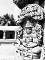
 Example for an excusite carving from Hoysala Architecture.jpg 4,096 × 3,072; 3.77 MB
-
 Lakshmikanta temple, Mullur Karnataka.jpg 3,300 × 5,100; 596 KB
-
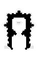
 Porta di mysore, 01.jpg 2,922 × 4,224; 5.39 MB
-
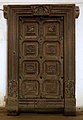
 Porta di mysore, 02.jpg 3,114 × 5,136; 8.44 MB
-
 Sidilu Mallikarjuna Swamy temple, Bettadapura, Karnataka.jpg 3,300 × 5,100; 505 KB
-
 Yet another example for the great craftsmanship of the temple.jpg 3,072 × 4,096; 3.34 MB


