Category:NCEP daily max-min temperature maps for 20 October
Jump to navigation
Jump to search
Media in category "NCEP daily max-min temperature maps for 20 October"
The following 18 files are in this category, out of 18 total.
-
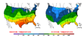
 2003-10-20 Color Max-min Temperature Map NOAA.png 800 × 350; 23 KB
-
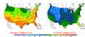
 2004-10-20 Color Max-min Temperature Map NOAA.png 800 × 350; 21 KB
-
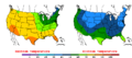
 2005-10-20 Color Max-min Temperature Map NOAA.png 800 × 350; 22 KB
-
 2006-10-20 Color Max-min Temperature Map NOAA.png 800 × 350; 22 KB
-
 2007-10-20 Color Max-min Temperature Map NOAA.png 800 × 350; 22 KB
-
 2008-10-20 Color Max-min Temperature Map NOAA.png 800 × 350; 22 KB
-
 2009-10-20 Color Max-min Temperature Map NOAA.png 800 × 350; 23 KB
-
 2010-10-20 Color Max-min Temperature Map NOAA.png 800 × 350; 23 KB
-
 2011-10-20 Color Max-min Temperature Map NOAA.png 800 × 350; 23 KB
-
 2012-10-20 Color Max-min Temperature Map NOAA.png 800 × 350; 23 KB
-
 2013-10-20 Color Max-min Temperature Map NOAA.png 800 × 350; 23 KB
-
 2014-10-20 Color Max-min Temperature Map NOAA.png 800 × 350; 23 KB
-
 2015-10-20 Color Max-min Temperature Map NOAA.png 800 × 350; 14 KB
-
 2016-10-20 Color Max-min Temperature Map NOAA.png 800 × 350; 15 KB
-
 2017-10-20 Color Max-min Temperature Map NOAA.png 800 × 350; 14 KB
-
 2018-10-20 Color Max-min Temperature Map NOAA.png 800 × 350; 14 KB
-
 2019-10-20 Color Max-min Temperature Map NOAA.png 800 × 350; 15 KB
-
 2020-10-20 Color Max-min Temperature Map NOAA.png 800 × 350; 15 KB


