Category:NUTS maps
Jump to navigation
Jump to search
Member states of the European Union: Austria [AT] · Bullgaria [BG] · Estonia [EE] · Finlanda [FI] · Francë [FR] · Gjermania [DE] · Greqia [EL] · Holanda [NL] · Hungaria [HU] · Italia [IT] · Kroacia [HR] · Polonia [PL] · Portugalia [PT] · Republika Çeke [CZ] · Republika e Irlandës [IE] · Rumania [RO] · Sllovakia [SK] · Spanja [ES] · Suedia [SE]
Former member countries or territories: Britania e Madhe [UK]
Former member countries or territories: Britania e Madhe [UK]

Kategoria kryesore: Nomenclature of Territorial Units for Statistics
English: The Nomenclature of Territorial Units for Statistics (NUTS, for the French nomenclature d'unités territoriales statistiques) is a geocode standard for referencing the spatial divisions of European countries for statistical purposes.
Français : La nomenclature d'unités territoriales statistiques (NUTS) est une norme de géocodage pour référencer les divisions spatiales des pays européens dans des buts statistiques.
- A NUTS code begins with a two-letter code referencing the country, which is identical to the ISO 3166-1 alpha-2 code (except UK instead of GB for the United Kingdom). NUTS codes are created not just for countries that are current member states of the European Union, but as well for candidate countries and countries in the European Economic Area, with which the European Union officially develops cooperation programs requiring a more limited collection of some statistics.
- The spatial division of the country is then referred to with one digit. A second or third subdivision level is referred to with another digit each. These NUTS divisions do not necessarily correspond to administrative divisions within the country.
- Each numbering starts with 1, as 0 is used for the upper level. In case the division has more than 9 entities, capital letters are used to continue the numbering.
Nënkategoritë
Kjo kategori ka 24 nënkategori, nga gjithsej 24.
- NUTS maps of the European Union (17 F)
A
- NUTS maps of Austria (11 F)
B
- NUTS maps of Bulgaria (5 F)
C
- NUTS maps of Croatia (3 F)
- NUTS maps of the Czech Republic (34 F)
E
- NUTS maps of Estonia (8 F)
F
- NUTS maps of Finland (4 F)
- NUTS maps of France (1 F)
G
- NUTS maps of Germany (3 F)
- NUTS maps of Greece (2 F)
H
- NUTS maps of Hungary (23 F)
I
- NUTS maps of Ireland (6 F)
N
- NUTS maps of the Netherlands (6 F)
P
- NUTS maps of Poland (9 F)
R
- NUTS maps of Romania (14 F)
S
- NUTS maps of Slovakia (4 F)
- NUTS maps of Spain (33 F)
- NUTS maps of Sweden (5 F)
U
Media në kategorinë "NUTS maps"
Kjo kategori ka 8 skedarë nga gjithsej 8.
-
 Apskritis of Lithuania.png 750 × 556; 74 KB
-
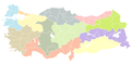 NUTS Map of Turkey.png 1.024 × 500; 37 KB
-
 NUTS Map of Turkey.svg 1.024 × 500; 499 KB
-
 NUTS of Albania (AL).png 1.000 × 2.174; 179 KB
-
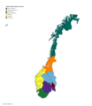 NUTS statistical regions of Norway.png 6.480 × 7.480; 1,9 MB
-
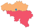 Regions of Belgium.svg 307 × 251; 68 KB
-
 RSUJ2.jpg 1.648 × 907; 220 KB
-
 Turkey NUTS 2nd Level.png 1.024 × 500; 31 KB


.png)


