Category:Nacton
Jump to navigation
Jump to search
English: Nacton is a civil parish in the Suffolk Coastal region of Suffolk, England, taking its name from the village within it. The parish is bounded by the neighbouring parishes of Levington to the east and Bucklesham in the north. It is located between the towns of Ipswich and Felixstowe.

village in Suffolk, England, UK  | |||||
| Upload media | |||||
| Instance of | |||||
|---|---|---|---|---|---|
| Location |
| ||||
| Population |
| ||||
 | |||||
Subcategories
This category has the following 13 subcategories, out of 13 total.
A
B
- Broke Hall (9 F)
H
- Handstanding (sculpture) (7 F)
M
- St Martin, Nacton (13 F)
N
- Nacton Quay (6 F)
- Nacton War Memorial (3 F)
O
- The Old Shop, Nacton (2 F)
- Orwell railway station (3 F)
R
V
- Nacton Village Hall (2 F)
Media in category "Nacton"
The following 200 files are in this category, out of 293 total.
(previous page) (next page)-
 7th Armoured Div. Desert Rats Memorial - geograph.org.uk - 6202321.jpg 3,456 × 2,592; 4 MB
-
 A crop of spuds - geograph.org.uk - 3255498.jpg 640 × 430; 76 KB
-
 A Squeeze on the Stour and Orwell Walk - geograph.org.uk - 3249135.jpg 640 × 430; 109 KB
-
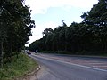 A1156 Felixstowe Road - geograph.org.uk - 3114070.jpg 3,072 × 2,304; 1.23 MB
-
 A1156 Felixstowe Road, Nacton - geograph.org.uk - 3807682.jpg 3,072 × 2,304; 980 KB
-
 A1156 Felixstowe Road, Nacton - geograph.org.uk - 3807685.jpg 3,072 × 2,304; 850 KB
-
 A1156 Felixstowe Road, Nacton - geograph.org.uk - 3812218.jpg 2,888 × 1,956; 1.01 MB
-
 A1156 Felixstowe Road, Nacton - geograph.org.uk - 5761016.jpg 4,608 × 3,072; 1.96 MB
-
 A1156 Felixstowe Road, Nacton - geograph.org.uk - 5761036.jpg 4,608 × 3,072; 1.82 MB
-
 A1156 Felixstowe Road, Nacton - geograph.org.uk - 5762656.jpg 4,000 × 2,667; 3.52 MB
-
 A12 overbridge carries A1156 - geograph.org.uk - 3580147.jpg 3,648 × 2,736; 1.41 MB
-
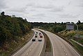
 A14 north of Orwell Meadows Caravan Site - geograph.org.uk - 3580673.jpg 3,540 × 2,585; 1.07 MB
-
 A14 northbound - geograph.org.uk - 3885517.jpg 640 × 421; 33 KB
-
 A14 northbound - geograph.org.uk - 3885519.jpg 640 × 402; 30 KB
-
 A14 south-east of White House Farm - geograph.org.uk - 3580632.jpg 3,384 × 2,379; 775 KB
-
 A14 westbound - geograph.org.uk - 3885522.jpg 640 × 480; 32 KB
-
 A14 westbound - geograph.org.uk - 3885526.jpg 640 × 480; 59 KB
-
 A14 westbound - geograph.org.uk - 3885537.jpg 640 × 480; 47 KB
-
 A14, eastbound - geograph.org.uk - 3249140.jpg 640 × 430; 53 KB
-
 Along the tracks towards Felixstowe - geograph.org.uk - 1187968.jpg 3,072 × 2,304; 1.44 MB
-
 Along the tracks towards Ipswich - geograph.org.uk - 1187963.jpg 3,072 × 2,304; 1.49 MB
-
 Anchor House The Street Postbox - geograph.org.uk - 2643835.jpg 2,304 × 3,072; 1.47 MB
-
 Boats moored in Downham Reach, River Orwell - geograph.org.uk - 5490059.jpg 1,024 × 615; 120 KB
-

-
 Boats on the River Orwell - geograph.org.uk - 4552192.jpg 1,920 × 1,080; 710 KB
-
 Bridgewood green navigation buoy, River Orwell - geograph.org.uk - 5490041.jpg 1,024 × 768; 145 KB
-
 Bus Shelter ^ Anchor House The Street Postbox - geograph.org.uk - 2643830.jpg 3,072 × 2,304; 1.54 MB
-
 Bus Shelter ^ Anchor House The Street Postbox - geograph.org.uk - 2643831.jpg 3,072 × 2,304; 1.63 MB
-
 Bus Shelter ^ Anchor House The Street Postbox - geograph.org.uk - 2643833.jpg 3,072 × 2,304; 1.53 MB
-
 Cafe at the Orwell Crossing lorry park, Nacton Heath - geograph.org.uk - 6229564.jpg 1,920 × 1,280; 806 KB
-
 Car Park at Seven Hills Crematorium - geograph.org.uk - 5761824.jpg 4,608 × 3,072; 1.96 MB
-
 Cathouse green navigation buoy, River Orwell - geograph.org.uk - 5490063.jpg 1,024 × 768; 144 KB
-
 Church Rd - geograph.org.uk - 3255640.jpg 640 × 430; 91 KB
-
 Church Rd - geograph.org.uk - 3257917.jpg 640 × 430; 104 KB
-
 Church Rd, Nacton - geograph.org.uk - 3255645.jpg 640 × 430; 108 KB
-
 Church Road, Nacton - geograph.org.uk - 3899452.jpg 3,072 × 2,304; 1.44 MB
-
 Church Road, Nacton - geograph.org.uk - 3899692.jpg 2,888 × 2,169; 1.31 MB
-
 Church Road, Nacton - geograph.org.uk - 3900392.jpg 3,029 × 2,276; 1.46 MB
-
 Clump of trees, Brokes Hall - geograph.org.uk - 3260617.jpg 640 × 430; 63 KB
-
 Concrete road to Fox's Farm - geograph.org.uk - 4621635.jpg 1,240 × 930; 666 KB
-
 Cottage, Bridge Wood - geograph.org.uk - 3246580.jpg 640 × 430; 109 KB
-
 Cottages in The Street, Nacton - geograph.org.uk - 2783658.jpg 640 × 451; 121 KB
-
 Decoy pond - geograph.org.uk - 1348821.jpg 640 × 510; 53 KB
-
 Decoy Wood from the air - geograph.org.uk - 2708704.jpg 640 × 480; 168 KB
-

-
 Derelict enclosure by Yachtsman's Cottage - geograph.org.uk - 660910.jpg 480 × 640; 184 KB
-
 Entering Nacton on Ipswich Road - geograph.org.uk - 3898465.jpg 2,983 × 2,241; 1.2 MB
-
 Entering Nacton on Orwell Road - geograph.org.uk - 4833761.jpg 3,072 × 2,304; 1.83 MB
-
 Entering Nacton, Ipswich Rd - geograph.org.uk - 3255500.jpg 640 × 430; 83 KB
-
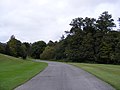
 Entering Priory Park - geograph.org.uk - 2648298.jpg 3,072 × 2,304; 1.45 MB
-
 Entrance road at Seven Hills Crematorium - geograph.org.uk - 5751681.jpg 4,608 × 3,072; 2.04 MB
-
 Entrance road at Seven Hills Crematorium - geograph.org.uk - 5751683.jpg 4,608 × 3,072; 1.87 MB
-
 Entrance road at Seven Hills Crematorium - geograph.org.uk - 5761056.jpg 4,608 × 3,072; 1.85 MB
-
 Entrance to Broke Hall - geograph.org.uk - 3257919.jpg 640 × 430; 109 KB
-
 Entrance to Orwell Park Lodge - geograph.org.uk - 3900383.jpg 3,072 × 2,304; 1.53 MB
-
 Entrance to Seven Hills Crematorium - geograph.org.uk - 5761042.jpg 3,797 × 2,528; 3.98 MB
-
 Entrance to Seven Hills Crematorium, Nacton - geograph.org.uk - 3807692.jpg 2,983 × 2,241; 1.17 MB
-
 Entrance to Snowdrop Glade - geograph.org.uk - 5761836.jpg 4,608 × 3,072; 1.81 MB
-
 Entrance to Woodland View - geograph.org.uk - 3808206.jpg 3,072 × 2,304; 1.99 MB
-
 Exit of Seven Hills Crematorium - geograph.org.uk - 5762648.jpg 4,608 × 3,072; 1.8 MB
-
 Exit Road at Seven Hills Crematorium - geograph.org.uk - 5761827.jpg 4,608 × 3,072; 1.78 MB
-
 Exit road at Seven Hills Crematorium - geograph.org.uk - 5762092.jpg 4,608 × 3,072; 1.83 MB
-
 Fallow field - geograph.org.uk - 3255488.jpg 640 × 430; 44 KB
-
 Farmland by Nacton Rd - geograph.org.uk - 3253647.jpg 640 × 430; 60 KB
-
 Farmland by Nacton Rd - geograph.org.uk - 3253648.jpg 640 × 430; 67 KB
-
 Farmland by Nacton Rd - geograph.org.uk - 3253687.jpg 640 × 430; 36 KB
-
 Farmland, Ipswich Road, Nacton - geograph.org.uk - 1540397.jpg 640 × 480; 92 KB
-
 Felixstowe Road, Nacton - geograph.org.uk - 3808175.jpg 2,965 × 2,228; 1.15 MB
-
 Felixstowe Road, Nacton - geograph.org.uk - 3808183.jpg 3,072 × 2,304; 1.34 MB
-
 Felixstowe Road, Nacton - geograph.org.uk - 3808195.jpg 3,072 × 2,304; 1.63 MB
-
 Felixstowe Road, Nacton - geograph.org.uk - 3808205.jpg 3,072 × 2,304; 1.81 MB
-
 Felixstowe Road, Nacton - geograph.org.uk - 3808236.jpg 3,072 × 2,304; 847 KB
-
 Field entrance off the A1156 Felixstowe Road - geograph.org.uk - 3807678.jpg 3,072 × 2,304; 1.03 MB
-
 Fields opposite Nacton Church - geograph.org.uk - 3255647.jpg 640 × 430; 120 KB
-
 Fly tip notice beside Ipswich Road, Nacton - geograph.org.uk - 4621644.jpg 1,240 × 930; 461 KB
-
 Forgotten Road - geograph.org.uk - 1293304.jpg 640 × 480; 107 KB
-
 Free Range Pigs - geograph.org.uk - 283680.jpg 640 × 480; 77 KB
-
 Gated entrance, Orwell Park Lodge - geograph.org.uk - 3255643.jpg 640 × 430; 81 KB
-
 Gateway to Orwell Park School - geograph.org.uk - 3257904.jpg 640 × 430; 95 KB
-
 Green navigation buoy No. 5, River Orwell - geograph.org.uk - 5497372.jpg 1,024 × 615; 99 KB
-
 Green Wind - geograph.org.uk - 531792.jpg 640 × 480; 65 KB
-
 Hallowtree Scout Camp Site - geograph.org.uk - 1246170.jpg 640 × 456; 68 KB
-
 Highfield Barn - geograph.org.uk - 6396130.jpg 800 × 533; 142 KB
-
 Home Wood, Nacton Shore - geograph.org.uk - 1587429.jpg 427 × 640; 154 KB
-
 Houses, Downham Boulevard - geograph.org.uk - 1163126.jpg 640 × 480; 69 KB
-
 Hulk on the shore - geograph.org.uk - 861632.jpg 640 × 427; 103 KB
-
 Ipswich Rd - geograph.org.uk - 3253675.jpg 640 × 430; 93 KB
-
 Ipswich Rd - geograph.org.uk - 3253677.jpg 640 × 430; 83 KB
-
 Ipswich Rd - geograph.org.uk - 3253693.jpg 640 × 430; 94 KB
-
 Ipswich Rd - geograph.org.uk - 3255490.jpg 640 × 430; 65 KB
-
 Ipswich Rd - geograph.org.uk - 3255505.jpg 640 × 430; 105 KB
-

-
 Ipswich Road to Nacton - geograph.org.uk - 3255482.jpg 640 × 430; 76 KB
-
 Ipswich road, Nacton - geograph.org.uk - 1280614.jpg 640 × 480; 104 KB
-
 Ipswich road, Nacton - geograph.org.uk - 1280619.jpg 640 × 480; 111 KB
-
 Ipswich Road, Nacton - geograph.org.uk - 3897948.jpg 3,072 × 2,304; 1.47 MB
-
 Ipswich Road, Nacton - geograph.org.uk - 3898457.jpg 3,072 × 2,304; 900 KB
-
 Ipswich Road, Nacton - geograph.org.uk - 3899450.jpg 3,072 × 2,304; 1.48 MB
-
 Ipswich Road, Nacton - geograph.org.uk - 3899459.jpg 3,072 × 2,304; 1.09 MB
-
 Ipswich Road, Nacton - geograph.org.uk - 3899462.jpg 3,072 × 2,304; 1.17 MB
-
 Ipswich Road, Nacton - geograph.org.uk - 3899467.jpg 2,872 × 2,157; 1.37 MB
-
 Irrigation equipment by Ipswich Rd - geograph.org.uk - 3255495.jpg 640 × 430; 72 KB
-
 John Banks Nacton Ipswich - geograph.org.uk - 280095.jpg 640 × 480; 85 KB
-
 Lady Wood - geograph.org.uk - 3253696.jpg 640 × 430; 52 KB
-
 Lady Wood - geograph.org.uk - 3255486.jpg 640 × 430; 65 KB
-
 Ladywood Lodge - geograph.org.uk - 3255502.jpg 640 × 430; 109 KB
-
 Lake at Priory Park - geograph.org.uk - 2648299.jpg 3,072 × 2,304; 1.52 MB
-
 Lake at Priory Park - geograph.org.uk - 2648309.jpg 3,072 × 2,304; 1.47 MB
-
 Lamppost ^ roadsign at Seven Hills Crematorium - geograph.org.uk - 5761062.jpg 2,553 × 3,707; 3.63 MB
-
 Lane to the village centre - geograph.org.uk - 3257906.jpg 640 × 430; 93 KB
-
 Leaving Priory Park at the entrance gates - geograph.org.uk - 2648318.jpg 2,640 × 1,848; 1.35 MB
-
 Leaving Priory Park on the entrance driveway - geograph.org.uk - 2648316.jpg 3,072 × 2,304; 1.25 MB
-
 Levington Road, Nacton - geograph.org.uk - 1280609.jpg 640 × 480; 106 KB
-
 Low tide, River Orwell - geograph.org.uk - 3260606.jpg 640 × 430; 69 KB
-
 Mud flats on the Orwell - geograph.org.uk - 3260604.jpg 640 × 430; 69 KB
-
 Mud flats, River Orwell - geograph.org.uk - 3260614.jpg 640 × 424; 68 KB
-
 Mud, River Orwell - geograph.org.uk - 3246569.jpg 640 × 430; 53 KB
-
 Mud, River Orwell - geograph.org.uk - 3246572.jpg 640 × 430; 52 KB
-
 Nacton Fields - geograph.org.uk - 3114077.jpg 2,827 × 2,120; 705 KB
-
 Nacton Fields - geograph.org.uk - 3114082.jpg 3,072 × 2,304; 1.31 MB
-
 Nacton Rd - geograph.org.uk - 3253634.jpg 640 × 430; 84 KB
-
 Nacton Rd - geograph.org.uk - 3253641.jpg 640 × 430; 88 KB
-
 Nacton Rd - geograph.org.uk - 3253662.jpg 640 × 430; 65 KB
-
 Nacton Road - geograph.org.uk - 2065448.jpg 1,024 × 768; 289 KB
-
 Nacton Road - geograph.org.uk - 3114084.jpg 2,304 × 3,072; 1.47 MB
-
 Nacton Road - geograph.org.uk - 3114093.jpg 2,304 × 3,072; 1.37 MB
-
 Nacton Road - geograph.org.uk - 3114095.jpg 3,072 × 2,304; 1.44 MB
-
 Nacton shore - geograph.org.uk - 2107665.jpg 2,313 × 1,572; 1.3 MB
-
 Nacton Shore - geograph.org.uk - 3260601.jpg 640 × 430; 68 KB
-
 Nacton Shore - geograph.org.uk - 3260642.jpg 640 × 394; 60 KB
-
 Nacton Shore - geograph.org.uk - 3260754.jpg 640 × 430; 58 KB
-
 Nacton Shore - geograph.org.uk - 861661.jpg 427 × 640; 108 KB
-
 Nacton Sunset - geograph.org.uk - 1099890.jpg 640 × 480; 55 KB
-
 Nacton Telephone Exchange - geograph.org.uk - 1187978.jpg 3,072 × 2,304; 1.46 MB
-
 Nacton Village Name sign on Ipswich Road - geograph.org.uk - 3899432.jpg 2,277 × 3,039; 1.74 MB
-
 Nacton Village Name sign on Ipswich Road - geograph.org.uk - 3899436.jpg 2,931 × 2,079; 1.56 MB
-
 Nacton Village Name sign on Orwell Road - geograph.org.uk - 4833763.jpg 2,253 × 2,995; 4.04 MB
-
 Nacton village.jpg 3,648 × 2,736; 2.5 MB
-
 Nacton WW2 Memorial - geograph.org.uk - 4622574.jpg 1,600 × 1,117; 519 KB
-
 New Onion Store at Home Farm, Nacton - geograph.org.uk - 3114051.jpg 2,952 × 2,212; 971 KB
-
 New Onion Store sign at Home Farm, Nacton - geograph.org.uk - 3114102.jpg 1,707 × 2,502; 1.07 MB
-
 Notice Board at Nacton Park picnic area - geograph.org.uk - 1044590.jpg 3,072 × 2,304; 1.56 MB
-
 Old defences on the Orwell shore - geograph.org.uk - 861636.jpg 427 × 640; 110 KB
-
 Old Fallen Logs - geograph.org.uk - 1099911.jpg 640 × 480; 79 KB
-
 Old Felixstowe Road - geograph.org.uk - 1312357.jpg 640 × 480; 106 KB
-
 Old pillbox - geograph.org.uk - 705018.jpg 640 × 480; 105 KB
-
 Old river bank defences - geograph.org.uk - 861627.jpg 640 × 427; 105 KB
-
 Old water tank in the woods - geograph.org.uk - 1163148.jpg 480 × 640; 137 KB
-
 One of the Seven Hills of Nacton - geograph.org.uk - 2003529.jpg 2,592 × 1,944; 2.25 MB
-
 Orwell foreshore - geograph.org.uk - 860760.jpg 427 × 640; 105 KB
-
 Orwell foreshore - geograph.org.uk - 860767.jpg 427 × 640; 116 KB
-
 Orwell Meadow sign - geograph.org.uk - 2648255.jpg 2,304 × 3,072; 1.29 MB
-
 Orwell Park and Nacton from the air - geograph.org.uk - 2708714.jpg 640 × 480; 136 KB
-
 Orwell Park Lodge and entrance - geograph.org.uk - 3255642.jpg 640 × 406; 86 KB
-
 Orwell Road Railway Bridge sign - geograph.org.uk - 4833769.jpg 2,240 × 2,978; 2.53 MB
-
 Orwell Road ^ Orwell Road Railway Bridge - geograph.org.uk - 4833768.jpg 3,072 × 2,304; 1.76 MB
-
 Orwell Stores ^ Post Office ^ Post Office The Street Postbox - geograph.org.uk - 2643801.jpg 3,072 × 2,304; 1.37 MB
-
 Park Bight navigation buoy, River Orwell - geograph.org.uk - 5497334.jpg 1,024 × 615; 119 KB
-
 Park Lane, Nacton - geograph.org.uk - 3897951.jpg 3,072 × 2,304; 1.72 MB
-
 Park Villas - geograph.org.uk - 3253669.jpg 640 × 430; 64 KB
-
 Part of Nacton Road, heading towards Nacton village - geograph.org.uk - 3358012.jpg 3,648 × 2,736; 3.21 MB
-
 Path through Snowdrop Glade - geograph.org.uk - 5762646.jpg 2,667 × 4,000; 5.66 MB
-
 Path through Snowdrop Glade - geograph.org.uk - 5762647.jpg 2,516 × 3,787; 7.19 MB
-
 Path through Snowdrop Glade - geograph.org.uk - 5762664.jpg 4,608 × 3,072; 2.03 MB
-
 Path to the A1156 Felixstowe Road - geograph.org.uk - 3808187.jpg 3,072 × 2,304; 1.78 MB
-
 Pig farm - geograph.org.uk - 1163144.jpg 640 × 480; 59 KB
-
 Pig farm at Nacton, Suffolk, England - geograph.org.uk - 1097545.jpg 640 × 480; 59 KB
-
 Pioneer Vegetation, Pond Ooze - geograph.org.uk - 3246564.jpg 640 × 430; 69 KB
-
 Playing fields and Orwell River - geograph.org.uk - 166789.jpg 640 × 427; 74 KB
-
 Ploughed field - geograph.org.uk - 3253650.jpg 640 × 430; 39 KB
-
 Ploughed field - geograph.org.uk - 3253683.jpg 640 × 430; 47 KB
-
 Ploughed field by Nacton Rd - geograph.org.uk - 3253656.jpg 640 × 430; 37 KB
-
 Ploughed field by Nacton Rd - geograph.org.uk - 3253665.jpg 640 × 430; 32 KB
-
 Pond Hall Farm - geograph.org.uk - 3246560.jpg 640 × 430; 52 KB
-
 Pond Ooze - geograph.org.uk - 3243374.jpg 640 × 393; 52 KB
-
 Pond Ooze, River Orwell - geograph.org.uk - 3246552.jpg 640 × 430; 49 KB
-
 Pond outside Nacton Village - geograph.org.uk - 1097554.jpg 640 × 480; 103 KB
-
 Post Office The Street Postbox - geograph.org.uk - 2643809.jpg 2,304 × 3,072; 1.32 MB
-
 Post Office, The Street Postbox - geograph.org.uk - 2643813.jpg 2,304 × 3,072; 1.42 MB
-
 Potter's Reach, River Orwell, close to high tide - geograph.org.uk - 5497358.jpg 1,024 × 768; 108 KB
-
 Priory Lane - geograph.org.uk - 2648221.jpg 3,072 × 2,304; 1.25 MB
-
 Priory Park Chalets - geograph.org.uk - 2648312.jpg 3,072 × 2,304; 1.25 MB
-
 Priory Park ^ Alnesbourne Priory Golf Club sign - geograph.org.uk - 2648254.jpg 2,304 × 3,072; 1.51 MB
-
 Railway bridge over A14 at Seven Hills - geograph.org.uk - 4057579.jpg 1,536 × 1,152; 972 KB
-
 Railway bridge over The Street, Nacton - geograph.org.uk - 1097567.jpg 640 × 480; 102 KB
-
 Railway bridge, just north of Nacton village - geograph.org.uk - 3358085.jpg 3,648 × 2,736; 3.03 MB
-
 Reception at Priory Park - geograph.org.uk - 2648307.jpg 3,072 × 2,304; 1.37 MB
-
 Red, green and white - geograph.org.uk - 3255489.jpg 640 × 430; 46 KB
-
 River Crouch Orwell - geograph.org.uk - 3246577.jpg 640 × 430; 66 KB
-
 River Orwell - geograph.org.uk - 2088531.jpg 1,600 × 1,200; 430 KB
-
 River Orwell - geograph.org.uk - 3246593.jpg 640 × 380; 65 KB
-
 River Orwell - geograph.org.uk - 3260755.jpg 640 × 430; 52 KB
-
 River Orwell - geograph.org.uk - 3260771.jpg 640 × 430; 60 KB
-
 River Orwell foreshore at Nacton - geograph.org.uk - 861667.jpg 640 × 427; 105 KB
-
 River Orwell Shore - geograph.org.uk - 1044562.jpg 3,072 × 2,304; 1.4 MB
-
 Riverside footpath - geograph.org.uk - 766909.jpg 427 × 640; 128 KB
-
 Road sign, Nacton - geograph.org.uk - 3255636.jpg 640 × 430; 134 KB
-
 Road to the picnic area car park - geograph.org.uk - 1044574.jpg 3,072 × 2,304; 1.65 MB
-
 Roadsign at Seven Hills Crematorium - geograph.org.uk - 5761068.jpg 2,667 × 4,000; 7.27 MB
-
 Roadsign on Ipswich Road - geograph.org.uk - 3899468.jpg 2,304 × 3,072; 2.2 MB


