Category:Naftali Mountains
Jump to navigation
Jump to search
mountain in Israel  Pohled na město Kirjat Šmona a Chulské údolí z hor Naftali | |||||
| Upload media | |||||
| Instance of | |||||
|---|---|---|---|---|---|
| Part of | |||||
| Location | Marjeyoun District, Nabatieh Governorate, Lebanon | ||||
| Highest point | |||||
| Elevation above sea level |
| ||||
 | |||||
Subcategories
This category has the following 8 subcategories, out of 8 total.
Media in category "Naftali Mountains"
The following 85 files are in this category, out of 85 total.
-
 10 Black Kites over Naftali Mountains.JPG 4,608 × 3,072; 6.19 MB
-
 12 Black Kites over Naftali Mountains 2.JPG 4,608 × 3,072; 6.59 MB
-
 12 Black Kites over Naftali Mountains.JPG 4,608 × 3,072; 6.45 MB
-
 3 Black Kites over Naftali Mountains.JPG 4,608 × 3,072; 3.96 MB
-
 4 Black Kites over Naftali Mountains.JPG 4,608 × 3,072; 3.42 MB
-
 6 Black Kites over Naftali Mountains.JPG 4,608 × 3,072; 4.25 MB
-
 Black Kite before Golan Heights 2.JPG 4,608 × 3,072; 3.69 MB
-
 Black Kite before Golan Heights.JPG 4,608 × 3,072; 3.81 MB
-
 Chirbat Akar 1.JPG 1,024 × 768; 160 KB
-
 Chirbat Akar 2.JPG 1,024 × 768; 202 KB
-
 Chirbat Nezer 1.JPG 1,024 × 768; 147 KB
-
 Chirbat Nezer 2.JPG 1,024 × 768; 166 KB
-
 Chirbat Nezer 3.JPG 1,024 × 768; 219 KB
-
 Climb to Malkia.jpg 496 × 600; 63 KB
-
 Geological Campsite.JPG 4,608 × 3,072; 8.63 MB
-
 GllSprng 005.jpg 1,002 × 668; 289 KB
-
 GllSprng 179PAN.jpg 2,657 × 742; 871 KB
-
 Kiryat Shmona (997008137433405171.jpg 1,314 × 1,338; 2.05 MB
-
 Kiryat Shmona (997008137433505171.jpg 1,330 × 1,330; 1.92 MB
-
 Manara Cliffs.JPG 4,608 × 3,072; 8.19 MB
-
 Naftali Cliffs.JPG 4,608 × 3,072; 7.35 MB
-
 Naftali Mountains (997009322890805171).jpg 1,322 × 1,289; 1.9 MB
-
 Naftali Mountains (997009322891405171).jpg 1,281 × 1,273; 1.95 MB
-
 Naftali Mountains (997009323186705171.jpg 1,314 × 1,314; 2.13 MB
-
 Naftali Mountains (997009323186805171.jpg 1,322 × 1,281; 1.98 MB
-
 Naftali Mountains (997009323186905171.jpg 1,297 × 1,241; 1.99 MB
-
 Naftali Mountains (997009323187005171.jpg 1,322 × 1,314; 2.05 MB
-
 Naftali Mountains (997009323187105171.jpg 1,314 × 1,289; 2.09 MB
-
 Naftali Mountains (997009323279005171.jpg 1,289 × 1,297; 1.94 MB
-
 Naftali Mountains (997009323279205171.jpg 1,314 × 1,297; 1.94 MB
-
 Naftali Mountains (997009323279305171.jpg 1,322 × 1,257; 2.03 MB
-
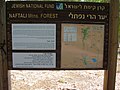 Naftali Mountains Forest sign.jpg 2,048 × 1,536; 668 KB
-
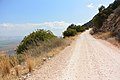 Naftali Mountains Scenic Road 2.JPG 4,608 × 3,072; 8.6 MB
-
 Naftali Mountains Scenic Road.JPG 4,608 × 3,072; 8.66 MB
-
 Naftali view into Hula Valley.JPG 4,608 × 3,072; 6.71 MB
-
 Nice house in ramot naftali.jpg 2,816 × 2,112; 3.67 MB
-
 PikiWiki Israel 1372 Galilee Israel רכס הרי נפתלי גליל עליון.jpg 700 × 525; 44 KB
-
 PikiWiki Israel 1374 Galilee Israel רכס הרי נפתלי גליל עליון.jpg 524 × 700; 44 KB
-
 PikiWiki Israel 1375 Galilee Israel רכס הרי נפתלי גליל עליון.jpg 700 × 525; 58 KB
-
 PikiWiki Israel 1376 Galilee Israel רכס הרי נפתלי גליל עליון.jpg 525 × 700; 56 KB
-
 PikiWiki Israel 1377 Galilee Israel רכס הרי נפתלי גליל עליון.jpg 700 × 525; 42 KB
-
 PikiWiki Israel 1378 Galilee Israel רכס הרי נפתלי גליל עליון.jpg 700 × 525; 47 KB
-
 PikiWiki Israel 1379 Galilee Israel רכס הרי נפתלי גליל עליון.jpg 700 × 525; 68 KB
-
 PikiWiki Israel 1382 Galilee Israel רכס הרי נפתלי גליל עליון.jpg 700 × 525; 37 KB
-
 PikiWiki Israel 1383 Galilee Israel רכס הרי נפתלי גליל עליון.jpg 700 × 525; 61 KB
-
 PikiWiki Israel 1384 Galilee Israel רכס הרי נפתלי גליל עליון.jpg 700 × 525; 58 KB
-
 PikiWiki Israel 1386 Galilee Israel רכס הרי נפתלי גליל עליון.jpg 700 × 524; 38 KB
-
 PikiWiki Israel 1387 Galilee Israel רכס הרי נפתלי גליל עליון.jpg 700 × 525; 30 KB
-
 PikiWiki Israel 1388 Galilee Israel רכס הרי נפתלי גליל עליון.jpg 700 × 525; 55 KB
-
 PikiWiki Israel 1389 Galilee Israel רכס הרי נפתלי גליל עליון.jpg 525 × 700; 61 KB
-
 PikiWiki Israel 1390 Galilee Israel רכס הרי נפתלי גליל עליון.jpg 700 × 525; 54 KB
-
 PikiWiki Israel 1394 Galilee Israel רכס הרי נפתלי גליל עליון.jpg 700 × 525; 48 KB
-
 PikiWiki Israel 15242 Menara Cliff.JPG 3,110 × 2,073; 2.85 MB
-
 PikiWiki Israel 16568 Geography of Israel.jpg 3,224 × 2,149; 5.08 MB
-
 PikiWiki Israel 16571 Geography of Israel.jpg 3,224 × 2,149; 4.85 MB
-
 PikiWiki Israel 28022 Geography of Israel.jpg 1,600 × 1,064; 607 KB
-
 PikiWiki Israel 28023 Geography of Israel.jpg 1,600 × 1,064; 526 KB
-
 PikiWiki Israel 28024 Geography of Israel.jpg 1,600 × 1,064; 651 KB
-
 PikiWiki Israel 29655 Agamon Hula.jpg 3,264 × 2,448; 2.09 MB
-
 PikiWiki Israel 43702 Geography of Israel.JPG 4,000 × 3,000; 5.59 MB
-
 PikiWiki Israel 6526 Geography of Israel.jpg 1,400 × 937; 283 KB
-
 PikiWiki Israel 6529 nabi yesha forest.jpg 1,500 × 1,004; 599 KB
-
 PikiWiki Israel 6530 nabi yesha forest.jpg 1,500 × 1,004; 435 KB
-
 PikiWiki Israel 6531 nabi yesha forest.jpg 1,500 × 1,004; 523 KB
-
 PikiWiki Israel 7850 mountainous Jorden.JPG 2,048 × 1,536; 528 KB
-
 PikiWiki Israel 7851 mountainous Jorden.JPG 2,048 × 1,536; 659 KB
-
 PikiWiki Israel 8669 View of Ramot Naftali.JPG 640 × 480; 149 KB
-
 PikiWiki Israel 8831 memorial to major eitan blahssan.jpg 2,048 × 1,536; 694 KB
-
 PikiWiki Israel 9494 Plants of Israel.jpg 1,200 × 1,600; 414 KB
-
 Ramot naftali panorama.jpg 6,420 × 1,810; 2.5 MB
-
 Short-toed snake eagle over Naftali Mountains.JPG 4,608 × 3,072; 3.67 MB
-
 Stony field.JPG 4,608 × 3,072; 8.27 MB
-
-
 View along Naftali Mountains.JPG 4,608 × 3,072; 8.26 MB
-
 View from Mitzpe Liran.jpg 2,048 × 1,536; 659 KB
-
 View from Naftali Mountains.jpg 7,712 × 2,896; 12.05 MB
-
 View over Hula Valley 2.JPG 4,608 × 3,072; 8.64 MB
-
 View over Hula Valley 3 from stony field.JPG 4,608 × 3,072; 8.79 MB
-
 View over Hula Valley.JPG 4,608 × 3,072; 6.59 MB
-
 Wadi Kedesh Nature Reserve sign.JPG 4,608 × 3,072; 8.2 MB
-
 Wadi Qedesh sign.JPG 4,608 × 3,072; 8.48 MB
-
 גבעת הקרב מלכיה 7.JPG 2,048 × 1,536; 837 KB
-
 הר שנאן.jpg 816 × 612; 70 KB
-
 ציטוט מהשיר "היה לי חבר היה לי אח" חקוק על סלע בדרך הנוף בהרי נפתלי.jpg 1,165 × 1,740; 416 KB
-
 שיר חקוק על סלע בדרך הנוף.jpg 401 × 599; 68 KB


.jpg)
.jpg)


