Category:Nagyszekeres
Jump to navigation
Jump to search
| Object location | | View all coordinates using: OpenStreetMap |
|---|
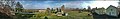
village in Hungary  A templom és a harangláb légifotója | |||||
| Upload media | |||||
| Instance of |
| ||||
|---|---|---|---|---|---|
| Location | Fehérgyarmat District, Szabolcs-Szatmár-Bereg County, Hungary | ||||
| Population |
| ||||
| Area |
| ||||
| official website | |||||
 | |||||
Subcategories
This category has only the following subcategory.
R
Media in category "Nagyszekeres"
The following 10 files are in this category, out of 10 total.
-
 Nagyszekeres rovastabla.png 139 × 40; 7 KB
-
 Nagyszekeres, Hungary - panoramio (1).jpg 1,372 × 926; 539 KB
-
 Nagyszekeres, Hungary - panoramio (2).jpg 5,954 × 926; 1.82 MB
-
 Nagyszekeres, Hungary - panoramio (3).jpg 3,285 × 926; 1.03 MB
-
 Nagyszekeres, Hungary - panoramio (4).jpg 5,935 × 926; 2.25 MB
-
 Nagyszekeres, Hungary - panoramio (5).jpg 1,372 × 926; 348 KB
-
 Nagyszekeres, Hungary - panoramio (6).jpg 1,373 × 926; 560 KB
-
 Nagyszekeres, Hungary - panoramio (7).jpg 926 × 1,372; 553 KB
-
 Nagyszekeres, Hungary - panoramio (8).jpg 4,546 × 926; 1.45 MB
-
 Nagyszekeres, Hungary - panoramio.jpg 1,629 × 926; 528 KB
.jpg)
.jpg)
.jpg)
.jpg)

.jpg)
.jpg)
.jpg)
.jpg)